Geo Map — Europe — Greece
Maps of Europe — Hellenic Republic
Greece is officially known as the “Hellenic Republic”. This country is historically also known as “Hellas” and it is a country in Europe, in the south-eastern part of it. The population of Greece is about 11 million people and the capital is Athens. The second largest city after Athens is Thessaloniki.
The location of Greece in Europe is very strategical as it is located at the crossroads of both Europe and Asia, and also Africa. The country is situated on the southern tip of the peninsula of Balkan and its neighbors are Bulgaria, Albania and Macedonia, as well as Turkey. Greece consists of all together nine regions, which are meant to split the country according to their geographical locations. There is a “Central Greece” region, Macedonia, Epirus, Thessaly, the Peloponnese, the Aegean Islands, Crete, Thrace and the Ionian Islands. There is an Aegean Sea lying to the east of the mainland of Greece, as well as the Mediterranean and Cretan Sea to the south and the Ionian Sea to the west. Greece has the longest coastline on the Mediterranean Basin and the coastline which takes the 11th place in the world as one of the longest — 13676 kilometers in length.
There are very many islands (between 1200 and 6000) which are all united and belong to Greece and only 227 of them are inhabited nowadays. Crete is the largest and the most populous island of Greece and the second largest is Euboea, followed by Lesbos and Rhodes. The Greek islands are traditionally grouped into the following clusters: the Cyclades, a large collection occupying the central part of the Aegean Sea, the Argo-Saronic Islands in the Saronic gulf near Athens, the North Aegean islands, the Dodecanese, the Sporades and the Ionian Islands, located to the west of the mainland in the Ionian Sea. 80% of the territory of Greece is mountainous and there is a “Mount Olympus” known as the highest peak of Greece (2918 meters).
Greece is a democratic country. It is quite well-developed with an advanced high-income economy, a high quality of life and a very high standard of living. Greece is also a founding member of the United Nations and it was the 10th member to join the “European Communities”. This country has been part of the “Eurozone” since 2001. Greece is also a member of the numerous international institutions, such as the “North Atlantic Treaty Organization” also known as “NATO”, the “Council of Europe”, the “World Trade Organization” or “WTO”, the “Organization for Economic Co-operation and Development” known as “OECD”, the “Organization internationale de la Francophonie” or “OIF” and the “Organization for Security and Co-operation in Europe” or “OSCE”. Greece is known as a great place for visiting by tourists having large tourism industry with a unique cultural heritage. This country has a well-developed shipping sector as well as the geographical importance, so being the largest economically developed country in the Balkans it attracts lots of attention, including the investments.
As it was mentioned before, Greece is located in the Southern Europe and it is a so-called “transcontinental” country, consisting of a peninsular and mountainous mainland next to the sea at the southern end of the Balkans. There are mountains and hills covering 80% of the territory of Greece making this country one of the most mountainous in Europe. Western part of Greece contains a number of lakes as well as wetlands and it is dominated by the Pindus mountain range, which reaches a maximum elevation of 2637 meters at Mt. Smolikas, known as the second-highest in Greece. The mentioned Pindus range continues through the central Peloponnese, crossing the islands of Antikythera and Kythera, finding its way into the southwestern Aegean, ending in the island of Crete.
The islands of the Aegean are the peaks of the underwater mountains that once constituted an extension of the mainland. Pindus is specific due to its dangerous peaks, and it is often divided by numerous canyons with a variety of other landscapes. The part of the Vikos’Aoos National part in the Pindus range is a spectacular “Vikos Gorge”, being listed by the “Guinness book of World Records” as the deepest gorge in the whole world. North-eastern Greece features another high-altitude mountain range which is the Rhodope one, spreading across the region of East Macedonia. In this area there are thick, vast and ancient forests, including the famous “Dadia forest” in the “Evros regional unit” in the far north-east of the country.
Extensive plains are located mainly in the regions of Central Macedonia, Thessaly and Thrace. They constitute key economic regions as they are among the few arable places in the country. Rare marine species (such as the pinniped seals) live in the seas surrounding mainland Greece, while its dense forests are home to the European lynx, the brown bear and the roe deer and the wild goat.
The nine areas of Greece (Macedonia, Central Greece, Peloponnese, Thessaly, Epirus, Aegean Islands (including the Dodecanese and Cyclades), Thrace, Crete and Ionian Islands) can be mentioned on the same map created in ConceptDraw DIAGRAM If you need to make such map, showing the regions as well as the other features of Greece, then you can do it using a very useful and convenient software ConceptDraw DIAGRAM as well as another product of CS Odessa — ConceptDraw STORE finding lots of the necessary solutions full of the stencil libraries and examples of pre-made maps, schemes, charts, flowcharts, diagrams and other schematics.
The “Continent Maps” solution can be also found in the “Maps area” of ConceptDraw Solution Park on this site and it includes the vector stencils library “Greece” containing the contours of this country which can be used while creating the maps of Greece using ConceptDraw DIAGRAM diagramming and vector drawing software. Once you download this application and find the right solution, including the samples of previously created maps, then you own map will look simply professional and smart as with the help of our support team and the solutions it is possible to make whatever is needed from a scratch.
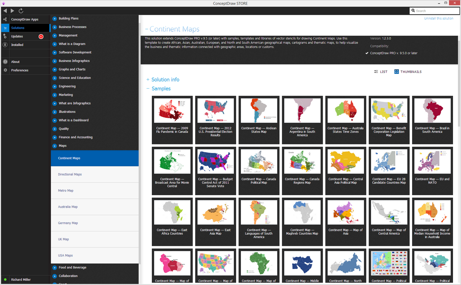
Pic. 1. Continent Maps Solution
Use the Greece library to draw thematic maps, geospatial infographics and vector illustrations for your business documents, presentations and websites.
Geo Map — Europe — Hellenic Republic

Pic. 2. Hellenic Republic
Geo Map — Europe — Greece Contour
A contour map is a map illustrated with contour lines, for example a topographic map, which thus shows valleys and hills, and the steepness of slopes.
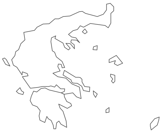
Pic. 3. Europe — Greece Contour
Geo Map — Europe
Europe is a continent that comprises the westernmost part of Eurasia. Europe is bordered by the Arctic Ocean to the north, the Atlantic Ocean to the west, and the Mediterranean Sea to the south. To the east and southeast, Europe is generally considered as separated from Asia by the watershed divides of the Ural and Caucasus Mountains, the Ural River, the Caspian and Black Seas, and the waterways of the Turkish Straits.
List of european countries:
- Albania
- Austria
- Belarus
- Bulgaria
- Bosnia and Herzegovina
- Belgium
- Czech Republic
- Croatia
- Denmark
- Estonia
- France
- Finland
- Greece
- Germany
- Hungary
- Italy
- Ireland
- Iceland
- United Kingdom
- Latvia
- Luxembourg
- Lithuania
- Montenegro
- Macedonia
- Moldova
- Norway
- Netherlands
- Portugal
- Poland
- Russia
- Romania
- Switzerland
- Sweden
- Spain
- Slovenia
- Slovakia
- Serbia
- Ukraine
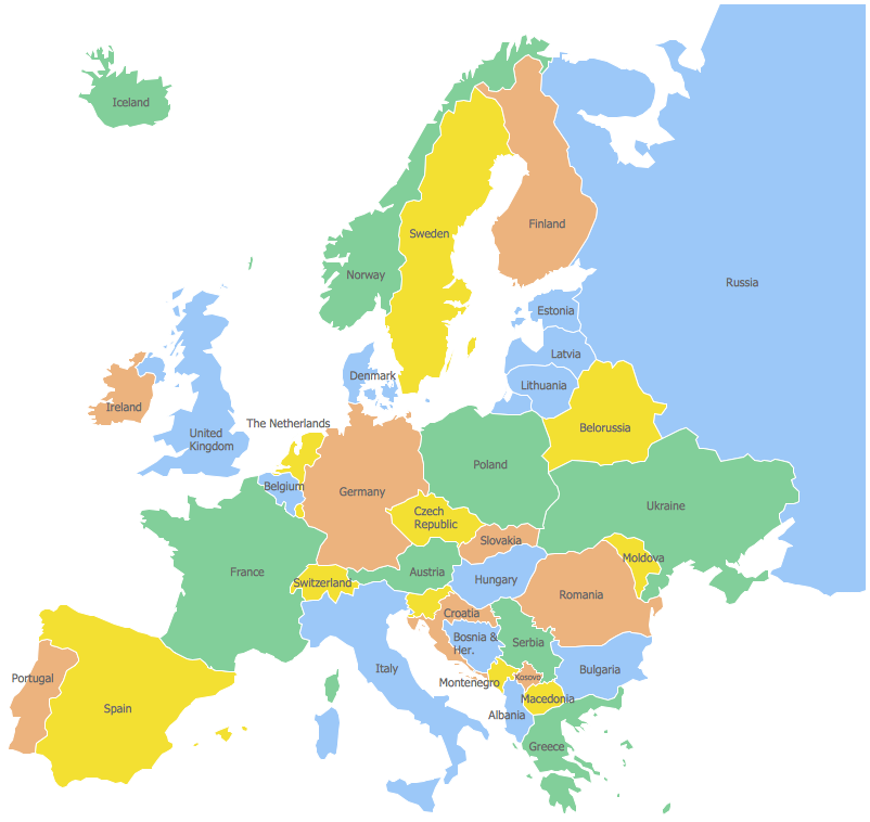
Pic. 4. Europe Map
Geo Map - Europe Contour
A contour map is a map illustrated with contour lines.
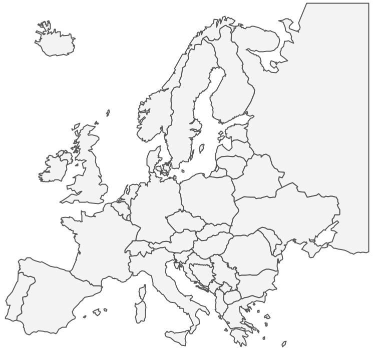
Pic. 5. Europe Contour
Geo Map - contours of Europe countries
Use the map contours library "Europe" to design thematic maps using the ConceptDraw DIAGRAM diagramming and vector drawing software.
The vector stencils library "Europe" contains 44 map contours: Europe political map, map contours of countries.
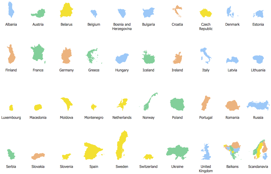
Pic. 6. Contours of Europe countries
Geo Map - Europe flags
The library "Europe flags" contains 48 flags of Europe countries
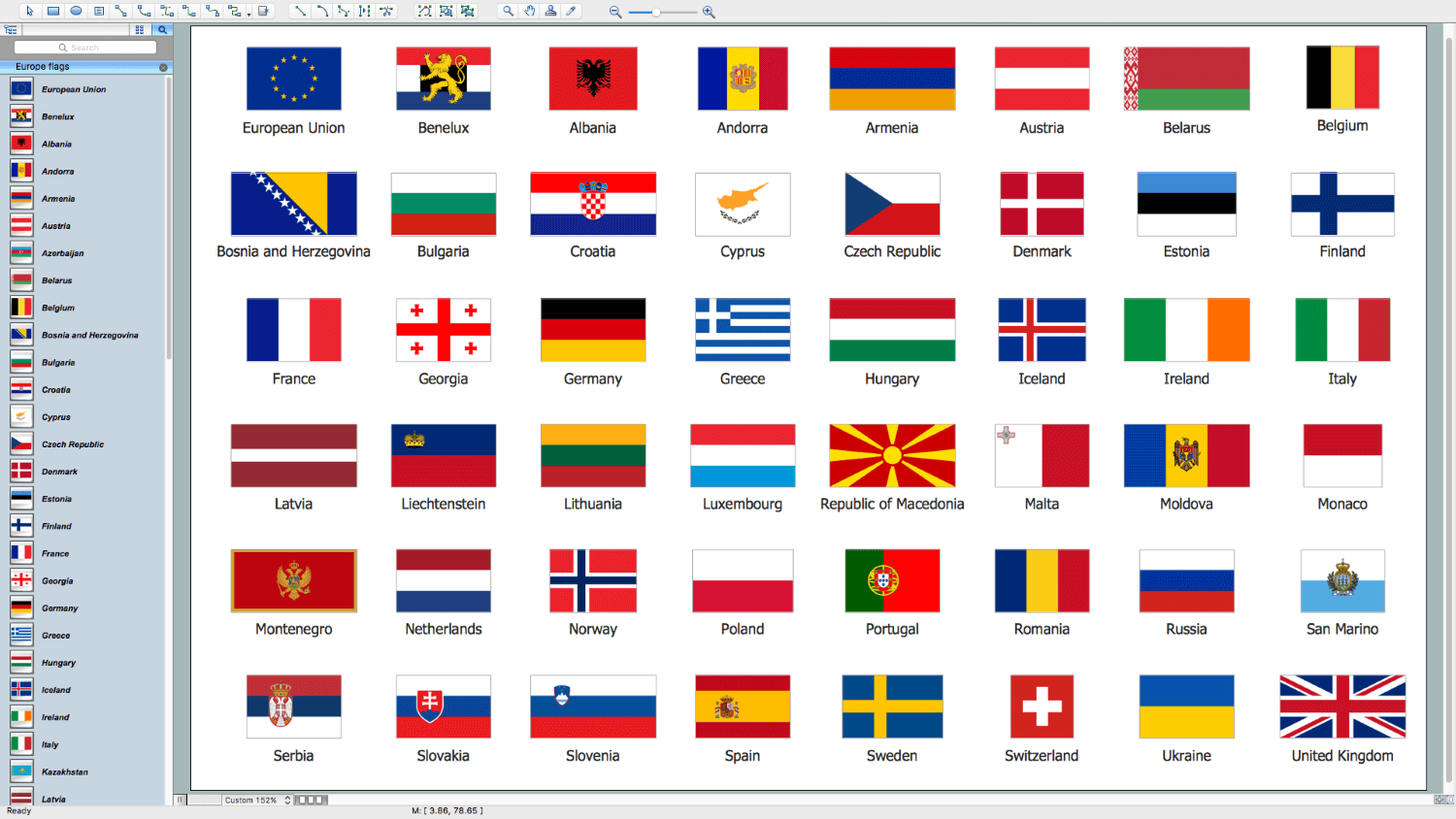
Pic. 7. Design Elements - Europe Flags
All ConceptDraw DIAGRAM documents are vector graphic files and are available for reviewing, modifying, and converting to a variety of formats: image, HTML, PDF file, MS PowerPoint Presentation, Adobe Flash, MS Visio (.VDX, .VSDX).
See also Geo Maps of Europe Countries :
- Albania
- Austria
- Belarus
- Bulgaria
- Bosnia and Herzegovina
- Belgium
- Czech Republic
- Croatia
- Denmark
- Estonia
- France
- Finland
- Greece
- Germany
- Hungary
- Italy
- Ireland
- Iceland
- United Kingdom
- Latvia
- Luxembourg
- Lithuania
- Montenegro
- Macedonia
- Moldova
- Norway
- Netherlands
- Portugal
- Poland
- Russia
- Romania
- Switzerland
- Sweden
- Spain
- Slovenia
- Slovakia
- Serbia
- Ukraine