Made with
ConceptDraw
DIAGRAM 17

Continents and Oceans Map

You need design a continent map, world continents map, continents and oceans map, or any other type of continent maps? Now, it's very easy thanks to the ConceptDraw DIAGRAM diagramming and vector drawing software supplied with Continent Maps Solution from the Maps Area of ConceptDraw Solution Park.

Continents and Oceans Map *

Example 1. Continents and Oceans Map - Southeast Asia Map

Continent Maps Solution offers you the great opportunities for Continents and Oceans Map. It's enough to look at the gallery of Continent Maps Solution libraries to make sure that this is true.

Continent Maps Solution in ConceptDraw STORE

Example 2. Continent Maps Solution in ConceptDraw STORE

Don't forget also look over the numerous collection of samples and templates included in Continent Maps Solution and available from ConceptDraw STORE. All samples are excellent examples and also the beautiful start for your own continents and oceans map.

Continent Map - Ranks US States by Peacefulness

Example 3. Continent Map - Ranks US States by Peacefulness

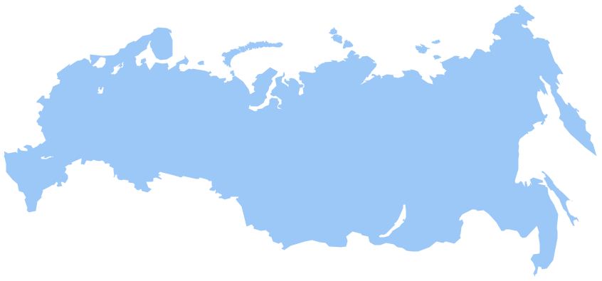
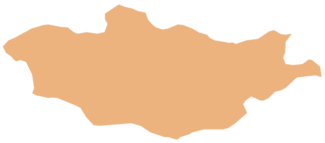
The samples you see on this page were created in ConceptDraw DIAGRAM software using the Continent Maps solution. Any Continents and Oceans Map created in ConceptDraw DIAGRAM successfully demonstrates solution's capabilities and professional results you can achieve. An experienced user spent 10 minutes creating every of these samples.

Use the tools of the Continent Maps solution to draw your own Continents and Oceans Map quickly and effectively in ConceptDraw DIAGRAM software.

All source documents are vector graphic documents. They are available for reviewing, modifying, or converting to a variety of formats (PDF file, MS PowerPoint, MS Visio, and many other graphic formats) from the ConceptDraw STORE. The Continent Maps Solution is available for all ConceptDraw DIAGRAM or later users.


SIX RELATED HOW TO's:
South America includes 12 sovereign states. ConceptDraw DIAGRAM is idea to draw the geological maps of South America continent from the pre-designed vector geo map shapes. Use Continent Maps solution from the Maps area of ConceptDraw Solution Park to draw thematic maps, geospatial infographics and vector illustrations for your business documents, presentations and websites.Geo Map — South America Continent *
Picture: Geo Map — South America Continent
Related Solution:
ConceptDraw DIAGRAM is idea to draw the geological maps of World from the pre-designed vector geo map shapes.Geo Map - World *
Picture: Geo Map - World
Related Solution:
Alaska is a U.S. state situated in the northwest extremity of the North American continent. The vector stencils library Alaska contains contours for ConceptDraw DIAGRAM diagramming and vector drawing software. This library is contained in the Continent Maps solution from Maps area of ConceptDraw Solution Park.Geo Map — USA — Alaska *
Picture: Geo Map — USA — Alaska
Related Solution:
ConceptDraw DIAGRAM diagramming and vector drawing software enhanced with Continent Maps Solution from the Maps Area is the best for drawing geographic, topography, political, and many other kinds of maps for any of seven earth continents and also world continents map of any detailing.World Continents Map *
Picture: World Continents Map
Related Solution:
Value Stream Mapping solution extends ConceptDraw DIAGRAM software with tools for drawing Value Stream Maps (VSM): templates, samples and library of vector stencils.Value Stream Mapping Tool *
Picture: Value Stream Mapping Tool
Related Solution:
Germany, officially the Federal Republic of Germany, is a federal parliamentary republic in West-Central Europe. You need design the map of Germany or detailed map of Germany with cities fast and easy? We reccomend you to use the indispensable ConceptDraw DIAGRAM diagramming and vector drawing software extended with unique Germany Map Solution from the Maps Area of ConceptDraw Solution Park.Map of Germany *
Picture: Map of Germany
Related Solution:
ConceptDraw
DIAGRAM 17