Geo Map - Asia - India
Maps of Asia — Republic of India
India or the Republic of India (officially) is a country in South Asia and the 17th largest country, taking into consideration its area. It is also the second-most populous country with over 1,2 billion people living there and also it is the most populous democratic republic in the world. There is the Indian Ocean in the southern part of it, the Bay of Bengal in its southeast part and the Arabian Sea in its southwestern part. India shares its land borders with other countries, including Bangladesh in the east, Pakistan in the west, Nepal, Bhutan and China in the north-eastern part of it, and Burma. India is in the vicinity of Sri Lanka in the Indian Ocean and the Maldives. The Nicobar Islands and Andaman Islands belong to India and share a maritime border with Indonesia and Thailand.
India and its subcontinent was home to the urban civilization, known as “Indus Valley Civilization”. There are castes and so the social stratification in India. The most popular religion is Buddhism. The economy of India finally expanded in the 17th century, when it was a “Mughal Empire”. In the mid-18th century, this subcontinent came under British East India Company rule and in the mid-19th it came under British so called “crown rule”, that is why later the “national movement” emerged in the late 19th century and with the help of Mahatma Gandhi it led to India's independence in 1947.
Since its independence, India has maintained cordial relations with most nations. In the 1950s, this country supported decolonisation in Asia and Africa and played a lead role in the Movement, called “Non-Aligned”. India’s leaders are in the difficult relationships with its neighbouring country – Pakistan. There were four wars between these two nations: in 1947, 1965, 1971 and 1999. India is in the strategic relationships with Russia, but it has the defence relations with both France and Israel. In 1965 India started to develop the nuclear weapons in order to protect its inhabitants after the nuclear test, which China conducted in 1964. India’s first nuclear weapons test was conducted in 1974, the next one — in 1998.
There is a president who is the head of the government in India. He is the supreme commander of the nation's armed forces. Many of the military expenditures were focused on defencing India against Pakistan as well as for the purpose of countering the Chinese influence growing in the Indian Ocean.
The Indian economy in 2015 was the world's 7th largest by its nominal “Gross domestic product” and 3rd largest by purchasing power parity. There were a few reforms in 1991, and after conducting them India became one of the most fast growing economies. Now this country is considered as a “newly industrial country”.
The oldest and geologically most stable part of India is the original Indian plate. It extends to far north up to the Vindhye and Satpura ranges in central India. These chains run from Gujarat (its Arabian Sea coast) in the west, to the Jharkhand (Chota Nagpur Plateau) in the east. There’s a landmass called the “Deccan Plateau” in the south and the “Western and Eastern Ghats” on the west and east. This plateau contains the country's oldest rock formations. The Republic of India lies to the north of the equator (between 6° 44' and 35° 30' north latitude and 68° 7' and 97° 25' east longitude).
There are the Greater Himalayas, which are the mountains in India. This country’s coastline measures 7517 kilometres in length, 5423 of which belong to the “peninsular India” and 2094 - to the Andaman, Nicobar and Lakshadweep island chains. The mainland Indian coastline consists of 43% sandy beaches, 11% rocky shores with cliffs and 46% marshy shores.
There are also many rivers flowing through India, including the Brahmaputra and the Ganges. Both of them drain into the so-called “Bay of Bengal”. One of the major rivers also include the Mahanadi, the Godavari, the Kaveri, the Krishna, the Tapti, the Narmada (the last two drain into the Arabian Sea). There are two archipelagos in India, which are the Andaman and Nicobar Islands and Lakshadweep.
In case you want to show the contours of India, its regions, or other countries’ contours in Asia, we recommend you to use ConceptDraw DIAGRAM software for creating your great looking maps. After downloading ConceptDraw DIAGRAM you might not even need to think about the location of each country and place in Asia as there are already pre-made maps available to choose from in the solution named “Continent Maps”, which can be found and downloaded from the “Maps” area of ConceptDraw Solution Park or from ConceptDraw STORE where all of the solutions are.
Using this “Continent Maps” solution, which includes the vector design elements library “Asia”, as well as a country map contours for using them in ConceptDraw DIAGRAM diagramming and vector drawing software while making your maps of Asian countries, including India, can simplify your drawing and make the process of generating the needed map entertaining and fun. The vector stencils library “India” contains contours of this country and you can use it to draw any thematic maps, geospatial infographics and vector illustrations for your business documents, presentations and websites.
You can choose to use the contours of Central Asia, East Asia, Southeast Asia, South Asia separately, as well as of all of the countries in Asia at once or you can pick up one of the needed shapes of the Asian countries territories: Afghanistan, Armenia, Azerbaijan, Bahrain, Bangladesh, Bhutan, Brunei, Cambodia, China, Cyprus, Georgia, India, Indonesia, Iran, Iraq, Israel, Japan, Jordan, Kazakhstan, Kuwait, Kyrgyzstan, Laos, Lebanon, Malaysia, Maldives, Mongolia, and other.
There are also 116 vector shapes, illustrating the Asia countries flags, including the Indian one, in colours and you can always use some or all of them any time you need.
Having ConceptDraw DIAGRAM software all together with other products of CS Odessa (such as ConceptDraw STORE) means having everything you need for making your own great looking drawings and enjoying the result.
The vector stencils library India contains contours for ConceptDraw DIAGRAM diagramming and vector drawing software. This library is contained in the Continent Maps solution from Maps area of ConceptDraw Solution Park.
Pic. 1. Continent Maps Solution
Use the India library to draw thematic maps, geospatial infographics and vector illustrations for your business documents, presentations and websites.
Geo Map — Asia — Republic of India
India has a population of over 1,2 billion and an area 3,287,263 sq km2 (1,269,346 sq mi).

Pic. 2. India
Geo Map — Asia — India Contour
Capital - New Delhi.
Pic. 3. India Contour
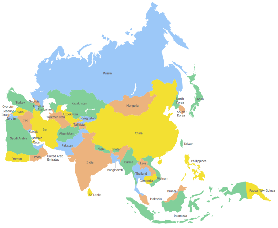
Geo Map — Asia
Area 44,579,000 km2 (17,212,000 sq mi). Population 4,164,252,000
Pic. 4. Asia
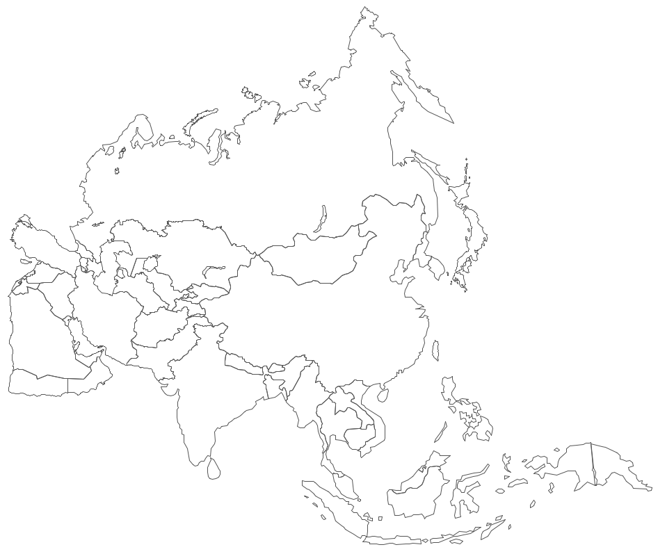
Geo Map — Asia Contour
A contour map is a map illustrated with contour lines.
Pic. 5. Asia Contour
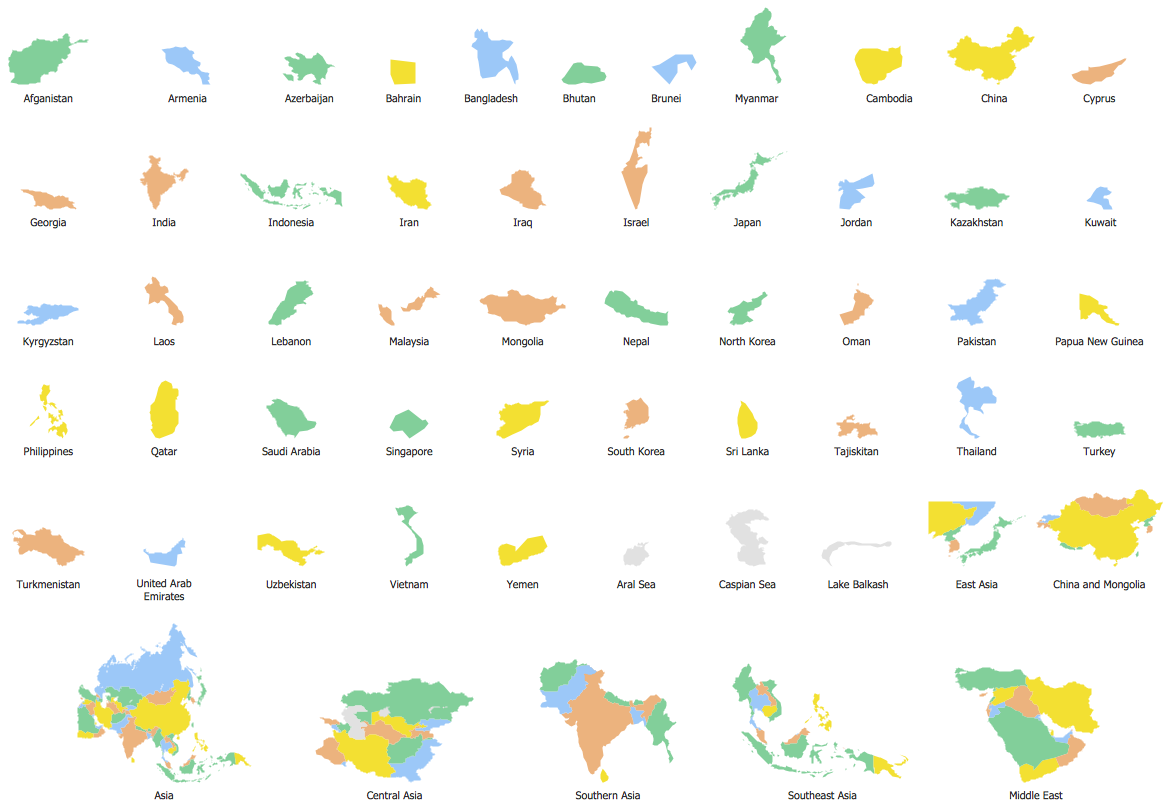
Geo Map — contours of Asia countries
Use the map contours library "Asia" to design thematic maps using the ConceptDraw DIAGRAM diagramming and vector drawing software.
The vector stencils library "Asia" contains 57 map contours: Asia political map, map contours of countries.
Pic. 6. Contours of Asia countries
Geo Map — Design elements — Asia flags
The library "Asia Flags" contains 49 flags of Asia countries.
Pic. 7. Asia flags
All ConceptDraw DIAGRAM documents are vector graphic files and are available for reviewing, modifying, and converting to a variety of formats: image, HTML, PDF file, MS PowerPoint Presentation, Adobe Flash, MS Visio (.VDX, .VSDX).
See also Geo Maps of Asia Countries :
- Afghanistan
- Armenia
- Azerbaijan
- Bahrain
- Bangladesh
- Bhutan
- Brunei
- Cambodia
- China
- Cyprus
- Georgia
- India
- Indonesia
- Iran
- Iraq
- Israel
- Japan
- Jordan
- Kazakhstan
- Kuwait
- Kyrgyzstan
- Laos
- Lebanon
- Malaysia
- Mongolia
- Myanmar
- Nepal
- North Korea
- Oman
- Pakistan
- Papua New Guinea
- Philippines
- Qatar
- Saudi Arabia
- Singapore
- South Korea
- Sri Lanka
- Syria
- Tajikistan
- Thailand
- Turkey
- Turkmenistan
- United Arab Emirates
- Uzbekistan
- Vietnam
- Yemen


