Geo Map - Asia - Mongolia
Maps of Asia - Mongolia
"Mongolia is a landlocked country in Central Asia. It is bordered by Russia to the north and China to the south, east and west. Ulaanbaatar, the capital and also the largest city, is home to about 45% of the population. Mongolia's political system is a parliamentary republic." [Mongolia. Wikipedia]
The vector stencils library Mongolia contains contours for ConceptDraw DIAGRAM diagramming and vector drawing software. This library is contained in the Continent Maps solution from Maps area of ConceptDraw Solution Park.

Pic. 1. Continent Maps Solution
Use the Mongolia library to draw thematic maps, geospatial infographics and vector illustrations for your business documents, presentations and websites.
Geo Map - Asia - Mongolia
Mongolia has a population of over 3 million and an area 1,566,000 km2(603,909 sq mi).
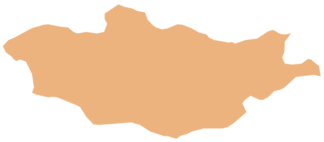
Pic. 2. Mongolia
Geo Map - Asia - Mongolia Contour
Capital - Ulaanbaatar

Pic. 3. Mongolia Contour
Geo Map - Asia
Area 44,579,000 km2 (17,212,000 sq mi). Population 4,164,252,000

Pic. 4. Asia Map
Geo Map - Asia Contour
A contour map is a map illustrated with contour lines.

Pic. 5. Asia Contour
Geo Map - contours of Asia countries
Use the map contours library "Asia" to design thematic maps using the ConceptDraw DIAGRAM diagramming and vector drawing software.
The vector stencils library "Asia" contains 57 map contours: Asia political map, map contours of countries.

Pic. 6. Contours of Asia countries
Geo Map - Design elements - Asia flags

Pic. 7. Asia flags
All ConceptDraw DIAGRAM documents are vector graphic files and are available for reviewing, modifying, and converting to a variety of formats: image, HTML, PDF file, MS PowerPoint Presentation, Adobe Flash, MS Visio (.VDX, .VSDX).
See also Geo Maps of Asia Countries :
NINE RELATED HOW TO's:
Germany, officially the Federal Republic of Germany, is a federal parliamentary republic in West-Central Europe. You need design the map of Germany or detailed map of Germany with cities fast and easy? We reccomend you to use the indispensable ConceptDraw DIAGRAM diagramming and vector drawing software extended with unique Germany Map Solution from the Maps Area of ConceptDraw Solution Park.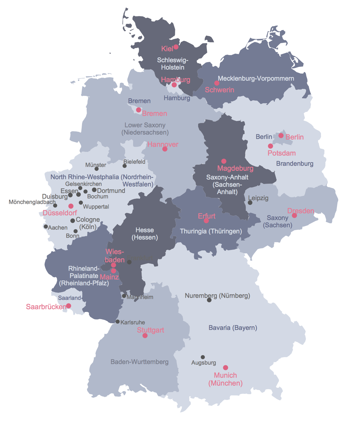
Picture: Map of Germany
Related Solution:
Paraguay, officially the Republic of Paraguay, is a landlocked country in South America, bordered by Argentina to the south and southwest, Brazil to the east and northeast, and Bolivia to the northwest.
The vector stencils library Paraguay contains contours for ConceptDraw DIAGRAM diagramming and vector drawing software. This library is contained in the Continent Maps solution from Maps area of ConceptDraw Solution Park.
Picture: Geo Map - South America - Paraguay
Related Solution:
Iraq, officially the Republic of Iraq, is a country in Western Asia encompassing the Mesopotamian alluvial plain, the northwestern end of the Zagros mountain range, and the eastern part of the Syrian Desert.
The vector stencils library Iraq contains contours for ConceptDraw DIAGRAM diagramming and vector drawing software. This library is contained in the Continent Maps solution from Maps area of ConceptDraw Solution Park.
Picture: Geo Map - Asia - Iraq
Related Solution:
Greece is strategically located at the crossroads of Europe, Asia, and Africa.
The vector stencils library Greece contains contours for ConceptDraw DIAGRAM diagramming and vector drawing software. This library is contained in the Continent Maps solution from Maps area of ConceptDraw Solution Park.
Picture: Geo Map — Europe — Greece
Related Solution:
The vector stencils library Serbia contains contours for ConceptDraw DIAGRAM diagramming and vector drawing software. This library is contained in the Continent Maps solution from Maps area of ConceptDraw Solution Park.
Picture: Geo Map - Europe - Serbia
Related Solution:
Benin, officially the Republic of Benin, is a country in West Africa. It is bordered by Togo to the west, by Nigeria to the east and by Burkina Faso and Niger to the north.
The vector stencils library Benin contains contours for ConceptDraw DIAGRAM diagramming and vector drawing software. This library is contained in the Continent Maps solution from Maps area of ConceptDraw Solution Park.
Picture: Geo Map - Africa - Benin
Related Solution:
Vector map is the best way to visually present a world, continents, islands, to display location and boundaries of countries and cities. ConceptDraw DIAGRAM diagramming and vector drawing software offers the Germany Map Solution from the Maps Area of ConceptDraw Solution Park - the best tool for fast and easy drawing vector map of Germany of any degree of detailing, and thematic cartograms and maps of Germany on its base.
Picture: Vector Map of Germany
Related Solution:


