Geo Map — Asia — Vietnam
Maps of Asia — Socialist Republic of Vietnam
The vector stencils library “Vietnam” contains the contours of this country for all of the ConceptDraw DIAGRAM diagramming and vector drawing software users in order to simplify their work in this unique application. This library can be found in the “Continent Maps solution”, which you can always download from the “Maps area” of the “ConceptDraw Solution Park” on this site or from the ConceptDraw STORE application, which is another CS Odessa product, allowing to choose from a huge range of the stencils and examples to have the last ones as your drafts for your own drawings.
You can always use this “Vietnam” library for drawing your own great looking thematic maps, vector illustrations and geospatial infographics, which all can be used in your business documents as well as presentations and websites. Also, you can always use the stencil library "Asia" full of the map contours of other countries in Asia to design the thematic maps in the ConceptDraw DIAGRAM diagramming and vector drawing software as this vector stencils library "Asia" contains 57 map contours: Asia political maps and map contours of different countries.
After mentioning Vietnam, it should be defined that this is the country located on the eastern Indochina Peninsula covering a total area of approximately 331210 square kilometres making it similar in its size to another country, which is, though, located in Europe and this country is Germany. The length of the Vietnam's land boundaries is 4639 kilometres and its coastline is all together 3444 kilometres long. The narrowest point of the country is the central province known as “Quang Binh” one. In this province the country is as little as 50 kilometres across, although it widens to around 600 kilometres in the north.
Vietnam's land is mainly hilly and forested with level land covering no more than 20%. About 40% of the country's land area is covered with mountains as well as tropical forests, covering all together around 42%. The northern part of the country consists of mostly the highlands. There is also the so-called “Red River Delta” in this area. The highest mountain in Vietnam stands 3143 metres high and it is called “Phan Xi Pang”, located in Lao Cai Province. The southern part of Vietnam is divided into the coastal lowlands, forests and the mountains of the Annamite Range. These highlands occupy about 16% of the country's arable land and 22% of its total forested land.
The “Red River Delta” is known to be a flat and roughly triangular region covering 15000 square kilometres. It is smaller but more intensely developed as well as more densely populated to compare to the so-called “Mekong River Delta”. This delta covers about 40000 square kilometres and it is a low-level plain no more than 3 meters above the sea point at any of its points.
The climate in Vietnam tends to vary from place to place, but usually during the winter the winds blow from the northeast across the Gulf of Tonkin and along the Chinese coast. In general, the winter season in most parts of the country is dry only comparing to the rainy or summer season. The mean annual temperature as a usual thing is higher in the plains than in the mountains. It also usually higher in the south than in the north and the temperatures vary less in the southern plains around the Mekong Delta and Ho Chi Minh City, ranging between 21 and 28 °C. The standard alterations occurring every season in the mountains and plateaus and in the north are much more critical, having their temperatures varying from 5°C in December and January to 37°C in July and August.
Since 2000, Vietnam has applied sequenced trade liberalisation and already in 2006 this country updated its intellectual property legislation to comply with TRIPS, becoming a member of the WTO in 2007. Vietnam is now one of Asia's most open economies. The two-way trade was valued at around 160% of GDP in 2006. The chief trading partners for this country include Japan, China, Australia, the United States, the Western Europe and the so-called “ASEAN” countries. The total value of the international merchandise trade for the first half of 2013 was US$124 billion. Lots of the produced within Vietnam mobile phones as well as their parts were both imported and exported during the period of that one year. The United States of America was the country that purchased the highest amount of Vietnam's exports. At the same time the Chinese goods were the most popular of the total Vietnamese import. Vietnam has become a major exporter of the agricultural products since then and still, nowadays, it is the world's largest producer of lots of products, including the cashew nuts, which are one-third of a global share market.
This country is also the largest producer of black pepper, accounting for one-third of the world's market. Vietnam is the second-largest rice exporter in the world, followed by Thailand. This Asian country also takes the second place in the world among other largest exporter of coffee, having the highest proportion of land use for the permanent crops — up to 7%. Rubber, tea, and other products, including the fishery ones are among the others as the primary ones for being exported.
Despite the fact that the agriculture's share of Vietnam's GDP has fallen in recent decades, declining from 42% in 1989 to 20% in 2006, the production in other sectors of the economy has risen. Thus, in 2014 Vietnam negotiated a free trade agreement with the European Union, which contributed to the country the way of providing the access to the EU's Generalized System of Preferences, enabling to support over 90,7 million people living in Vietnam, allowing most of them to have jobs. Talking about the population of this country, it is fair to say that nowadays the total fertility rate of Vietnam is 1,8 (births per woman).
The biggest ethnic groups in Vietnam is Kinh and Viet, as there are about 73,6 million of the representatives of these groups live within the borders of Vietnam (over 85% of the total population). The Kinh population is concentrated mainly in the coastal plains and alluvial deltas of the country, possessing the significant political as well as economic influence over the country of Vietnam. There are also about 54 ethnic minority groups, including the Dao, Thai, Tay, Nung and Hmong, living in Vietnam.
If you want to mention all of the nationalities within one demographic map of Vietnam, then you can make your own map using ConceptDraw DIAGRAM application as well as the Continent Maps solution from Maps area of ConceptDraw Solution Park which can be found and downloaded from this site.
Pic. 1. Continent Maps Solution
Use the Vietnam library to draw thematic maps, geospatial infographics and vector illustrations for your business documents, presentations and websites.
Geo Map — Asia — Socialist Republic of Vietnam
Vietnam has a population of over 91.7 million and an area 332,698 km2(128,565 sq mi).

Pic. 2. Vietnam
Geo Map — Asia — Vietnam Contour
Capital — Hanoi.
Pic. 3. Vietnam Contour
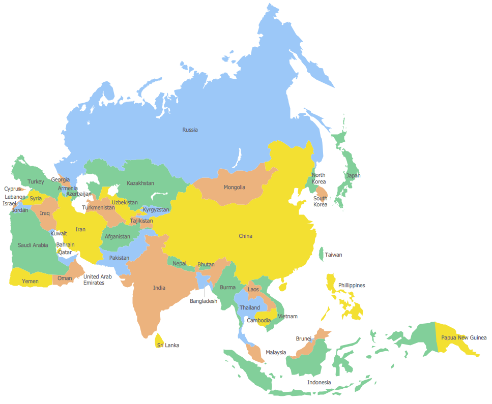
Geo Map — Asia
Asia contains 48 countries(UN members) and 6 other states.
Area 44,579,000 km2 (17,212,000 sq mi). Population 4,164,252,000.
Pic. 4. Asia Contour
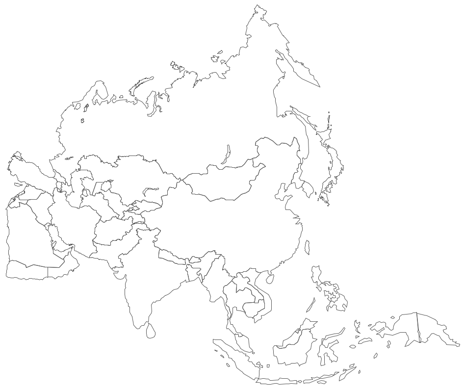
Geo Map — Asia Contour
A contour map is a map illustrated with contour lines.
Pic. 5. Asia Contour
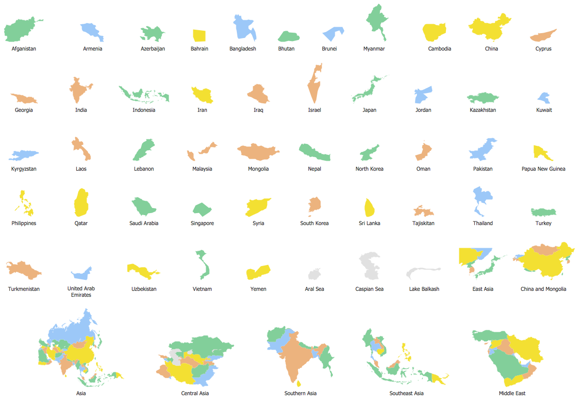
Geo Map — contours of Asia countries
Use the map contours library "Asia" to design thematic maps using the ConceptDraw DIAGRAM diagramming and vector drawing software.
The vector stencils library "Asia" contains 57 map contours: Asia political map, map contours of countries.
Pic. 6. Contours of Asia countries
All ConceptDraw DIAGRAM documents are vector graphic files and are available for reviewing, modifying, and converting to a variety of formats: image, HTML, PDF file, MS PowerPoint Presentation, Adobe Flash, MS Visio (.VDX, .VSDX).
See also Geo Maps of Asia Countries :
- Afghanistan
- Armenia
- Azerbaijan
- Bahrain
- Bangladesh
- Bhutan
- Brunei
- Cambodia
- China
- Cyprus
- Georgia
- India
- Indonesia
- Iran
- Iraq
- Israel
- Japan
- Jordan
- Kazakhstan
- Kuwait
- Kyrgyzstan
- Laos
- Lebanon
- Malaysia
- Mongolia
- Myanmar
- Nepal
- North Korea
- Oman
- Pakistan
- Papua New Guinea
- Philippines
- Qatar
- Saudi Arabia
- Singapore
- South Korea
- Sri Lanka
- Syria
- Tajikistan
- Thailand
- Turkey
- Turkmenistan
- United Arab Emirates
- Uzbekistan
- Vietnam
- Yemen


