Geo Map - Europe - Serbia
Maps of Europe - Republic of Serbia
"Serbia, officially the Republic of Serbia, is a country located at the crossroads of Central and Southeast Europe, covering the southern part of the Pannonian Plain and the central Balkans. A landlocked country in relative proximity to the Mediterranean, Serbia borders Hungary to the north; Romania and Bulgaria to the east; Macedonia to the south; and Croatia, Bosnia, and Montenegro to the west; it also borders Albania through the disputed territory of Kosovo. The capital of Serbia, Belgrade, is among Europe's oldest cities and one of the largest in Southeast Europe." [Serbia. Wikipedia]
The vector stencils library Serbia contains contours for ConceptDraw DIAGRAM diagramming and vector drawing software. This library is contained in the Continent Maps solution from Maps area of ConceptDraw Solution Park.

Pic. 1. Continent Maps Solution
Use the Serbia library to draw thematic maps, geospatial infographics and vector illustrations for your business documents, presentations and websites.
Geo Map - Europe - Republic of Serbia
Area including Kosovo 88,361 km2(34,116 sq mi), excluding Kosovo 77,474 km2 (29,913 sq mi).

Pic. 2. Republic of Serbia
Geo Map - Europe - Serbia Contour
Capital - Belgrade

Pic. 3. Serbia Contour
Geo Map - Europe
Europe is a continent that comprises the westernmost part of Eurasia.

Pic. 4. Europe Map
Geo Map - Europe Contour
A contour map is a map illustrated with contour lines.

Pic. 5. Europe Contour
Geo Map - contours of Europe countries
Use the map contours library "Europe" to design thematic maps using the ConceptDraw DIAGRAM diagramming and vector drawing software.
The vector stencils library "Europe" contains 44 map contours: Europe political map, map contours of countries.

Pic. 6. Contours of Europe countries
Geo Map - Europe flags
The library "Europe flags" contains 48 flags of Europe countries

Pic. 7. Design Elements - Europe Flags
All ConceptDraw DIAGRAM documents are vector graphic files and are available for reviewing, modifying, and converting to a variety of formats: image, HTML, PDF file, MS PowerPoint Presentation, Adobe Flash, MS Visio (.VDX, .VSDX).
See also Geo Maps of Europe Countries :
TEN RELATED HOW TO's:
Burma, officially the Republic of the Union of Myanmar, commonly shortened to Myanmar, is a sovereign state in Southeast Asia bordered by Bangladesh, India, China, Laos and Thailand.
The vector stencils library Myanmar contains contours for ConceptDraw DIAGRAM diagramming and vector drawing software. This library is contained in the Continent Maps solution from Maps area of ConceptDraw Solution Park.
Picture: Geo Map - Asia - Myanmar
Related Solution:
Kuwait, officially the State of Kuwait, is an Arab country in Western Asia.
The vector stencils library Kuwait contains contours for ConceptDraw DIAGRAM diagramming and vector drawing software. This library is contained in the Continent Maps solution from Maps area of ConceptDraw Solution Park.
Picture: Geo Map - Asia - Kuwait
Related Solution:
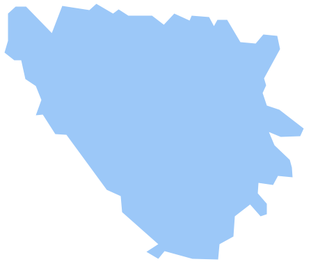
The vector stencils library Bosnia and Herzegovina contains contours for ConceptDraw DIAGRAM diagramming and vector drawing software. This library is contained in the Continent Maps solution from Maps area of ConceptDraw Solution Park.
Picture: Geo Map - Europe - Bosnia and Herzegovina
Related Solution:
Greece is strategically located at the crossroads of Europe, Asia, and Africa.
The vector stencils library Greece contains contours for ConceptDraw DIAGRAM diagramming and vector drawing software. This library is contained in the Continent Maps solution from Maps area of ConceptDraw Solution Park.
Picture: Geo Map — Europe — Greece
Related Solution:
India, officially the Republic of India (Bharat Ganrajya), is a country in South Asia.
The vector stencils library India contains contours for ConceptDraw DIAGRAM diagramming and vector drawing software. This library is contained in the Continent Maps solution from Maps area of ConceptDraw Solution Park.
Picture: Geo Map - Asia - India
Related Solution:
The vector stencils library Russia contains contours for ConceptDraw DIAGRAM diagramming and vector drawing software. This library is contained in the Continent Maps solution from Maps area of ConceptDraw Solution Park.
Picture: Geo Map - Europe - Russia
Related Solution:
The vector stencils library Ukraine contains contours for ConceptDraw DIAGRAM diagramming and vector drawing software. This library is contained in the Continent Maps solution from Maps area of ConceptDraw Solution Park
Picture: Geo Map - Europe - Ukraine
Related Solution:
The vector stencils library Czech Republic contains contours for ConceptDraw DIAGRAM diagramming and vector drawing software. This library is contained in the Continent Maps solution from Maps area of ConceptDraw Solution Park.
Picture: Geo Map - Europe - Czech Republic
Related Solution:
Malaysia is a federal constitutional monarchy in Southeast Asia.
The vector stencils library Malaysia contains contours for ConceptDraw DIAGRAM diagramming and vector drawing software. This library is contained in the Continent Maps solution from Maps area of ConceptDraw Solution Park.
Picture: Geo Map - Asia - Malaysia
Related Solution:
Morocco, officially the Kingdom of Morocco, is a country in the Maghreb region of North Africa.
The vector stencils library Morocco contains contours for ConceptDraw DIAGRAM diagramming and vector drawing software. This library is contained in the Continent Maps solution from Maps area of ConceptDraw Solution Park.
Picture: Geo Map - Africa - Morocco
Related Solution:


