Geo Map — USA — California
Maps of USA — State of California
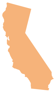
"California is a state located on the West Coast of the United States. It is the most populous U.S. state, home to one out of eight Americans (38 million people), and is the third largest state by area (after Alaska and Texas). California is bordered by Oregon to the north, Nevada to the east, Arizona to the southeast, and the Mexican State of Baja California to the south. It is home to the nation's second and fifth most populous census statistical areas (Greater Los Angeles area and San Francisco Bay Area, respectively), and eight of the nation's 50 most populated cities (Los Angeles, San Diego, San Jose, San Francisco, Fresno, Sacramento, Long Beach, and Oakland). Sacramento is the state's capital." [California. Wikipedia]
The vector stencils library California contains contours for ConceptDraw DIAGRAM diagramming and vector drawing software. This library is contained in the Continent Maps solution from Maps area of ConceptDraw Solution Park.

Pic. 1. Continent Maps Solution
Use the California library to draw thematic maps, geospatial infographics and vector illustrations for your business documents, presentations and websites.
Geo Map — USA — State of California
Area 163,696 sq mi (423,970 sq km); Width 250 miles (400 km); Length 770 miles (1,240 km).

Pic. 2. California
Geo Map — USA — California Contour
Capital - Sacramento.

Pic. 3. California Contour
Geo Map — USA
The United States of America, is a federal republic composed of 50 states, a federal district, five major territories.

Pic. 4. USA Map
Geo Map — USA Contour
A contour map is a map illustrated with contour lines.

Pic. 5. USA Contour
Geo Map — Contours of Territories of the United States
Use the map contours library "United States of America" to design thematic maps using the ConceptDraw DIAGRAM diagramming and vector drawing software.
The vector stencils library "United States of America" contains 53 map contours: US political map, map contours of states.

Pic. 6. Contours of Territories of the United States
See Also Territories of the United States Geo Maps :
TEN RELATED HOW TO's:
Maine is a state in the New England region of the northeastern United States, bordered by the Atlantic Ocean to the east and south; New Hampshire to the west; the Canadian provinces of Quebec to the northwest; and New Brunswick to the northeast.
The vector stencils library Maine contains contours for ConceptDraw DIAGRAM diagramming and vector drawing software. This library is contained in the Continent Maps solution from Maps area of ConceptDraw Solution Park.
Picture: Geo Map — USA — Maine
Related Solution:
Brunei, officially the Nation of Brunei, the Abode of Peace (Malay: Negara Brunei Darussalam, Jawi), is a sovereign state located on the north coast of the island of Borneo, in Southeast Asia.
The vector stencils library Brunei contains contours for ConceptDraw DIAGRAM diagramming and vector drawing software. This library is contained in the Continent Maps solution from Maps area of ConceptDraw Solution Park.
Picture: Geo Map - Asia - Brunei
Related Solution:
Design illustrative maps and explore the geographic diversity of American continents. 🔸 Create detailed maps of North America, South America, Central America, USA, and thematic maps based on them for ✔️ presentations, ✔️ websites, ✔️ social media, ✔️ reports, ✔️ marketing materials, ✔️ educational materials, ✔️ business documents
Picture: Geo Map of Americas
Related Solution:
Hawaii is the most recent of the 50 U.S. states (joined the Union on August 21, 1959), and is the only U.S. state made up entirely of islands.
The vector stencils library Hawaii contains contours for ConceptDraw DIAGRAM diagramming and vector drawing software. This library is contained in the Continent Maps solution from Maps area of ConceptDraw Solution Park.
Picture: Geo Map — USA — Hawaii
Related Solution:
North Dakota is the 39th state of the United States, having been admitted to the union on November 2, 1889.
The vector stencils library North Dakota contains contours for ConceptDraw DIAGRAM diagramming and vector drawing software. This library is contained in the Continent Maps solution from Maps area of ConceptDraw Solution Park.
Picture: Geo Map — USA — North Dakota
Related Solution:
Tennessee is a U.S. state located in the Southeastern United States.
The vector stencils library Tennesse contains contours for ConceptDraw DIAGRAM diagramming and vector drawing software. This library is contained in the Continent Maps solution from Maps area of ConceptDraw Solution Park.
Picture: Geo Map — USA — Tennesse
Related Solution:
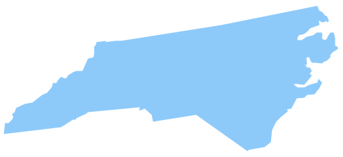
North Carolina is a state in Southeastern United States.
The vector stencils library North Carolina contains contours for ConceptDraw DIAGRAM diagramming and vector drawing software. This library is contained in the Continent Maps solution from Maps area of ConceptDraw Solution Park.
Picture: Geo Map — USA — North Carolina
Related Solution:
Design versatile maps based on the South America continent map effortlessly. 🔸 Create stunning and detailed South America maps and use them in ✔️ presentations, ✔️ educational materials, ✔️ websites, ✔️ business documents
Picture: Geo Map — South America Continent
Related Solution:
The United Arab Emirates, sometimes simply called the Emirates or the UAE, is a country located in the southeast end of the Arabian Peninsula on the Persian Gulf, bordering Oman to the east and Saudi Arabia to the south, as well as sharing sea borders with Qatar, Iran and Pakistan.
The vector stencils library United Arab Emirates contains contours for ConceptDraw DIAGRAM diagramming and vector drawing software. This library is contained in the Continent Maps solution from Maps area of ConceptDraw Solution Park.
Picture: Geo Map - Asia - United Arab Emirates
Related Solution:
Alaska is a U.S. state situated in the northwest extremity of the North American continent.
The vector stencils library Alaska contains contours for ConceptDraw DIAGRAM diagramming and vector drawing software. This library is contained in the Continent Maps solution from Maps area of ConceptDraw Solution Park.
Picture: Geo Map — USA — Alaska
Related Solution:


