Simple Site Plan Drawing
A Site plan is a type of drawing drawn to scale, which shows a land plot and the objects placed on it. These are already existing properties and projected ones, landscape features, greening plants, drives, etc. Site plans are widely used by architects, engineers, designers, landscape architects, urban planners, property developers, landscapers, builders, and other specialists. There are designed both large-scale Site plans, which show the entire plots of land with all buildings constructed and planned on-site and small-scale plans showing a small private plot of land or a part of it, home, garden, patio, backyard, etc. They are designed for both the existing sites and the proposed ones, show the buildable space, can illustrate the phasing of construction works and also the intermediate stages. The detailed Site plans help the contractors to define the scope of work, make estimates, and avoid any miscommunications.
As for the large-scale Site plans and urban planning, they include roads, sidewalks, paths, and trails, in addition to buildings, parking, and other facilities. They include water lines, sanitary sewer lines, lighting, landscaping and garden elements, natural objects like plants, trees, ponds, streams, waterfalls, or other water sources. The displayed information will differ depending on the nature features and size of the project. Site boundaries and delineation of adjacent properties are usually marked on the plan.
The Site plan obligatory takes into account the features of a site and surrounding area, the local building, and zoning codes. It helps to develop the design of a free land plot or redesign an existing one, and show changes to a property. The Site plan helps to think over different components, organize zoning, provide security and access, circulation, land drainage, and other details according to the site properties, soil, climate conditions, weather seasonal changes, winds, rains, seasonal swales, and other significant factors. It helps to think over the rational use of a particular space and visualize all details within the property lines.
An accurate and scaled Site plan is an essential document to take a permit for the construction of a new building, demolition of a house or another structure, remodeling, or making other additions. Site plans are important for accurate planning and design. They are drawn to scale, all dimensions must be clearly shown and labeled on them. Site plans help to guarantee adherence to both local and state building codes when the new property is constructed or the existing one is reconstructed.
Site plans help to make improvements to the design of your property and landscape and show the plan of improvements or additions on the defined plot of land. They make the technical plans understandable for everyone interested in the field of site planning, help to avoid any confusion, and achieve an expected result in building. They are also useful for marketing and property sales.
Site plans include driveways, walkways, patio, garage, fencing, gates, ramps, external lighting, main elements of the landscape, green areas, large trees, gardens, paved areas, pools, terraces, and additional components like litter bins, fire hydrants, plantings, and other details. The information and details shown on the Site plan vary depending on the nature of the project. However, key information is included in most Site plans. These are dimensions, directional orientation, and the title block with the project name, drawing type, author, revision number, status, date, scale, etc. They may include key materials, the layout of external services, including drainage, water, electricity, gas, telephone, internet, also notes to indicate changes from previous revisions and more information.
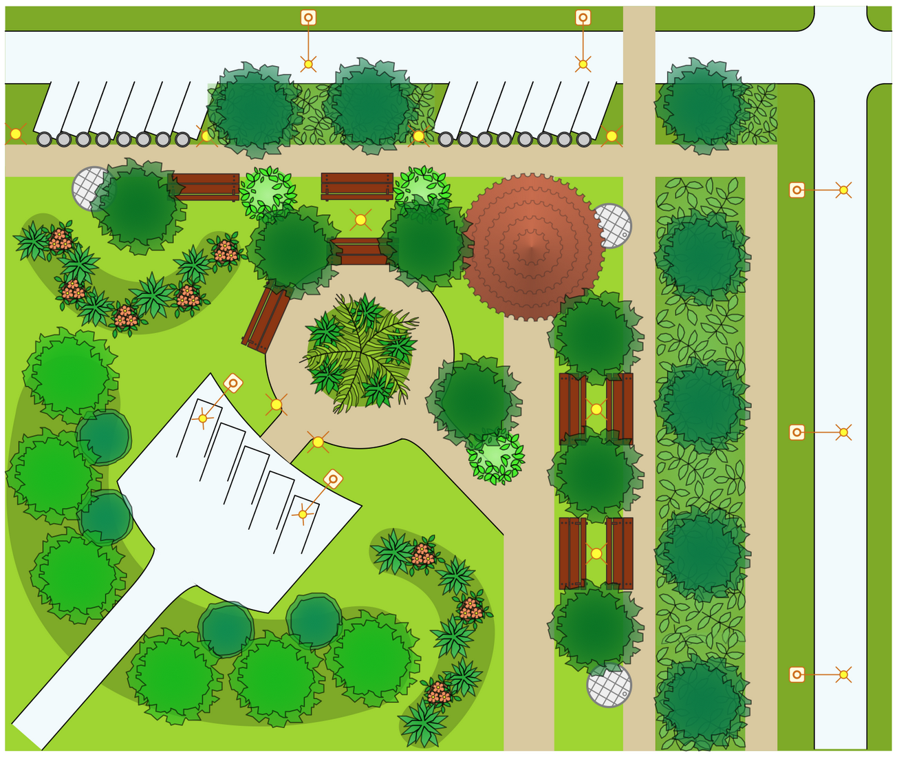
Example 1. Simple Site Plan Drawing in ConceptDraw DIAGRAM
ConceptDraw DIAGRAM site plan software with the Site Plans solution is easy to use and has lots of samples and templates to get started with complex or simple Site Plan drawing. You are able to produce high-quality detailed and accurate Site plans with ease, taking into account landscaping features, proposed changes, building regulations, and any additional features.
Usually, the solid lines and dashed lines indicate existing and proposed structures respectively. The included drag and drop symbols help to design Site plans quickly and take a building permit in short terms. Site Plans solution provides 3 libraries with pre-made vector design elements — parking and roads, site accessories, trees and plants.

Example 2. Design Elements - Parking and Roads
When your Site plan is complete, generate and print it directly from the software, or export to a variety of supported formats. Use it for building or as a part of marketing real estate properties to demonstrate to the potential buyers the complete plot with the property and the surrounding territory, its size, scale, orientation of the property, and other outdoor features better than photos. If the plan is complex, some of this information might be shown on additional pages.

Example 3. Site Plan for Hotel
The sample you see on this page was created in ConceptDraw DIAGRAM software using the Site Plans Solution for ConceptDraw DIAGRAM Solution Park. An experienced user spent 10 minutes creating it based on a ready template.
Use the Site Plans Solution for ConceptDraw DIAGRAM software to develop your own professional-looking Site Plans quickly, simply and effectively.
All source documents are vector graphic documents. They are available for reviewing, modifying, or converting to a variety of formats (PDF file, MS PowerPoint, MS Visio, and many more graphic formats) from the ConceptDraw STORE. The Site Plans Solution is available for all ConceptDraw DIAGRAM users.