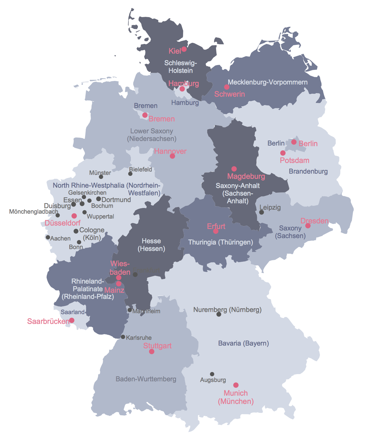
United Kingdom Map
United Kingdom Map Overview
The United Kingdom includes England, Scotland, Wales, and Northern Ireland. UK maps are used to show countries, counties, administrative areas, regions, routes, sales territories, statistical data, and geographic relationships.
Custom United Kingdom maps are useful for business presentations, education, regional reporting, market analysis, logistics planning, travel documents, and geographic infographics.
Software for Creating United Kingdom Maps
ConceptDraw DIAGRAM diagramming and vector drawing software offers the Map of UK solution from the Maps area of ConceptDraw Solution Park.
This solution provides a large collection of predesigned samples and vector map objects for drawing a United Kingdom Map with the required level of detail.
United Kingdom Map Library Features
The Map of UK solution provides editable vector maps of the United Kingdom and the British Isles for creating business presentations, educational materials, geographic infographics, reports, and thematic maps.
What is included?
The solution includes vector maps of the United Kingdom, the British Isles, counties, countries, and islands, together with ready-to-use design elements and map templates.
How many map objects are included?
The Map of UK solution contains two vector libraries with 12 ready-to-use map objects representing countries and islands of the United Kingdom and the British Isles.
What templates are available?
Users can start with predesigned examples, county maps, British Isles maps, regional maps, and thematic map templates available in ConceptDraw STORE.
How to edit the map?
All map objects are vector-based. You can resize, recolor, label, combine, group, or modify individual regions and create custom thematic maps that match your presentation or reporting requirements.
How to export it?
Maps created in ConceptDraw DIAGRAM can be exported to PDF, PowerPoint, Visio, image formats, HTML, and other commonly used document formats.
Common Uses for United Kingdom Maps
United Kingdom maps are commonly used for business territory planning, regional reporting, demographic analysis, logistics visualization, education, travel documentation, market analysis, and geographic presentations.
Because all map elements are editable vector objects, users can quickly create customized maps focused on specific counties, regions, countries, transportation routes, sales territories, or statistical data.
United Kingdom Map Examples and Templates
The following examples show how the Map of UK solution can be used to create editable maps of the United Kingdom, the British Isles, and UK counties.
United Kingdom Map
This United Kingdom map example provides a ready-to-edit visual base for showing England, Scotland, Wales, Northern Ireland, and surrounding geographic areas.
Use this map when you need to create a political map, business territory map, educational diagram, regional overview, or presentation slide focused on the UK.
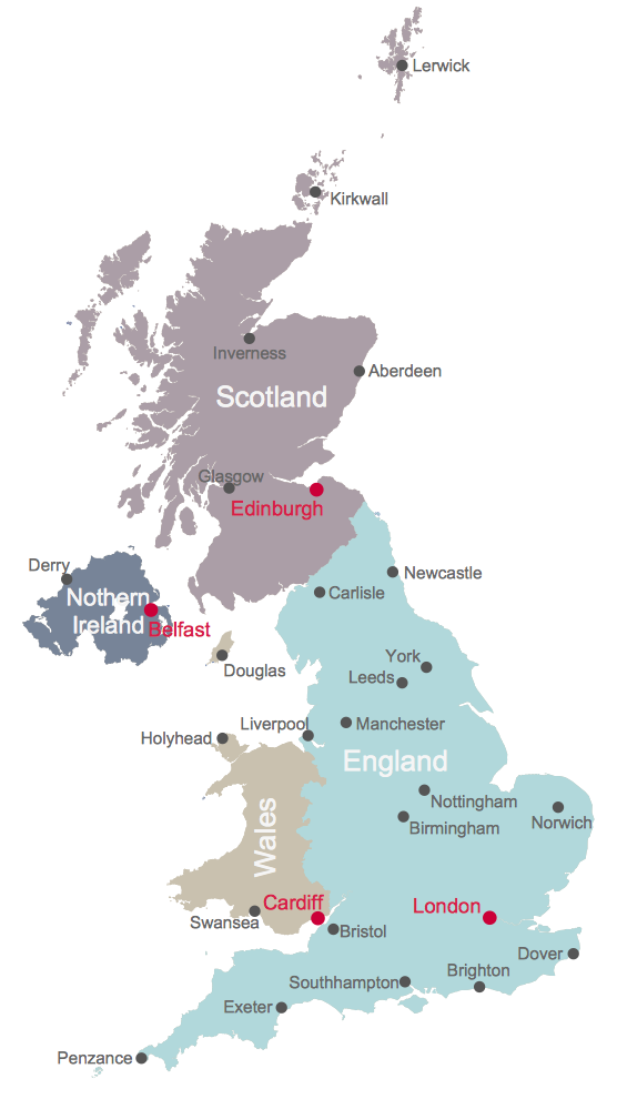
Example 1. United Kingdom Map
Map of UK Solution and Vector Libraries
Map of UK Solution offers ConceptDraw DIAGRAM users an extensive set of drawing tools and two vector libraries with 12 ready-to-use map objects representing the countries and islands of the United Kingdom and the British Isles.
These editable vector maps can be used to create political maps, county maps, regional maps, business territory maps, educational illustrations, travel documents, and thematic geographic visualizations.
The British Isles library provides editable vector elements for creating maps that show the British Isles as a geographic region.
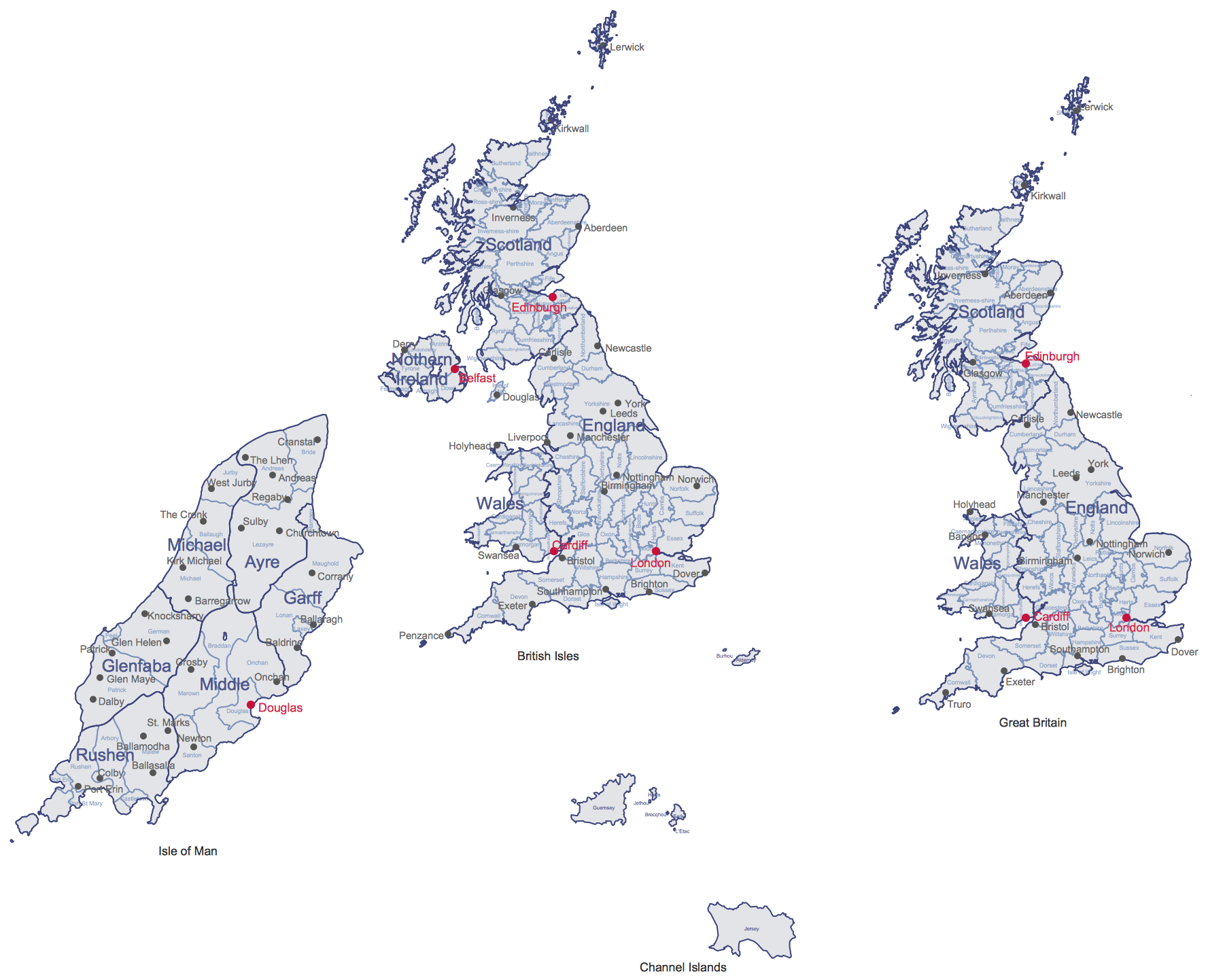 British Isles Library
The United Kingdom library provides editable map objects for building UK-focused maps, county maps, and thematic geographic diagrams.
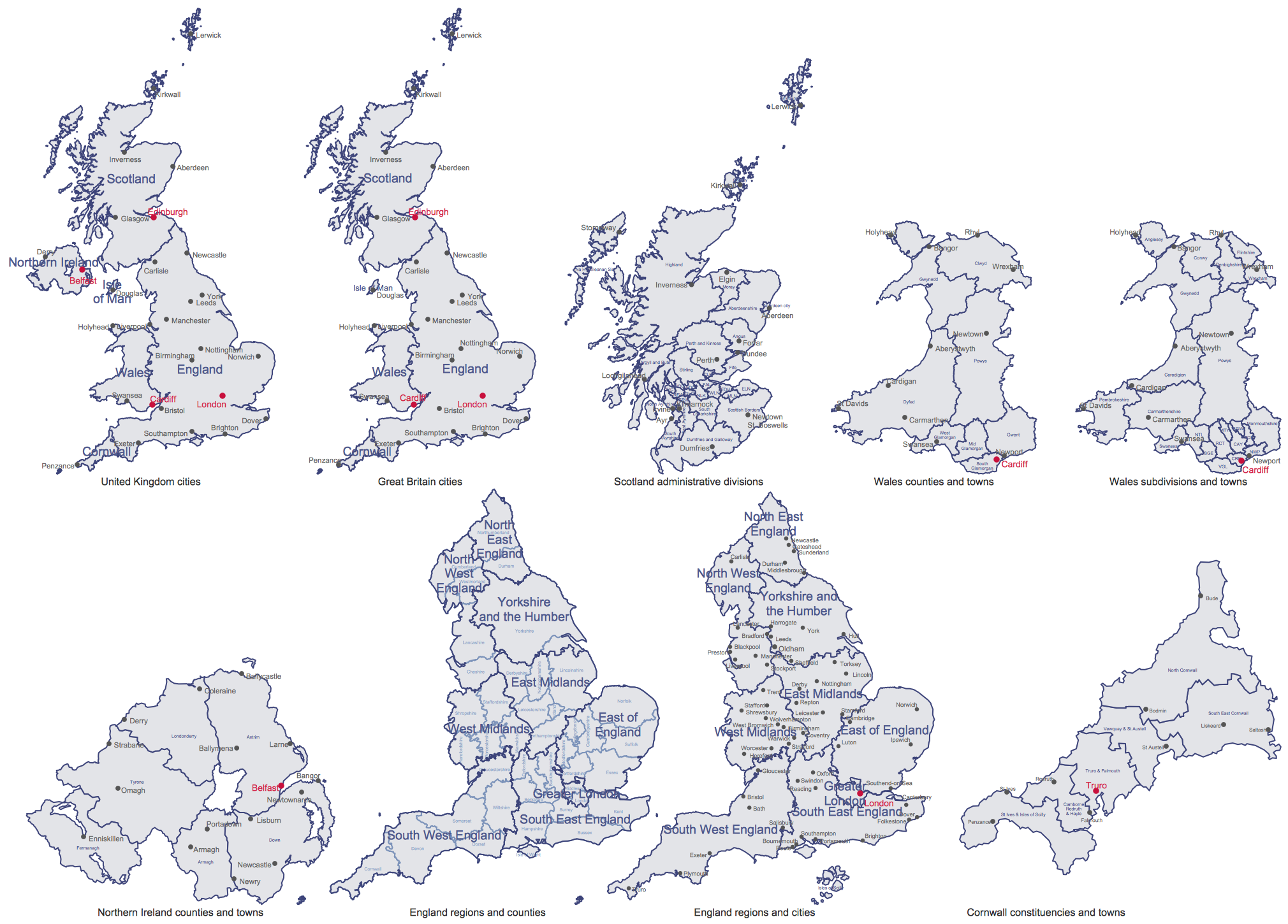 United Kingdom Library
All objects in these libraries are editable vector elements that maintain visual quality at any scale. Users can combine them with labels, icons, routes, statistics, and custom styling to create thematic maps, business reports, educational materials, and geographic infographics.
Map of UK Solution in ConceptDraw STORE
ConceptDraw STORE gives access to the Map of UK solution, libraries, and ready-made examples for ConceptDraw DIAGRAM users.
The solution browser helps users quickly find UK map templates, open them in ConceptDraw DIAGRAM, modify the content, and reuse the final map in business or educational documents.
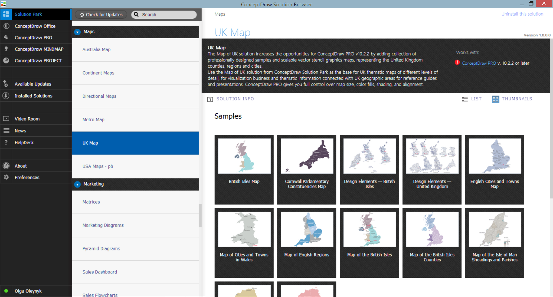
Example 2. Map of UK Solution in ConceptDraw STORE
Map of UK Solution also includes a collection of predesigned samples and examples that help users start new projects faster.
These templates demonstrate different approaches to county mapping, regional visualization, political maps, and thematic map design, and can be modified to fit specific business or educational requirements.
United Kingdom County Map Example
County maps are useful when a UK map requires more detail than a national-level outline. They help show administrative areas, regional structures, planning zones, service coverage, and local data.

Example 3. Map of the British Isles Counties
The United Kingdom map samples shown on this page were created in ConceptDraw DIAGRAM using the drawing tools included in the Map of UK solution.
The county map example demonstrates how detailed administrative boundaries can be visualized for planning, reporting, statistical analysis, regional management, and geographic presentations.
United Kingdom Map Resources and Design Elements
The Map of UK solution combines vector map libraries, editable country and county contours, and ready-made examples in a single workspace.
Users can create maps of England, Scotland, Wales, Northern Ireland, individual counties, and the British Isles without drawing geographic contours manually.
These resources help reduce map creation time while maintaining a professional appearance across presentations, reports, publications, websites, and educational materials.
Create and Export Custom UK Maps
Use the Map of UK solution for ConceptDraw DIAGRAM Solution Park to develop your own United Kingdom map and UK-related thematic maps quickly and effectively.
All source documents are vector graphic documents. They are available for reviewing, modifying, or converting to a variety of formats, including PDF, MS PowerPoint, MS Visio, image formats, and other commonly used formats from ConceptDraw STORE.
The Map of UK solution is available for ConceptDraw DIAGRAM users.
See Also Maps of European Countries
The Maps area of ConceptDraw Solution Park includes editable vector maps for many European countries. These country map templates can be used to create political maps, regional visualizations, sales territory maps, geographic infographics, educational materials, and business presentations.
Each country map contains editable vector contours that can be customized, labeled, recolored, and exported to multiple formats.
- Albania Map
- Austria Map
- Belarus Map
- Belgium Map
- Bulgaria Map
- Bosnia and Herzegovina Map
- Croatia Map
- Czech Republic Map
- Denmark Map
- Estonia Map
- Finland Map
- France Map
- Germany Map
- Greece Map
- Hungary Map
- Iceland Map
- Ireland Map
- Italy Map
- Latvia Map
- Lithuania Map
- Luxembourg Map
- Macedonia Map
- Moldova Map
- Montenegro Map
- Netherlands Map
- Norway Map
- Poland Map
- Portugal Map
- Romania Map
- Russia Map
- Serbia Map
- Slovakia Map
- Slovenia Map
- Spain Map
- Sweden Map
- Switzerland Map
- Ukraine Map
- United Kingdom Map