 Australia Map
For graphic artists creating accurate maps of Australia. The Australia Map solution - allows designers to map Australia for their needs, offers a collection of scalable graphics representing the political geography of Australia, split into distinct state
HelpDesk
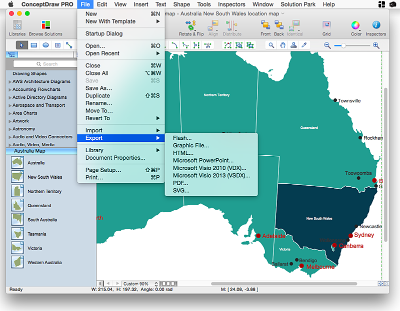
How to Draw Maps of Australia Using ConceptDraw PRO
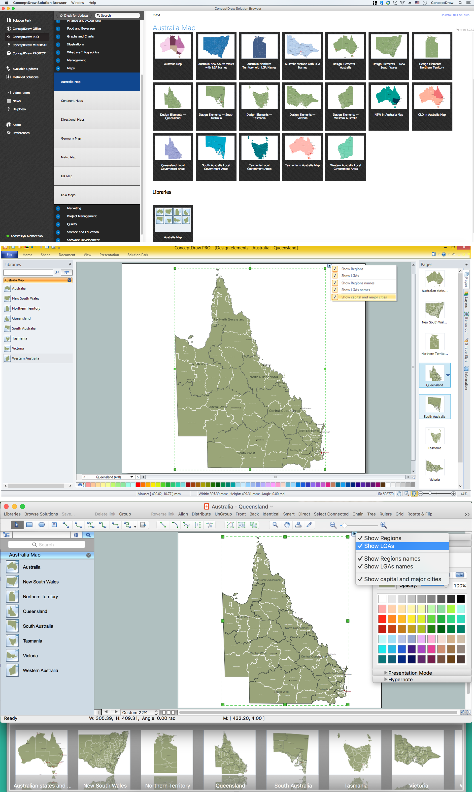
Australia is the sixth largest country in the world. Australia consists from the mainland which is surrounded by many thousands of small fringing islands and numerous larger ones. The vast territories, aligned with interesting historic features across a wide expanse, make the thematic map an ideal way of depicting geographical, geological and political information related to Australia.The Australia Map solution for ConceptDraw PRO will help you to make the steps of the creativeness easy and intuitive. The Australia Map solution provides templates and samples along with vector stencils to get you started. Used together with other ConceptDraw PRO solutions it will allow you to create comprehensive geography-related infographics.Australia Map — Queensland
Queensland (abbreviated as Qld) is the second-largest and third-most-populous state in Australia. Maps surround us everywhere in our life, study, work, traveling, they are widely used in geography, history, politics, economics, and many other fields of science and life activity. But designing of maps is usually complex and labor-intensive process. Now we have the possibility to make easier this process - ConceptDraw PRO diagramming and vector drawing software extended with Australia Map Solution from the Maps Area of ConceptDraw Solution Park will help us in easy drawing detailed Australia map.Map of Australia
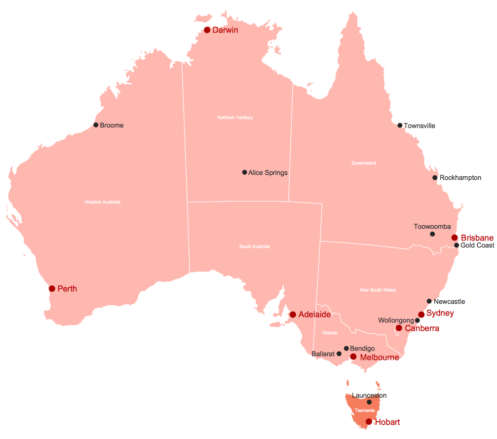
You want design the map of Australia, maps of Australia states or surround islands, maps of Australia self governing mainland territories or extra external territories? Use the indispensable ConceptDraw PRO diagramming and vector drawing software extended with unique Australia Map Solution from the Maps Area of ConceptDraw Solution Park.
 Maps Area
Solutions from the Maps Area of ConceptDraw Solution Park collect templates, samples and libraries of vector stencils for drawing geographical, directional and transport maps.
Map of Germany — Schleswig-Holstein State
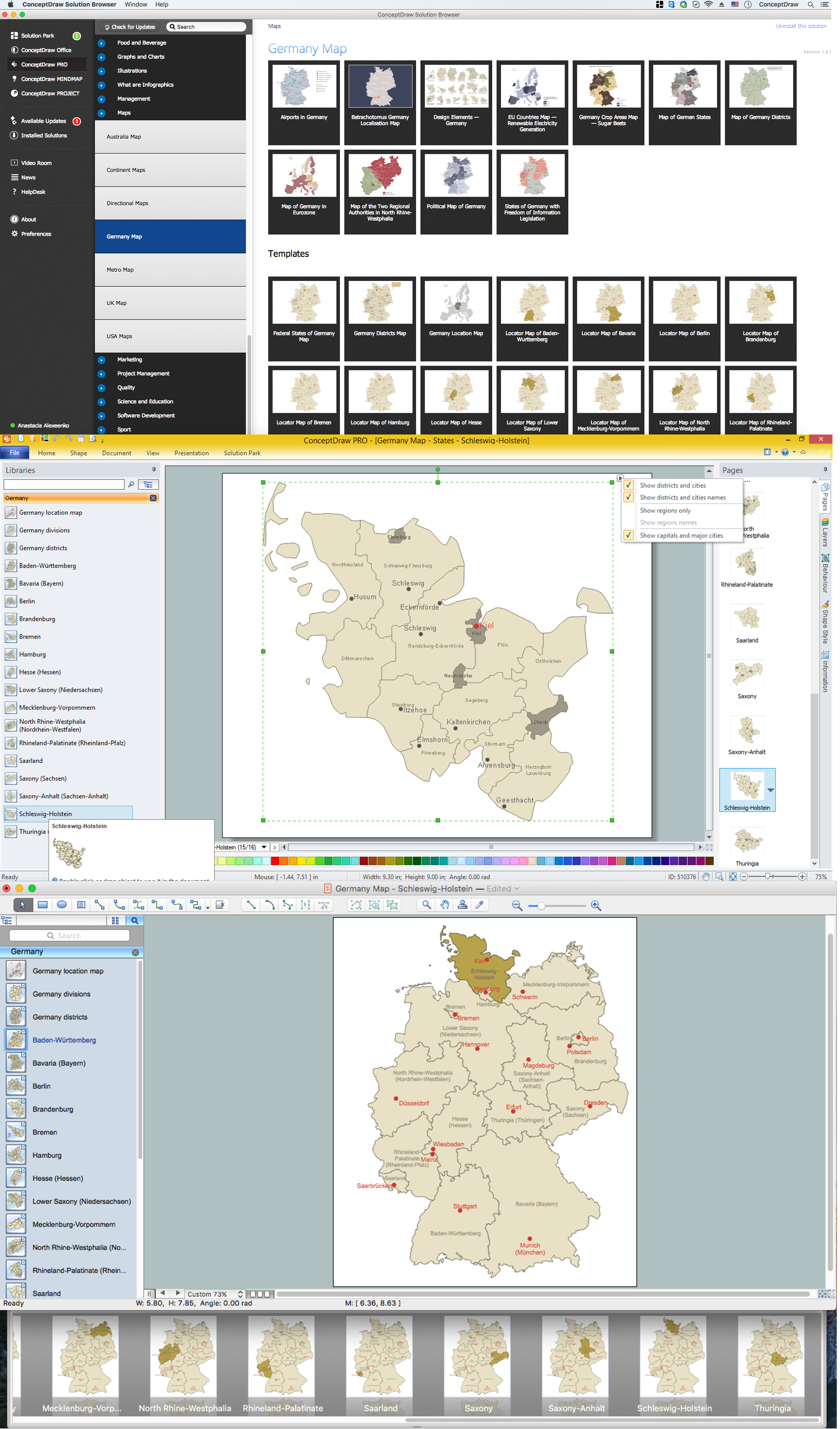
Schleswig-Holstein is the northernmost of the 16 states of Germany, comprising most of the historical duchy of Holstein and the southern part of the former Duchy of Schleswig. Its capital city is Kiel. Despite the fact that the maps surround us everywhere in our life, usually the process of their drawing is sufficienly complex and labor-intensive. But now, thanks to the ConceptDraw PRO diagramming and vector drawing software extended with Germany Map Solution from the Maps Area of ConceptDraw Solution Park, we have the possibility to make easier this process. Design fast and easy your own pictorial maps of Germany, map of Germany with cities, and thematic Germany maps in ConceptDraw PRO!UK Map
The United Kingdom of Great Britain and Northern Ireland, commonly known as the United Kingdom (UK), is a sovereign state in Europe which consists of four countries: England, Scotland, Wales, and Northern Ireland. UK is surrounded by the waters of Atlantic ocean, the North Sea, the English Channel, and the Irish Sea and includes large number of big and small islands. ConceptDraw PRO diagramming and vector drawing software offers the unique Map of UK Solution from the Maps Area of ConceptDraw Solution Park that is indispensable for easy drawing professional looking map of UK, UK counties map, UK map with cities, map of Scotland, map of England, map of Wales, Northern Ireland map.Map of Germany
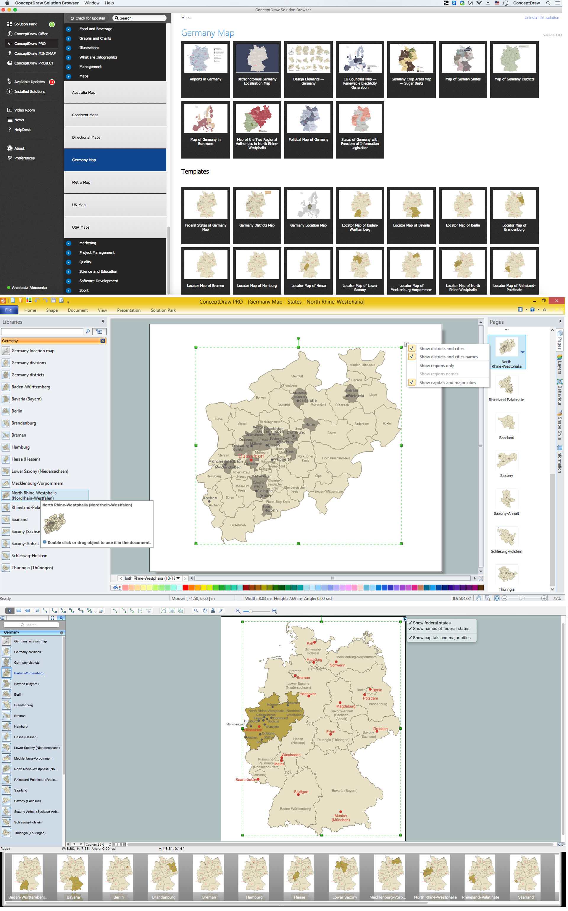
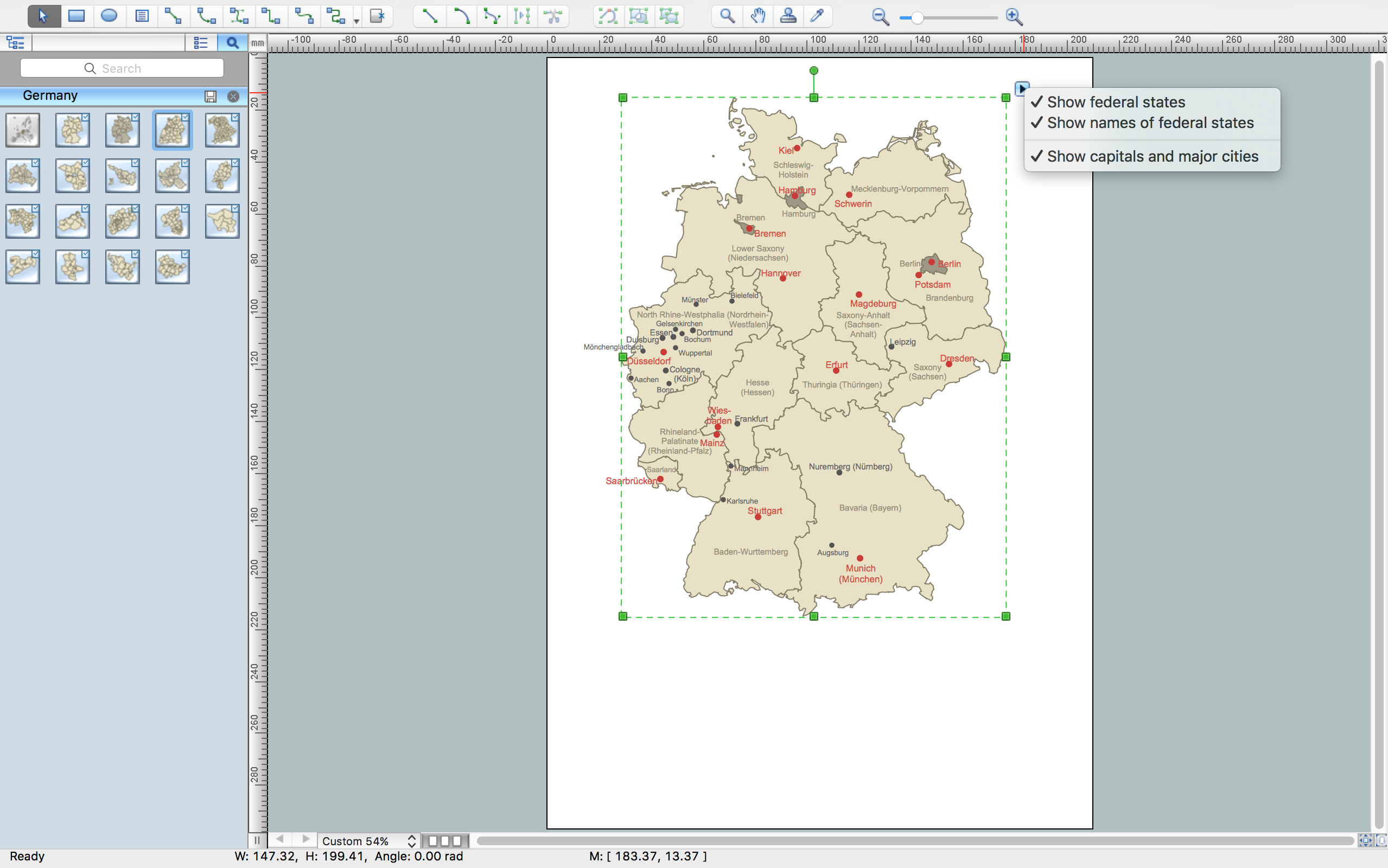
Germany, officially the Federal Republic of Germany, is a federal parliamentary republic in West-Central Europe. You need design the map of Germany or detailed map of Germany with cities fast and easy? We reccomend you to use the indispensable ConceptDraw PRO diagramming and vector drawing software extended with unique Germany Map Solution from the Maps Area of ConceptDraw Solution Park.Map of Germany — North Rhine-Westphalia State
North Rhine-Westphalia is the most populous state of Germany, as well as the fourth largest by area. Its capital is Düsseldorf; the biggest city is Cologne. Despite the fact that the maps surround us everywhere in our life, usually the process of their drawing is sufficienly complex and labor-intensive. But now, thanks to the ConceptDraw PRO diagramming and vector drawing software extended with Germany Map Solution from the Maps Area of ConceptDraw Solution Park, we have the possibility to make easier this process. Design fast and easy your own pictorial maps of Germany, map of Germany with cities, and thematic Germany maps in ConceptDraw PRO!Geo Map - South America Continent
South America includes 12 sovereign states. ConceptDraw PRO is idea to draw the geological maps of South America continent from the pre-designed vector geo map shapes. Use Continent Maps solution from the Maps area of ConceptDraw Solution Park to draw thematic maps, geospatial infographics and vector illustrations for your business documents, presentations and websites.Germany Map
Germany is in Western and Central Europe, with Denmark bordering to the north, Poland and the Czech Republic to the east, Austria to the southeast, Switzerland to the south-southwest, France, Luxembourg and Belgium lie to the west, and the Netherlands to the northwest. ConceptDraw PRO diagramming and vector drawing software enhanced with Germany Map Solution from the Maps Area of ConceptDraw Solution Park is the best for drawing geographic Germany map, topography, political, and various thematic maps of Germany.The vector stencils library "Marketing maps" contains 44 state map contours with capitals and major cities: the Group of Twenty (G20) state maps, EU state maps and World map.
Use it to visualize geospatial information in your marketing infograms.
"The Group of Twenty (also known as the G-20 or G20) is a forum for the governments and central bank governors from 20 major economies. The members, shown highlighted on the map at right, include 19 individual countries—Argentina, Australia, Brazil, Canada, China, France, Germany, India, Indonesia, Italy, Japan, Republic of Korea, Mexico, Russian Federation, Saudi Arabia, South Africa, Turkey, United Kingdom, United States—and the European Union (EU). The EU is represented by the European Commission and by the ECB." [G-20 major economies. Wikipedia]
The G-20 state map contours example "Design elements - Marketing maps (G-20)" was created using the ConceptDraw PRO diagramming and vector drawing software extended with the Marketing Infographics solition from the area "Business Infographics" in ConceptDraw Solution Park.
 UK Map
The Map of UK solution contains collection of professionally designed samples and scalable vector stencil graphics maps, representing the United Kingdom counties, regions and cities. Use the Map of UK solution from ConceptDraw Solution Park as the base fo
 Education Package
Education Package is a comprehensive set of multifarious graphical solutions from ConceptDraw Solution Park, collected together in help to ConceptDraw PRO users working in a field of science, education and training, which is aimed at improving the quality of education and helping to design with ease variety of interesting and colorful educational materials, diagrams, charts and maps. Use it to present the information and knowledge in an interesting, clear, structured and simple form to achieve a success in education and pedagogy, to maintain the interest of students and pupils throughout the whole learning process, at the lectures, lessons and even during independent work with additional materials, to contribute to better perception of scientific information by listeners during the conferences and reports.
Geo Map - USA - Oklahoma
Oklahom is a state located in the South Central United States. The vector stencils library Oklahoma contains contours for ConceptDraw PRO diagramming and vector drawing software. This library is contained in the Continent Maps solution from Maps area of ConceptDraw Solution Park.- Australia map with cities - Template | Australia map - Template ...
- Major Cities In Germany Map
- Map Of Africa With Capital Cities
- Africa map with countries, main cities and capitals - Template | Geo ...
- Easy To Draw Map Of Europe
- Europe map with capitals - Template | Geo Map - Europe - France ...
- Maps of Germany With Cities | Germany Map | Map of Germany ...
- Continent Maps | Geo Map - United States of America Map | Map of ...
- USA Maps | How to Create a Map of Germany Using ConceptDraw ...
- Map Australia
- The Map Of States
- Infographic software: the sample of New York City Subway map ...
- Geo Map - Europe | Design elements - Asia | Design elements ...
- How to Draw a Map of North America Using ConceptDraw PRO ...
- Geo Map - United States of America Map | Learn how to create a ...
- How to Draw a Map of North America Using ConceptDraw PRO ...
- Us Map With Cities
- Geo Map - United States of America Map | How to Draw a Map of ...
- How to Draw a Map of North America Using ConceptDraw PRO ...
- Geo Map - Asia - Papua New Guinea | Geo Map - Australia | Design ...



-state-maps-design-elements---marketing-maps-(g-20).png--diagram-flowchart-example.png)
