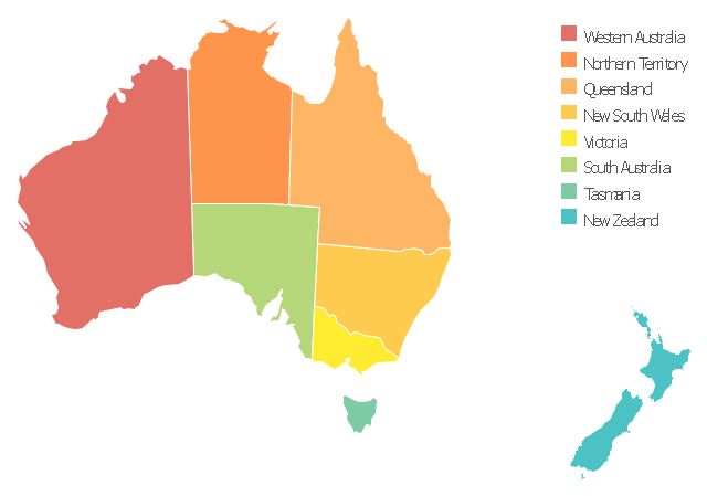
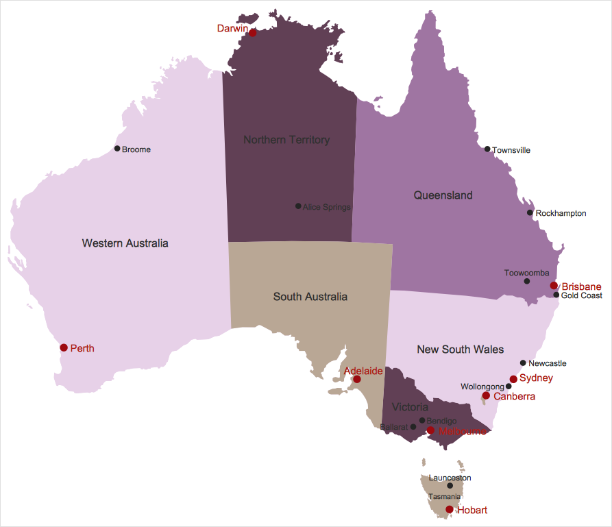
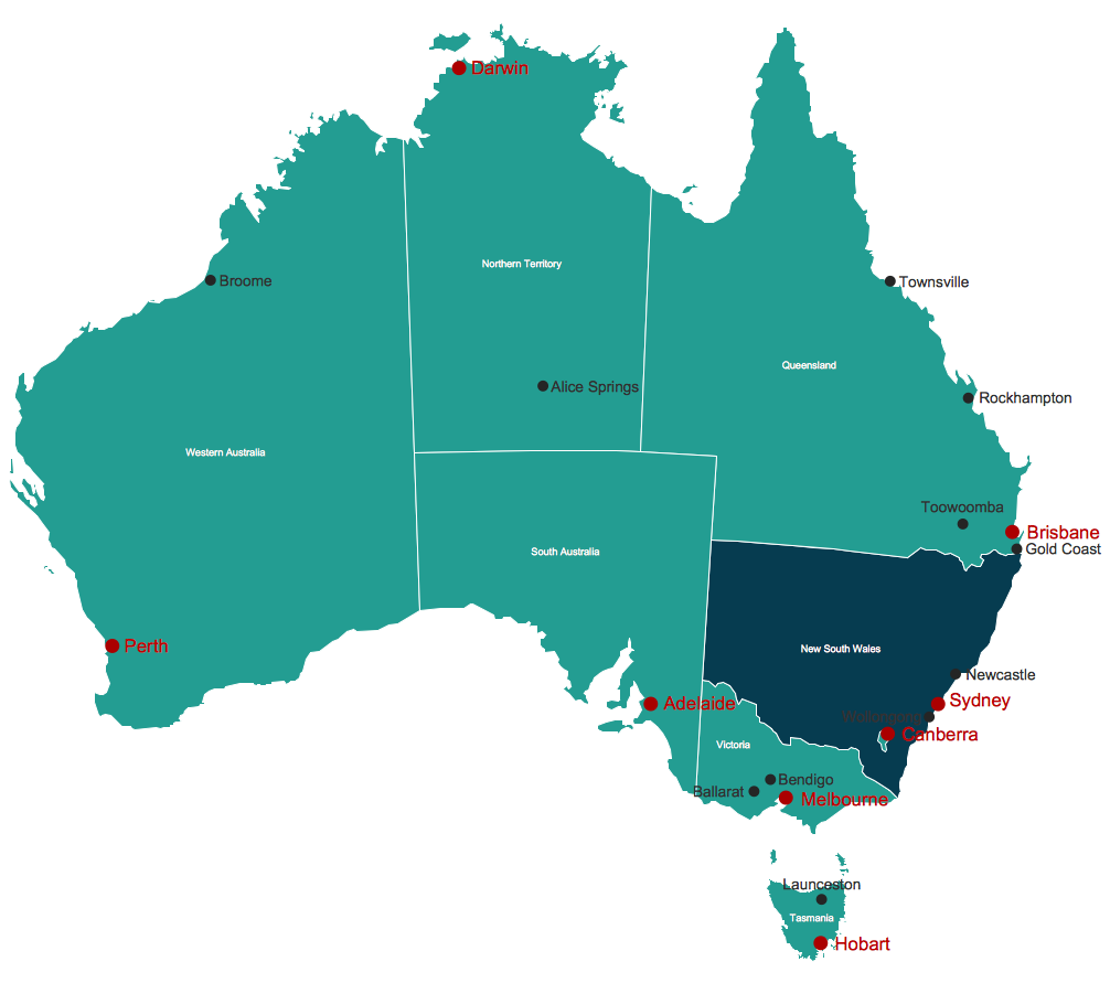
Use this template of Australia map with contours of Australian states and territories, and main cities to design your political or thematic map.
This Australia map template for the ConceptDraw PRO diagramming and vector drawing software is included in the Continent Maps solution from the Maps area of ConceptDraw Solution Park.
This Australia map template for the ConceptDraw PRO diagramming and vector drawing software is included in the Continent Maps solution from the Maps area of ConceptDraw Solution Park.
Use this template to design your Australia political map, cartogram or thematic map, to visualize your spatial business information connected with geographic areas, locations or ways.
This Australia map template for the ConceptDraw PRO diagramming and vector drawing software is included in the Continent Maps solution from the Maps area of ConceptDraw Solution Park.
This Australia map template for the ConceptDraw PRO diagramming and vector drawing software is included in the Continent Maps solution from the Maps area of ConceptDraw Solution Park.
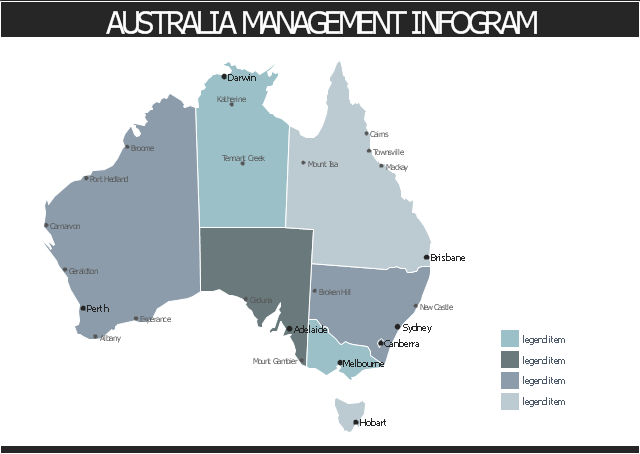
This thematic map template shows contours of Australia states and territories with capitals and major cities.
Use it to design your management infograms using the ConceptDraw PRO diagramming and vector drawing software.
The template "Australia management infogram" is included in the Management infographics solution from the Business infographics area of ConceptDraw Solution Park.
Use it to design your management infograms using the ConceptDraw PRO diagramming and vector drawing software.
The template "Australia management infogram" is included in the Management infographics solution from the Business infographics area of ConceptDraw Solution Park.
Continents Map
Designing of Continents Map is a quite complex and labour-intensive process. But now we have a way to make it easier - ConceptDraw PRO diagramming and vector drawing software extended with useful drawing tools of Continent Maps Solution from the Maps Area.
 Maps
Maps
This solution extends ConceptDraw PRO v9.4 with the specific tools necessary to help you draw continental, directional, road, or transit maps, to represent international, business, or professional information visually.
Continents Map
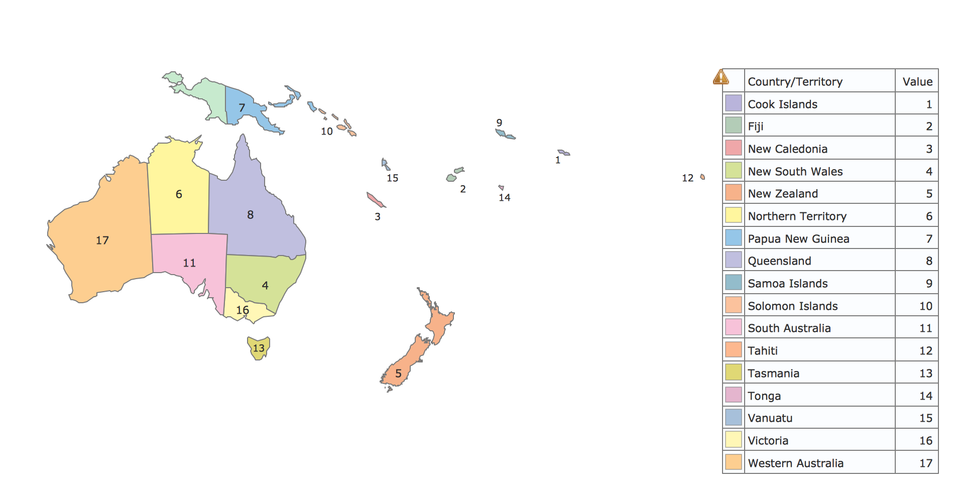
Designing of Continents Map is a quite complex and labour-intensive process. But now we have a way to make it easier - ConceptDraw PRO diagramming and vector drawing software extended with useful drawing tools of Continent Maps Solution from the Maps Area.Geo Map - Oceania
The vector stencils library Oceania contains contours for ConceptDraw PRO diagramming and vector drawing software.HelpDesk
How to Draw Maps of Australia
Australia is the sixth largest country in the world. Australia consists from the mainland which is surrounded by many thousands of small fringing islands and numerous larger ones. The vast territories, aligned with interesting historic features across a wide expanse, make the thematic map an ideal way of depicting geographical, geological and political information related to Australia.The Australia Map solution for ConceptDraw PRO will help you to make the steps of the creativeness easy and intuitive. The Australia Map solution provides templates and samples along with vector stencils to get you started. Used together with other ConceptDraw PRO solutions it will allow you to create comprehensive geography-related infographics.How To use House Electrical Plan Software
How we can conduct the electricity at house correctly without a plan? It is impossible. The House electrical diagram depicts locations of switches, outlets, dimmers and lights, and lets understand how you will connect them. But design of House Electrical Plan looks a complex task at a glance, which requires a lot of tools and special experience. But now all is simple with all-inclusive floor plan software - ConceptDraw PRO. As a house electrical plan software, the ConceptDraw PRO contains libraries with a large range of professional lighting and electrical symbols, ready-to-use electrical plans samples and examples, and built-in templates for creating great-looking Home floor electrical plans. It is a fastest way to draw Electrical circuit diagrams, Electrical wiring and Circuit schematics, Digital circuits, Electrical equipment, House electrical plans, Satellite television, Cable television, Home cinema, Closed-circuit television when are used the tools of Electric and Telecom Plans Solution from ConceptDraw Solution Park. Files created in Visio for Mac app can be easily imported to ConceptDraw PRO. Also you may import stencils and even libraries. Try for free an alternative to Visio that Apple users recommend.
Emergency Plan
The Fire Emergency Plan illustrates the scheme of the building and location of the main and fire exits for a safe evacuation, and clearly defines directions to them on the plan. Fire Emergency Plans are constructed on the case of unexpected or emergency situations, fires, hazardous leaks, natural disasters, and other sudden events. They must to be obligatorily on the plain sight at every building and on each floor, at living houses and apartments, schools and universities, medical centers, clinics and hospitals, office buildings, banks, cafes, restaurants, and also at all other public buildings and institutions. The Evacuation plans and Emergency Plans preliminary designed in ConceptDraw PRO software help employees and family members when some emergency events happen and let avoid the accidents and sad consequences, prevent injuries and fatalities, allow reduce damages and speed the work resumption. Start drawing emergency blueprint from floor bounds, then add the inner walls and doors, and finally use bright arrows to visually show evacuation directions to fire exits. ConceptDraw is a serious alternative to Visio. It's a desktop based solution aimed at professional designers working in CAD environments. It is also a good option for those who work between Mac and PC because one license is valid for both.
Geo Map - Australia - Tasmania
Tasmania (abbreviated as Tas and known colloquially as "Tassie") is an island state, part of the Commonwealth of Australia.Geo Map - Australia - South Australia
South Australia (abbreviated as SA) is a state in the southern central part of Australia. It covers some of the most arid parts of the continent.Geo Map - Australia
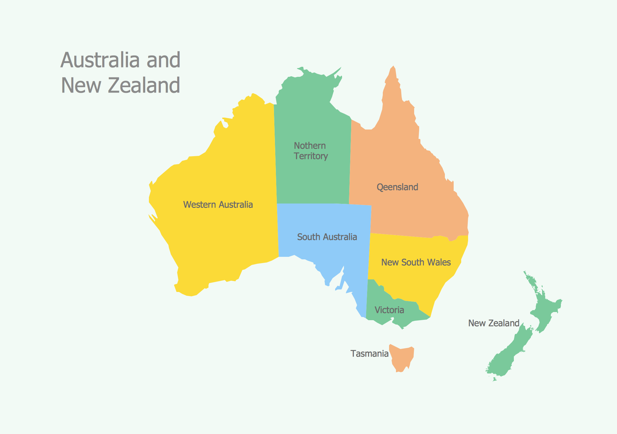
The vector stencils library Australia contains contours of New Zealand and Australian states and mainland territories for ConceptDraw PRO diagramming and vector drawing software.Map Australia
ConceptDraw PRO diagramming and vector drawing software offers the Australia Map Solution from the Maps Area of ConceptDraw Solution Park - the best tool for fast and easy drawing various types of Australia maps, maps of Australia states and islands, Map Australia with cities, thematic Australia maps and cartograms of any degree of detailing.- Geo Map - Australia - New Zealand | Map Australia | Australia map ...
- Geo Map — Australia — New Zealand | Australia map - Template ...
- Australia map - Template | Maps | Continent Maps | Australia Map ...
- Australia map - Template
- Australia management infogram - Template
- Map Software | Australia map - Template | Australia map with cities ...
- Australia map with cities - Template | Australia Map | How to Draw ...
- Africa map with countries, main cities and capitals - Template ...
- Australia map with cities - Template | Australia Map | Map of ...
- Australia states time zones - Thematic map | Australia map ...
- Australia Map
- Visio Template Of Australia
- Africa map with countries, main cities and capitals - Template | Maps ...
- Australia Map | USA Maps | Pie Charts | Australia Map Colours
- Australia New Zealand Outline Map
- Germany location map - Template | Spatial infographics Design ...
- Outline Map Of Australia And New Zealand
- Map Australia
- Africa map with countries, main cities and capitals - Template | Africa ...

