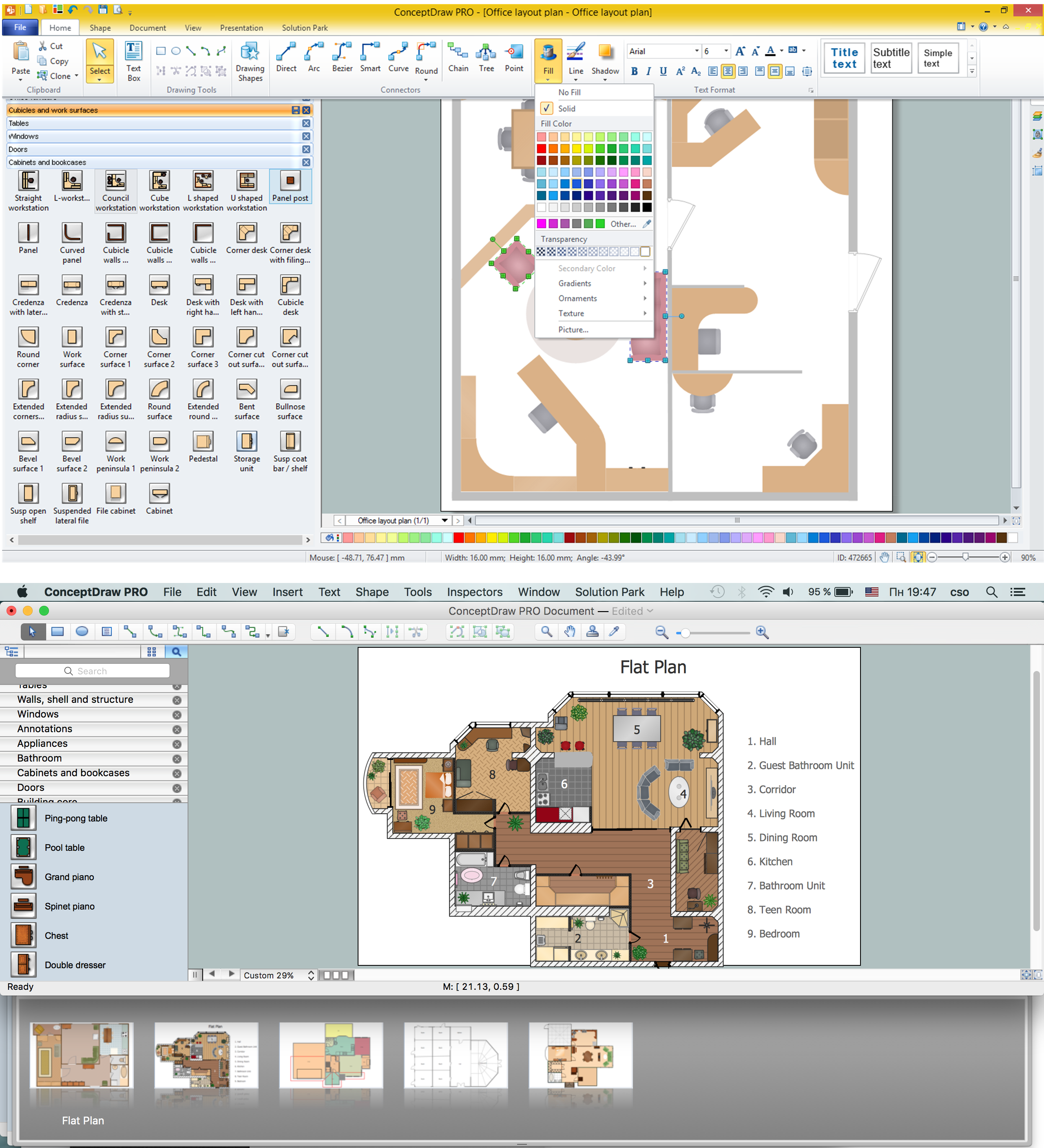
How To Draw Building Plans
Building Plan is the basis for implementation construction and repair works. Creation of Building Plans is the main purpose of architects and designers. They are required and even obligatory for builders to accurately implement your wishes and ideas during the building, designing or redesigning your home, flat, office, or any other premise. ConceptDraw PRO is a powerful quick building plan software for creating great-looking Office layouts, Home floor plans, Commercial floor plans, Storage building plans, Expo and Shopping mall building plans, School and Training building plans, Cafe or Restaurant plans, Gym and Spa area plans, Sport field plans, House interior designs, Electric and Telecom building plans, Fire and Emergency plans, HVAC plans, Security and Access plans, Plumbing and Piping plans, Plant layouts, etc. Use helpful samples, templates and variety of libraries with numerous building design elements from Floor Plans solution for ConceptDraw PRO software to facilitate design drawing process.
 Directional Maps
Directional Maps solution extends ConceptDraw PRO software with templates, samples and libraries of vector stencils for drawing the directional, location, site, transit, road and route maps, plans and schemes.
 Spatial Infographics
Spatial infographics solution extends ConceptDraw PRO software with infographic samples, map templates and vector stencils libraries with design elements for drawing spatial information graphics.
The vector stencils library "Landmarks" contains 69 landmark symbols of buildings, waterways, scale and directional indicators for labeling transportation and directional maps, road and route maps, street and transit maps, locator and tourist maps.
The pictograms example "Landmarks - Vector stencils library" was created using the ConceptDraw PRO diagramming and vector drawing software extended with the Directional Maps solution from the Maps area of ConceptDraw Solution Park.
The pictograms example "Landmarks - Vector stencils library" was created using the ConceptDraw PRO diagramming and vector drawing software extended with the Directional Maps solution from the Maps area of ConceptDraw Solution Park.
Design Pictorial Infographics. Design Infographics
In the course of recent decades data visualization went through significant development and has become an indispensable tool of journalism, business intelligence and science. The way visual information may be conveyed is not limited simply to static or dynamic representation, it can also be interactive. Infographics can be conditionally divided into several general levels. Primarily, this is level of visualization of information, its interpretation and association on any ground. Second level can be defined as a visualization of knowledge, depiction of thoughts and ideas in the form of images or diagrams. Finally, the level of data visualization, which processes data arrays in charts, enabling the information to be more clearly perceived. You can also identify the main approaches to the creation of infographics: exploratory and narrative. Exploratory method insists on minimalist design in favor of data precision without unnecessary details and is common for scientific researches and ana- Aerospace and Transport | Bike Factory Layout Diagram
- Factory layout floor plan | Buildings and green spaces - Vector ...
- Gym layout plan
- Network Layout Floor Plans | How To Create Restaurant Floor Plan ...
- Factory Layout Symbols
- Health club floor plan | How to Create a SysML Diagram Using ...
- Office Layout Bicycle
- Physical training | Gym layout plan | Health club floor plan ...
- Gym layout | Fitness center layout | Gym equipment layout floor plan ...
- Bike
- Plant Layout Plans | Interior Design Machines and Equipment ...
- Gym Workout Plan | Gym and Spa Area Plans | Gym layout plan ...
- Factory layout floor plan | Restaurant Floor Plans Samples | Interior ...
- Site Plan | Plant Layout Plans | Site Plan Software | Sample Layout ...
- Building Drawing Software for Design Office Layout Plan | How To ...
- Building Drawing Software for Design Office Layout Plan | Interior ...
- Cafe and Restaurant Floor Plans | Site Plans | Building Drawing ...
- Gym equipment layout floor plan
- Gym equipment layout floor plan | Building Drawing Software for ...
- Factory Clipart Png


