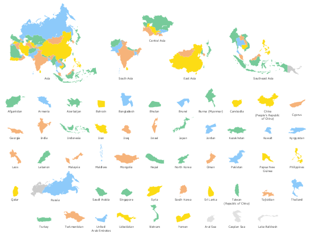
Use the map contours library "Asia" to design thematic maps of Asian countries using the ConceptDraw PRO diagramming and vector drawing software.
"Asia ... is the world's largest and most populous continent, located primarily in the eastern and northern hemispheres. ...
The boundaries of Asia are culturally determined, as there is no clear geographical separation between it and Europe, which together form one continuous landmass called Eurasia. The most commonly accepted boundaries place Asia to the east of the Suez Canal, the Ural River, and the Ural Mountains, and south of the Caucasus Mountains (or the Kuma–Manych Depression) and the Caspian and Black Seas. It is bounded on the east by the Pacific Ocean, on the south by the Indian Ocean and on the north by the Arctic Ocean." [Asia. Wikipedia]
The vector stencils library "Asia" contains 57 map contours: Asia state map contours, Asia political map, sea contours, lake contours.
The map contours example "Design elements - Asia" is included in the Continent Maps solution from the Maps area of ConceptDraw Solution Park.
Geo Map Software
Geo Map Software - Full Geographic Reach of Your Business with Geo Map Shapes.Types of Map - Overview
ConceptDraw defines some map types, divided into three categories. Every map type has specific shapes and examples.Geo Mapping Software Examples - World Map Outline
An Example world map, showing a simple outline of world map. The world map is vector and can be edited or export to svg format.Map Software
Create maps, flags, and more with ConceptDrawWork Flow Diagram
ConceptDraw PRO diagramming and vector drawing software offers the Workflow Diagrams solution from the Business Processes area of ConceptDraw Solution Park with powerful tools to help you draw any Work Flow Diagram fast and easy.Geo Map - Europe - Luxembourg
The vector stencils library Luxembourg contains contours for ConceptDraw PRO diagramming and vector drawing software. This library is contained in the Continent Maps solution from Maps area of ConceptDraw Solution Park.Geo Map - USA - Minnesota
Minnesota is a U.S. state in the Midwestern United States. The vector stencils library Minnesota contains contours for ConceptDraw PRO diagramming and vector drawing software. This library is contained in the Continent Maps solution from Maps area of ConceptDraw Solution Park.
 Business Package for Management
Package intended for professional who designing and documenting business processes, preparing business reports, plan projects and manage projects, manage organizational changes, prepare operational instructions, supervising specific department of an organization, workout customer service processes and prepare trainings for customer service personal, carry out a variety of duties to organize business workflow.
 25 Typical Orgcharts
The 25 Typical Orgcharts solution contains powerful organizational structure and organizational management drawing tools, a variety of professionally designed organization chart and matrix organization structure samples, 25 templates based on various orga
- Geo Map Software | Clear Map Of Asia With Capitals
- Asian Map Designs
- Geo Mapping Software Examples - World Map Outline | Asia - Vector ...
- Asia map with capitals - Template | Geo Map - Asia - Indonesia | Geo ...
- Map Of Asia
- Asian Country Map
- Asian Country And Capital Map
- Asia map with capitals - Template | Geo Map - Asia - Indonesia ...
- Design elements - Asia flags | Asia map with capitals - Template ...
- Geo Map - Asia
- Asian Continents Countries
- Geo Map - Asia - Myanmar | Geo Mapping Software Examples ...
- Geo Map - Asia | South Asia - Political map | North Asia - Political ...
- Northern Asia Political Map
- Geo Map - Asia - Yemen
- Design elements - Asia flags | Geo Map - Asia - Philippines | Geo ...
- Continent Maps | Geo Map - Asia | Central Asia - Political map ...
- Geo Map - Asia
- Types of Flowchart - Overview | Geo Map - Africa | Geo Map - Asia ...
- Geo Map - Asia


