 ConceptDraw Solution Park
ConceptDraw Solution Park collects graphic extensions, examples and learning materials
Geo Map Software
Geo Map Software - Full Geographic Reach of Your Business with Geo Map Shapes.
 Continent Maps
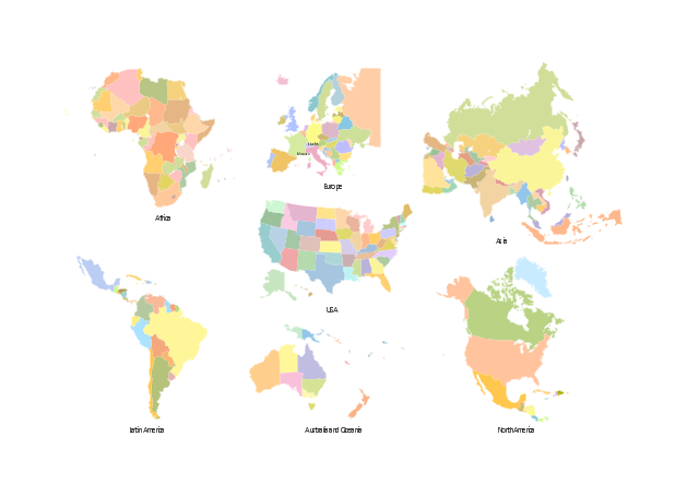
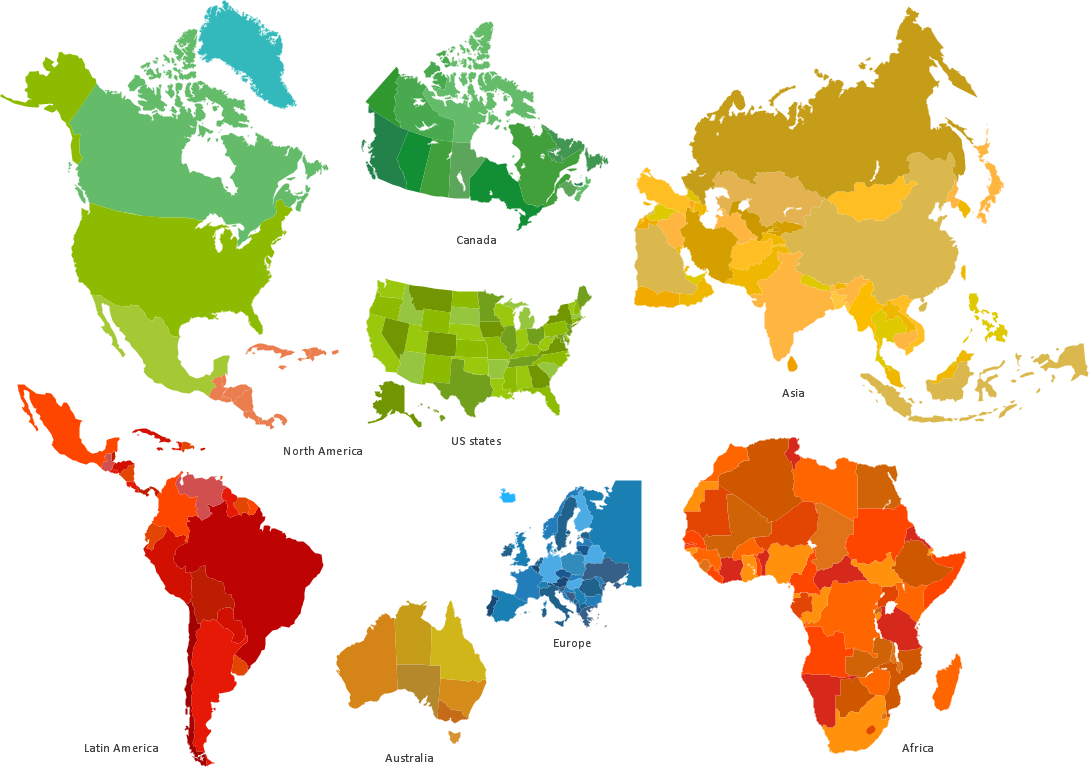
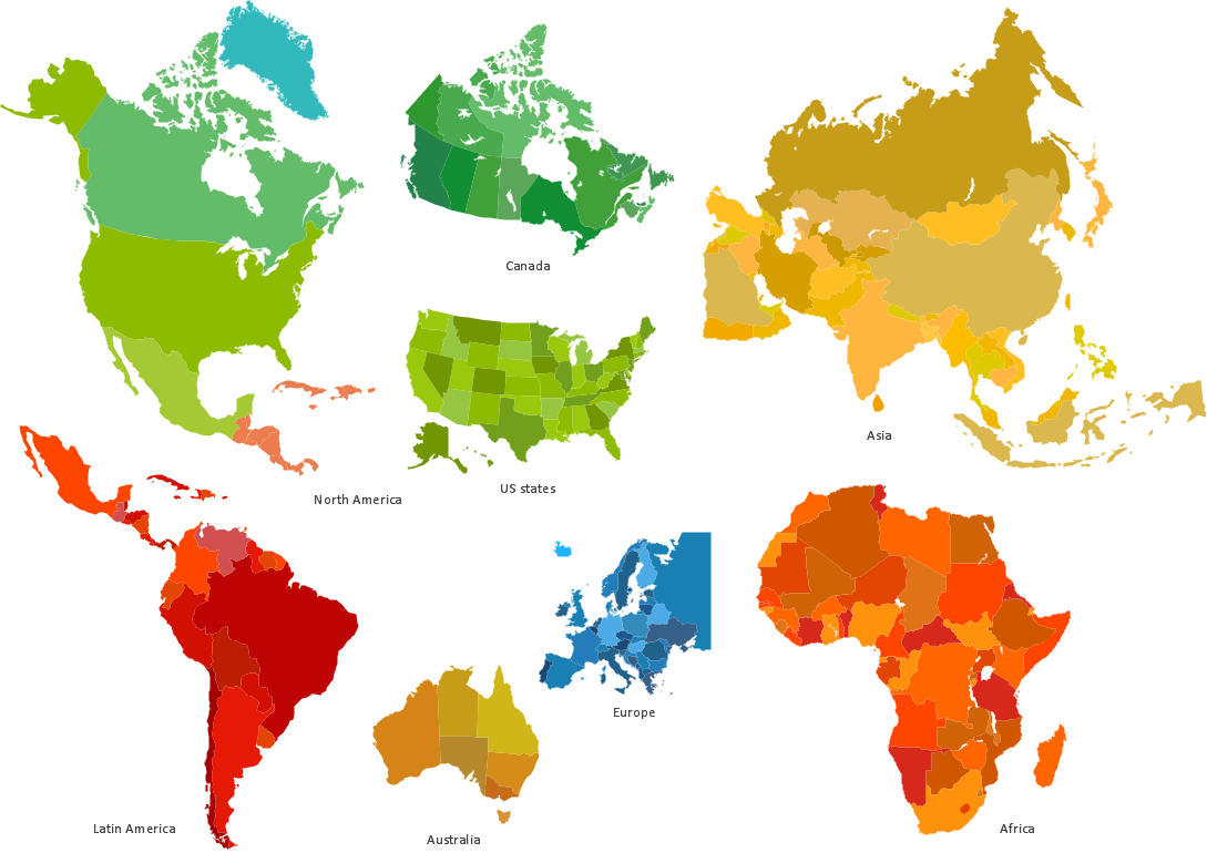
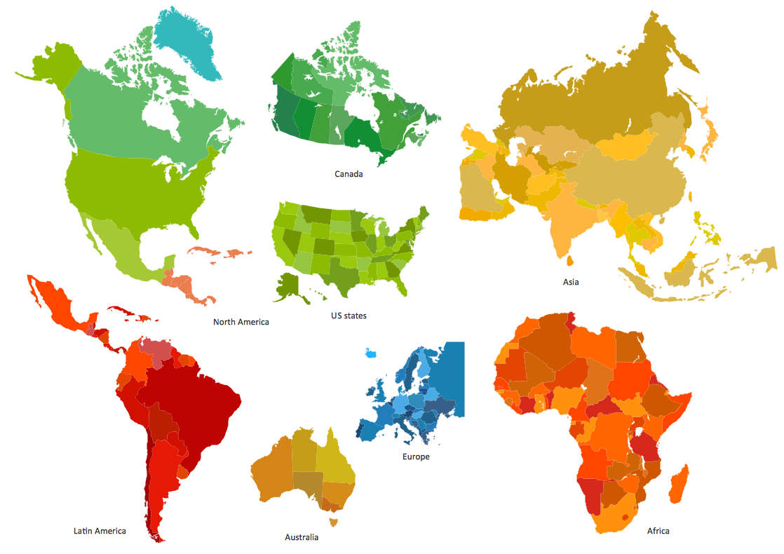
Continent Maps solution extends ConceptDraw PRO software with templates, samples and libraries of vector stencils for drawing the thematic maps of continents, state maps of USA and Australia.
Spatial infographics Design Elements: Location Map
Infographic Design Elements for visually present various geographically distributed information."A thematic map is a type of map or chart especially designed to show a particular theme connected with a specific geographic area. ...
A thematic map is a map that focuses on a specific theme or subject area, whereas in a general map the variety of phenomena - geological, geographical, political - regularly appear together. ...
Thematic maps emphasize spatial variation of one or a small number of geographic distributions. These distributions may be physical phenomena such as climate or human characteristics such as population density and health issues. ...
Thematic map are sometimes referred to as graphic essays that portray spatial variations and interrelationships of geographical distributions. Location, of course, is important to provide a reference base of where selected phenomena are occurring. ...
Thematic maps serve three primary purposes.
First, they provide specific information about particular locations.
Second, they provide general information about spatial patterns.
Third, they can be used to compare patterns on two or more maps." [Thematic map. Wikipedia]
The vector stencils library "Thematic maps" contains 7 continent map contours for creating the thematic maps of geographic regions displaying the metric values by countries, states and territories marked by different colors.
Use the design elements library "Thematic maps" to create spatial dashboards using the ConceptDraw PRO diagramming and vector drawing software for your Spatial Intelligence and Location Intelligence business practice.
The example "Design elements - Thematic maps" is included in the Spatial Dashboard solution from the area "What is a Dashboard" of ConceptDraw Solution Park.
Geo Mapping Software Examples - World Map Outline
An Example world map, showing a simple outline of world map. The world map is vector and can be edited or export to svg format.Infographics and Maps
ConceptDraw is a tool that produces colorful infographics.Map Software
Create maps, flags, and more with ConceptDrawInformative and Well-Designed Infographics
Informative and well-designed Infographics allows visually present various map containing information.HelpDesk
How to Draw a Map of North America Using ConceptDraw PRO
Geographic maps, cardiograms, and thematic maps are often used for geographical visualization of business information. Any country can inspire a wealth of geopolitical statistical data. A common way of assimilating this data is to create maps that convey a particular theme or subject matter in relation to a specific geographical area. Known as thematic maps, they cover themes such as population density, average rainfall, or political allegiance, differentiating the data by using graphical elements and annotation. Thematic maps contrast general reference maps, which tend to display information on a variety of subjects — vegetation, topology, roads and highways, for example. A thematic map will always focus on one particular subject matter. ConceptDraw PRO can be helpful as a tool for creating maps of countries and regions of the world. It allows you to draw continental maps quickly and easily using the special templates and vector stencils libraries.Best Tool for Infographic Construction
ConceptDraw is a best data visualization tool that will allow everyone to create rich infographics and visualizations quickly and easily.Geo Map - Africa
Africa has 54 fully recognized sovereign states, 9 territories and two de facto independent states with limited or no recognition.Vector design elements library Africa contains country map contours, geographical maps, cartograms and thematic maps for ConceptDraw PRO diagramming and vector drawing software. To help visualize the business and thematic information connected with geographic areas, locations or customs.
All ConceptDraw PRO documents are vector graphic files and are available for reviewing, modifying, and converting to a variety of formats: image, HTML, PDF file, MS PowerPoint Presentation, Adobe Flash, MS Visio (.VDX, .VSDX).
Types of Map - Overview
ConceptDraw defines some map types, divided into three categories. Every map type has specific shapes and examples.
 Maps Area
Solutions from the Maps Area of ConceptDraw Solution Park collect templates, samples and libraries of vector stencils for drawing geographical, directional and transport maps.
Geo Map - Asia
ConceptDraw is idea to draw the geological maps of Asia from the pre-designed vector geo map shapes.Use Geo Map Asia to draw thematic maps, geospatial infographics and vector illustrations for your business documents, presentations and websites.
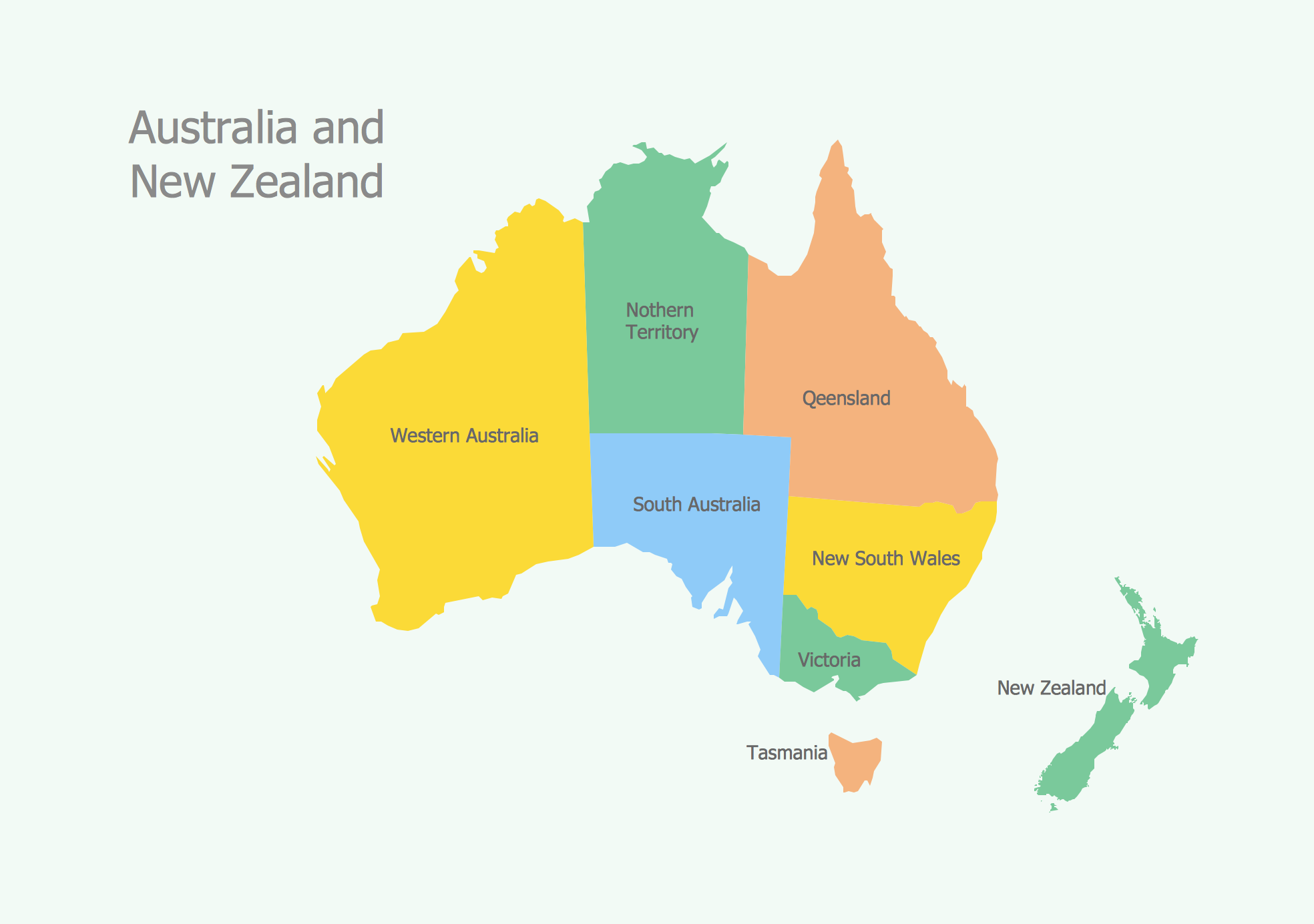
Geo Map - Australia
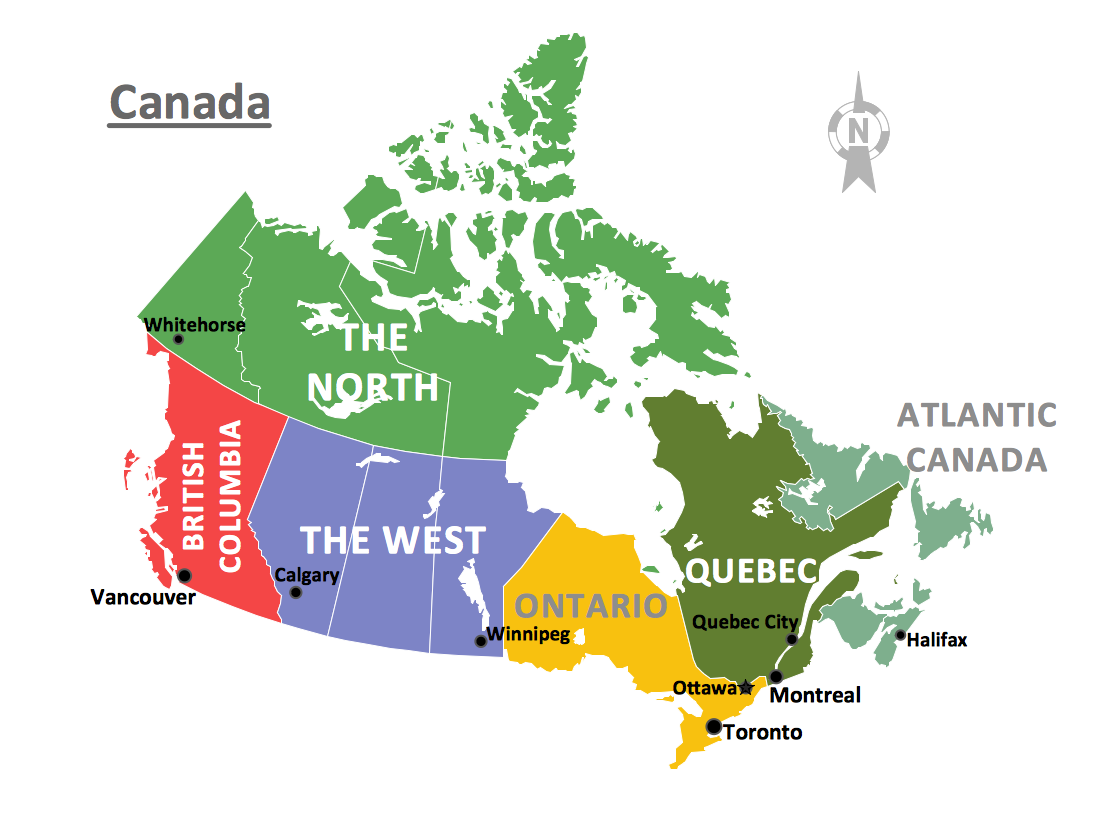
The vector stencils library Australia contains contours of New Zealand and Australian states and mainland territories for ConceptDraw PRO diagramming and vector drawing software.Geo Map - Canada
Canada is a country in North America consisting of 10 provinces and 3 territories.ConceptDraw PRO is idea to draw the geological maps of Canada from the pre-designed vector geo map shapes.
Geo Map - South America Continent
South America includes 12 sovereign states.ConceptDraw PRO is idea to draw the geological maps of South America continent from the pre-designed vector geo map shapes.
Use Continent Maps solution from the Maps area of ConceptDraw Solution Park to draw thematic maps, geospatial infographics and vector illustrations for your business documents, presentations and websites.
- Continent Maps | Maps | Geo Map - World | - Conceptdraw.com
- Continent Maps | ConceptDraw Solution Park | Block Diagrams |
- Continent Maps | Spatial infographics Design Elements: Continental ...
- How to Draw a Geographical Map Quickly | Geo Map - World ...
- Continent Maps | Design elements - Continental map | How to Draw ...
- Continent Maps | How to Draw a Geographical Map Quickly | Geo ...
- California Relief | Maps | Continent Maps | - Conceptdraw.com
- ConceptDraw PRO Compatibility with MS Visio | Comparing ...
- Picture Graphs | Picture graph - Population growth by continent ...
- Continent Maps | Spatial Infographics | Maps |
- Picture graph - Conceptdraw.com
- ConceptDraw Solution Park | ConceptDraw Solution Park | Business
- ConceptDraw Solution Park | Aerospace and Transport | Metro Map |
- Aerospace - Design Elements
- What is Infographics Area | Continent Maps |
- Maps | Directional Maps | Value Stream Mapping |
- Continent Maps | Political map of Central America | Political map of ...
- Picture graph - Population growth by continent , 2010 - 2013 | Picture ...
- Maps | Continent Maps | Geo Map - Africa |
- Universal Diagramming Area | Maps | How to Draw a Natural ...


