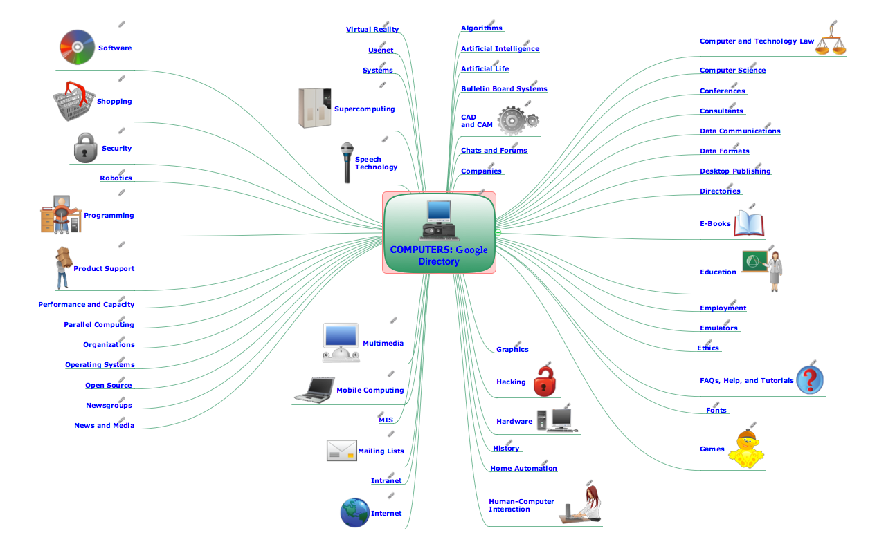
How to view a mind map presentation via Skype
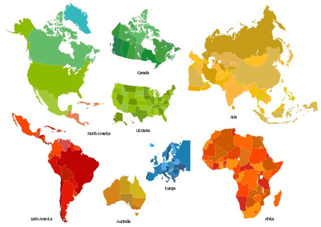
Geo Map - World

The vector stencils library "Africa" contains 51 African countries contour maps.
The vector stencils library "Asia" contains 47 Asian countries contour maps.
The vector stencils library "Australia and New Zealand" contains 10 contour maps.
The vector stencils library "Europe" contains 39 European countries contour maps.
The vector stencils library "Latin America" contains 30 Latin American countries contour maps.
The vector stencils library "North America" contains 70 North American countries contour maps.
"A continent is one of several very large landmasses on Earth. They are generally identified by convention rather than any strict criteria, with up to seven regions commonly regarded as continents. These are from largest in size to smallest: Asia, Africa, North America, South America, Antarctica, Europe, and Australia." [Continent. Wikipedia]
The contour maps example "Design elements - Continental map" was created using the ConceptDraw PRO diagramming and vector drawing software extended with the Spatial Infographics solution from the Maps area of ConceptDraw Solution Park.
Continental contour maps
Types of Map - Overview

Geo Map Software

Map Software

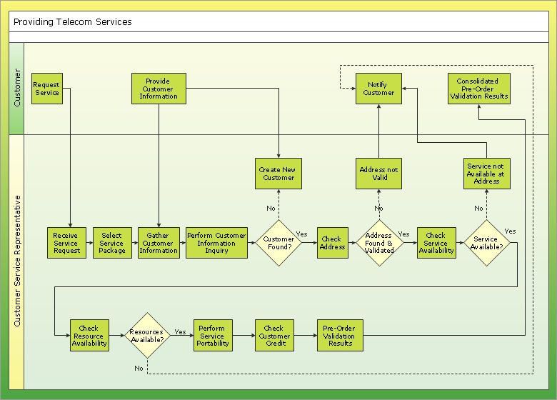
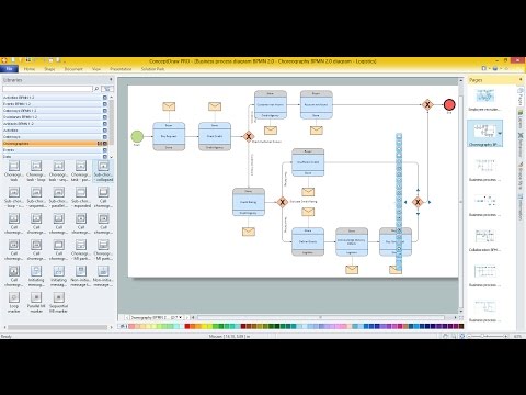
Business diagrams & Org Charts with ConceptDraw DIAGRAM
- Continent Maps | Spatial infographics Design Elements: Continental ...
- Continent Maps | Maps | Geo Map - World | - Conceptdraw.com
- Continent Maps | Geo Map Software | Types of Map - Overview |
- Continent Maps | Design elements - Continental map | Geo Map ...
- Continent Maps | Spatial Infographics | Maps | - Conceptdraw.com
- Continent Maps | Europe map template | Spatial infographics Design ...
- Continent Maps | Design elements - Continental map | How to Draw ...
- Maps | Continent Maps | Geo Map - Africa |
- Continent Maps | Maps | Europe map template |
- Continent Maps | Spatial infographics Design Elements: Location ...
- Geo Map - Australia | Continent Maps | Map of median household ...
- Map Infographic Creator | Spatial infographics Design Elements ...
- Continent Maps | Picture graph - Population growth by continent ...
- Continent Maps | Political map of Central America | Political map of ...
- continent map, maps of continents Continent Maps - Conceptdraw.com
- Spatial infographics Design Elements: Continental Map | Design ...
- Continent Maps | Flags - Stencils library | Spatial Infographics |
- Design elements - Thematic maps | Map of USA with state names ...
- Telecommunication Network Diagrams | Cisco Network Objects in ...
- Telecommunication Network Diagrams | Aerospace and Transport ...