Geo Map — Europe

Use the map contours library "Asia" to design thematic maps of Asian countries using the ConceptDraw PRO diagramming and vector drawing software.
"Asia ... is the world's largest and most populous continent, located primarily in the eastern and northern hemispheres. ...
The boundaries of Asia are culturally determined, as there is no clear geographical separation between it and Europe, which together form one continuous landmass called Eurasia. The most commonly accepted boundaries place Asia to the east of the Suez Canal, the Ural River, and the Ural Mountains, and south of the Caucasus Mountains (or the Kuma–Manych Depression) and the Caspian and Black Seas. It is bounded on the east by the Pacific Ocean, on the south by the Indian Ocean and on the north by the Arctic Ocean." [Asia. Wikipedia]
The vector stencils library "Asia" contains 57 map contours: Asia state map contours, Asia political map, sea contours, lake contours.
The map contours example "Design elements - Asia" is included in the Continent Maps solution from the Maps area of ConceptDraw Solution Park.
Asia map contours

Geo Map - Europe - Austria

Geo Map - Europe - United Kingdom

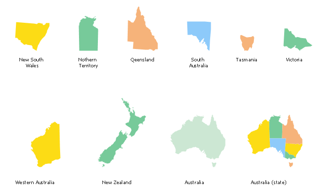
Use the map contours library "Australia" to design thematic maps using the ConceptDraw PRO diagramming and vector drawing software.
The vector stencils library "Australia" contains 10 map contours: Australia continent contour, Australia political maps, map contours of New Zealand and Australian states and mainland territories: New South Wales, Nothern Territory, Qeensland, Tasmania, Victoria, Western Australia.
The map contours example "Design elements - Australia" is included in the Continent Maps solution from the Maps area of ConceptDraw Solution Park.
Australia and New Zealand map contours
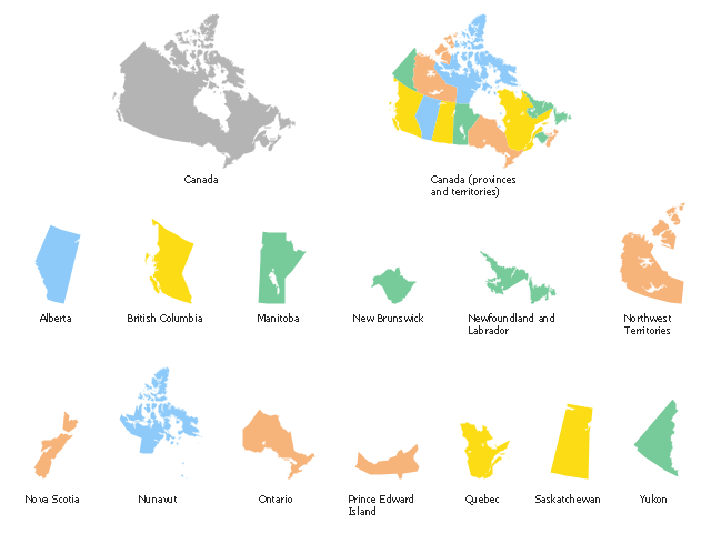
Use the map contours library "Canada" to design thematic maps using the ConceptDraw PRO diagramming and vector drawing software.
The vector stencils library "Canada" contains 15 map contours: Canada political map and map contours of Canada provinces and territories: Alberta, British Columbia, Manitoba, New Brunswick, Newfoundland and Labrador, Northwest Territories, Nova Scotia, Nunavut, Ontario, Prince Edward Island, Quebec, Saskatchewan, Yukon.
The map contours example "Design elements - Canada" is included in the Continent Maps solution from the Maps area of ConceptDraw Solution Park.
Canada map contours
The vector stencils library "Education maps" contains 44 state map contours with capitals and major cities: G-20 state maps, EU state maps and world map.
Use it to visualize geospatial information in your education infograms.
"The European Union (EU) is a politico-economic union of 28 member states that are primarily located in Europe: Austria, Belgium, Bulgaria, Croatia, Cyprus, Czech Republic, Denmark, Estonia, Finland, France, Germany, Greece, Hungary, Ireland, Italy, Latvia, Lithuania, Luxembourg, Malta, Netherlands, Poland, Portugal, Romania, Slovakia, Slovenia, Spain, Sweden, United Kingdom." [European Union. Wikipedia]
The European Union map contours example "Design elements - Education maps (EU)" was created using the ConceptDraw PRO diagramming and vector drawing software extended with the Education Infographics solition from the area "Business Infographics" in ConceptDraw Solution Park.
European Union state map contours
.png--diagram-flowchart-example.png)
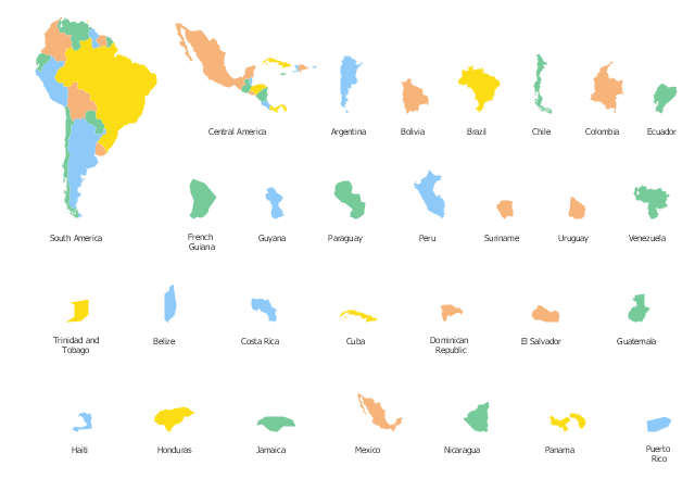
Use the map contours library "South America" to design thematic maps of South American countries using the ConceptDraw PRO diagramming and vector drawing software.
The vector stencils library "South America" contains 29 map contours: South America political map, Central America political map, state map contours of South American countries.
The map contours example "Design elements - South America" is included in the Continent Maps solution from the Maps area of ConceptDraw Solution Park.
South and Central America state map contours
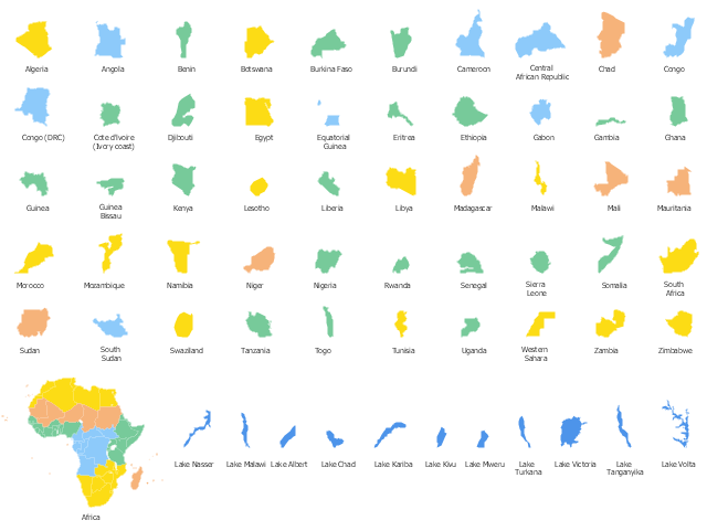
Use the map contours library Africa to design thematic maps of African countries using the ConceptDraw PRO diagramming and vector drawing software.
The design elements library Africa contains 122 African state map contours, Africa political map and biggest lakes contours.
The vector stencils library "Africa" is included in the Continent Maps solution from the Maps area of ConceptDraw Solution Park.
The design elements library Africa contains 122 African state map contours, Africa political map and biggest lakes contours.
The vector stencils library "Africa" is included in the Continent Maps solution from the Maps area of ConceptDraw Solution Park.
African countries map contours
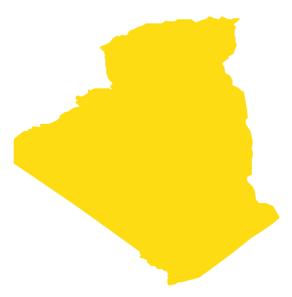
Geo Map - Africa - Algeria
- Map Contours Library Europe
- Geo Map - Asia - Vietnam | Design elements - Asia map | Contours ...
- Geo Map - Europe - United Kingdom | Contours Map of UK | Geo ...
- Continent Contour
- Design elements - South America | Geo Map - South America ...
- Design elements - Europe
- Geo Map - Europe - Croatia | Geo Map - Europe - Greece | Design ...
- Map Europe Design
- Contour Continent