Map of Germany
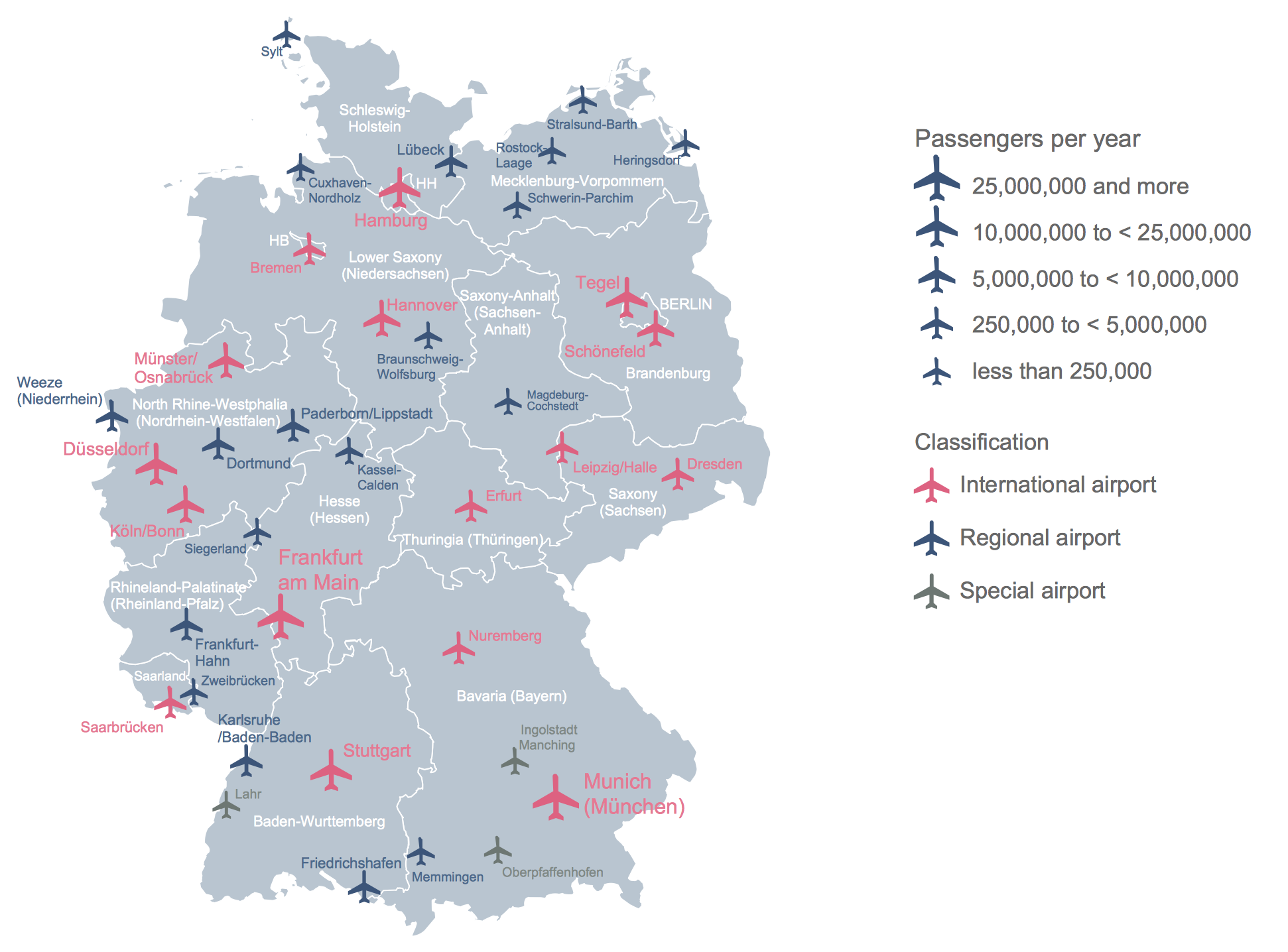
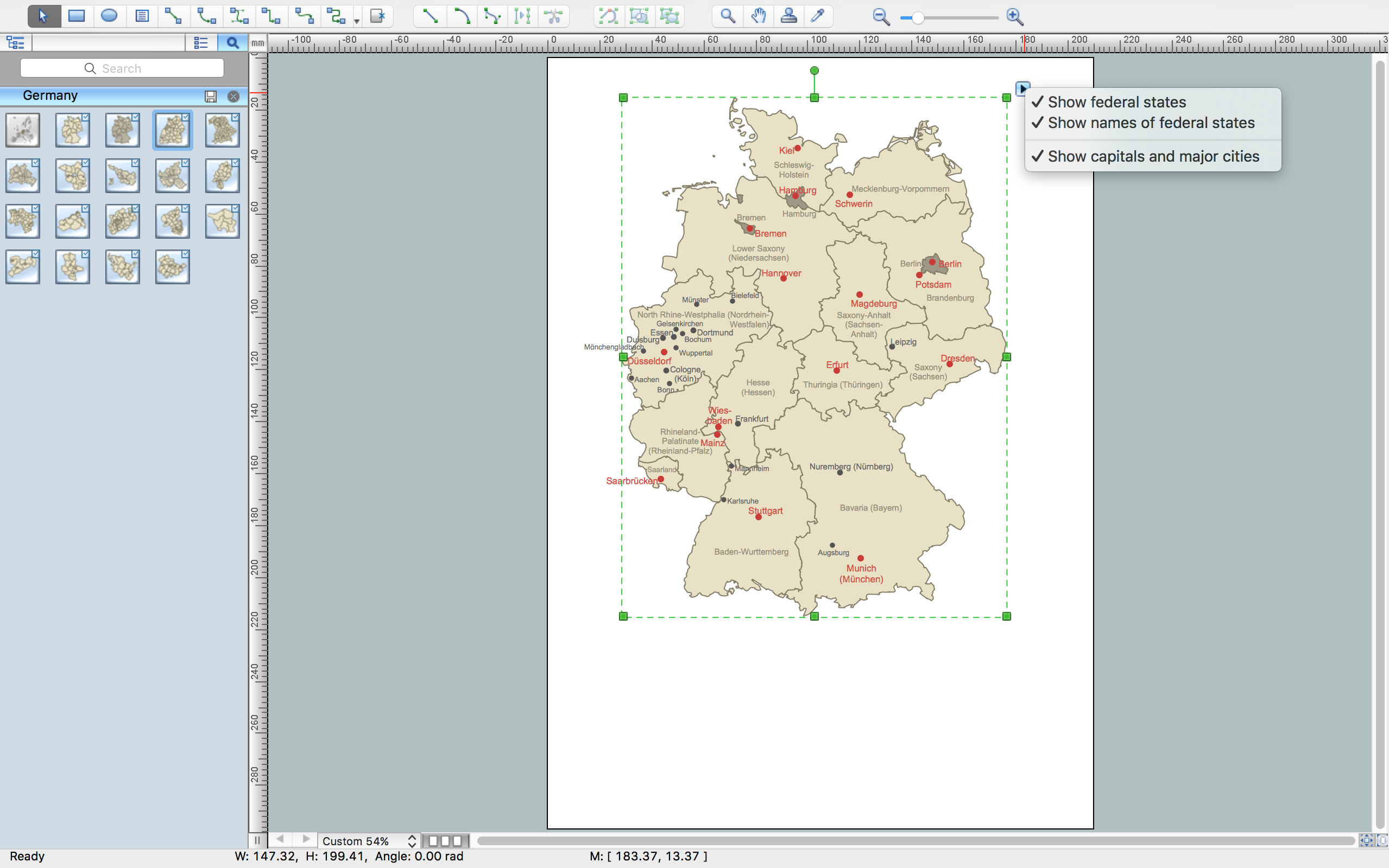
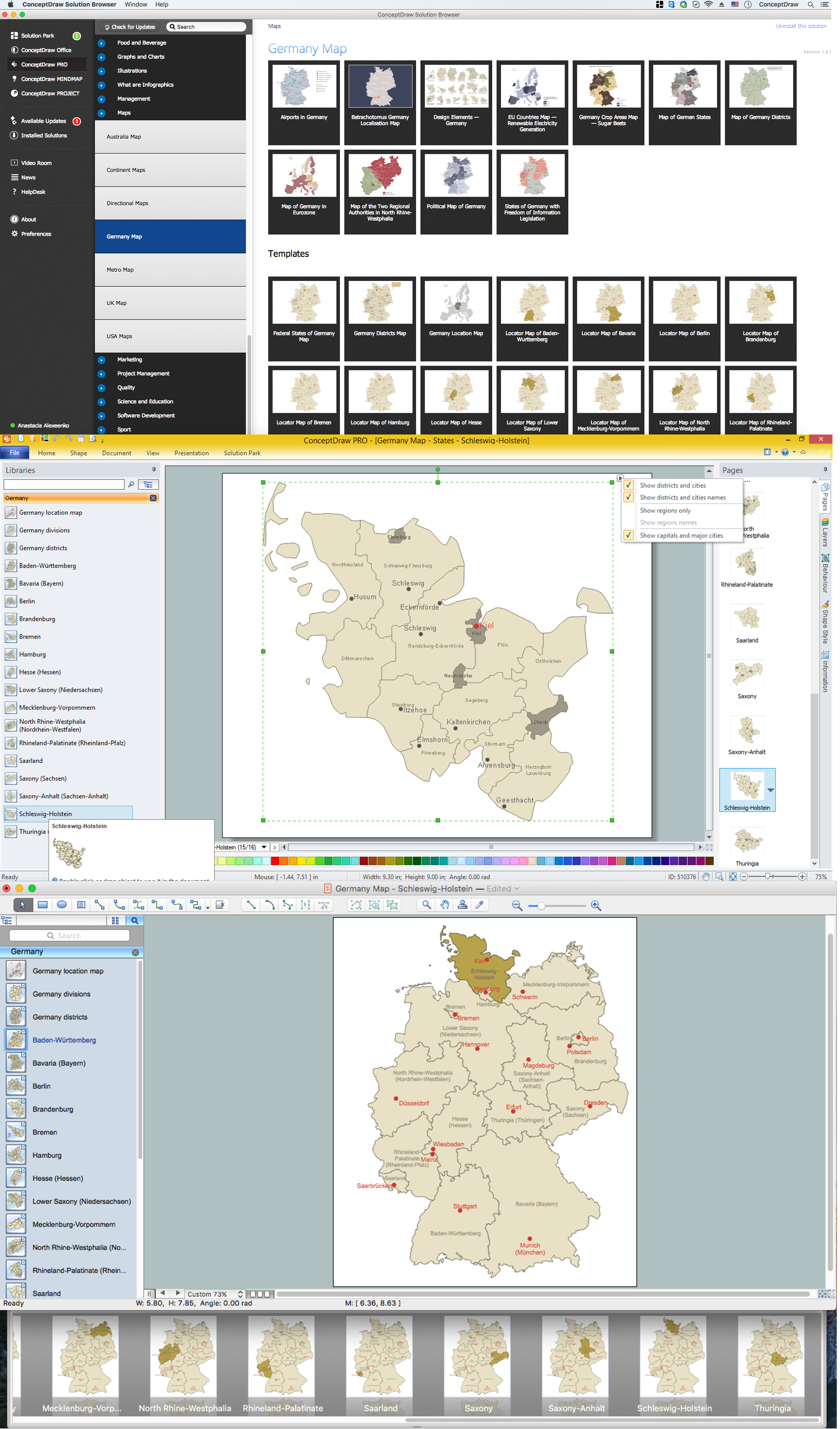
Germany, officially the Federal Republic of Germany, is a federal parliamentary republic in West-Central Europe. You need design the map of Germany or detailed map of Germany with cities fast and easy? We reccomend you to use the indispensable ConceptDraw PRO diagramming and vector drawing software extended with unique Germany Map Solution from the Maps Area of ConceptDraw Solution Park.Geo Map Software
Geo Map Software - Full Geographic Reach of Your Business with Geo Map Shapes.Maps of Germany
Germany is a federal parliamentary republic in West-Central Europe which consists of 16 constituent states. It is a part of Schengen area and the most populous member state in the European Union. ConceptDraw PRO diagramming and vector drawing software offers the unique Germany Map Solution from the Maps Area of ConceptDraw Solution Park, developed specially for easy drawing the maps of Germany of different levels of complexity and detailing.Vector Map of Germany
Vector map is the best way to visually present a world, continents, islands, to display location and boundaries of countries and cities. ConceptDraw PRO diagramming and vector drawing software offers the Germany Map Solution from the Maps Area of ConceptDraw Solution Park - the best tool for fast and easy drawing vector map of Germany of any degree of detailing, and thematic cartograms and maps of Germany on its base.Map Software
Create maps, flags, and more with ConceptDrawGermany Map
Germany is in Western and Central Europe, with Denmark bordering to the north, Poland and the Czech Republic to the east, Austria to the southeast, Switzerland to the south-southwest, France, Luxembourg and Belgium lie to the west, and the Netherlands to the northwest.ConceptDraw PRO diagramming and vector drawing software enhanced with Germany Map Solution from the Maps Area of ConceptDraw Solution Park is the best for drawing geographic Germany map, topography, political, and various thematic maps of Germany.
Maps of Germany With Cities
Despite the fact that the maps surround us everywhere in our life, usually the process of their drawing is sufficienly complex and labor-intensive. But now, thanks to the ConceptDraw PRO diagramming and vector drawing software extended with Germany Map Solution from the Maps Area of ConceptDraw Solution Park, we have the possibility to make easier this process. Design fast and easy your own pictorial maps of Germany, map of Germany with cities, and thematic Germany maps in ConceptDraw PRO!Map of Germany — North Rhine-Westphalia State
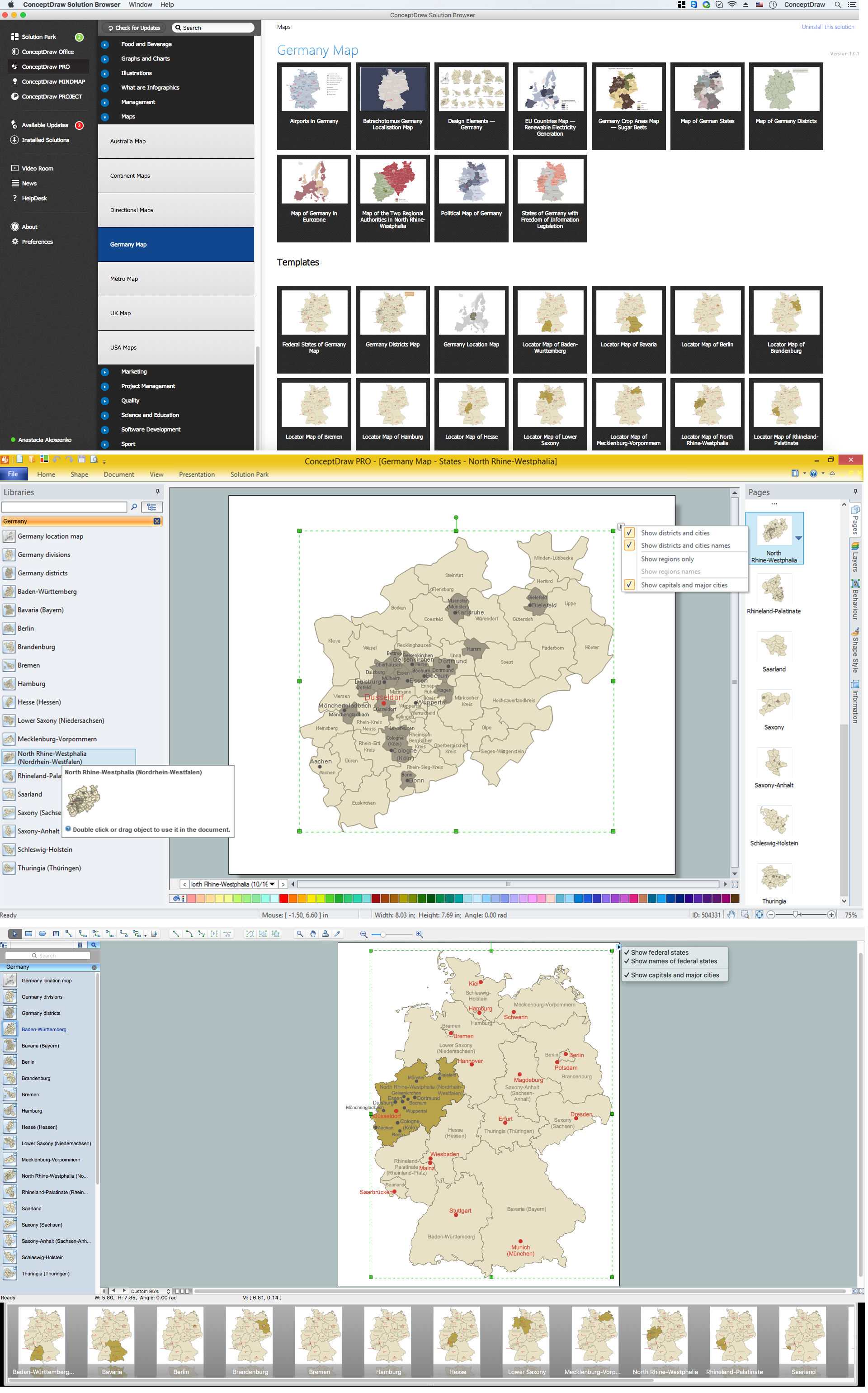
North Rhine-Westphalia is the most populous state of Germany, as well as the fourth largest by area. Its capital is Düsseldorf; the biggest city is Cologne.Despite the fact that the maps surround us everywhere in our life, usually the process of their drawing is sufficienly complex and labor-intensive. But now, thanks to the ConceptDraw PRO diagramming and vector drawing software extended with Germany Map Solution from the Maps Area of ConceptDraw Solution Park, we have the possibility to make easier this process. Design fast and easy your own pictorial maps of Germany, map of Germany with cities, and thematic Germany maps in ConceptDraw PRO!
Map of Germany — Berlin
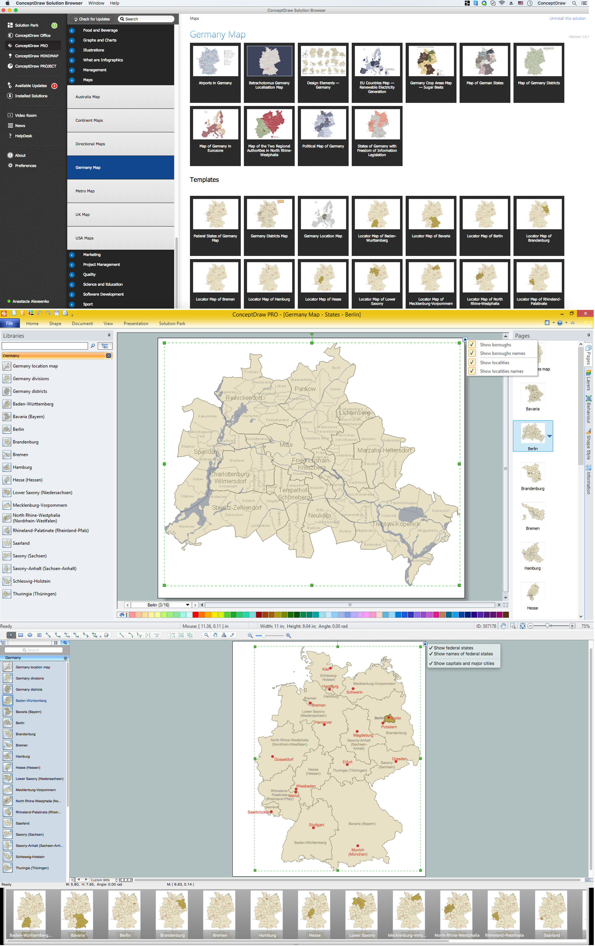
Berlin is the capital of Germany and one of the 16 states of Germany. With a population of 3.5 million people, it is the second most populous city proper and the seventh most populous urban area in the European Union.Despite the fact that the maps surround us everywhere in our life, usually the process of their drawing is sufficienly complex and labor-intensive. But now, thanks to the ConceptDraw PRO diagramming and vector drawing software extended with Germany Map Solution from the Maps Area of ConceptDraw Solution Park, we have the possibility to make easier this process. Design fast and easy your own pictorial maps of Germany, map of Germany with cities, and thematic Germany maps in ConceptDraw PRO!
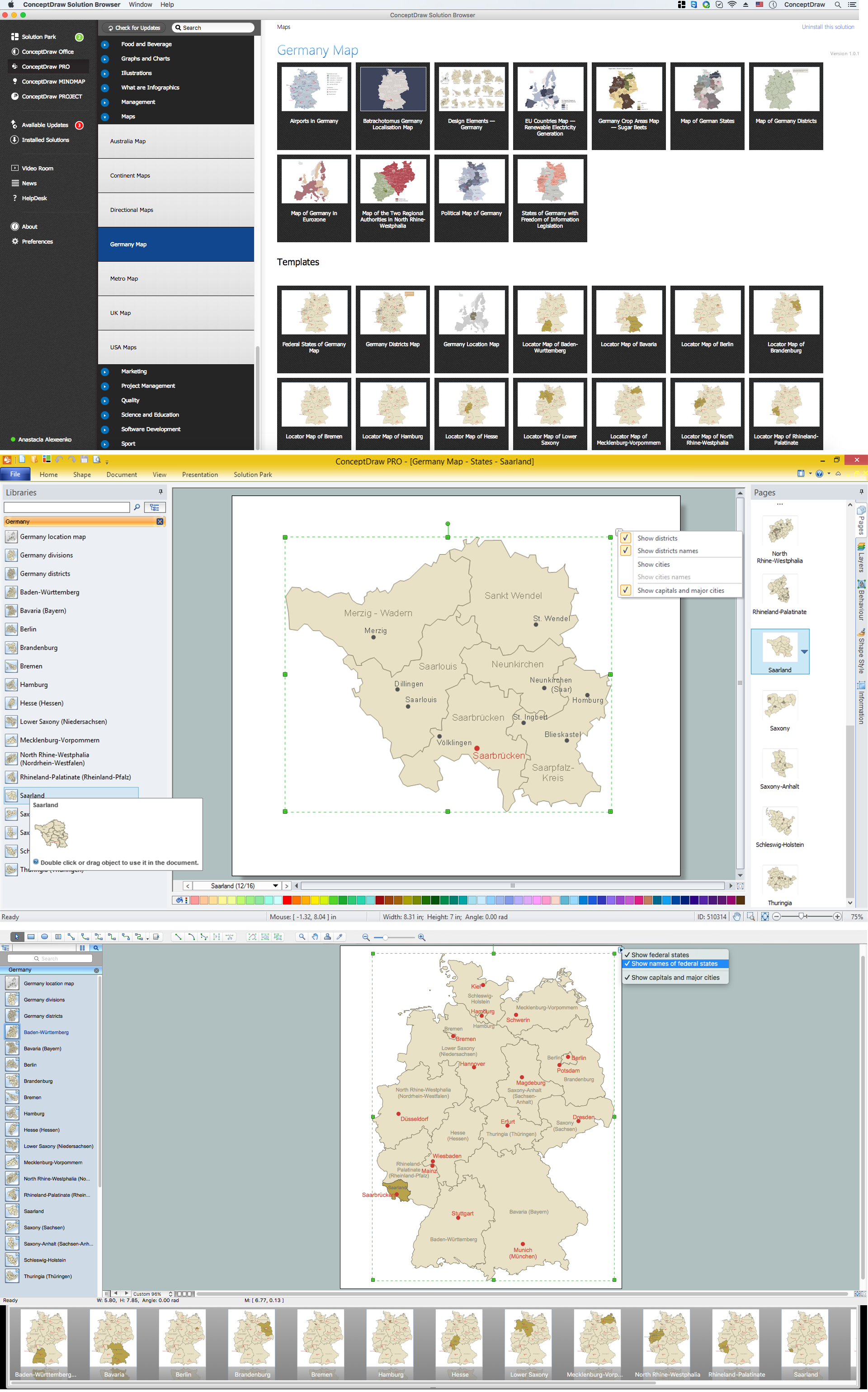
Map of Germany — Saarland State
The Saarland is one of the sixteen federal states (or Bundesländer) of Germany. The capital city is Saarbrücken.Despite the fact that the maps surround us everywhere in our life, usually the process of their drawing is sufficienly complex and labor-intensive. But now, thanks to the ConceptDraw PRO diagramming and vector drawing software extended with Germany Map Solution from the Maps Area of ConceptDraw Solution Park, we have the possibility to make easier this process. Design fast and easy your own pictorial maps of Germany, map of Germany with cities, and thematic Germany maps in ConceptDraw PRO!
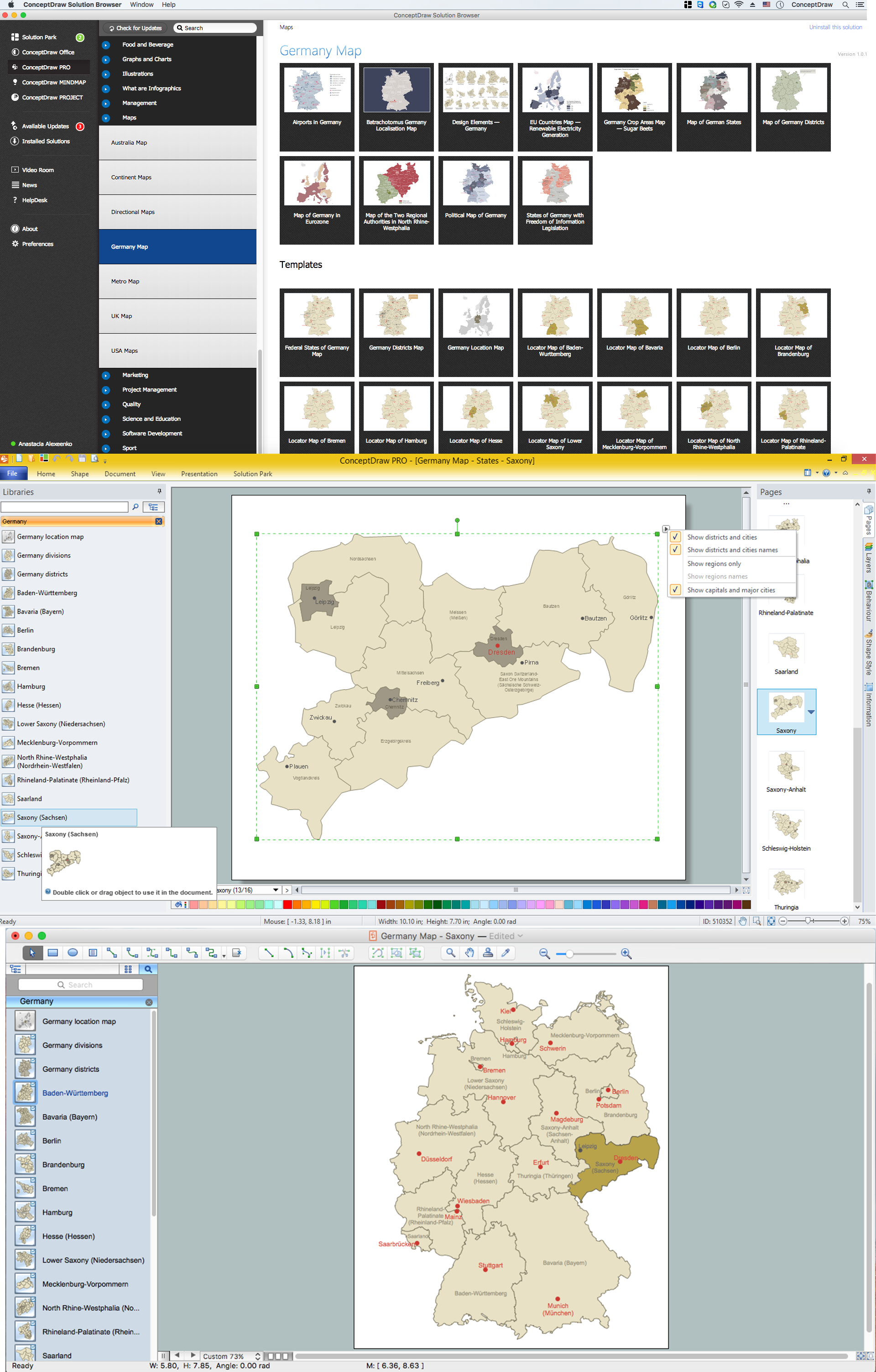
Map of Germany — Saxony State
Saxony is the tenth-largest of Germany's sixteen states, with an area of 18,413 square kilometres (7,109 sq mi), and the sixth most populous, with 4.3 million people. The capital city is Dresden.Despite the fact that the maps surround us everywhere in our life, usually the process of their drawing is sufficienly complex and labor-intensive. But now, thanks to the ConceptDraw PRO diagramming and vector drawing software extended with Germany Map Solution from the Maps Area of ConceptDraw Solution Park, we have the possibility to make easier this process. Design fast and easy your own pictorial maps of Germany, map of Germany with cities, and thematic Germany maps in ConceptDraw PRO!
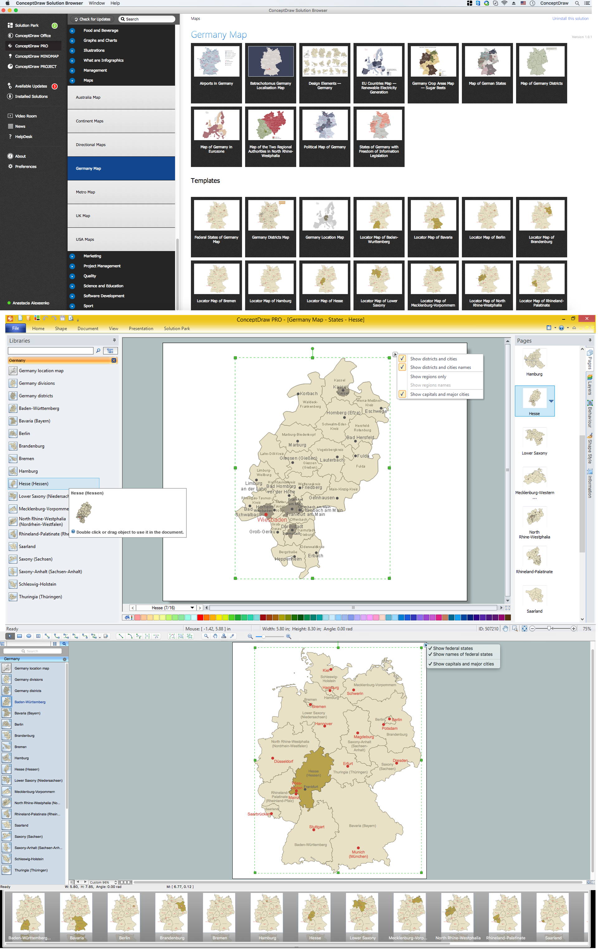
Map of Germany — Hesse State
Hesse is a federal state (Land) of the Federal Republic of Germany, with just over six million inhabitants.Despite the fact that the maps surround us everywhere in our life, usually the process of their drawing is sufficienly complex and labor-intensive. But now, thanks to the ConceptDraw PRO diagramming and vector drawing software extended with Germany Map Solution from the Maps Area of ConceptDraw Solution Park, we have the possibility to make easier this process. Design fast and easy your own pictorial maps of Germany, map of Germany with cities, and thematic Germany maps in ConceptDraw PRO!
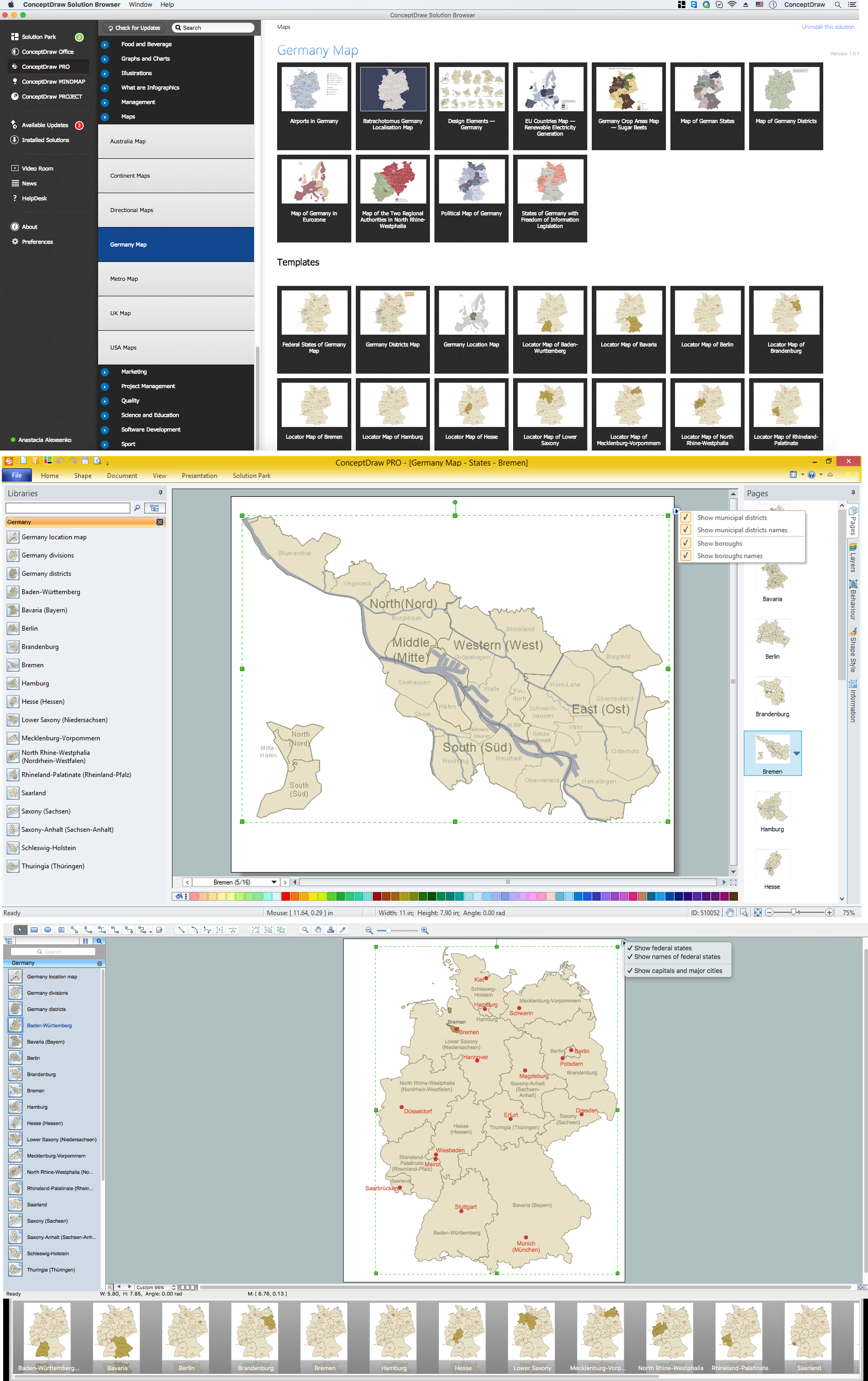
Map of Germany — Bremen
The City Municipality of Bremen is a Hanseatic city in northwestern Germany. The Free Hanseatic City of Bremen is the smallest of Germany's 16 states.Despite the fact that the maps surround us everywhere in our life, usually the process of their drawing is sufficienly complex and labor-intensive. But now, thanks to the ConceptDraw PRO diagramming and vector drawing software extended with Germany Map Solution from the Maps Area of ConceptDraw Solution Park, we have the possibility to make easier this process. Design fast and easy your own pictorial maps of Germany, map of Germany with cities, and thematic Germany maps in ConceptDraw PRO!
Map of Germany — Schleswig-Holstein State
Schleswig-Holstein is the northernmost of the 16 states of Germany, comprising most of the historical duchy of Holstein and the southern part of the former Duchy of Schleswig. Its capital city is Kiel.Despite the fact that the maps surround us everywhere in our life, usually the process of their drawing is sufficienly complex and labor-intensive. But now, thanks to the ConceptDraw PRO diagramming and vector drawing software extended with Germany Map Solution from the Maps Area of ConceptDraw Solution Park, we have the possibility to make easier this process. Design fast and easy your own pictorial maps of Germany, map of Germany with cities, and thematic Germany maps in ConceptDraw PRO!
Continents Map
Designing of Continents Map is a quite complex and labour-intensive process. But now we have a way to make it easier - ConceptDraw PRO diagramming and vector drawing software extended with useful drawing tools of Continent Maps Solution from the Maps Area.- Easy To Draw Map Of Europe
- Create Own Political Map Europe
- Map Of Europe Powerpoint
- Spatial infographics Design Elements: Continental Map | Design ...
- Europe Map Infographic
- Geo Map - Europe - United Kingdom
- Geo Map - Europe | Spatial infographics Design Elements ...
- Maps | Spatial Infographics | Map Infographic Creator | How To Draw ...
- Europe Map
- Geo Map - Europe - Germany | Germany Map | Maps of Germany ...
- Map Infographic Creator | Visualization Spatial Data Using Thematic ...
- Map of UK — Northern Ireland | UK Map | Geo Map - Europe ...
- Geo Map - Europe - Germany
- UK Map | How to Create a Map Depicting the United Kingdom ...
- Geo Map - Europe - Germany | Map of Germany | Germany Map ...
- Geo Map - Europe - Norway | Germany Map | Maps of Germany ...
- Germany Map | Map of Germany | Geo Map - Europe - Germany ...
- European membership of the EU and NATO map | EU 28: Candidate ...
- European membership of the EU and NATO map | EU 28: Candidate ...
- Geo Map - Europe - Germany | Germany Map | Vector Map of ...


