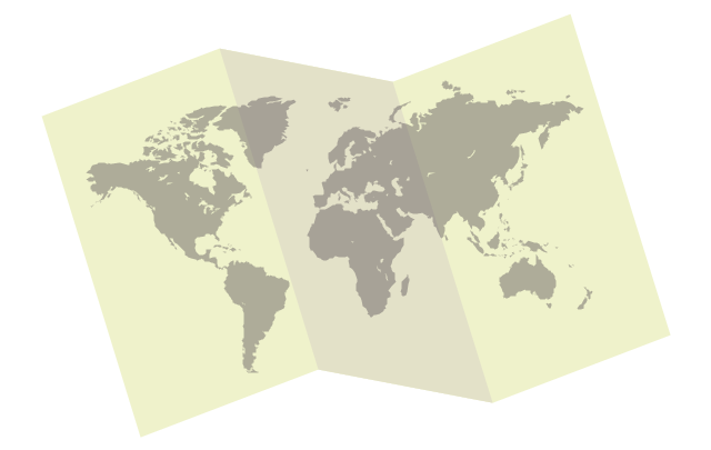
The vector stencils library "Education maps" contains 44 map contours: the Group of Twenty (G20) state maps, EU state maps and world map.
Use it to visualize geospatial information on thematic maps in your education infograms.
"A world map is a map of most or all of the surface of the Earth. ...
A thematic map shows geographic information about one or a few focused subjects." [World map. Wikipedia]
The political World map example "Design elements - Education maps (World map)" was created using the ConceptDraw PRO diagramming and vector drawing software extended with the Education Infographics solition from the area "Business Infographics" in ConceptDraw Solution Park.
Education Information
The Education Information is multifariuos and can be often represented in various forms. Еру the most successful ways of presentation the information and data are various illustrations, diagrams and colorful education infographics which you can easily make in ConceptDraw PRO software extended with Education Infographics Solution from the Business Infographics Area.Educational Technology Tools
What are the favorite educational technology tools and techniques for teachers? Of course these are pictures, images and education infographics! ConceptDraw PRO software supplied with Education Infographics Solution from the Business Infographics Area provides powerful drawing tools to help design the education infographics of any complexity.The vector stencils library "Education pictograms" contains 128 education pictograms. Use this flat icon set to design your educational infogram in ConceptDraw PRO diagramming and vector drawing software.
The vector stencils library "Education pictograms" is included in the Education Infographics solution from the Business Infographics area of ConceptDraw Solution Park.
The vector stencils library "Education pictograms" is included in the Education Infographics solution from the Business Infographics area of ConceptDraw Solution Park.
The vector stencils library "Education maps" contains 44 state map contours with capitals and major cities: G-20 state maps, EU state maps and world map.
Use it to visualize geospatial information in your education infograms.
"The European Union (EU) is a politico-economic union of 28 member states that are primarily located in Europe: Austria, Belgium, Bulgaria, Croatia, Cyprus, Czech Republic, Denmark, Estonia, Finland, France, Germany, Greece, Hungary, Ireland, Italy, Latvia, Lithuania, Luxembourg, Malta, Netherlands, Poland, Portugal, Romania, Slovakia, Slovenia, Spain, Sweden, United Kingdom." [European Union. Wikipedia]
The European Union map contours example "Design elements - Education maps (EU)" was created using the ConceptDraw PRO diagramming and vector drawing software extended with the Education Infographics solition from the area "Business Infographics" in ConceptDraw Solution Park.
The vector stencils library "Education maps" contains 44 state map contours with capitals and major cities: the Group of Twenty (G20) state maps, EU state maps and World map.
Use it to visualize geospatial information in your education infograms.
"The Group of Twenty (also known as the G-20 or G20) is a forum for the governments and central bank governors from 20 major economies. The members, shown highlighted on the map at right, include 19 individual countries—Argentina, Australia, Brazil, Canada, China, France, Germany, India, Indonesia, Italy, Japan, Republic of Korea, Mexico, Russian Federation, Saudi Arabia, South Africa, Turkey, United Kingdom, United States—and the European Union (EU). The EU is represented by the European Commission and by the ECB." [G-20 major economies. Wikipedia]
The G-20 state map contours example "Design elements - Education maps (G-20)" was created using the ConceptDraw PRO diagramming and vector drawing software extended with the Education Infographics solition from the area "Business Infographics" in ConceptDraw Solution Park.
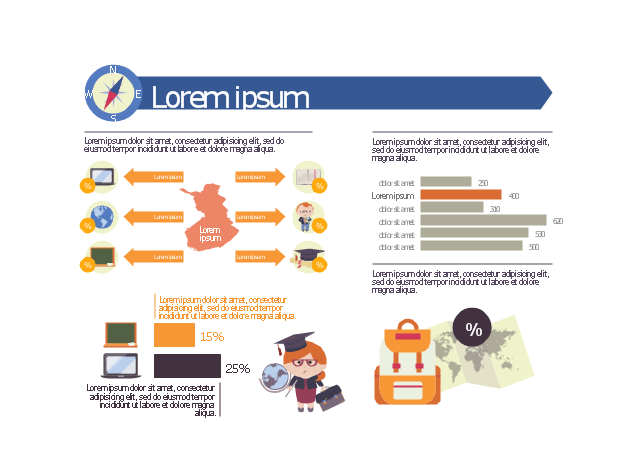
This education infographic template consists of design elements: callouts, world map contour, horizontal bar chart indicator, horizontal bar graph, pictograms.
Simply add text and data to design your educational infogram.
The template "Education infogram 2" for the ConceptDraw PRO diagramming and vector drawing software is included in the Education Infographics solition from the area "Business Infographics" in ConceptDraw Solution Park.
Simply add text and data to design your educational infogram.
The template "Education infogram 2" for the ConceptDraw PRO diagramming and vector drawing software is included in the Education Infographics solition from the area "Business Infographics" in ConceptDraw Solution Park.
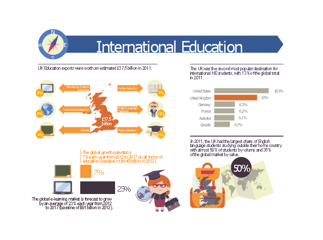
This example was designed on the base of infographic "International education" from the Great Britain Government website.
"UK Education exports were worth an estimated £17.5 billion in 2011.
The UK was the second most popular destination for international HE students, with 13% of the global total in 2011.
The global growth potential is 7% each year from 2012 to 2017 on all forms of education (baseline of $4.45 trillion in 2012).
In 2011, the UK had the largest share of English language students studying outside their home country with almost 50% of students by volume and 35% of the global market by value.
The global e-learning market is forecast to grow by an average of 23% each year from 2012 to 2017 (baseline of $91 billion in 2012)." [gov.uk/ government/ uploads/ system/ uploads/ attachment_ data/ file/ 225562/ international-education-industrial-strategy-infographics.pdf]
The educational infogram "International education" was created using the ConceptDraw PRO diagramming and vector drawing software extended with the Education Infographics solition from the area "Business Infographics" in ConceptDraw Solution Park.
The vector stencils library "Education pictograms" contains 128 color icons.
Use this flat icon set to design your educational infograms.
Educational infographics helps to communicate knowledge and education-related stories and messages as easy-to-understand one-page visuals.
The pictogram example "Design elements - Education pictograms" was created using the ConceptDraw PRO diagramming and vector drawing software extended with the Education Infographics solition from the area "Business Infographics" in ConceptDraw Solution Park.
The vector stencils library "Education pictograms" contains 128 education pictograms. Use this flat icon set to design your educational infogram in ConceptDraw PRO diagramming and vector drawing software.
The vector stencils library "Education pictograms" is included in the Education Infographics solution from the Business Infographics area of ConceptDraw Solution Park.
The vector stencils library "Education pictograms" is included in the Education Infographics solution from the Business Infographics area of ConceptDraw Solution Park.
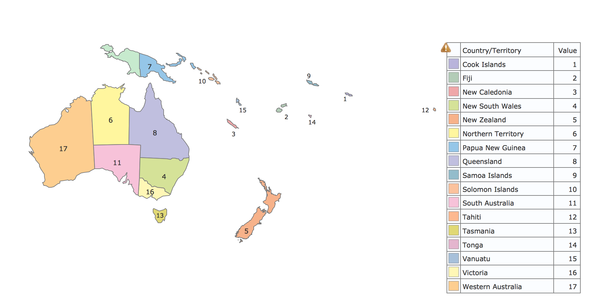
Geo Map - Oceania
The vector stencils library Oceania contains contours for ConceptDraw PRO diagramming and vector drawing software.The vector stencils library "Education pictograms" contains 128 education pictograms. Use this flat icon set to design your educational infogram in ConceptDraw PRO diagramming and vector drawing software.
The vector stencils library "Education pictograms" is included in the Education Infographics solution from the Business Infographics area of ConceptDraw Solution Park.
The vector stencils library "Education pictograms" is included in the Education Infographics solution from the Business Infographics area of ConceptDraw Solution Park.
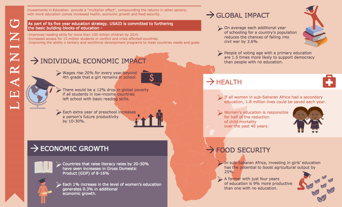
Education Infographics
The Education Infographics are popular and effectively applied in the educational process. Now you don't need to be an artist to design colorful pictorial education infographics thanks to the unique drawing tools of Education Infographics Solution for ConceptDraw PRO diagramming and vector drawing software.Applications
Use ConceptDraw MINDMAP for creative thinking, planning, organization, problem solving, presentations, decision making, note taking, team brainstorming and other tasks.- Geo Mapping Software Examples - World Map Outline | Geo Map ...
- Superb Examples of Infographic Maps | Education infogram 2 ...
- Croatia World Map Wiki
- Geo Map - World | Geo Mapping Software Examples - World Map ...
- How it works : eLearning | International education | Map of UK ...
- World map
- Management maps - Vector stencils library | Education maps ...
- Europe - Vector stencils library | Geo Map - Europe - Poland ...
- Geo Map - Asia - Indonesia | Asia - Vector stencils library | Education ...
- Political map of Europe | Design elements - Education maps (EU ...
- Design elements - Education maps (EU) | North and Central ...
- Education infogram 4 - Template | Education infogram 5 - Template ...
- Education | Education Information | How to Support Your Mind Map ...
- Design Map
- United Kingdom And Romania Map
- Education Infographics | Educational Technology Tools | Make an ...
- Education | How to Create Education Infographics | Presentations in ...
- Er Diagram Of Education World
- Geo Mapping Software Examples - World Map Outline | Geo Map ...
- Geo Map - USA - New York | Organizational chart - New York State ...
.png--diagram-flowchart-example.png)


















































.png--diagram-flowchart-example.png)
-state-maps-design-elements---education-maps-(g-20).png--diagram-flowchart-example.png)
