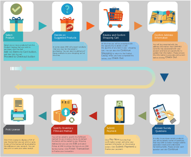
This example was created on the base of the hunting and fishing license sales flowchart from the COMPASS portal of the Department of Natural Resources, Maryland, U.S.
[compass.dnr.maryland.gov/ Help/ Topic/ ViewTopic/ ExecutingaSalesTransaction]
The COMPASS portal "allow you quick and easy access to hunting and fishing licenses, regulations and other important information about outdoor recreation in Maryland." [compass.dnr.maryland.gov/ DnrCompassPortal]
The example "Hunting and fishing license sales flowchart" was created using the ConceptDraw PRO diagramming and vector drawing software extended with the Sales Flowcharts solution from the Marketing area of ConceptDraw Solution Park.
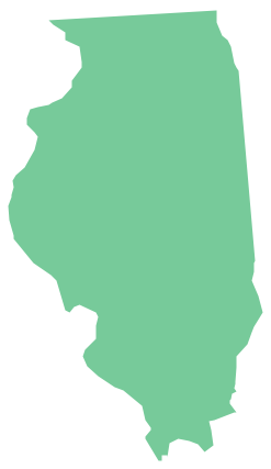
Geo Map - USA - Illinois
Illinois is a state in the Midwestern United States. It is the 5th most populous and 25th most extensive state, and is often noted as a microcosm of the entire country. The vector stencils library Illinois contains contours for ConceptDraw PRO diagramming and vector drawing software. This library is contained in the Continent Maps solution from Maps area of ConceptDraw Solution Park.UK Map
The United Kingdom of Great Britain and Northern Ireland, commonly known as the United Kingdom (UK), is a sovereign state in Europe which consists of four countries: England, Scotland, Wales, and Northern Ireland. UK is surrounded by the waters of Atlantic ocean, the North Sea, the English Channel, and the Irish Sea and includes large number of big and small islands. ConceptDraw PRO diagramming and vector drawing software offers the unique Map of UK Solution from the Maps Area of ConceptDraw Solution Park that is indispensable for easy drawing professional looking map of UK, UK counties map, UK map with cities, map of Scotland, map of England, map of Wales, Northern Ireland map.Geo Map - Asia - Philippines
The Philippines, officially known as the Republic of the Philippines, is a sovereign island country in Southeast Asia situated in the western Pacific Ocean. Use the Continent Maps solution and Philippines library to draw thematic maps, geospatial infographics and vector illustrations. This solution to help visualize the business and thematic information connected with geographic areas, locations or customs; for your business documents, presentations and websites.- Natural Resources Flow Chat
- Flowchart Of Classification Of Natural Resources With Examples
- Flow Chart On Classification Of Natural Resources With Eg
- Make A Flow Chart Classifying Various Natural Resources With
- Landscape Plan | Flowchart Of Natural And Human Made Resources
- Classification Of Natural Resources Flow Chart Download
- Flow Chart Classifying Various Natural Resource With Exxample
- Flow Chart Symbols | | Emergency Plan | Natural Resources ...
- Make A Flow Chart Classifying Various Natural Resources With ...
- Flow Chart On Classification Of Natural Resources With Examples
- Flow Chat Classification Of Natural Resources And Human Resources
- Natural Resources Bar Graph Maths
- Flow Chart Of Natural Resources With Meaning And Examples
- Classification Of Natural Resources Flow Chart
- Natural Resources Pie Chart Graphs
- Natural Resource And Development Flow Chart
- Flow Chart On Classification Of Natural Resources
- Classification Of Natural Resources Diagram
- Drawing Of Flow Chart On Natural Resources Classification
- Classification Of Natural Resources With Flow Chart Pdf


