HelpDesk
How to Draw a Map of North America
Geographic maps, cardiograms, and thematic maps are often used for geographical visualization of business information. Any country can inspire a wealth of geopolitical statistical data. A common way of assimilating this data is to create maps that convey a particular theme or subject matter in relation to a specific geographical area. Known as thematic maps, they cover themes such as population density, average rainfall, or political allegiance, differentiating the data by using graphical elements and annotation. Thematic maps contrast general reference maps, which tend to display information on a variety of subjects — vegetation, topology, roads, and highways, for example. A thematic map will always focus on one particular subject matter. ConceptDraw DIAGRAM can be helpful as a tool for creating maps of countries and regions of the world. It allows you to draw continental maps quickly and easily using the special templates and vector stencils libraries.HelpDesk
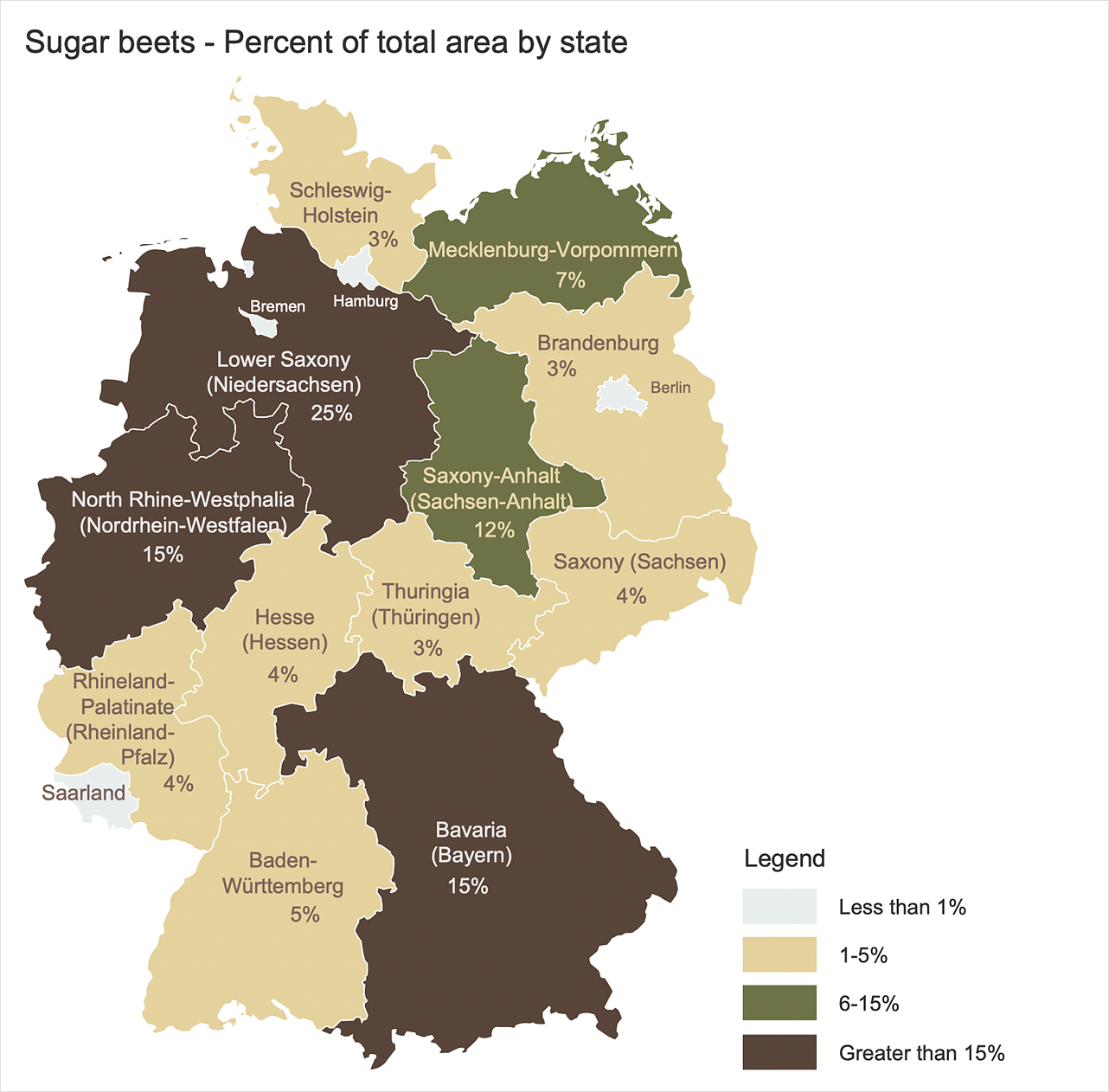
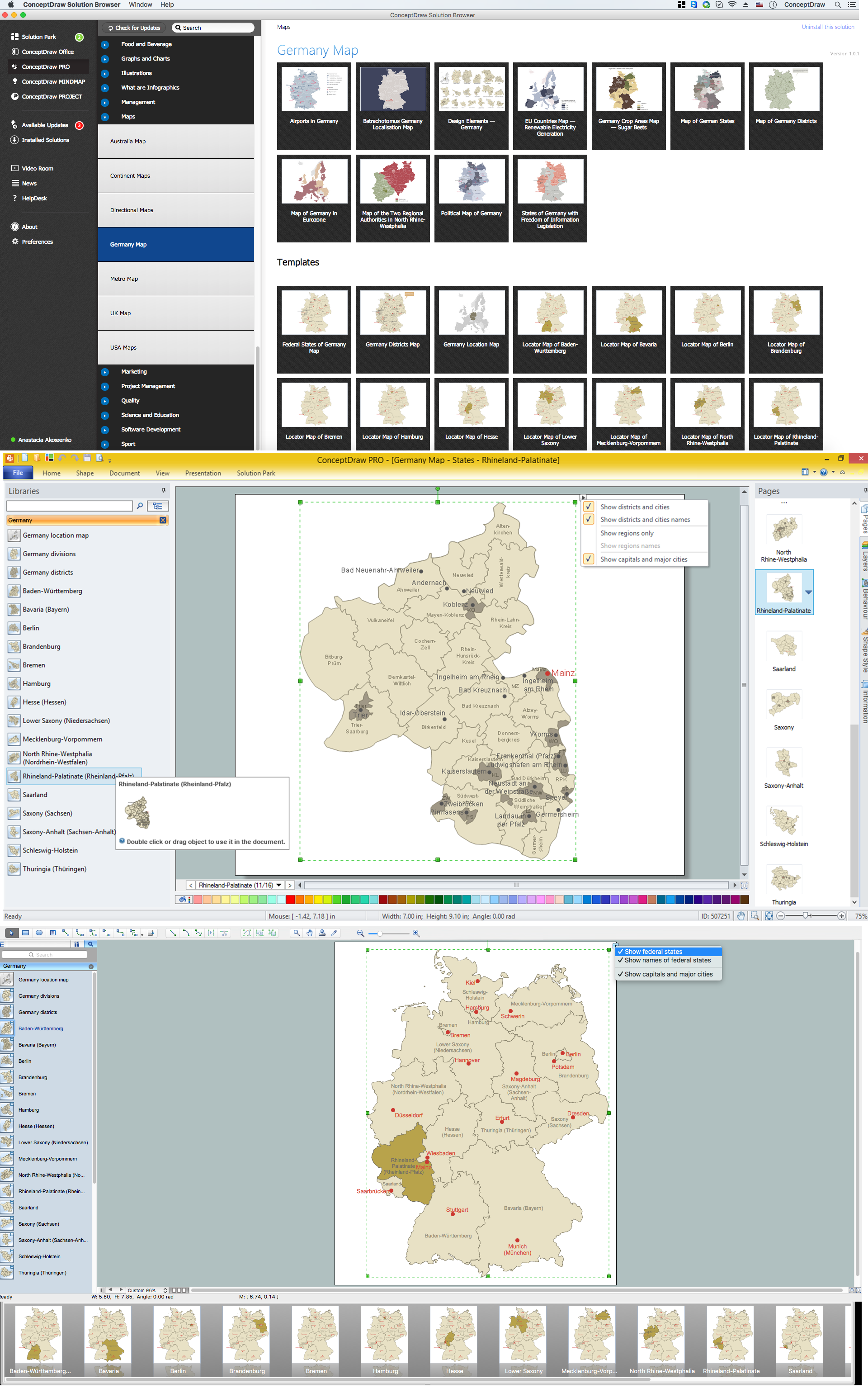
How to Create a Map of Germany
Geographical thematic maps are used to display information on a variety of subjects. It is a common way of representing any form of spatial data in relation to a specific geographical area. The Germany Map Solution for ConceptDraw DIAGRAM includes all of the German federal states with county outlined borders and major cities. You can quickly create geographic maps, cartograms, and thematic maps for geographical visualization information for business and travels."A thematic map is a type of map or chart especially designed to show a particular theme connected with a specific geographic area. ...
A thematic map is a map that focuses on a specific theme or subject area, whereas in a general map the variety of phenomena - geological, geographical, political - regularly appear together. ...
Thematic maps emphasize spatial variation of one or a small number of geographic distributions. These distributions may be physical phenomena such as climate or human characteristics such as population density and health issues. ...
Thematic map are sometimes referred to as graphic essays that portray spatial variations and interrelationships of geographical distributions. Location, of course, is important to provide a reference base of where selected phenomena are occurring. ...
Thematic maps serve three primary purposes.
First, they provide specific information about particular locations.
Second, they provide general information about spatial patterns.
Third, they can be used to compare patterns on two or more maps." [Thematic map. Wikipedia]
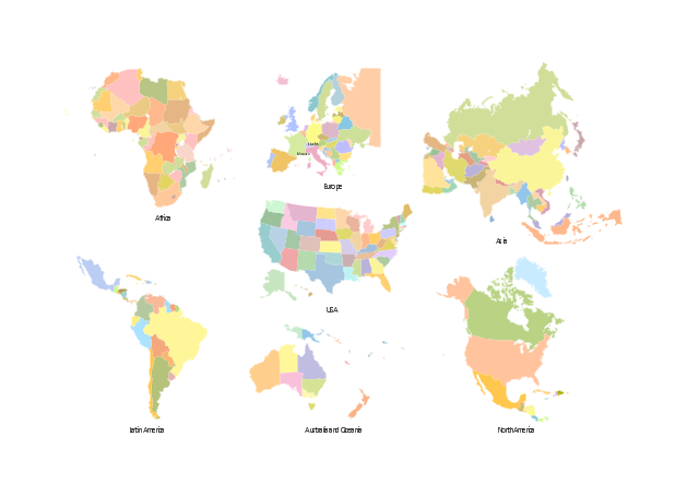
The vector stencils library "Thematic maps" contains 7 continent map contours for creating the thematic maps of geographic regions displaying the metric values by countries, states and territories marked by different colors.
Use the design elements library "Thematic maps" to create spatial dashboards using the ConceptDraw PRO diagramming and vector drawing software for your Spatial Intelligence and Location Intelligence business practice.
The example "Design elements - Thematic maps" is included in the Spatial Dashboard solution from the area "What is a Dashboard" of ConceptDraw Solution Park.
HelpDesk
How to Draw a Map of USA States
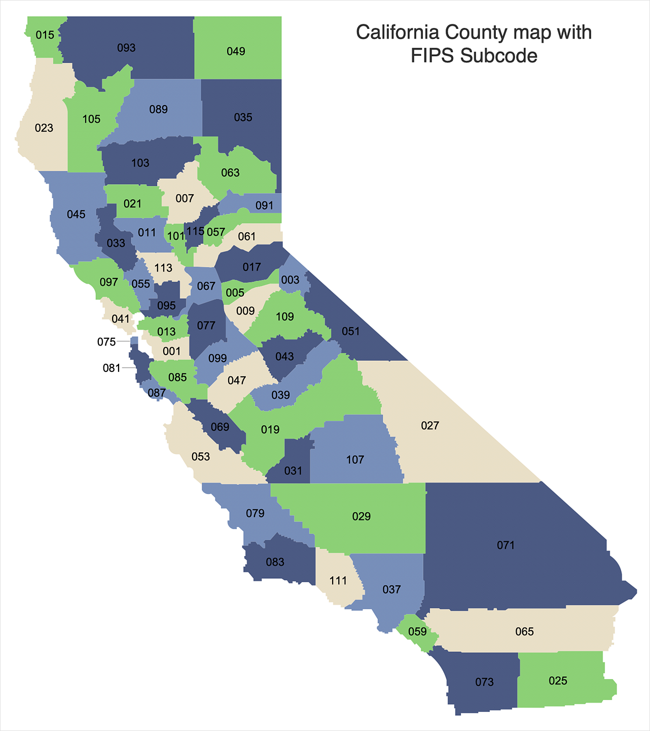
You can find a huge set of geopolitical statistical data regarding America. A common way of visualizing this data is to create maps that connect a particular data in relation to a specific geographical area. Thematic maps are used to depict such data as population density, average rainfall, or political allegiance, representing the data by using visual elements and annotation. Thematic maps always focus on one particular subject matter unlike general reference maps, which display information on different subjects — vegetation, topology, roads, and highways, etc. The United States Mapping Solution for ConceptDraw DIAGRAM includes all of the US States with county outlined borders, from the largest, San Bernardino in California, to the smallest Kalawao County, Hawaii.HelpDesk
How to Create a Map Depicting the United Kingdom Counties and Regions
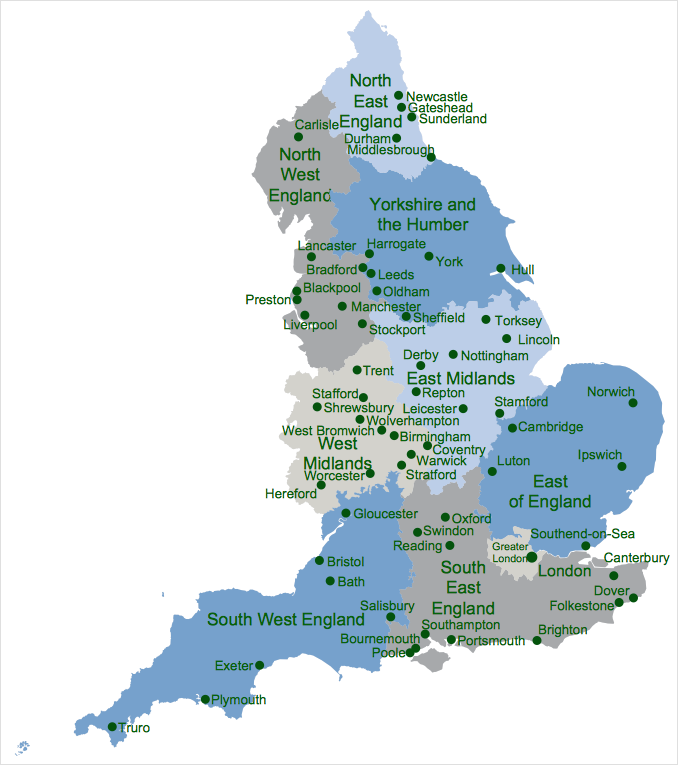
The UK Map Solution for ConceptDraw DIAGRAM includes all of the UK counties with county outlined borders, from the largest, North Yorkshire, to the smallest Rutlandshire. Geographical thematic maps are used to visualize information on a number of subjects related to certain geographical location. It is a common way of representing any form of spatial data in relation to a specific geographical area. The UK Map Solution for ConceptDraw DIAGRAM includes all of the United Kingdom counties with county outlined borders and major cities. You can quickly create geographic maps, cartograms, and thematic maps for geographical visualization information for business and travels.World Continents Map
ConceptDraw DIAGRAM diagramming and vector drawing software enhanced with Continent Maps Solution from the Maps Area is the best for drawing geographic, topography, political, and many other kinds of maps for any of seven earth continents and also world continents map of any detailing.HelpDesk
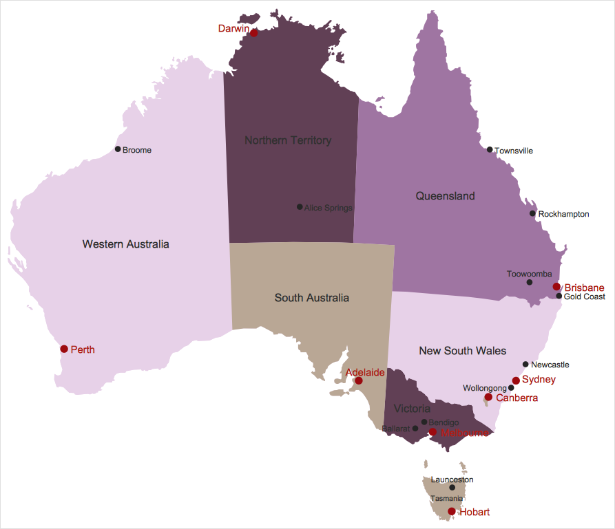
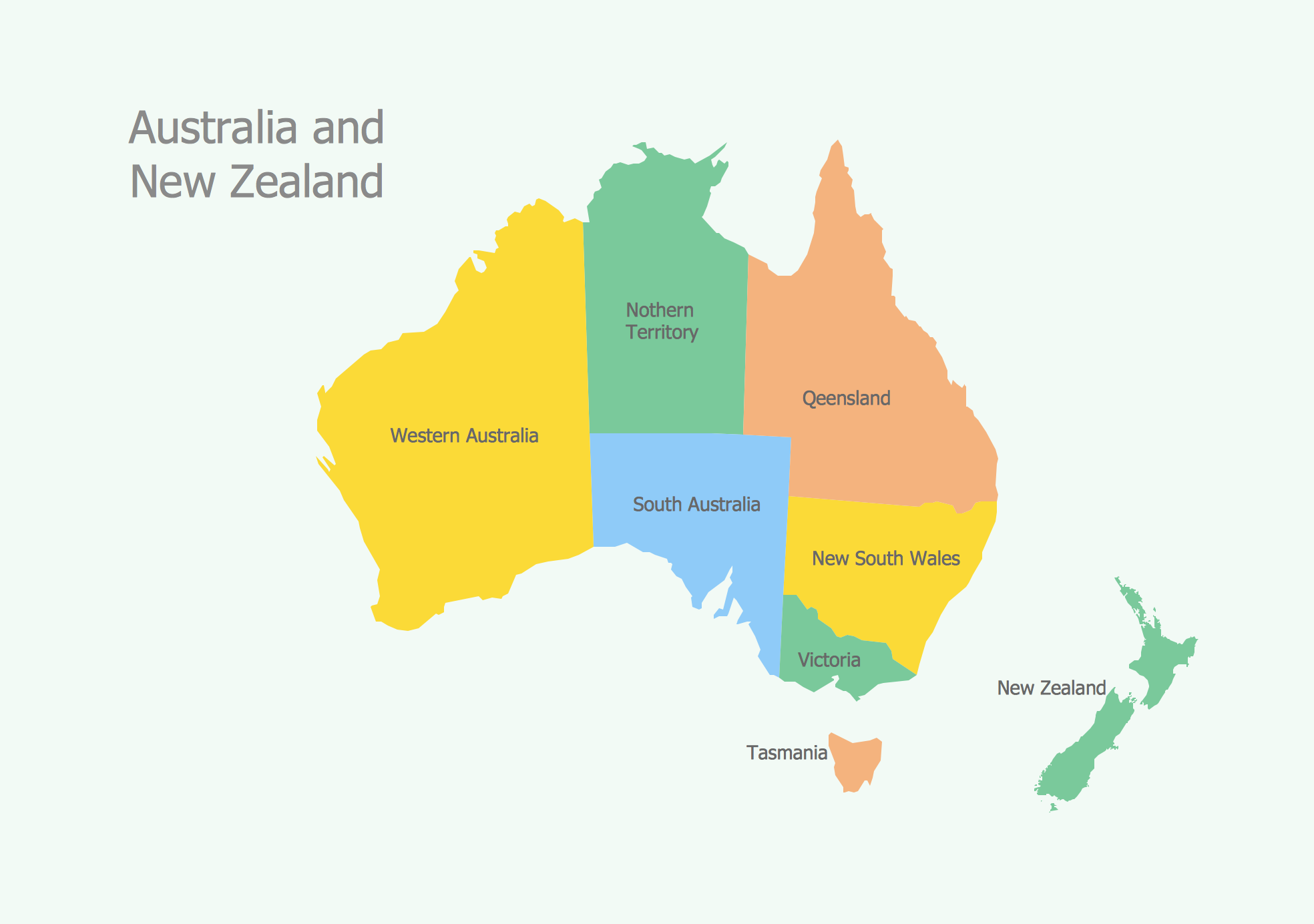
How to Draw Maps of Australia
Australia is the sixth largest country in the world. Australia consists from the mainland which is surrounded by many thousands of small fringing islands and numerous larger ones. The vast territories, aligned with interesting historic features across a wide expanse, make the thematic map an ideal way of depicting geographical, geological and political information related to Australia. The Australia Map solution for ConceptDraw DIAGRAM will help you to make the steps of the creativeness easy and intuitive. The Australia Map solution provides templates and samples along with vector stencils to get you started. Used together with other ConceptDraw DIAGRAM solutions it will allow you to create comprehensive geography-related infographics.Map Software
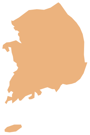
Create maps, flags, and more with ConceptDrawGeo Map - Asia - South Korea
South Korea, officially the Republic of Korea, is a country in East Asia, constituting the southern part of the Korean Peninsula. The vector stencils library South Korea contains contours for ConceptDraw DIAGRAM diagramming and vector drawing software. This library is contained in the Continent Maps solution from Maps area of ConceptDraw Solution Park.Geo Map — Asia
ConceptDraw is idea to draw the geological maps of Asia from the pre-designed vector geo map shapes. Use Geo Map Asia to draw thematic maps, geospatial infographics and vector illustrations for your business documents, presentations and websites.
 Continent Maps
Continent Maps solution extends ConceptDraw DIAGRAM software with templates, samples and libraries of vector stencils for drawing the thematic maps of continents, state maps of USA and Australia.
Types of Map - Overview
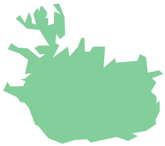
ConceptDraw defines some map types, divided into three categories. Every map type has specific shapes and examples.Geo Map - Europe - Iceland
The vector stencils library Iceland contains contours for ConceptDraw DIAGRAM diagramming and vector drawing software. This library is contained in the Continent Maps solution from Maps area of ConceptDraw Solution Park.Map of Germany — Rhineland-Palatinate State
Rhineland-Palatinate is a southwest German state bordered by France, Belgium and Luxembourg. The capital city is Mainz. Despite the fact that the maps surround us everywhere in our life, usually the process of their drawing is sufficienly complex and labor-intensive. But now, thanks to the ConceptDraw DIAGRAM diagramming and vector drawing software extended with Germany Map Solution from the Maps Area of ConceptDraw Solution Park, we have the possibility to make easier this process. Design fast and easy your own pictorial maps of Germany, map of Germany with cities, and thematic Germany maps in ConceptDraw DIAGRAM !Geo Map - Africa - Rwanda
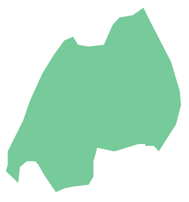
Rwanda, officially the Republic of Rwanda, is a sovereign state in central and east Africa. The vector stencils library Rwanda contains contours for ConceptDraw DIAGRAM diagramming and vector drawing software. This library is contained in the Continent Maps solution from Maps area of ConceptDraw Solution Park.Geo Map - Africa - Gabon
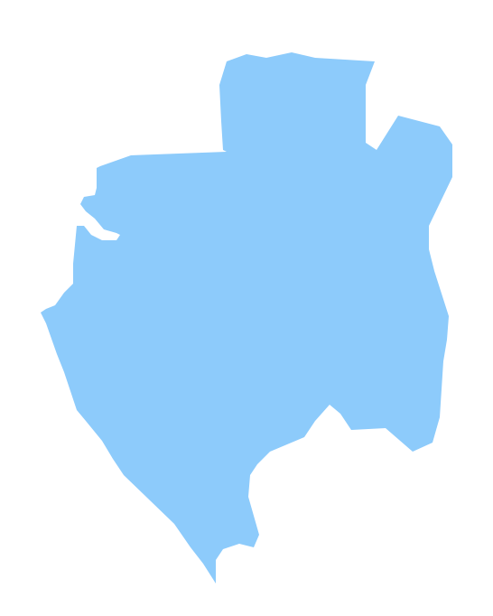
Gabon, officially the Gabonese Republic, is a sovereign state on the west coast of Central Africa. The vector stencils library Gabon contains contours for ConceptDraw DIAGRAM diagramming and vector drawing software. This library is contained in the Continent Maps solution from Maps area of ConceptDraw Solution Park.Geo Map - Australia
The vector stencils library Australia contains contours of New Zealand and Australian states and mainland territories for ConceptDraw DIAGRAM diagramming and vector drawing software.Geo Map - Asia - Philippines
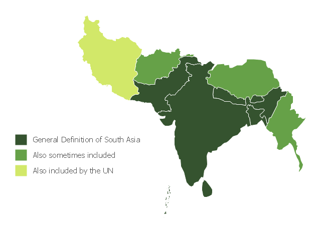
The Philippines, officially known as the Republic of the Philippines, is a sovereign island country in Southeast Asia situated in the western Pacific Ocean. Use the Continent Maps solution and Philippines library to draw thematic maps, geospatial infographics and vector illustrations. This solution to help visualize the business and thematic information connected with geographic areas, locations or customs; for your business documents, presentations and websites."South Asia or Southern Asia is the southern region of the Asian continent, which comprises the sub-Himalayan countries and, for some authorities, adjoining countries to the west and east. Topographically, it is dominated by the Indian Plate, which rises above sea level as northern parts of India south of the Himalayas and the Hindu Kush. South Asia is bounded on the south by the Indian Ocean and on land (clockwise, from west) by West Asia, Central Asia, East Asia, and Southeast Asia.
The current territories of Bangladesh, India, Sri Lanka and Pakistan form the core countries of South Asia, while Nepal, Bhutan and Maldives are generally included, and Afghanistan and Myanmar often added. By various deviating definitions based on often substantially different reasons, the British Indian Ocean Territory, Mauritius, Iran and the Tibet Autonomous Region are included as well. With the 7 core countries considered, South Asia is home to well over one fifth of the world's population, making it both the most populous and the most densely populated geographical region in the world. The South Asian Association for Regional Cooperation is an economic cooperation organisation in the region which was established in 1985." [South Asia. Wikipedia]
This political map sample was redesigned from the Wikimedia Commons file: South Asia (ed)update.PNG.
[commons.wikimedia.org/ wiki/ File:South_ Asia_ %28ed%29update.PNG]
The example "South Asia - Political map" was created using the ConceptDraw PRO diagramming and vector drawing software extended with the Continent Maps solution from the Maps area of ConceptDraw Solution Park.
Geo Map — Europe
Europe is a continent that comprises the westernmost part of Eurasia. ConceptDraw DIAGRAM is idea to draw the geological maps of Europe from the pre-designed vector geo map shapes. Use it to draw thematic maps, geospatial infographics and vector illustrations for your business documents, presentations and websites.- Geographical Maps
- Variety Geographical Maps
- Drawing Of A Map Of East Africa
- North America Thematic Map
- Geographic Maps
- Conference centre location map | How to Draw a Map of North ...
- Design elements - Geography | Business People Figures | Map ...
- Geography - Vector stencils library | How to Draw a Map of North ...
- Geo Map — South America — Peru
- Location Intelligence Dashboard - New European Customers | Maps ...
- Design elements - Geography | Geography - Vector stencils library ...
- Visualization Spatial Data Using Thematic Maps Combined with ...
- Design elements - Geography | Spatial infographics Design ...
- Design elements - Thematic maps | Name Three Primary Purposes ...
- Design elements - Thematic maps | Design elements - Continental ...
- Easy Drawing Map Of Greece
- California relief | Geo Map - Europe - Russia | Geo Map - USA ...
- How to Draw a Map of North America | Beautiful Nature Scene ...
- Network Layout Floor Plans | How to Draw Maps of Australia Using ...

