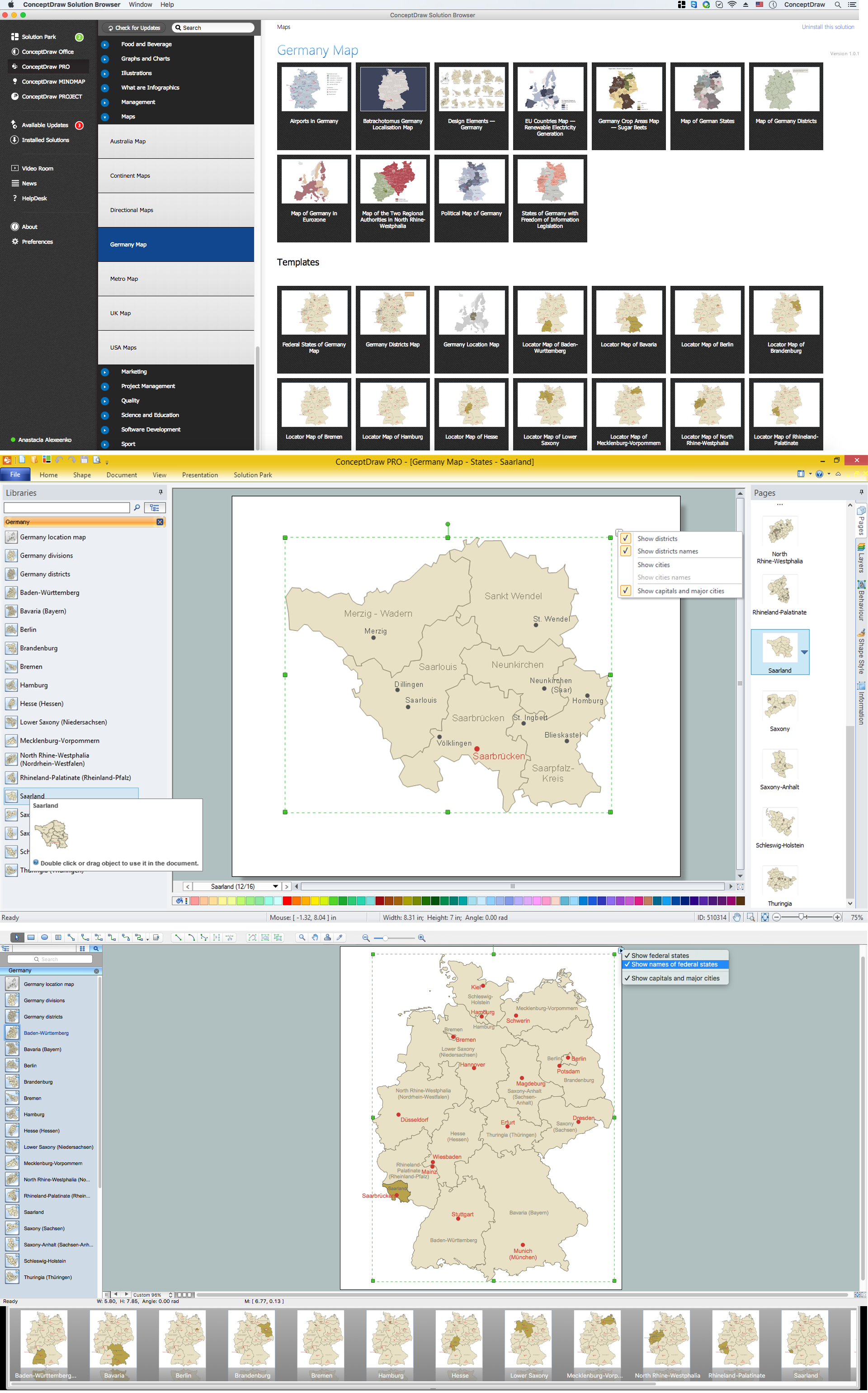
Map of Germany — Saarland State
The Saarland is one of the sixteen federal states (or Bundesländer) of Germany. The capital city is Saarbrücken. Despite the fact that the maps surround us everywhere in our life, usually the process of their drawing is sufficienly complex and labor-intensive. But now, thanks to the ConceptDraw PRO diagramming and vector drawing software extended with Germany Map Solution from the Maps Area of ConceptDraw Solution Park, we have the possibility to make easier this process. Design fast and easy your own pictorial maps of Germany, map of Germany with cities, and thematic Germany maps in ConceptDraw PRO!
 Germany Map
The Germany Map solution contains collection of samples, templates and scalable vector stencil graphic maps, representing map of Germany and all 16 states of Germany. Use the Germany Map solution from ConceptDraw Solution Park as the base for various them
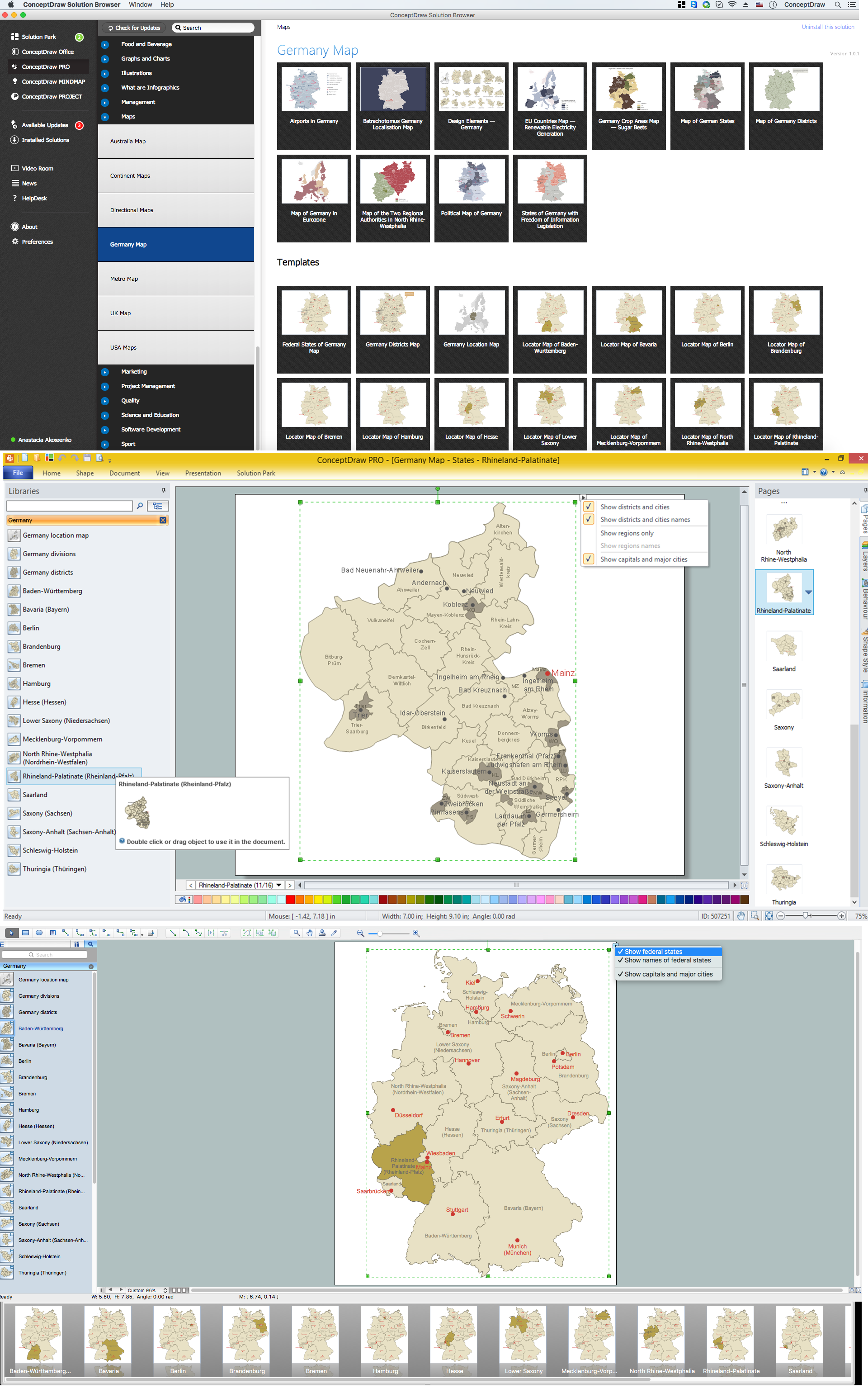
Map of Germany — Rhineland-Palatinate State
Rhineland-Palatinate is a southwest German state bordered by France, Belgium and Luxembourg. The capital city is Mainz. Despite the fact that the maps surround us everywhere in our life, usually the process of their drawing is sufficienly complex and labor-intensive. But now, thanks to the ConceptDraw PRO diagramming and vector drawing software extended with Germany Map Solution from the Maps Area of ConceptDraw Solution Park, we have the possibility to make easier this process. Design fast and easy your own pictorial maps of Germany, map of Germany with cities, and thematic Germany maps in ConceptDraw PRO!This Germany political map example was created on the base of Wikimedia Commons file: Map Germany Länder-en.svg. [commons.wikimedia.org/ wiki/ File:Map_ Germany_ Länder-en.svg]
This file is licensed under the Creative Commons Attribution-Share Alike 3.0 Unported license. [creativecommons.org/ licenses/ by-sa/ 3.0/ deed.en]
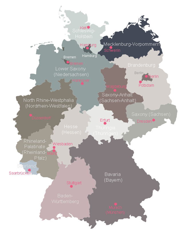
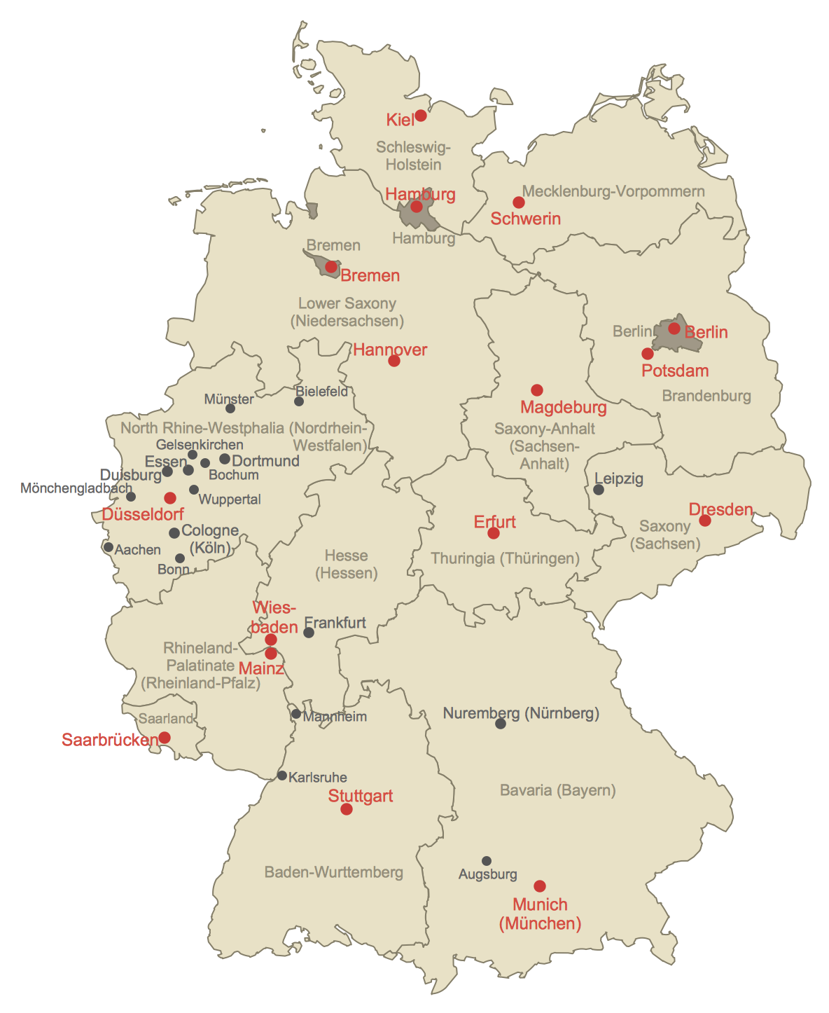
"Germany is a federal republic consisting of sixteen federal states (German: Bundesland, or Land). Since today's Germany was formed from an earlier collection of several states, it has a federal constitution, and the constituent states retain a measure of sovereignty. With an emphasis on geographical conditions, Berlin and Hamburg are frequently called Stadtstaaten (city-states), as is the Free Hanseatic City of Bremen, which in fact includes the cities of Bremen and Bremerhaven. The remaining 13 states are called Flächenländer (literally: area states)." [States of Germany. Wikipedia]
The political map example "Map of German states" was designed using the ConceptDraw PRO software extended with the Map of Germany solution from the Maps area of ConceptDraw Solution Park.
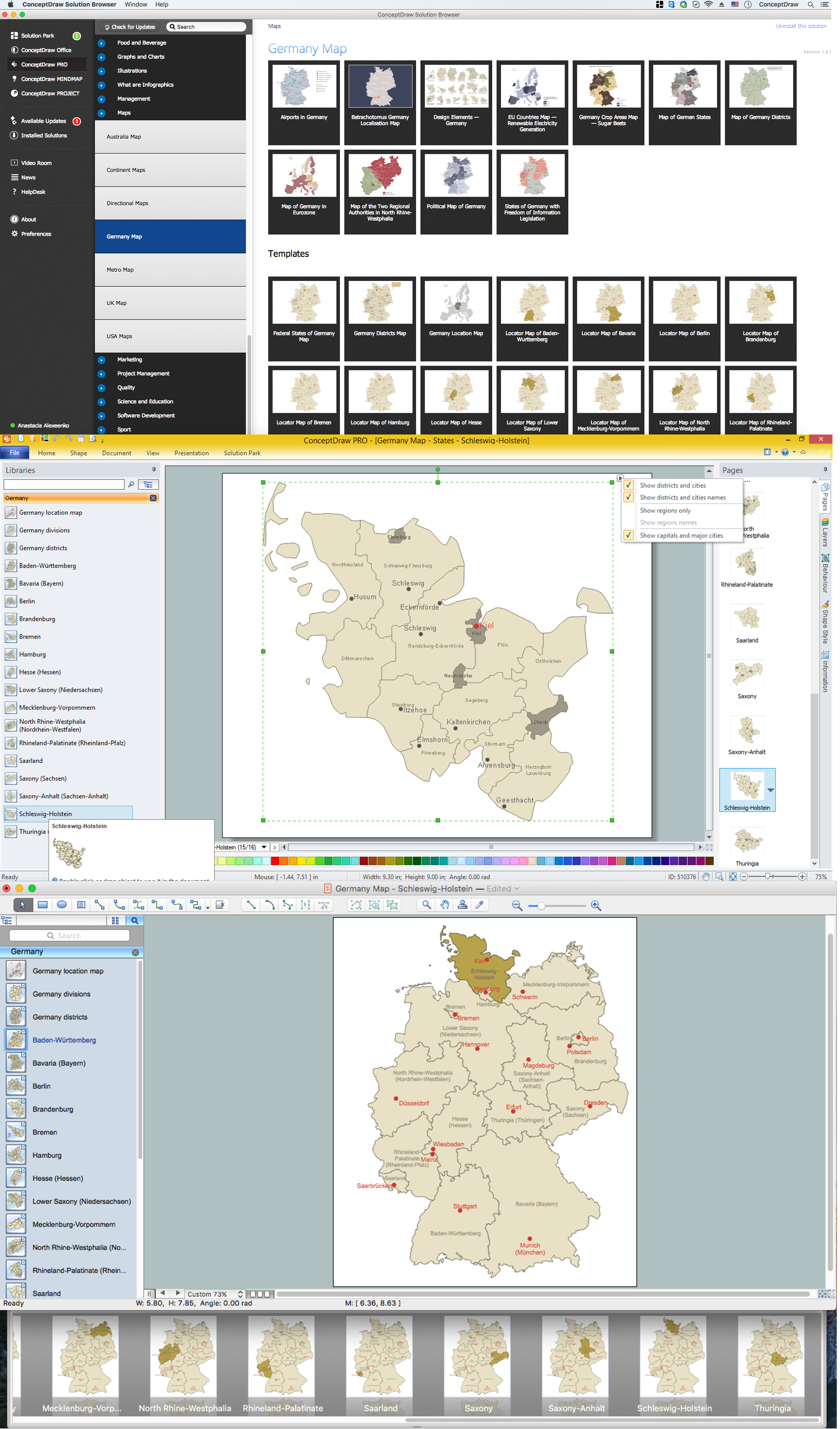
Map of Germany — Schleswig-Holstein State
Schleswig-Holstein is the northernmost of the 16 states of Germany, comprising most of the historical duchy of Holstein and the southern part of the former Duchy of Schleswig. Its capital city is Kiel. Despite the fact that the maps surround us everywhere in our life, usually the process of their drawing is sufficienly complex and labor-intensive. But now, thanks to the ConceptDraw PRO diagramming and vector drawing software extended with Germany Map Solution from the Maps Area of ConceptDraw Solution Park, we have the possibility to make easier this process. Design fast and easy your own pictorial maps of Germany, map of Germany with cities, and thematic Germany maps in ConceptDraw PRO!Map of Germany — Lower Saxony State
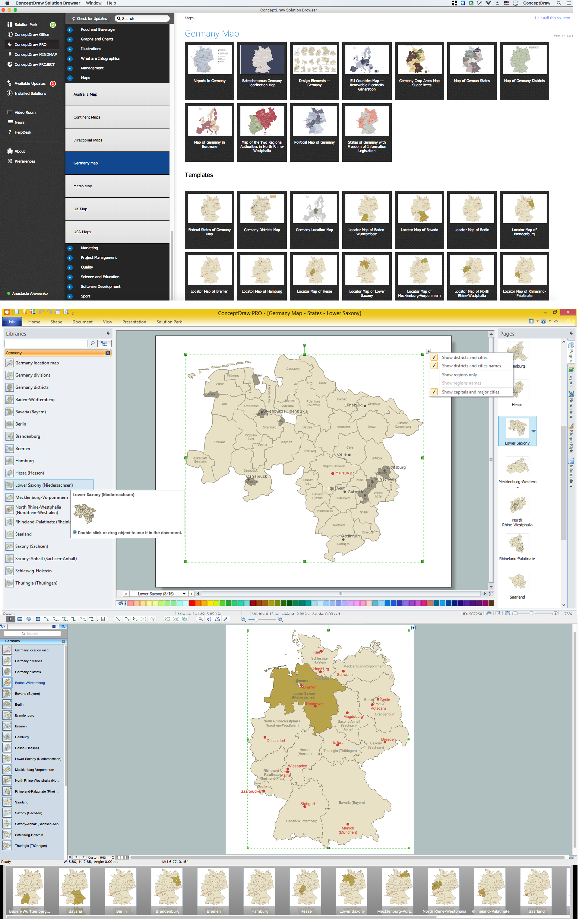
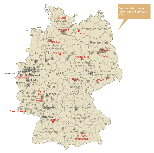
Lower Saxony is a German state (Bundesland) situated in northwestern Germany and is second in area, with 47,624 square kilometres (18,388 sq mi), and fourth in population (8 million) among the sixteen Länder of Germany. Despite the fact that the maps surround us everywhere in our life, usually the process of their drawing is sufficienly complex and labor-intensive. But now, thanks to the ConceptDraw PRO diagramming and vector drawing software extended with Germany Map Solution from the Maps Area of ConceptDraw Solution Park, we have the possibility to make easier this process. Design fast and easy your own pictorial maps of Germany, map of Germany with cities, and thematic Germany maps in ConceptDraw PRO!Use this German districts map template to design Germany political or thematic maps with ConceptDraw PRO software.
You can show or hide borders or names of federal states, districts and main cities, or regions by the map selecting and Action menu commands.
The template "Germany districts map" is included in the Map of Germany solution from the Maps area of ConceptDraw Solution Park.
You can show or hide borders or names of federal states, districts and main cities, or regions by the map selecting and Action menu commands.
The template "Germany districts map" is included in the Map of Germany solution from the Maps area of ConceptDraw Solution Park.
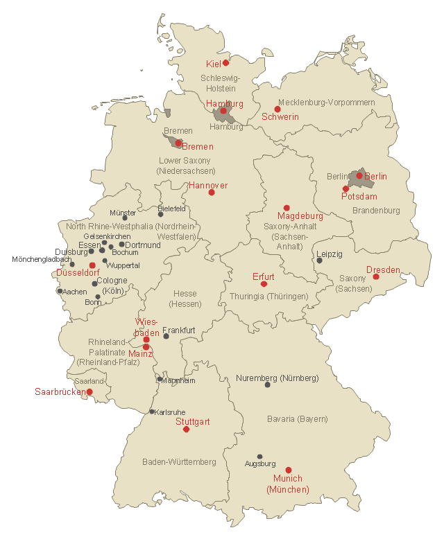
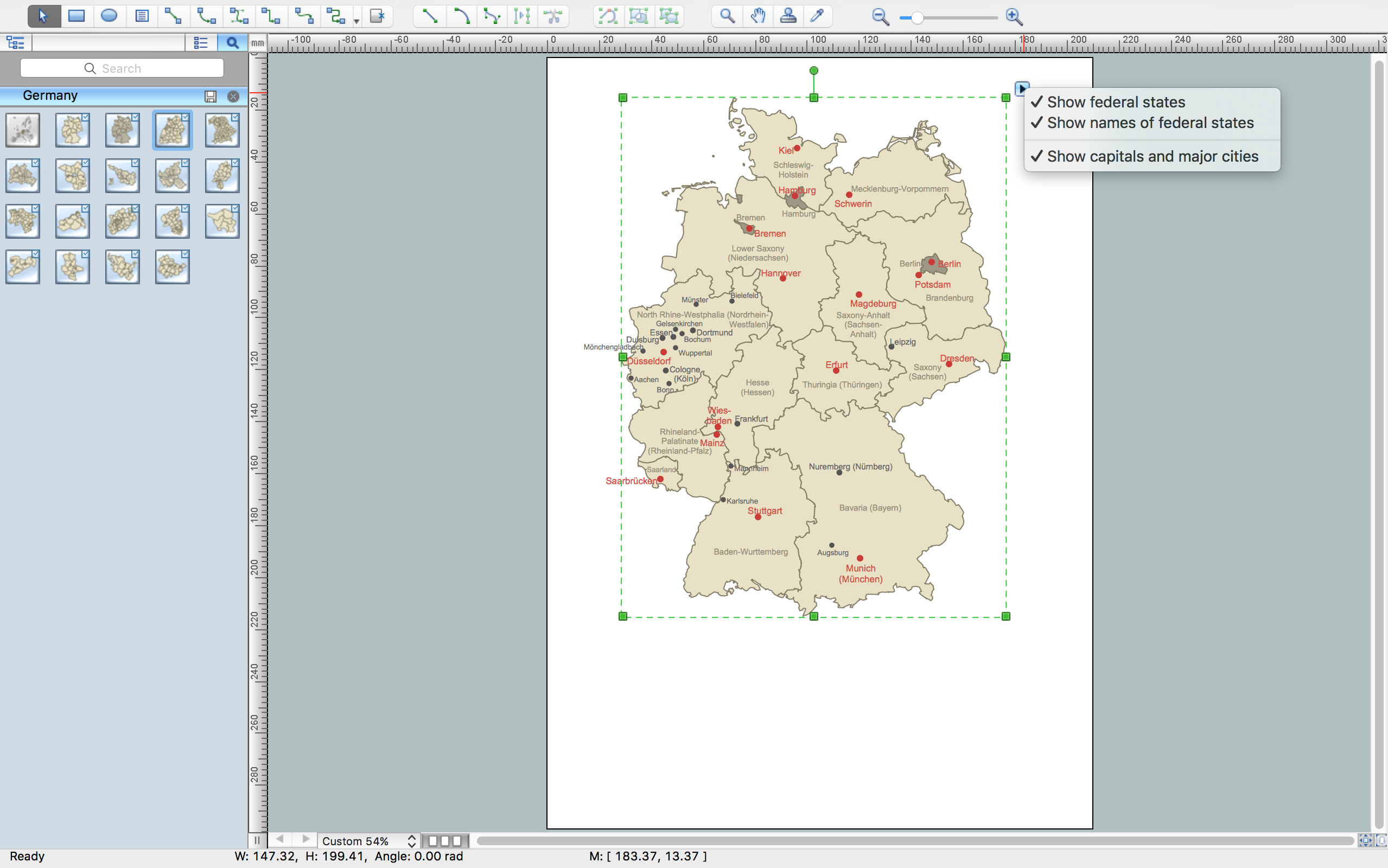
Use this German states map template to design Germany political or thematic maps with ConceptDraw PRO software.
You can show or hide federal state borders or names, or main cities by the map selecting and Action menu commands.
The template "Federal States of Germany map" is included in the Map of Germany solution from the Maps area of ConceptDraw Solution Park.
You can show or hide federal state borders or names, or main cities by the map selecting and Action menu commands.
The template "Federal States of Germany map" is included in the Map of Germany solution from the Maps area of ConceptDraw Solution Park.
Vector Map of Germany
Vector map is the best way to visually present a world, continents, islands, to display location and boundaries of countries and cities. ConceptDraw PRO diagramming and vector drawing software offers the Germany Map Solution from the Maps Area of ConceptDraw Solution Park - the best tool for fast and easy drawing vector map of Germany of any degree of detailing, and thematic cartograms and maps of Germany on its base.Map of Germany — Hamburg
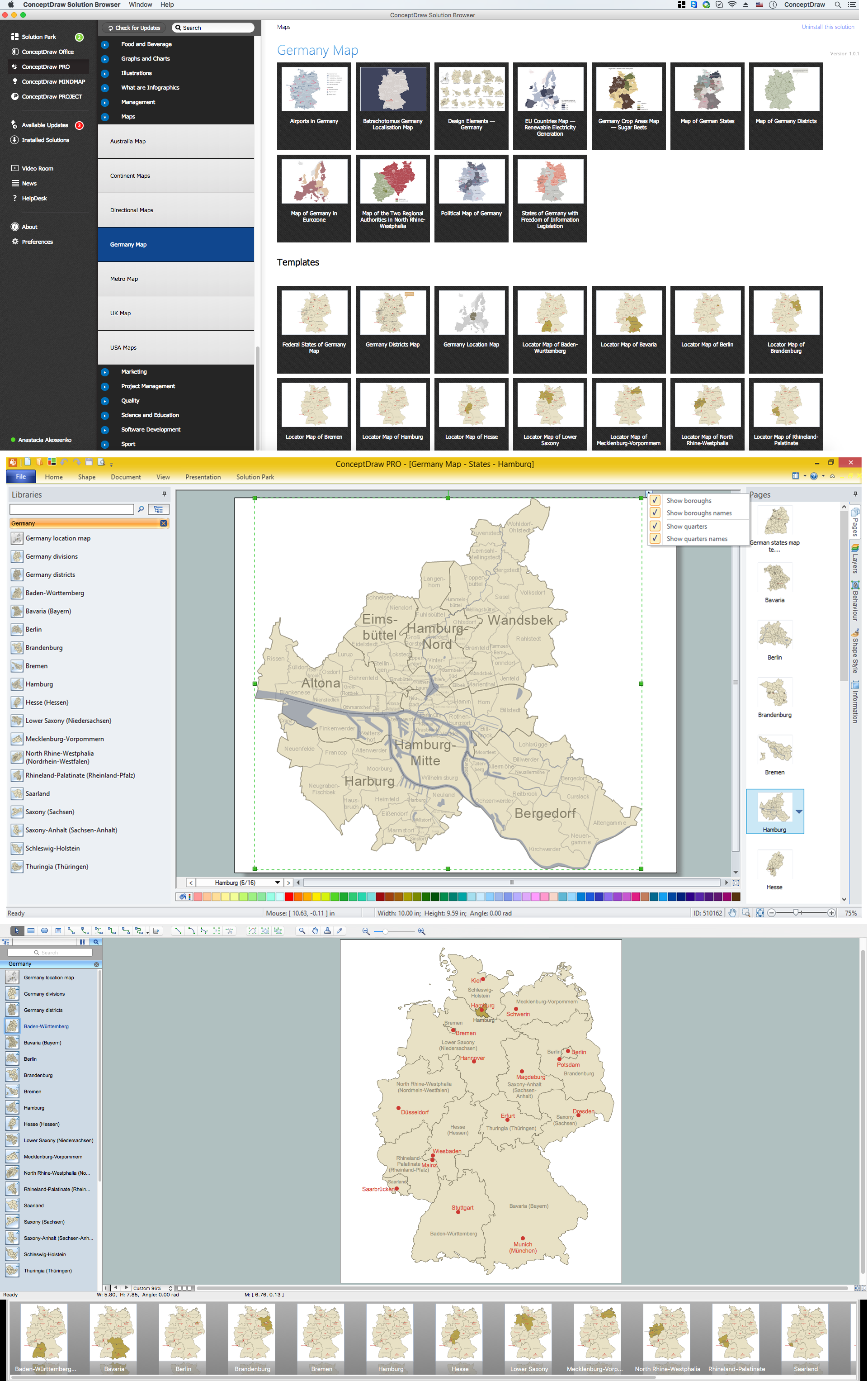
Hamburg is the second largest city in Germany and the eighth largest city in the European Union. It is the second smallest German state by area. Despite the fact that the maps surround us everywhere in our life, usually the process of their drawing is sufficienly complex and labor-intensive. But now, thanks to the ConceptDraw PRO diagramming and vector drawing software extended with Germany Map Solution from the Maps Area of ConceptDraw Solution Park, we have the possibility to make easier this process. Design fast and easy your own pictorial maps of Germany, map of Germany with cities, and thematic Germany maps in ConceptDraw PRO!HelpDesk
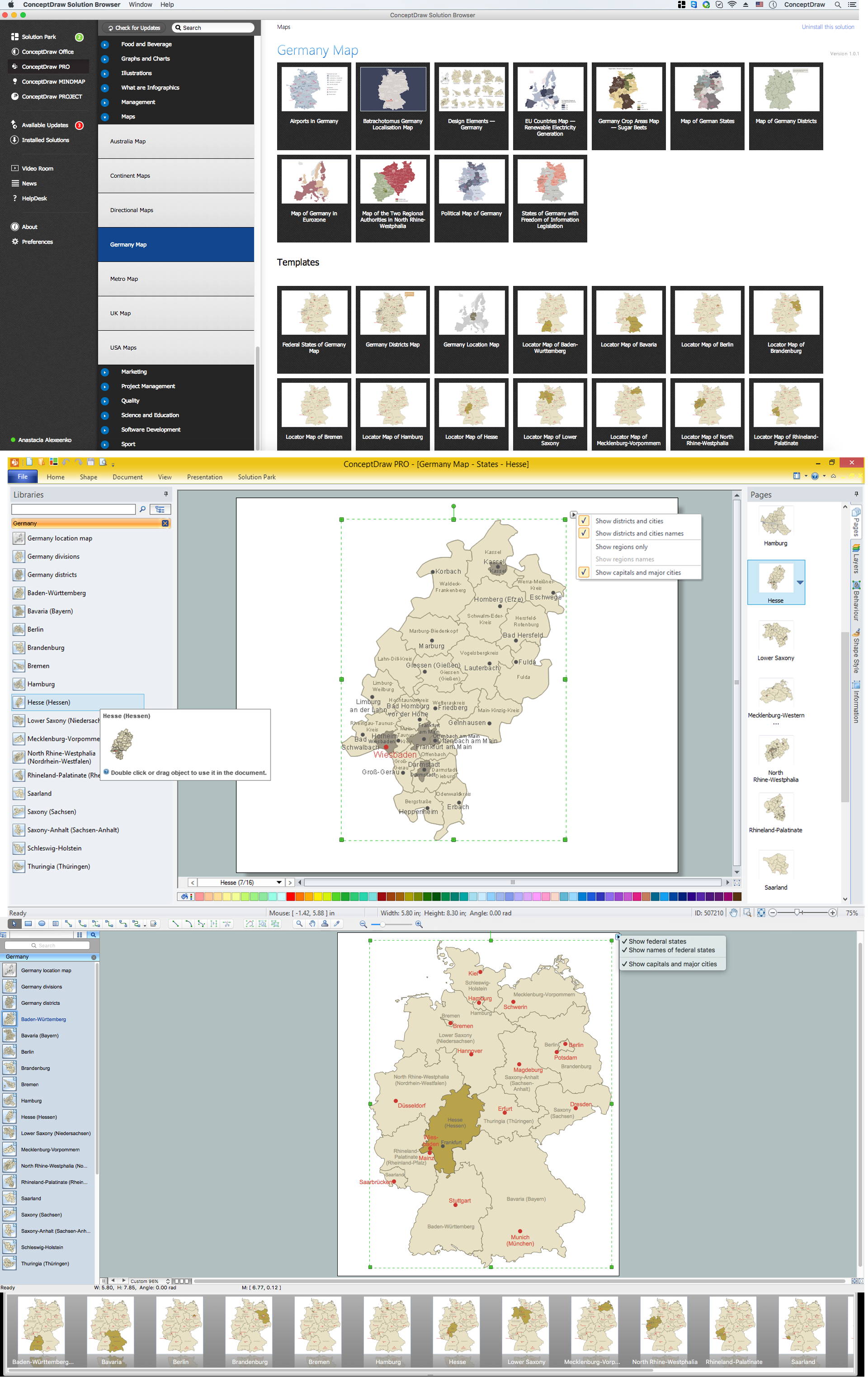
How to Create a Map of Germany Using ConceptDraw PRO
Geographical thematic maps are used to display information on a variety of subjects. It is a common way of representing any form of spatial data in relation to a specific geographical area. The Germany Map Solution for ConceptDraw PRO includes all of the German federal states with county outlined borders and major cities. You can quickly create geographic maps, cartograms, and thematic maps for geographical visualization information for business and travels.Germany Map
Germany is in Western and Central Europe, with Denmark bordering to the north, Poland and the Czech Republic to the east, Austria to the southeast, Switzerland to the south-southwest, France, Luxembourg and Belgium lie to the west, and the Netherlands to the northwest. ConceptDraw PRO diagramming and vector drawing software enhanced with Germany Map Solution from the Maps Area of ConceptDraw Solution Park is the best for drawing geographic Germany map, topography, political, and various thematic maps of Germany.Map of Germany — Hesse State
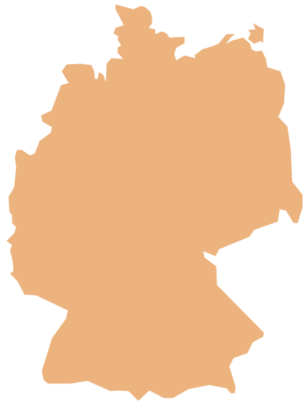
Hesse is a federal state (Land) of the Federal Republic of Germany, with just over six million inhabitants. Despite the fact that the maps surround us everywhere in our life, usually the process of their drawing is sufficienly complex and labor-intensive. But now, thanks to the ConceptDraw PRO diagramming and vector drawing software extended with Germany Map Solution from the Maps Area of ConceptDraw Solution Park, we have the possibility to make easier this process. Design fast and easy your own pictorial maps of Germany, map of Germany with cities, and thematic Germany maps in ConceptDraw PRO!Geo Map — Europe — Germany
The vector stencils library Germany contains contours for ConceptDraw PRO diagramming and vector drawing software. This library is contained in the Continent Maps solution from Maps area of ConceptDraw Solution Park.- New German Map Solution for ConceptDraw PRO v10
- Germany Map | Map of Germany — Saarland State | Map of ...
- Maps of Germany With Cities
- Germany Map | Continent Maps | Maps of Germany | East German ...
- Germany Map | Germany Map | Geo Map - Europe - Austria ...
- Germany Map | How to Create a Map of Germany Using ...
- Maps of Germany With Cities | Map of Germany — Saarland State ...
- Map of Germany — Bremen | Germany Map | Geo Map - Europe ...
- Map Of German Cities And States
- Map of Germany
- Map Of German Regions
- Germany Map | Germany Map | Geo Map - Europe - Austria ...
- Map of Germany — Saarland State | Germany Map | Map of ...
- Map of Germany — Schleswig-Holstein State | Germany Map | Map ...
- Major Cities In Germany Map
- Germany Map | How to Create a Map of Germany Using ...
- Map of Germany — Hesse State | How to Create a Map of Germany ...
- How to Create a Map of Germany Using ConceptDraw PRO | Map Of ...
- Maps of Germany With Cities | Infographic software: the sample of ...
