Metro Maps
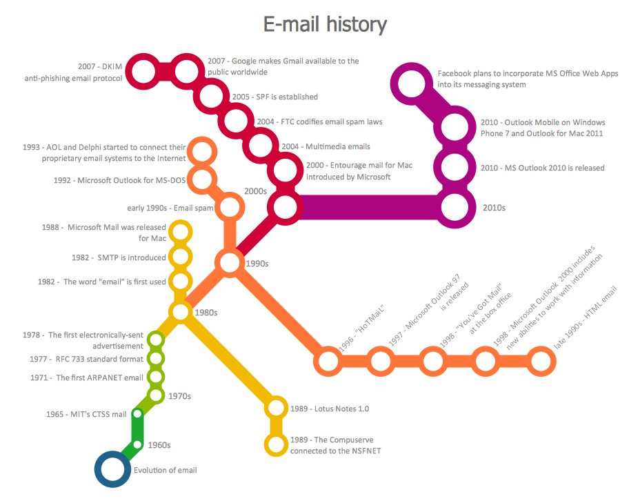
ConceptDraw PRO software enhanced with Metro Map Solution from the Maps Area of ConceptDraw Solution Park provides extensive drawing tools for fast and easy creating various metro maps, route maps, transport schemes, metro path maps, subway train maps, and many other types of maps.
 Metro Map
Metro Map solution extends ConceptDraw PRO software with templates, samples and library of vector stencils for drawing the metro maps, route maps, bus and other transport schemes, or design tube-style infographics.
Map of USA
It is impossible to imagine modern life and science without maps, they surround us anywhere, they are used in geography, history, politics, economics, and many other fields of science. ConceptDraw PRO diagramming and vector drawing software offers the USA Maps Solution from the Maps Area of ConceptDraw Solution Park with its collection of samples and libraries for easy drawing the Map of USA.Australia Map
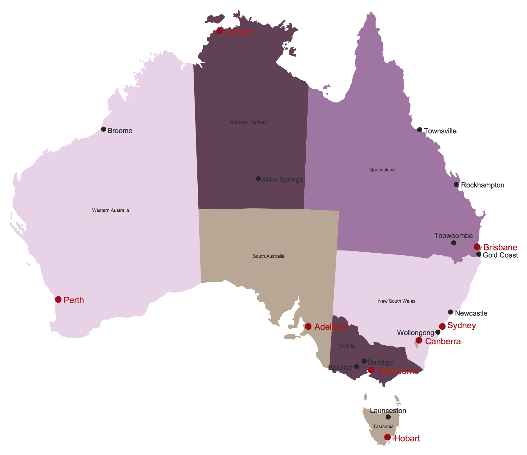
Maps surround us everywhere in our life, study, work, traveling, they are widely used in geography, history, politics, economics, and many other fields of science and life activity. But designing of maps is usually complex and labor-intensive process. Now we have the possibility to make easier this process - ConceptDraw PRO diagramming and vector drawing software extended with Australia Map Solution from the Maps Area of ConceptDraw Solution Park will help us in easy drawing detailed Australia map.
 Audio, Video, Media
Use it to make professional-looking documents, impressive presentations, and efficient websites with colorful and vivid illustrations and schematics of digital audio, video and photo gadgets and devices, audio video connections and configurations, S Video connection, HD and 3D television systems, home entertainment systems, Closed-circuit television (CCTV) surveillance systems. All audio video schematics, drawings and illustrations designed in ConceptDraw PRO are professional looking, clear and understandable for all thanks to applying the most commonly used standards of designations, and are effective for demonstrating in front of a small audience and on the big screens.
 Area Charts
Area Charts are used to display the cumulative totals over time using numbers or percentages; or to show trends over time among related attributes. The Area Chart is effective when comparing two or more quantities. Each series of data is typically represented with a different color, the use of color transparency in an object’s transparency shows overlapped areas and smaller areas hidden behind larger areas.
 Collaboration Area
The solutions from Collaboration area of ConceptDraw Solution Park extend ConceptDraw PRO and ConceptDraw MINDMAP software with features, samples, templates and vector stencils libraries for drawing diagrams and mindmaps useful for collaboration.
- Maps of Germany With Cities
- Germany Maps Design Vector Samples
- Design elements - Thematic maps | How to Create a Map Depicting ...
- Design elements - Geography | Geography - Vector stencils library ...
- Storage area networks (SAN). Computer and Network Examples ...
- Collaboration Software | ConceptDraw.com
- Geo Map - Australia
- Winter Sports Vector Clipart. Medal Map . Spatial Infographics ...
- Winter Sports Vector Clipart. Medal Map . Spatial Infographics ...
- Storage area networks (SAN). Computer and Network Examples ...
- Winter Sports. Olympic Games Infographics. Medal Table | Sochi ...
- Winter Olympics - Ski jumping | Sochi 2014 RusSki Gorki Ski ...
- Sochi 2014 Olympics - Men's hockey tournament schedule ...
- Ski jumping - Winter sports pictograms | Sochi 2014 RusSki Gorki ...
- Sochi 2014 RusSki Gorki Ski Jumping Center | Medal table - Ski ...
- Sochi 2014 Olympics - Men's hockey tournament schedule ...
- Winter Sports | Winter Olympics - Bobsleigh | Winter Olympics ...
- Sochi 2014 Olympics - Men's hockey tournament schedule ...
- Winter Sports | Sochi 2014 Olympics - Men's hockey tournament ...
- Winter Sports | Winter Olympics - Freestyle skiing | Winter Olympics ...


