 Plumbing and Piping Plans
Plumbing and Piping Plans solution extends ConceptDraw DIAGRAM.2.2 software with samples, templates and libraries of pipes, plumbing, and valves design elements for developing of water and plumbing systems, and for drawing Plumbing plan, Piping plan, PVC Pipe plan, PVC Pipe furniture plan, Plumbing layout plan, Plumbing floor plan, Half pipe plans, Pipe bender plans.
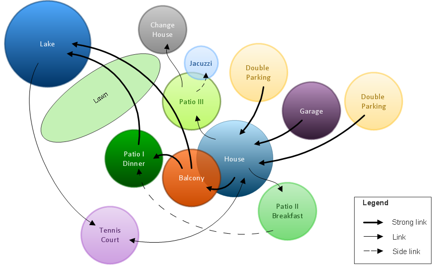
Bubble diagrams in Landscape Design with ConceptDraw DIAGRAM
Bubble Diagrams are the charts with a bubble presentation of data with obligatory consideration of bubble's sizes. They are analogs of Mind Maps and find their application at many fields, and even in landscape design. At this case the bubbles are applied to illustrate the arrangement of different areas of future landscape design, such as lawns, flowerbeds, playgrounds, pools, recreation areas, etc. Bubble Diagram helps to see instantly the whole project, it is easy for design and quite informative, in most cases it reflects all needed information. Often Bubble Diagram is used as a draft for the future landscape project, on the first stage of its design, and in case of approval of chosen design concept is created advanced detailed landscape plan with specification of plants and used materials. Creation of Bubble Diagrams for landscape in ConceptDraw DIAGRAM software is an easy task thanks to the Bubble Diagrams solution from "Diagrams" area. You can use the ready scanned location plan as the base or create it easy using the special ConceptDraw libraries and templates.Spatial infographics Design Elements: Location Map
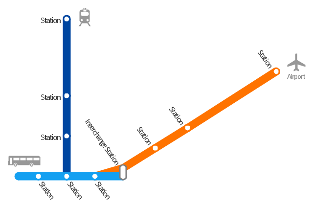
Infographic Design Elements for visually present various geographically distributed information."A transit map is a topological map in the form of a schematic diagram used to illustrate the routes and stations within a public transport system - whether this be bus lines, tramways, rapid transit, commuter rail or ferry routes. The main components are color coded lines to indicate each line or service, with named icons to indicate stations or stops. ...
There are a growing number of books, websites and works of art on the subject of urban rail and metro map design and use. There are now hundreds of examples of diagrams in an urban rail or metro map style that are used to represent everything from other transit networks like buses and national rail services to sewerage systems and Derbyshire public houses." [Transit map. Wikipedia]
The transportation map template for the ConceptDraw PRO diagramming and vector drawing software is included in the Spatial Infographics solution from the area "What is Infographics" of ConceptDraw Solution Park.
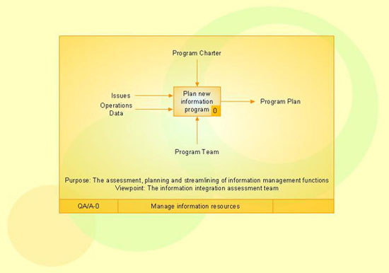
IDEF3 Standard
Use Case Diagrams technology. IDEF3 Standard is intended for description and further analysis of technological processes of an enterprise. Using IDEF3 standard it is possible to examine and model scenarios of technological processes.- How To use House Electrical Plan Software | Wiring Diagram Floor ...
- How To use House Electrical Plan Software | Bubble diagrams in ...
- Electrical One Line Diagram Symbols
- How To Draw Single Line Diagram Og Building
- How To use House Electrical Plan Software | Electrical Symbols ...
- India Map Line Diagram
- Drawing Of Building By Line Diagram
- Detailed Design Of A Landscape For A Public Building Line Diagram
- Map Templates From House
- Single Line Diagram Electrical House Wiring
- How To use House Electrical Plan Software | Landscape ...
- How to draw Metro Map style infographics? (New York) | Transport ...
- How To use House Electrical Plan Software | Wiring Diagrams with ...
- Transformer Symbol Single Line Diagram
- Line Diagram Of Simple Residential Building Plan
- House Hall Design Line Diagram
- Basic CCTV System Diagram . CCTV Network Diagram Example ...
- Building Drawing Design Element: Piping Plan | Plumbing and ...
- Make A House Diagram Map
- Electrical Single Line Diagram Of A Restaurant


