Nature Drawings - How to Draw
Nature solution expands this software possibilities to create beautiful illustrations diagrams with the new library which contains 17 vector objects.Geo Map - USA - California
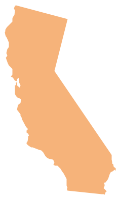
California is a state located on the West Coast of the United States. The vector stencils library California contains contours for ConceptDraw DIAGRAM diagramming and vector drawing software. This library is contained in the Continent Maps solution from Maps area of ConceptDraw Solution Park.Geo Map - USA - New Mexico
New Mexico is a state located in the southwest and western regions of the United States. The vector stencils library New Mexico contains contours for ConceptDraw DIAGRAM diagramming and vector drawing software. This library is contained in the Continent Maps solution from Maps area of ConceptDraw Solution Park.
 USA Maps
Use the USA Maps solution to create a map of USA, a US interstate map, printable US maps, US maps with cities and US maps with capitals. Create a complete USA states map.
Geo Map - USA - Massachusetts
Massachusetts, officially the Commonwealth of Massachusetts, is a state in the New England region of the northeastern United States. The vector stencils library Massachusetts contains contours for ConceptDraw DIAGRAM diagramming and vector drawing software. This library is contained in the Continent Maps solution from Maps area of ConceptDraw Solution Park.Geo Map - USA - Maryland
Maryland is a U.S. state located in the Mid-Atlantic region of the United States, bordering Virginia, West Virginia, and Washington, D.C. to its south and west; Pennsylvania to its north; and Delaware to its east. The vector stencils library Maryland contains contours for ConceptDraw DIAGRAM diagramming and vector drawing software. This library is contained in the Continent Maps solution from Maps area of ConceptDraw Solution Park.Ansoff Matrix
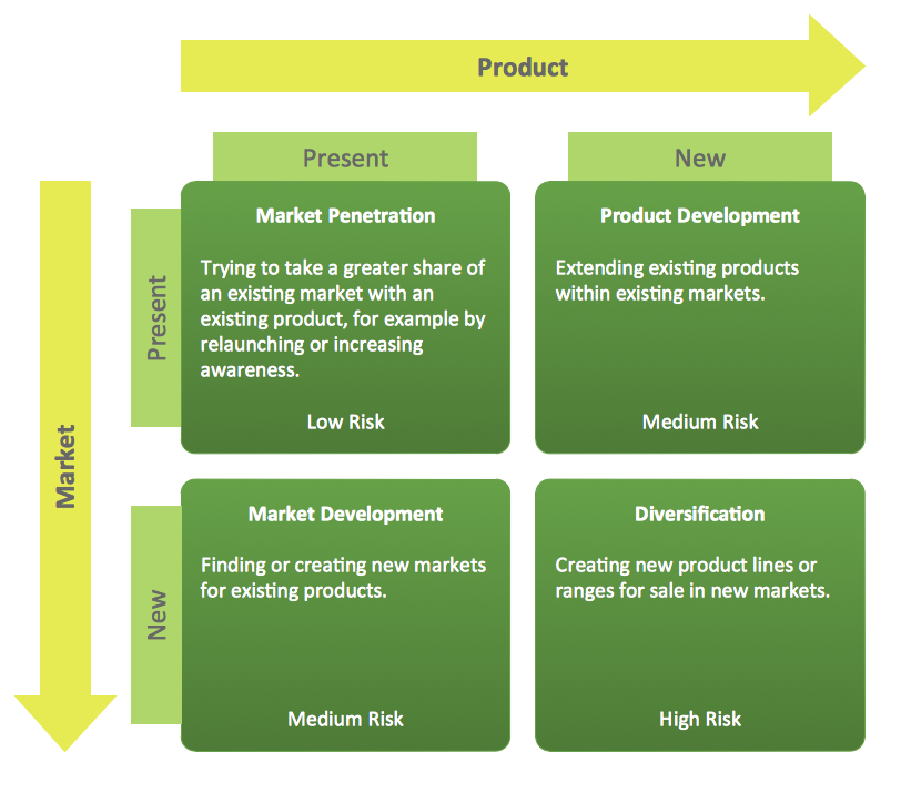
ConceptDraw DIAGRAM software extended with Matrices Solution from the Marketing Area of ConceptDraw Solution Park offers you the possibility to develop the Ansoff Matrix of any complexity.Geo Map - USA - Nevada
Nevada is a state in the western, mountain west, and southwestern regions of the United States. The vector stencils library Nevada contains contours for ConceptDraw DIAGRAM diagramming and vector drawing software. This library is contained in the Continent Maps solution from Maps area of ConceptDraw Solution Park.How to Draw a Natural Landscape
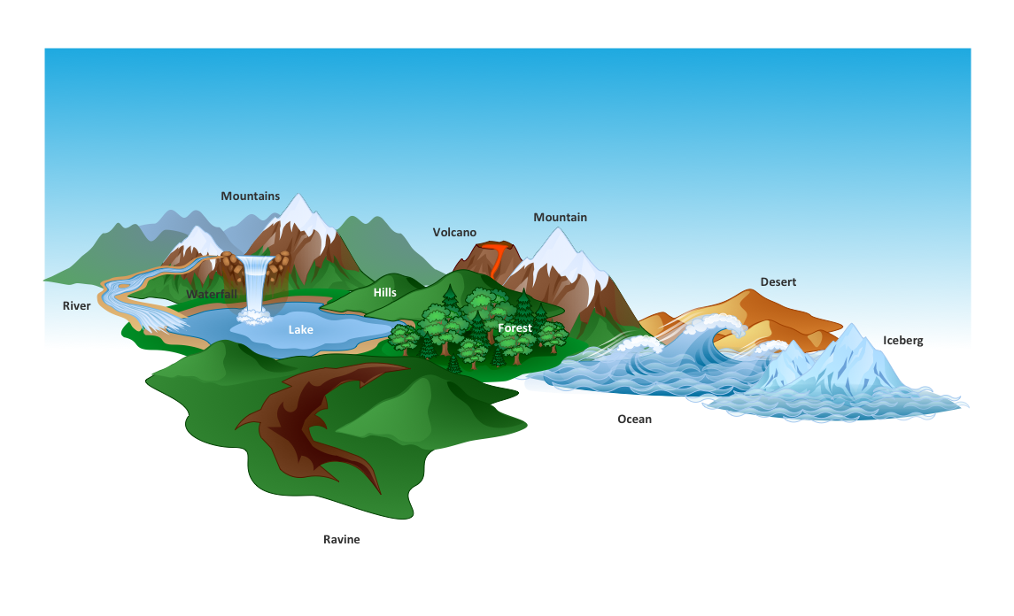
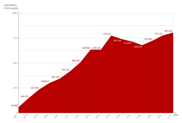
Nature solution expands ConceptDraw DIAGRAM software with samples, templates and libraries of vector clip art for drawing of Nature illustrations. Use Geography library of vector stencils to draw natural landscapes.This area chart sample shows the San Francisco population changes from 1860 to 2010.
"San Francisco ..., officially the City and County of San Francisco, is the leading financial and cultural center of Northern California and the San Francisco Bay Area.
The only consolidated city-county in California, San Francisco encompasses a land area of about 46.9 square miles (121 km2) on the northern end of the San Francisco Peninsula, giving it a density of about 17,620 people per square mile (6,803 people per km2). It is the most densely settled large city (population greater than 200,000) in the state of California and the second-most densely populated major city in the United States after New York City. San Francisco is the fourth most populous city in California, after Los Angeles, San Diego and San Jose, and the 14th most populous city in the United States—with a Census-estimated 2012 population of 825,863. The city is also the financial and cultural hub of the larger San Jose-San Francisco-Oakland metropolitan area, with a population of 8.4 million." [San Francisco. Wikipedia]
The area graph example "San Francisco population history" was created using the ConceptDraw PRO diagramming and vector drawing software extended with the Area Charts solution from the Graphs and Charts area of ConceptDraw Solution Park.
Geo Map - USA - Arizona
Arizona is a state in the southwestern region of the United States. The vector stencils library Arizona contains contours for ConceptDraw DIAGRAM diagramming and vector drawing software. This library is contained in the Continent Maps solution from Maps area of ConceptDraw Solution Park.- How To Draw California Easy
- How To Draw Arizona Map
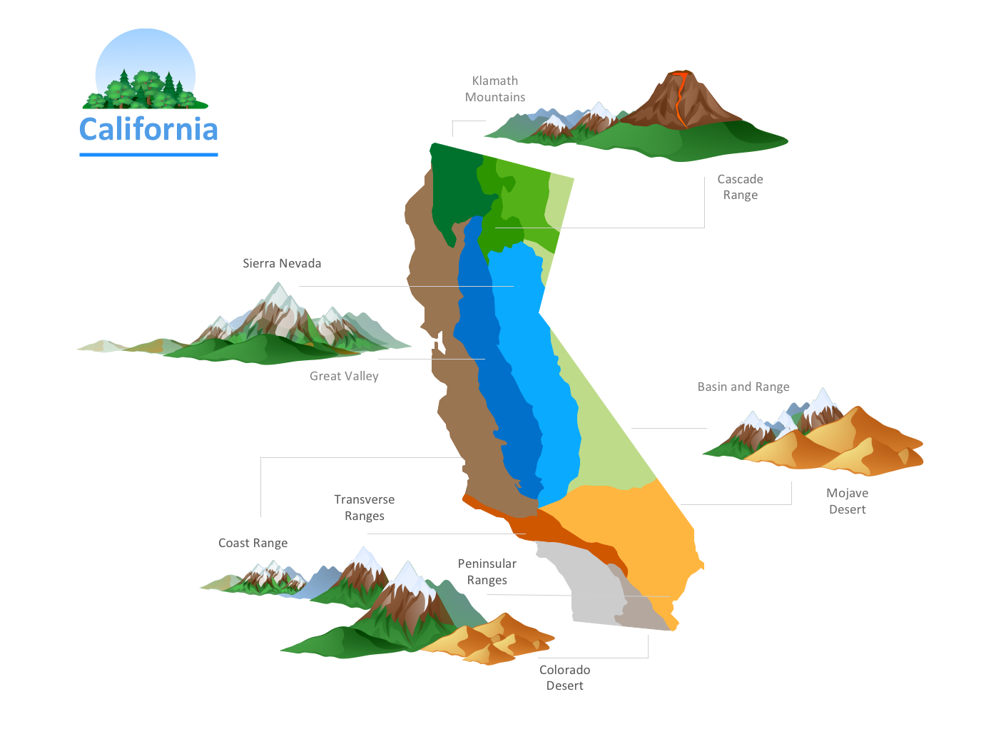
- California relief | Nature Drawings - How to Draw | Nature ...
- Geo Map - USA - California | California relief | Nature Drawings ...
- California relief | California relief | Landforms Of California
- Geo Map - USA - Alabama
- How To Draw The State Maine
- How to Draw a Natural Landscape | How can you illustrate the ...
- Basic Diagramming | Picture Graph | San Francisco CA Population ...
- Nature Drawings - How to Draw | Drawing Illustration | Drawing a ...
- Easy Steps To Draw North America Outline Map
- Nature Drawings - How to Draw | Beauty in nature Illustrations and ...
- Drawing Illustration | Drawing a Nature Scene | How to Draw a Map ...
- Nature Drawings - How to Draw | Design elements - Watercraft ...
- How To Draw The Cloudy Weather
- How To Draw Florida State
- California relief | Geo Map - Europe - Russia | Geo Map - USA ...
- Design elements - Geography | How to Draw a Natural Landscape ...
- Population Chart Drawing
