Road Transport - Design Elements
 Directional Maps
Directional Maps solution extends ConceptDraw DIAGRAM software with templates, samples and libraries of vector stencils for drawing the directional, location, site, transit, road and route maps, plans and schemes.
How To Draw Building Plans

 Site Plans
The Site Plans solution extends ConceptDraw DIAGRAM with samples, templates and numerous libraries of design elements making it powerful site plan software, ideal for landscape drawing, designing Site Plans, Site Layout Plans, Landscape Design Drawings, Home Site Plans, Hotel Site Plans, Park Site Plans, for developing the residential and commercial landscape design drawings and site plan, parks planning, landscaping territories, lighting trails, for creating drainage facilities, yard layouts, plant maps, outdoor recreational facilities, and irrigation systems plans.
How to draw Metro Map style infographics? Moscow, New York, Los Angeles, London

How to draw Metro Map style infographics? (New York)

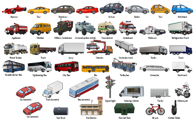
The vector clipart library Road transport contains 43 images of vehicles. Use the vector stencils library Road transport to draw road transportation and vehicles illustrations, presentation slides, infographics and diagrams using the ConceptDraw PRO diagramming and vector drawing software. "Transport on roads can be roughly grouped into the transportation of goods and transportation of people. In many countries licencing requirements and safety regulations ensure a separation of the two industries. The nature of road transportation of goods depends, apart from the degree of development of the local infrastructure, on the distance the goods are transported by road, the weight and volume of the individual shipment, and the type of goods transported. For short distances and light, small shipments a van or pickup truck may be used. For large shipments even if less than a full truckload a truck is more appropriate. ... Delivery services are sometimes considered a separate category from cargo transport. In many places fast food is transported on roads by various types of vehicles. For inner city delivery of small packages and documents bike couriers are quite common. People are transported on roads either in individual cars or automobiles, or in mass transit by bus or coach. Special modes of individual transport by road like rickshaws or velotaxis may also be locally available." [Road_ transport. Wikipedia] The design elements library Road transport is included in the Aerospace and Transport solution from the Illustration area of ConceptDraw Solution Park.
Vector clip art
Nature Drawings - How to Draw
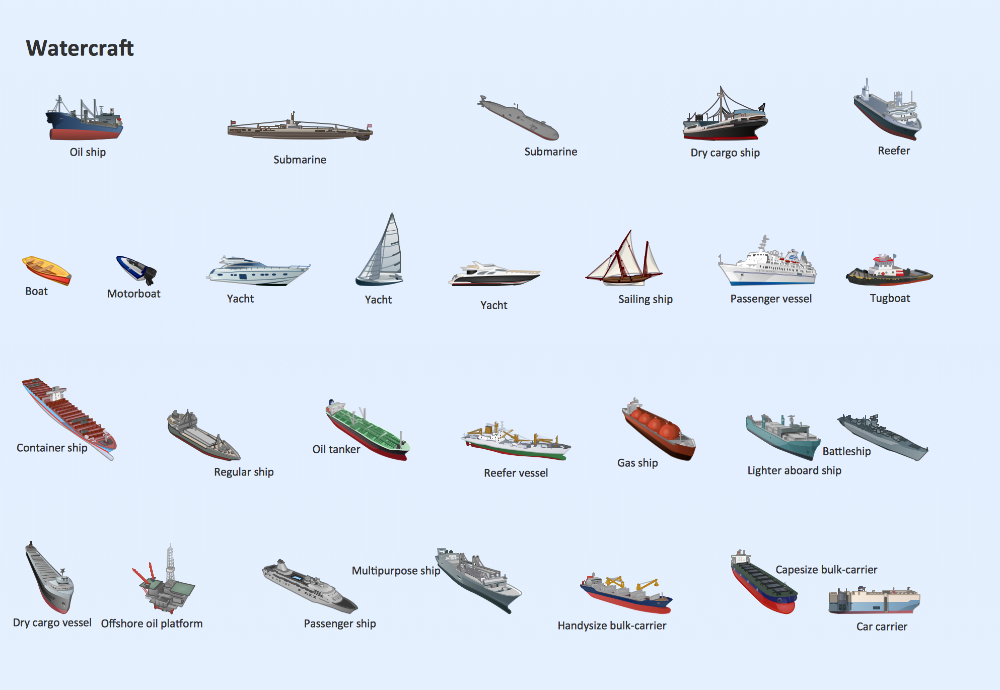
Watercraft - Design Elements
How to Draw a Natural Landscape

- Software To Draw Plan And Road Map
- Draw Road Signs
- Simple Way To Draw Road Map
- Road Map
- Drawing Simple Road Map Software
- Draw Traffic Light With Road
- Road Map Drawing Software
- Draw A Road Map With Transport Symbols
- How to draw Metro Map style infographics? (Los Angeles) | Road ...
- How To Draw A Road Without Traffic Signal