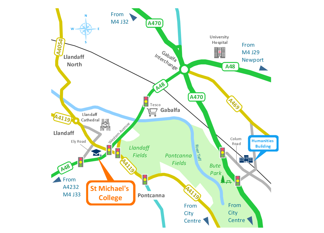
Brilliant Examples of Infographics Map, Transport, Road
ConceptDraw DIAGRAM contains spatial infographics samples, map templates to be filled in, and libraries of vector stencils for main design elements of spatial infographics.How tо Represent Information Graphically
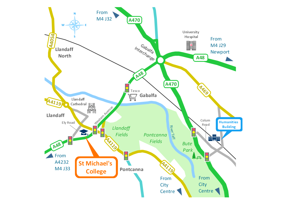
ConceptDraw Infographics is a great visual tool for communicating the large amounts of data and graphic visualization and representations of data and information.Spatial infographics Design Elements: Location Map
Infographic Design Elements for visually present various geographically distributed information.Bubble diagrams in Landscape Design with ConceptDraw DIAGRAM
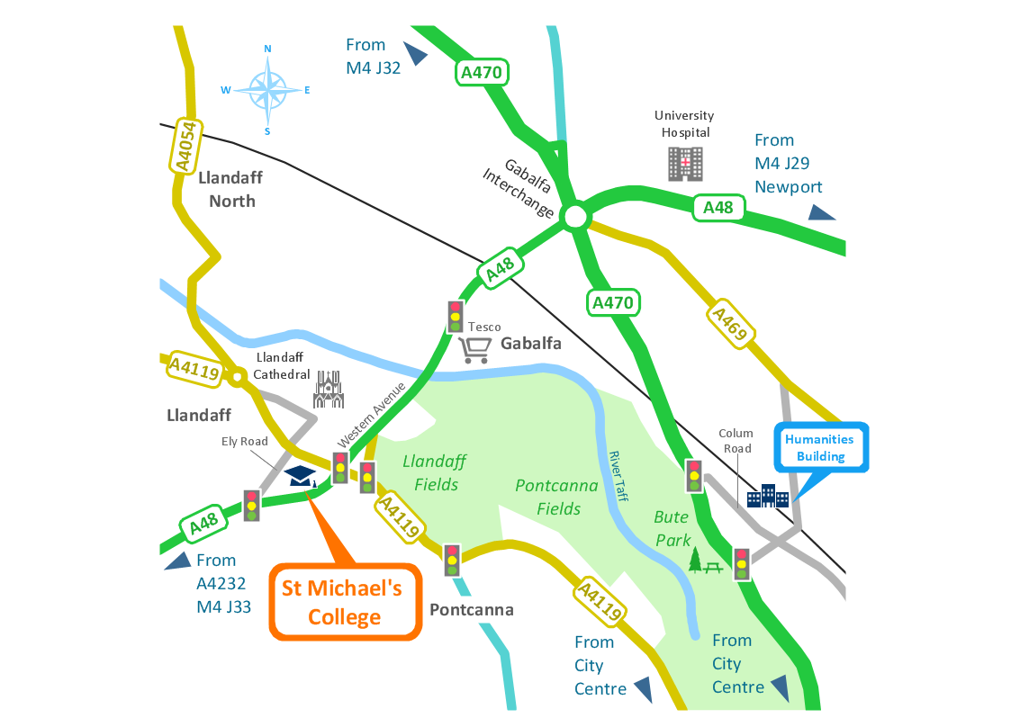
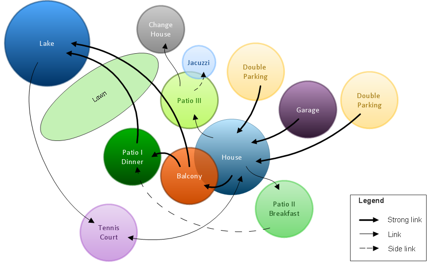
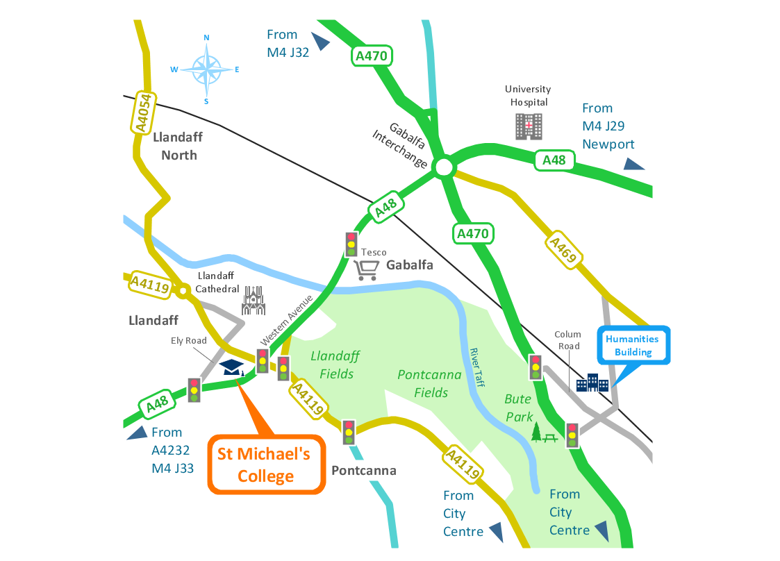
Bubble Diagrams are the charts with a bubble presentation of data with obligatory consideration of bubble's sizes. They are analogs of Mind Maps and find their application at many fields, and even in landscape design. At this case the bubbles are applied to illustrate the arrangement of different areas of future landscape design, such as lawns, flowerbeds, playgrounds, pools, recreation areas, etc. Bubble Diagram helps to see instantly the whole project, it is easy for design and quite informative, in most cases it reflects all needed information. Often Bubble Diagram is used as a draft for the future landscape project, on the first stage of its design, and in case of approval of chosen design concept is created advanced detailed landscape plan with specification of plants and used materials. Creation of Bubble Diagrams for landscape in ConceptDraw DIAGRAM software is an easy task thanks to the Bubble Diagrams solution from "Diagrams" area. You can use the ready scanned location plan as the base or create it easy using the special ConceptDraw libraries and templates.Spatial infographics Design Elements: Transport Map
Do you like infographics and data visualization? Creating infographics is super-easy with ConceptDraw.
 Spatial Infographics
Spatial infographics solution extends ConceptDraw DIAGRAM software with infographic samples, map templates and vector stencils libraries with design elements for drawing spatial information graphics.
Map Infographic Tool
ConceptDraw is a data visualization tool, which can help you to create a map infographics. Anyone can do this, it's that easy!
 Directional Maps
Directional Maps solution extends ConceptDraw DIAGRAM software with templates, samples and libraries of vector stencils for drawing the directional, location, site, transit, road and route maps, plans and schemes.
- Spatial infographics Design Elements: Location Map | Process ...
- Spatial infographics Design Elements: Location Map | Data Flow ...
- Design elements - Location map | Landmarks - Vector stencils ...
- Diagram On Road Map
- Process Flowchart | Spatial infographics Design Elements: Location ...
- Maps and Directions | Map Directions | Interior Design Site Plan ...
- Sample Transport Network Map Diagram
- Road Transport - Design Elements | Directional Maps | Bubble ...
- Hotel locator map | Hotel Network Topology Diagram | Fire Exit Plan ...
- Map symbols - Vector stencils library | Design elements - Location ...
- Directional Maps | Map Directions | Interior Design Site Plan ...
- Directional Maps | 3D Network Diagram Software | Maps and ...
- USA Maps | Design elements - Location map | Fire Exit Plan ...
- Spatial infographics Design Elements: Location Map | How To use ...
- Road Transport Information Diagrams
- The Building Blocks Used in EPC Diagrams | Metro Map ...
- How To Create A 2d Location Map
- Map Of Nepal With Diagram Of Syol
- Automatic vehicle location | GPS operation diagram | 3D Network ...
- EU countries map - Renewable electricity generation | Energy ...
