 Germany Map
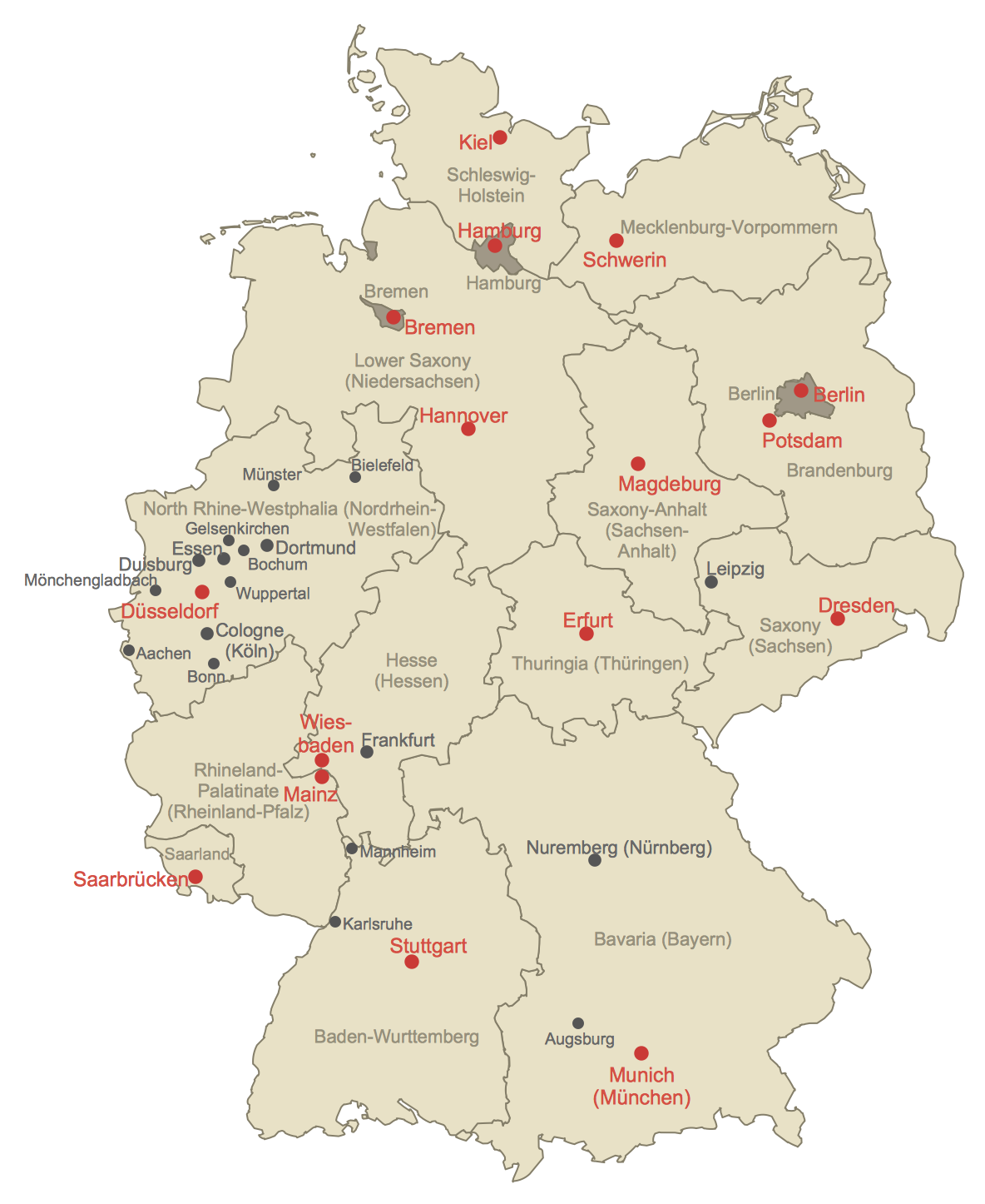
The Germany Map solution contains collection of samples, templates and scalable vector stencil graphic maps, representing map of Germany and all 16 states of Germany. Use the Germany Map solution from ConceptDraw Solution Park as the base for various them
HelpDesk
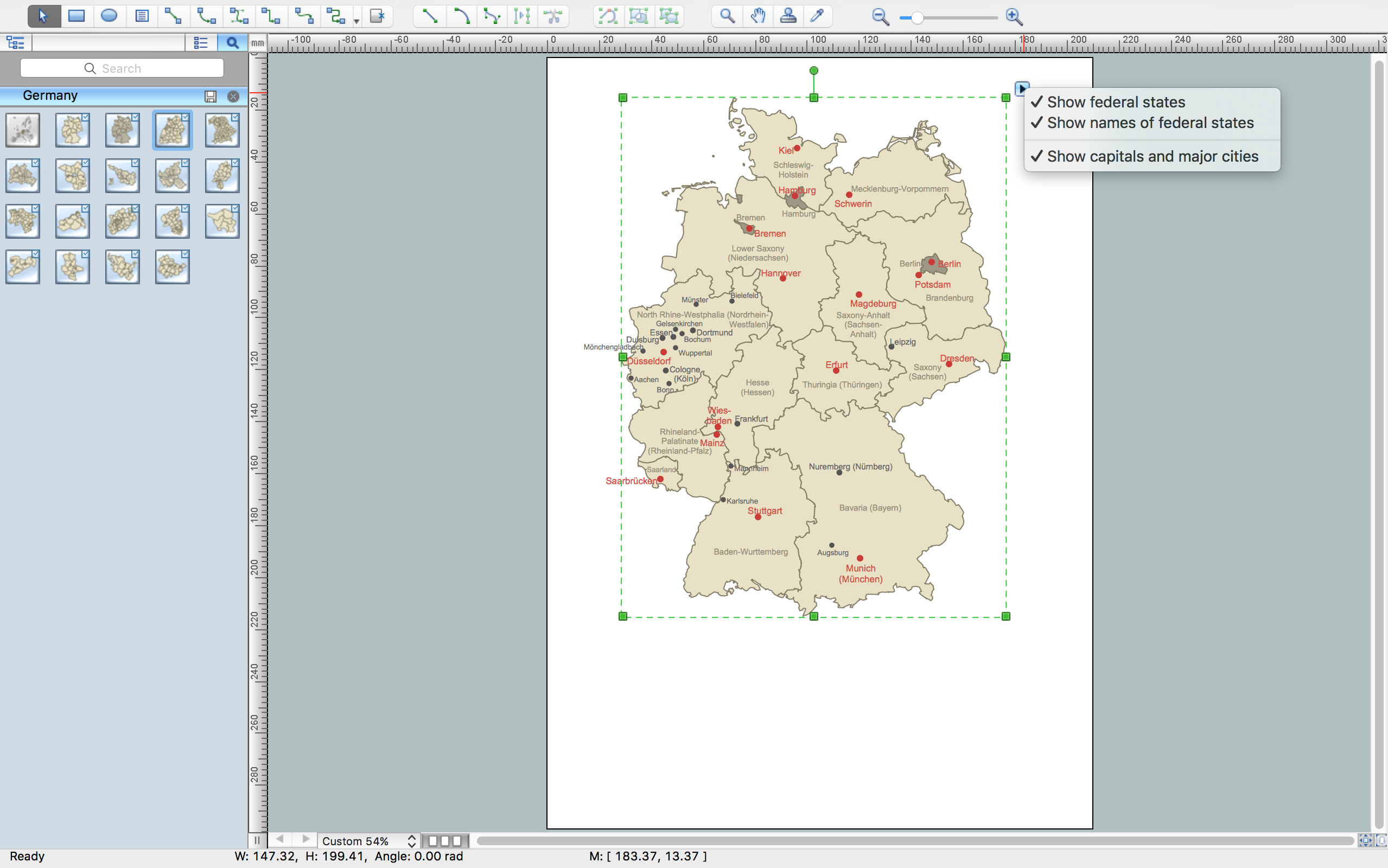
How to Create a Map of Germany Using ConceptDraw PRO
Geographical thematic maps are used to display information on a variety of subjects. It is a common way of representing any form of spatial data in relation to a specific geographical area. The Germany Map Solution for ConceptDraw PRO includes all of the German federal states with county outlined borders and major cities. You can quickly create geographic maps, cartograms, and thematic maps for geographical visualization information for business and travels.Geo Map - Europe - Austria
The vector stencils library Austria contains contours for ConceptDraw PRO diagramming and vector drawing software. This library is contained in the Continent Maps solution from Maps area of ConceptDraw Solution Park.Germany Map
Germany is in Western and Central Europe, with Denmark bordering to the north, Poland and the Czech Republic to the east, Austria to the southeast, Switzerland to the south-southwest, France, Luxembourg and Belgium lie to the west, and the Netherlands to the northwest.ConceptDraw PRO diagramming and vector drawing software enhanced with Germany Map Solution from the Maps Area of ConceptDraw Solution Park is the best for drawing geographic Germany map, topography, political, and various thematic maps of Germany.
Maps of Germany With Cities
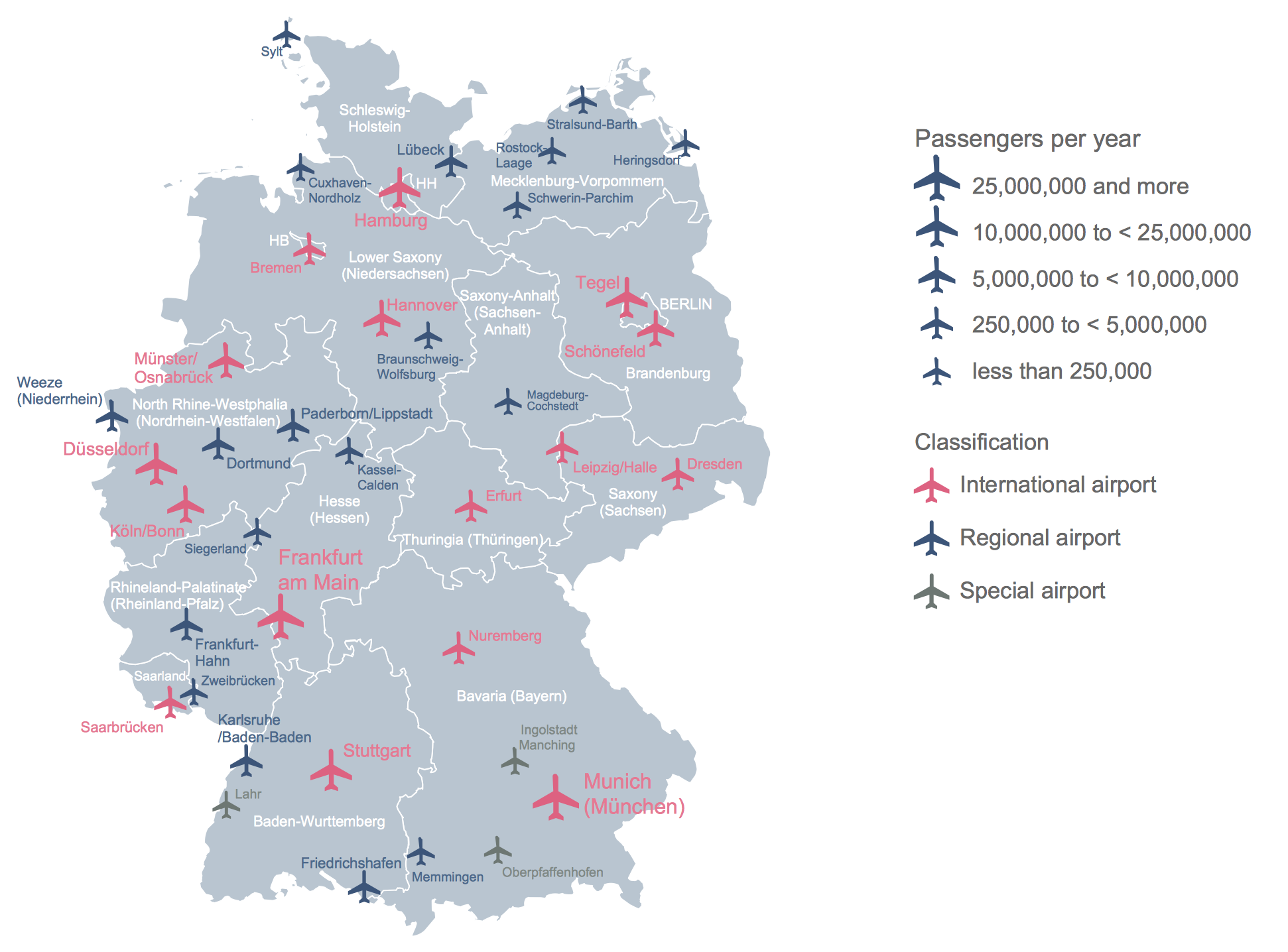
Despite the fact that the maps surround us everywhere in our life, usually the process of their drawing is sufficienly complex and labor-intensive. But now, thanks to the ConceptDraw PRO diagramming and vector drawing software extended with Germany Map Solution from the Maps Area of ConceptDraw Solution Park, we have the possibility to make easier this process. Design fast and easy your own pictorial maps of Germany, map of Germany with cities, and thematic Germany maps in ConceptDraw PRO!Maps of Germany
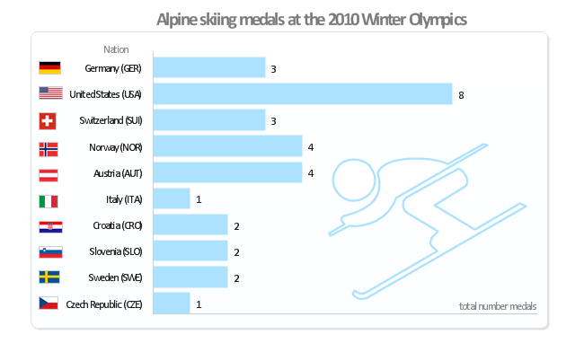
Germany is a federal parliamentary republic in West-Central Europe which consists of 16 constituent states. It is a part of Schengen area and the most populous member state in the European Union. ConceptDraw PRO diagramming and vector drawing software offers the unique Germany Map Solution from the Maps Area of ConceptDraw Solution Park, developed specially for easy drawing the maps of Germany of different levels of complexity and detailing."Alpine skiing at the 2010 Winter Olympics was held at Whistler Creekside in Whistler, British Columbia, Canada. The ten events were scheduled for 13–27 February, 2010; weather delayed the first event, the men's downhill, two days until Monday, 15 February. ... Notably absent from the medals in these Olympics were the Austrian men, who had won 8 medals in 2006 and 7 in 2002. France and host Canada were shut out from the podium, as were the German men and the Swiss and Italian women. The U.S. had its best Olympics ever with eight alpine medals, only the fourth nation to achieve that total in a single Olympics (Austria, France, Switzerland). Individually, three men and five women won multiple medals; triple medalists were Bode Miller of the U.S. and Aksel Lund Svindal of Norway, who both won a medal of each color. The sole double gold medalist was Maria Riesch of Germany." [Alpine skiing at the 2010 Winter Olympics. wikipedia]
This medal bar chart example "Alpine skiing at the 2010 Winter Olympics" was created using the ConceptDraw PRO diagramming and vector drawing software extended with the Winter Sports solution.
The Winter Sports solution from the Sport area of ConceptDraw Solution Park contains the vector stencils library "Winter sports pictograms" and examples of diagrams and infographics.
- Conceptdraw.com: Mind Map Software, Drawing Tools | Project ...
- Maps of Germany With Cities
- How to Create a Map of Germany Using ConceptDraw PRO ...
- Maps of Germany | Geo Map - Europe - Germany | How to Create a ...
- Geo Map - South America Continent | Geo Map Software | Geo Map ...
- Design elements - Thematic maps | How to Create a Map Depicting ...
- Germany Maps Design Vector Samples
- Design elements - Geography | Geography - Vector stencils library ...
- Organizational Chart | Organization Chart Software | Process ...
- Geo Map - Europe - Italy | FIFA World Cup 2014 team flags - Vector ...
- Geo Map - Europe - Sweden | Europe flags - Stencils library | Geo ...
- Geo Map - Europe - Norway | Europe - Vector stencils library | Alpine ...
- Winter Sports | Winter Sports Vector Clipart. Medal Map . Spatial ...
- Winter Sports Vector Clipart. Medal Map . Spatial Infographics ...
- Winter Sports | Winter Sports Vector Clipart. Medal Map . Spatial ...
- Winter Sports | Winter Sports Vector Clipart. Medal Map . Spatial ...
- Winter Sports Vector Clipart. Medal Map . Spatial Infographics ...
- Gold Medals in 2010 Winter Olympics - Infographics with winter ...
- Winter Sports | Winter Sports Vector Clipart. Medal Map . Spatial ...
- Winter Sports. Olympic Games Illustrations. Medal Summary | Winter ...
