Geo Map — United States of America Map
United States is a federal republic consisting of 50 states and a federal district.ConceptDraw is idea to draw the geological map of the United States of America from the pre-designed vector geo map shapes.
Each map is scaled, with the option to add further levels of detail - county borders, their names, capitals and major cities can be shown or hidden using the action menu for each state map. ConceptDraw DIAGRAM gives you full control over map size, shading, color fills and alignment.
Use the Continent Maps solution for easy drawing professional looking geological maps, thematic maps, geospatial infographics and vector illustrations for your business documents, presentations and websites.
Geo Map of Americas
The Americas are the combined continental landmasses of North America and South America, in the Western Hemisphere. There are 35 sovereign states in the Americas.ConceptDraw is idea to draw the geological maps of America from the pre-designed vector geo map shapes and vector images map of america.
Use Continent Maps solution from the Maps area of ConceptDraw Solution Park to draw thematic maps, geospatial infographics and vector illustrations for your business documents, presentations and websites.
Geo Map - South America - Mexico
Mexico, officially the United Mexican States, is a federal republic in North America.The vector stencils library Mexico contains contours for ConceptDraw DIAGRAM diagramming and vector drawing software. This library is contained in the Continent Maps solution from Maps area of ConceptDraw Solution Park.
Geo Map - USA - Kansas
Kansas is a U.S. state located in the Midwestern United States.The vector stencils library Kansas contains contours for ConceptDraw DIAGRAM diagramming and vector drawing software. This library is contained in the Continent Maps solution from Maps area of ConceptDraw Solution Park.
Geo Map - South America - Cuba
Cuba, officially the Republic of Cuba, is an island country in the Caribbean.The vector stencils library Cuba contains contours for ConceptDraw DIAGRAM diagramming and vector drawing software. This library is contained in the Continent Maps solution from Maps area of ConceptDraw Solution Park.
Geo Map - South America - Bolivia
Bolivia, officially known as the Plurinational State of Bolivia, is a landlocked country located in central South America.The vector stencils library Bolivia contains contours for ConceptDraw DIAGRAM diagramming and vector drawing software. This library is contained in the Continent Maps solution from Maps area of ConceptDraw Solution Park.
Geo Map — South America Continent
South America includes 12 sovereign states.ConceptDraw DIAGRAM is idea to draw the geological maps of South America continent from the pre-designed vector geo map shapes.
Use Continent Maps solution from the Maps area of ConceptDraw Solution Park to draw thematic maps, geospatial infographics and vector illustrations for your business documents, presentations and websites.
Geo Map - South America - Jamaica
Jamaica is an island country situated in the Caribbean Sea, comprising the third-largest island of the Greater Antilles.The vector stencils library Jamaica contains contours for ConceptDraw DIAGRAM diagramming and vector drawing software. This library is contained in the Continent Maps solution from Maps area of ConceptDraw Solution Park.
Geo Map - South America - Guyana
Guyana, officially the Co-operative Republic of Guyana, is a sovereign state on the northern coast of South America.The vector stencils library Guyana contains contours for ConceptDraw DIAGRAM diagramming and vector drawing software. This library is contained in the Continent Maps solution from Maps area of ConceptDraw Solution Park.
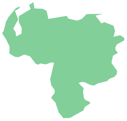
Geo Map - South America - Venezuela
Venezuela, officially called the Bolivarian Republic of Venezuela, is a country on the northern coast of South America.The vector stencils library Venezuela contains contours for ConceptDraw DIAGRAM diagramming and vector drawing software. This library is contained in the Continent Maps solution from Maps area of ConceptDraw Solution Park.
Geo Map - South America - Honduras
Honduras, officially the Republic of Honduras, is a republic in Central America.The vector stencils library Honduras contains contours for ConceptDraw DIAGRAM diagramming and vector drawing software. This library is contained in the Continent Maps solution from Maps area of ConceptDraw Solution Park.
Geo Map - South America - Costa Rica
Costa Rica, officially the Republic of Costa Rica, is a country in Central America, bordered by Nicaragua to the north, Panama to the southeast, the Pacific Ocean to the west, and the Caribbean Sea to the east.The vector stencils library Costa Rica contains contours for ConceptDraw DIAGRAM diagramming and vector drawing software. This library is contained in the Continent Maps solution from Maps area of ConceptDraw Solution Park.
Geo Map - USA - New Jersey
New Jersey is a state in the Northeastern and Middle Atlantic regions of the United States.The vector stencils library New Jersey contains contours for ConceptDraw DIAGRAM diagramming and vector drawing software. This library is contained in the Continent Maps solution from Maps area of ConceptDraw Solution Park.
Geo Map - South America - Paraguay
Paraguay, officially the Republic of Paraguay, is a landlocked country in South America, bordered by Argentina to the south and southwest, Brazil to the east and northeast, and Bolivia to the northwest.The vector stencils library Paraguay contains contours for ConceptDraw DIAGRAM diagramming and vector drawing software. This library is contained in the Continent Maps solution from Maps area of ConceptDraw Solution Park.
Geo Map - South America - Trinidad and Tobago
Trinidad and Tobago, officially the Republic of Trinidad and Tobago, is an island country off the northern edge of South America, lying just off the coast of northeastern Venezuela and south of Grenada in the Lesser Antilles.The vector stencils library Trinidad and Tobago contains contours for ConceptDraw DIAGRAM diagramming and vector drawing software. This library is contained in the Continent Maps solution from Maps area of ConceptDraw Solution Park.
Geo Map - South America - Belize
Belize is a country on the northeastern coast of Central America.The vector stencils library Belize contains contours for ConceptDraw DIAGRAM diagramming and vector drawing software. This library is contained in the Continent Maps solution from Maps area of ConceptDraw Solution Park.
Geo Map - South America - Brazil
Brazi, officially the Federative Republic of Brazil, is the largest country in both South America and the Latin American region.The vector stencils library Brazil contains contours for ConceptDraw DIAGRAM diagramming and vector drawing software. This library is contained in the Continent Maps solution from Maps area of ConceptDraw Solution Park.
Geo Map - South America - Panama
Panama, officially Republic of Panama, is the southernmost country of Central America and the whole of North America.The vector stencils library Panama contains contours for ConceptDraw DIAGRAM diagramming and vector drawing software. This library is contained in the Continent Maps solution from Maps area of ConceptDraw Solution Park.
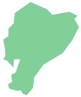
Geo Map - South America - Ecuador
Ecuador, officially the Republic of Ecuador, which literally translates as "Republic of the Equator") is a representative democratic republic in South America, bordered by Colombia on the north, Peru on the east and south, and the Pacific Ocean to the west.The vector stencils library Ecuador contains contours for ConceptDraw DIAGRAM diagramming and vector drawing software. This library is contained in the Continent Maps solution from Maps area of ConceptDraw Solution Park.
- Geo Map - America - United States | Map of USA with state names ...
- Geo Map - America | Geo Map - America - United States | Geo Map ...
- Geo Map - America - United States | Geo Map - America | Geo Map ...
- Map of USA with state names | Geo Map - America - United States ...
- Design elements - South America | Map of USA with state names ...
- Map of USA with state names | Geo Map - South America - Haiti ...
- North America map template | Geo Map - America | Maps |
- Learn how to create a current state value stream map | Map of USA ...
- Map of USA with state names | Geo Map - Asia - South Korea | Geo ...
- Geo Map - South America
- Map of USA with state names | Central Asia political map | Geo Map ...
- North America map template | Design elements - South America |
- Map of USA with state names | Depiction of the Senate votes on ...
- Geo Map - USA - Colorado
- Geo Map - South America
- Geo Map - USA - California
- Continent Maps | Spatial infographics Design Elements: Location ...
- Geo Map - USA - Louisiana
- Geo Map - USA - New Hampshire
- ERD | Entity Relationship Diagrams, ERD Software for Mac and Win
- Flowchart | Basic Flowchart Symbols and Meaning
- Flowchart | Flowchart Design - Symbols, Shapes, Stencils and Icons
- Flowchart | Flow Chart Symbols
- Electrical | Electrical Drawing - Wiring and Circuits Schematics
- Flowchart | Common Flowchart Symbols