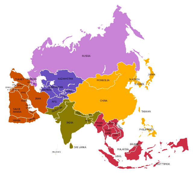
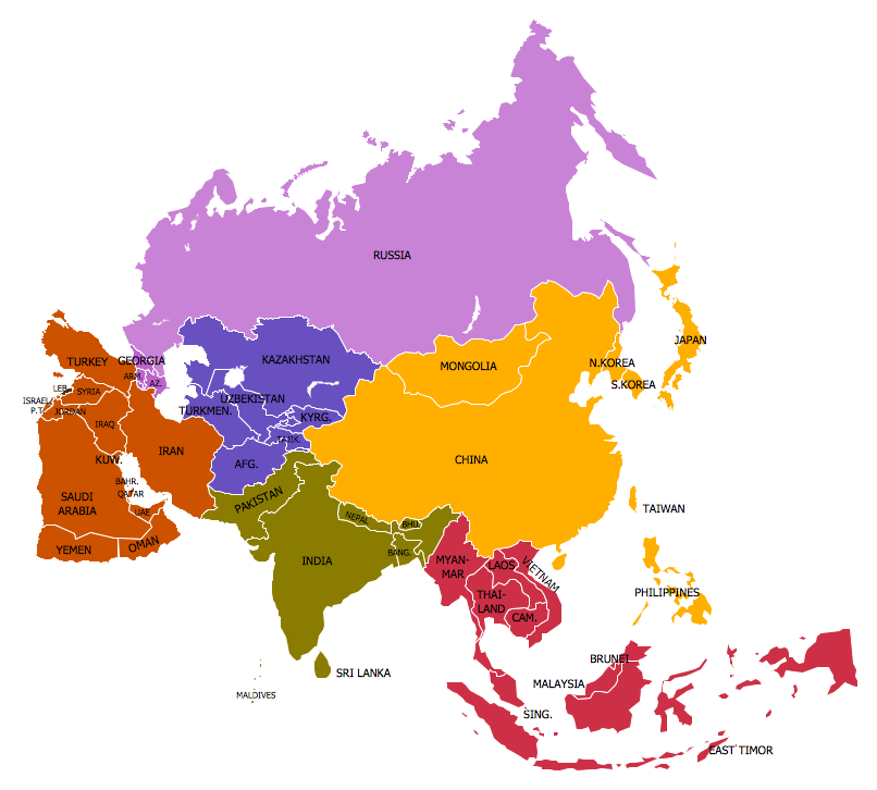
"Asia ... is the world's largest and most populous continent, located primarily in the eastern and northern hemispheres. It covers 8.7% of the Earth's total surface area and comprises 30% of its land area. With approximately 4.3 billion people, it hosts 60% of the world's current human population. Asia has a high growth rate in the modern era. For instance, during the 20th century, Asia's population nearly quadrupled." [Asia. Wikipedia]
This Asia political map was redesigned from Wikimedia Commons file: Map of Asia.svg.
[commons.wikimedia.org/ wiki/ File:Map_ of_ Asia.svg]
This file is licensed under the Creative Commons Attribution-Share Alike 3.0 Unported license. [creativecommons.org/ licenses/ by-sa/ 3.0/ deed.en]
Legend:
Purple = North Asia/ Eurasia (Russia, Georgia, Armenia, Azerbaijan),
Yellow = East Asia (China, Mongolia, Korea, Japan),
Red = South East Asia (10 ASEAN countries + East Timor),
Green = South Asia (India, Pakistan, Bangladesh, Nepal, Bhutan),
Brown = West Asia/ Middle East,
Blue = Central Asia.
The example "Political map of Asia" was created using the ConceptDraw PRO diagramming and vector drawing software extended with the Continent Maps solution from the Maps area of ConceptDraw Solution Park.
Geo Map - Asia - Philippines
The Philippines, officially known as the Republic of the Philippines, is a sovereign island country in Southeast Asia situated in the western Pacific Ocean.Use the Continent Maps solution and Philippines library to draw thematic maps, geospatial infographics and vector illustrations. This solution to help visualize the business and thematic information connected with geographic areas, locations or customs; for your business documents, presentations and websites.
Geo Map - Asia
ConceptDraw is idea to draw the geological maps of Asia from the pre-designed vector geo map shapes.Use Geo Map Asia to draw thematic maps, geospatial infographics and vector illustrations for your business documents, presentations and websites.
Continent Map
Every day many of people confront in their work with necessity of drawing various continent maps. Specially for these people was developed the Continent Maps Solution and included to the Maps Area of ConceptDraw Solution Park. Thanks to it you can design any Continent Map quick and easy.
 Continent Maps
Continent Maps solution extends ConceptDraw PRO software with templates, samples and libraries of vector stencils for drawing the thematic maps of continents, state maps of USA and Australia.
Geo Map - Europe - Russia
The vector stencils library Russia contains contours for ConceptDraw PRO diagramming and vector drawing software. This library is contained in the Continent Maps solution from Maps area of ConceptDraw Solution Park.Geo Map - Europe - Poland
The vector stencils library Poland contains contours for ConceptDraw PRO diagramming and vector drawing software. This library is contained in the Continent Maps solution from Maps area of ConceptDraw Solution Park.Geo Map of Americas
The Americas are the combined continental landmasses of North America and South America, in the Western Hemisphere. There are 35 sovereign states in the Americas.ConceptDraw is idea to draw the geological maps of America from the pre-designed vector geo map shapes and vector images map of america.
Use Continent Maps solution from the Maps area of ConceptDraw Solution Park to draw thematic maps, geospatial infographics and vector illustrations for your business documents, presentations and websites.
Geo Map - Asia - Vietnam
Vietnam, officially the Socialist Republic of Vietnam, is the easternmost country on the Indochina Peninsula in Southeast Asia.The vector stencils library Vietnam contains contours for ConceptDraw PRO diagramming and vector drawing software. This library is contained in the Continent Maps solution from Maps area of ConceptDraw Solution Park.
- Continent Maps | Central Asia - Political map | Political map of Asia ...
- Political map of Asia
- Map Of Asia
- East Asia - Political map | Geo Map - Asia | Political map of Asia ...
- Geo Map - Asia - Singapore | Political map of Asia | Geo Map - Asia ...
- Geo Map - Asia - Bangladesh | Political map of Asia | Geo Map ...
- Emergency Plan | Blank Map Of Asia
- Picture graph - Population growth by continent, 2010 - 2013 ...
- New Map Of Asia
- Drawing Of Map Of Asia
- A Drawing Of Asia
- A Map Of Asia
- Drawn Map Of Asia
- Asia map
- Middle East - Political map | Geo Map - Asia | Continent Maps | Map ...
- Map Of Asia And Europe
- Asia Map Countries
- Asia Continent Map
- Design elements - Asia | Geo Map - Asia | Continent Maps | Asian ...
- Geo Map - Asia | Asia - Vector stencils library | South Asia - Political ...


