 Continent Maps
Continent Maps solution extends ConceptDraw PRO software with templates, samples and libraries of vector stencils for drawing the thematic maps of continents, state maps of USA and Australia.
World Continents Map
ConceptDraw PRO diagramming and vector drawing software enhanced with Continent Maps Solution from the Maps Area is the best for drawing geographic, topography, political, and many other kinds of maps for any of seven earth continents and also world continents map of any detailing.Geo Map Software
Geo Map Software - Full Geographic Reach of Your Business with Geo Map Shapes.Geo Map - South America Continent
South America includes 12 sovereign states.ConceptDraw PRO is idea to draw the geological maps of South America continent from the pre-designed vector geo map shapes.
Use Continent Maps solution from the Maps area of ConceptDraw Solution Park to draw thematic maps, geospatial infographics and vector illustrations for your business documents, presentations and websites.
Geo Map - Europe - Greece
Greece is strategically located at the crossroads of Europe, Asia, and Africa.The vector stencils library Greece contains contours for ConceptDraw PRO diagramming and vector drawing software. This library is contained in the Continent Maps solution from Maps area of ConceptDraw Solution Park.
Map Software
Create maps, flags, and more with ConceptDrawGeo Map - Asia
ConceptDraw is idea to draw the geological maps of Asia from the pre-designed vector geo map shapes.Use Geo Map Asia to draw thematic maps, geospatial infographics and vector illustrations for your business documents, presentations and websites.
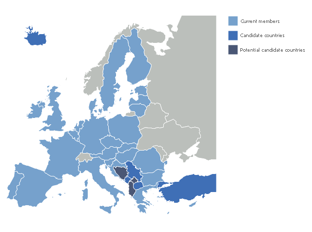
"The 2013 enlargement of the European Union saw Croatia join the European Union as their 28th member state on 1 July 2013.
Croatia is the second former Yugoslav republic to join the European Union after a decade-long negotiation process. The country applied for EU membership in 2003, and the European Commission recommended making it an official candidate in early 2004. Candidate country status was granted to Croatia by the European Council in mid-2004. The entry negotiations, while originally set for March 2005, began in October that year together with the screening process." [2013 enlargement of the European Union. Wikipedia]
This Europe map example was redesigned using ConceptDraw PRO diagramming and vector drawing software from the Wikimedia Commons file: EU28-candidate countries map.svg.
[commons.wikimedia.org/ wiki/ File:EU28-candidate_ countries_ map.svg]
The Europe political map example "EU 28: Candidate countries map" is included in the Continent Maps solution from the Maps area of ConceptDraw Solution Park.
Geo Map - Africa - Uganda
Uganda, officially the Republic of Uganda, is a landlocked country in East Africa.The vector stencils library Uganda contains contours for ConceptDraw PRO diagramming and vector drawing software. This library is contained in the Continent Maps solution from Maps area of ConceptDraw Solution Park.
Geo Map - Africa - Burkina Faso
Burkina Faso, is a landlocked country in West Africa.The vector stencils library Burkina Faso contains contours for ConceptDraw PRO diagramming and vector drawing software. This library is contained in the Continent Maps solution from Maps area of ConceptDraw Solution Park.
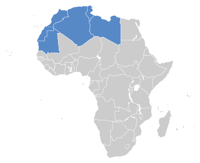
"The Maghreb is usually defined as much or most of the region of Northwest Africa, west of Egypt. The traditional definition as being the region including the Atlas Mountains and the coastal plains of Morocco, Algeria, Tunisia, and Libya, was later superseded, especially since the 1989 formation of the Arab Maghreb Union, by the inclusion of Mauritania and of the disputed territory of Western Sahara (mostly controlled by Morocco)." [Maghreb. Wikipedia]
This Maghreb map example was redesigned using ConceptDraw PRO diagramming and vector drawing software from the Wikimedia Commons file: Maghreb.png.
[commons.wikimedia.org/ wiki/ File:Maghreb.png]
The political map example "Maghreb countries" is included in the Continent Map solution from Maps area of ConceptDraw Solution Park.
Geo Map - Europe - Serbia
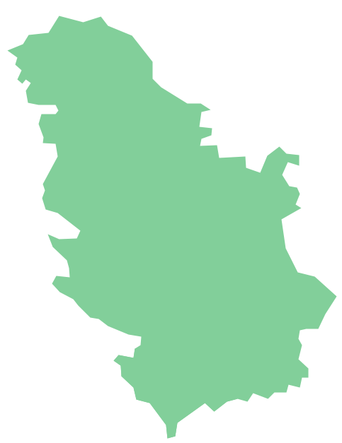
The vector stencils library Serbia contains contours for ConceptDraw PRO diagramming and vector drawing software. This library is contained in the Continent Maps solution from Maps area of ConceptDraw Solution Park.Geo Map - Europe - Czech Republic
The vector stencils library Czech Republic contains contours for ConceptDraw PRO diagramming and vector drawing software. This library is contained in the Continent Maps solution from Maps area of ConceptDraw Solution Park.Geo Map - Europe - France
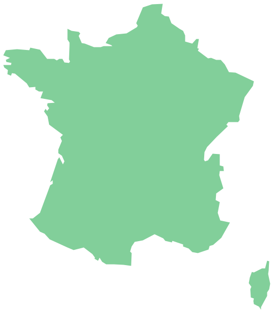
The vector stencils library France contains contours for ConceptDraw PRO diagramming and vector drawing software. This library is contained in the Continent Maps solution from Maps area of ConceptDraw Solution Park.Geo Map - Africa - Ethiopia
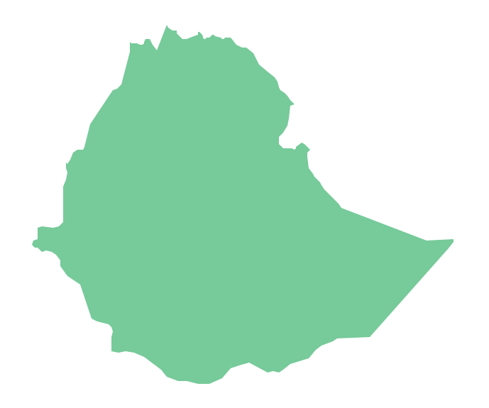
Ethiopia, officially known as the Federal Democratic Republic of Ethiopia, is a country located in the Horn of Africa.The vector stencils library Ethiopia contains contours for ConceptDraw PRO diagramming and vector drawing software. This library is contained in the Continent Maps solution from Maps area of ConceptDraw Solution Park.
- Continent Maps | How to Draw a Map of North America Using ...
- Maghreb countries - Political map | Continent Maps | Maps ...
- West Africa countries | Geo Map - Africa | Continent Maps | West ...
- Spatial infographics Design Elements: Continental Map | Design ...
- Continent Maps | Asia map with capitals - Template | Geo Map - Asia ...
- Continent Maps | Design elements - Continental map | How to Draw ...
- Maps Of The Continents
- Continent Maps | Best Tool for Infographic Construction | Spatial ...
- Continent Maps | How to Draw a Geographical Map Quickly | Geo ...
- Design elements - Asia | Geo Map - Asia | Continent Maps | Asian ...
- Maghreb countries - Political map | Geo Map - Europe | Africa map ...
- Continent Maps | Design elements - Continental map | Geo Map ...
- Maghreb countries - Political map | Geo Map - Africa - Morocco | Geo ...
- Continent Map
- West Africa countries | Geo Map - Africa | Geo Map - Africa - Guinea ...
- EU 28: Candidate countries map | Geo Map - Australia - New ...
- Spatial infographics Design Elements: Continental Map | Spatial ...
- Geo Map - South America Continent | Design elements - South ...
- Continent Maps | Design elements - Continental map | European ...


