Basic Diagramming
Create flowcharts, organizational charts, bar charts, line graphs, and more with ConceptDraw PRO.
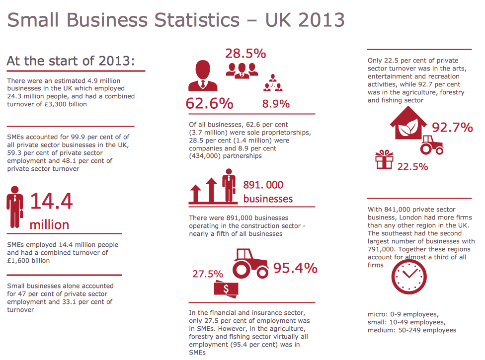
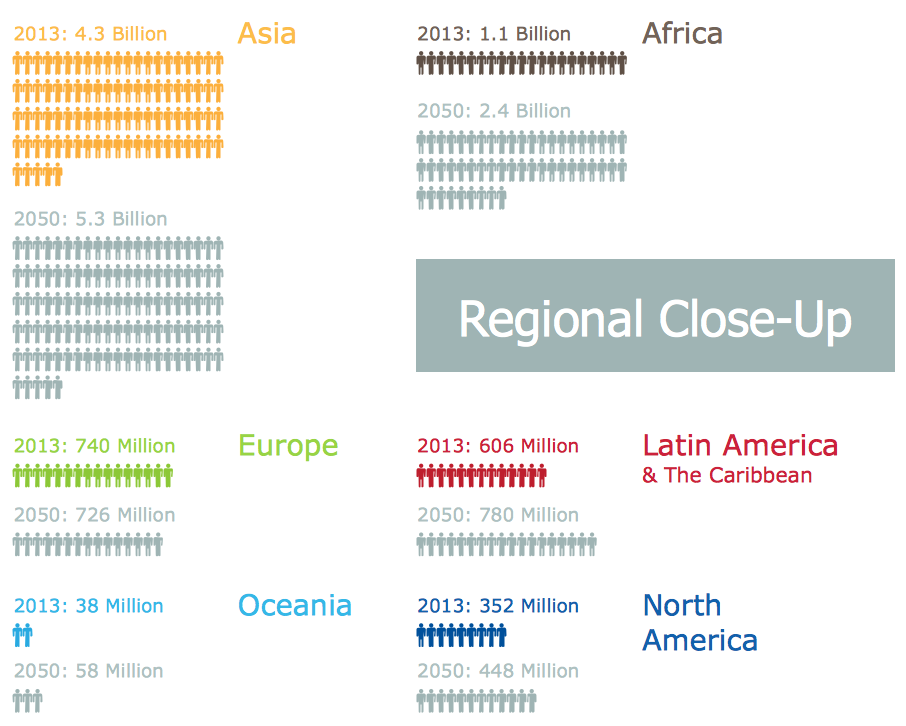
Sample Pictorial Chart. Sample Infographics
Sample Pictorial Chart - Pictorial Infographics solution provides easy-to-use design infographics drawing tools, large collection of different sample infographics and infograms, sample pictorial chart and templates to be filled in, and 10 libraries with great quantity of predesigned vector pictograms. Use Pictorial Infographics solution to draw your own design pictorial infographics documents quick and easy.Infographic Maker
Infographic is a visual way of representing various information, data, knowledge in statistics, geography, journalism, education, and much more areas. ConceptDraw PRO supplied with Pictorial Infographics Solution from the “What are Infographics” Area, provides a set of powerful pictorial infographics tools. Thanks to them it is the best Infographic Maker.Pictorial Chart
You want design Pictorial Chart or Infographic? And you need powerful infographic software? Then ConceptDraw PRO diagramming and vector drawing software extended with Pictorial Infographics Solution from the “What are Infographics” Area is exactly what you need.Pictures of Graphs
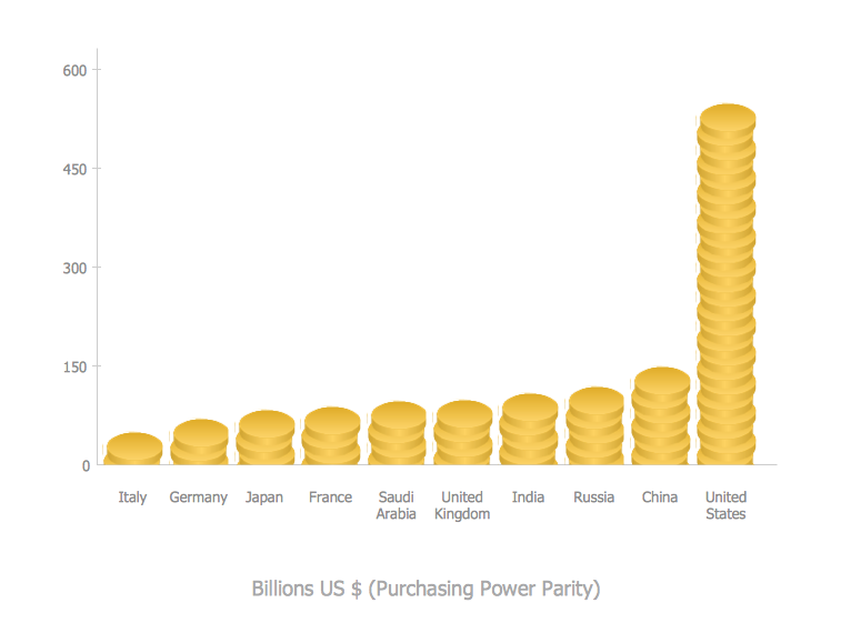
ConceptDraw PRO diagramming and vector drawing software extended with Picture Graphs solution from the Graphs and Charts Area is the best choice for making professional looking pictures of graphs and colorful picture graphs.
 Circle-Spoke Diagrams
Examples of subject areas that are well suited to this approach are marketing, business, products promotion, process modeling, market, resource, time, and cost analysis. Circle-Spoke Diagrams are successfully used in presentations, conferences, management documents, magazines, reportages, reviews, reports, TV, and social media.
Map of Germany — Saarland State
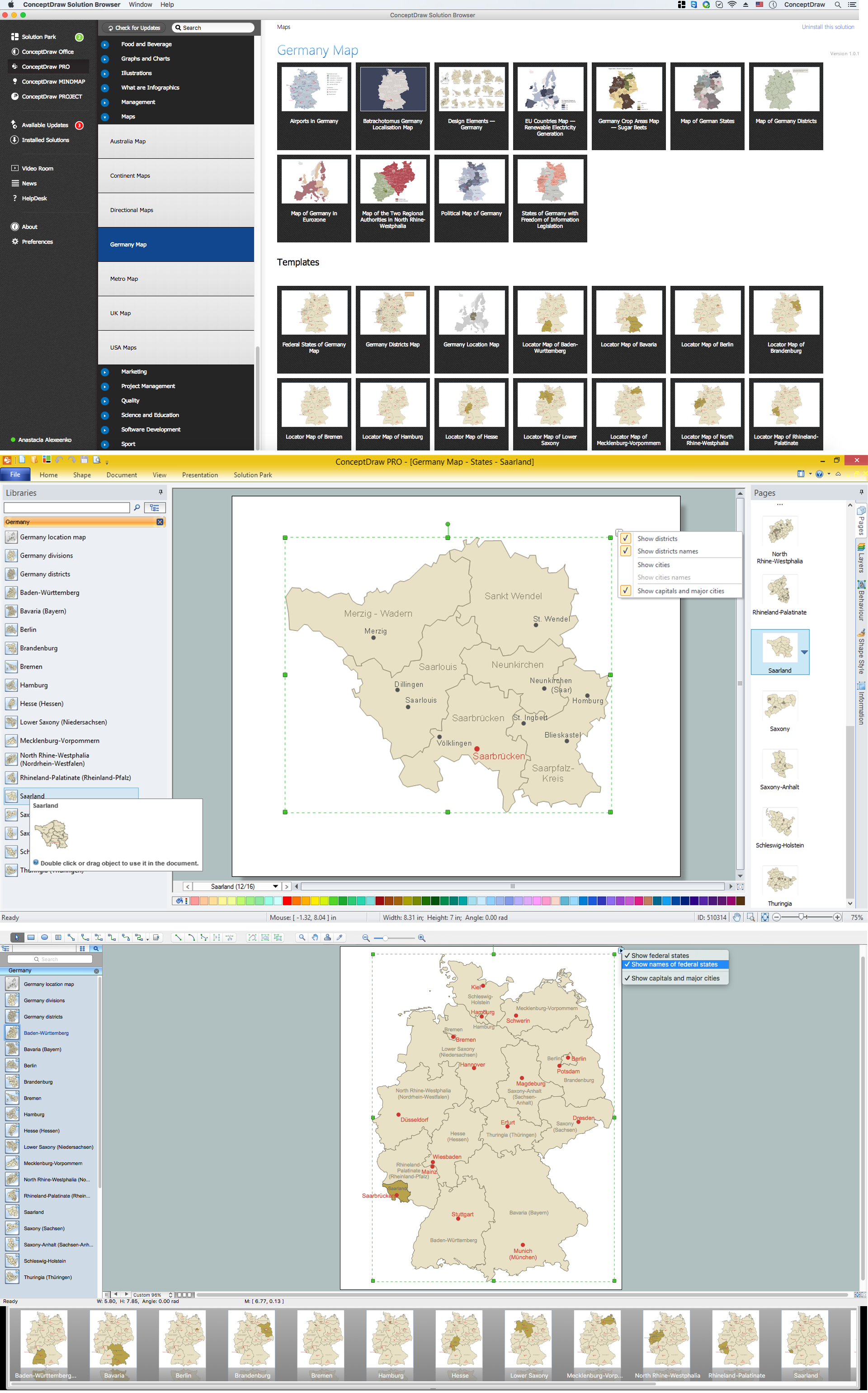
The Saarland is one of the sixteen federal states (or Bundesländer) of Germany. The capital city is Saarbrücken. Despite the fact that the maps surround us everywhere in our life, usually the process of their drawing is sufficienly complex and labor-intensive. But now, thanks to the ConceptDraw PRO diagramming and vector drawing software extended with Germany Map Solution from the Maps Area of ConceptDraw Solution Park, we have the possibility to make easier this process. Design fast and easy your own pictorial maps of Germany, map of Germany with cities, and thematic Germany maps in ConceptDraw PRO!
 Area Charts
Area Charts are used to display the cumulative totals over time using numbers or percentages; or to show trends over time among related attributes. The Area Chart is effective when comparing two or more quantities. Each series of data is typically represented with a different color, the use of color transparency in an object’s transparency shows overlapped areas and smaller areas hidden behind larger areas.
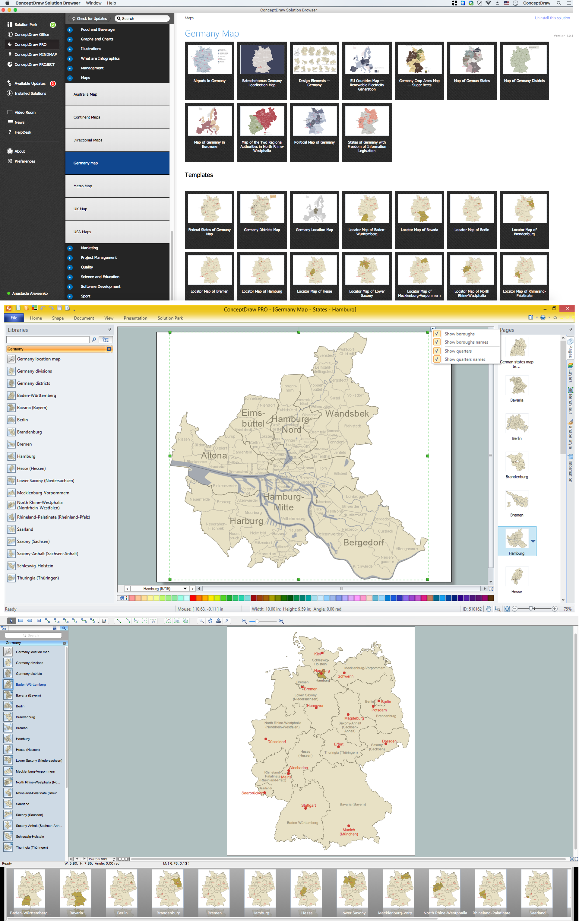
Map of Germany — Hamburg
Hamburg is the second largest city in Germany and the eighth largest city in the European Union. It is the second smallest German state by area. Despite the fact that the maps surround us everywhere in our life, usually the process of their drawing is sufficienly complex and labor-intensive. But now, thanks to the ConceptDraw PRO diagramming and vector drawing software extended with Germany Map Solution from the Maps Area of ConceptDraw Solution Park, we have the possibility to make easier this process. Design fast and easy your own pictorial maps of Germany, map of Germany with cities, and thematic Germany maps in ConceptDraw PRO!Geo Map - USA - Tennesse
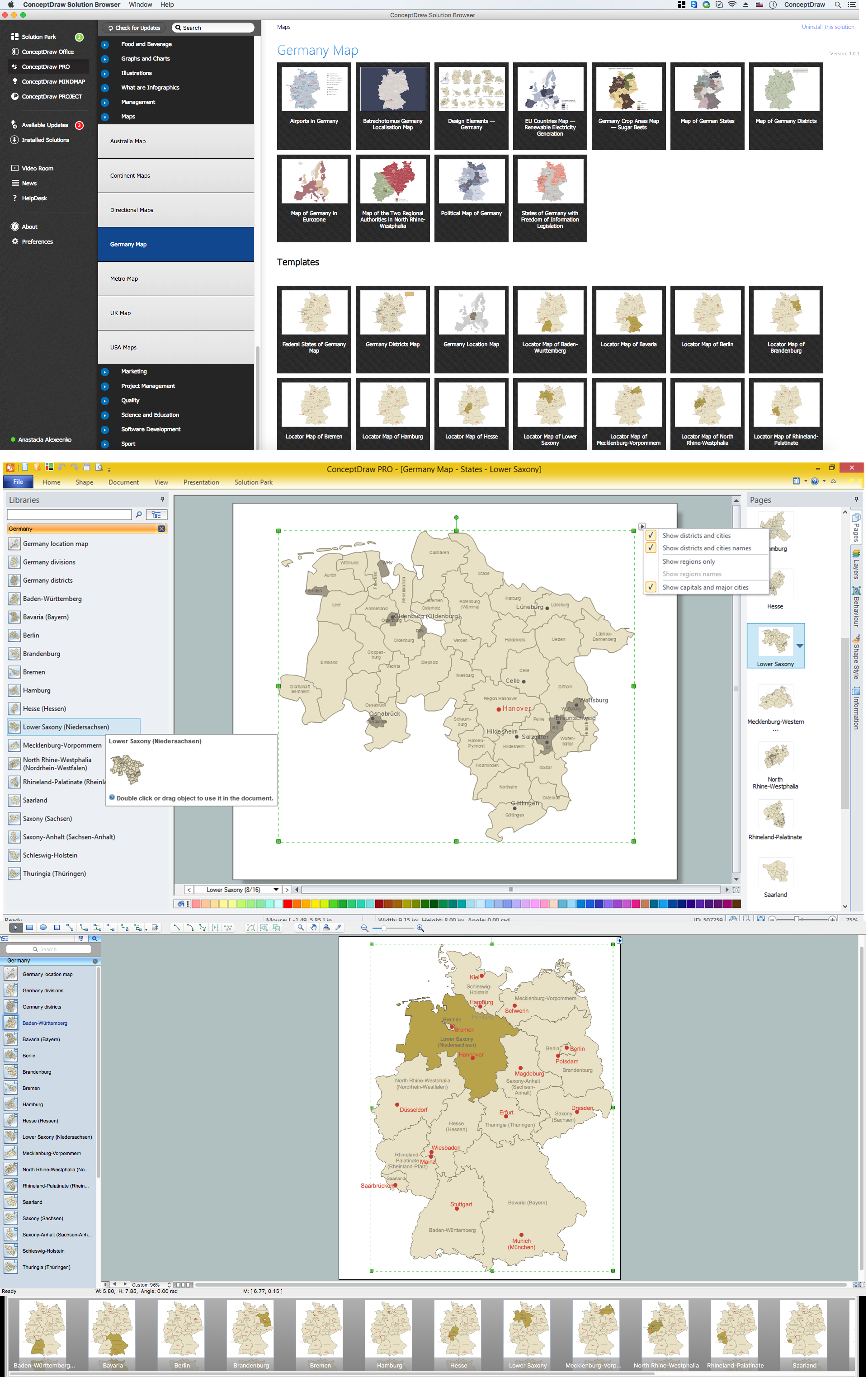
Tennessee is a U.S. state located in the Southeastern United States. The vector stencils library Tennesse contains contours for ConceptDraw PRO diagramming and vector drawing software. This library is contained in the Continent Maps solution from Maps area of ConceptDraw Solution Park.Map of Germany — Lower Saxony State
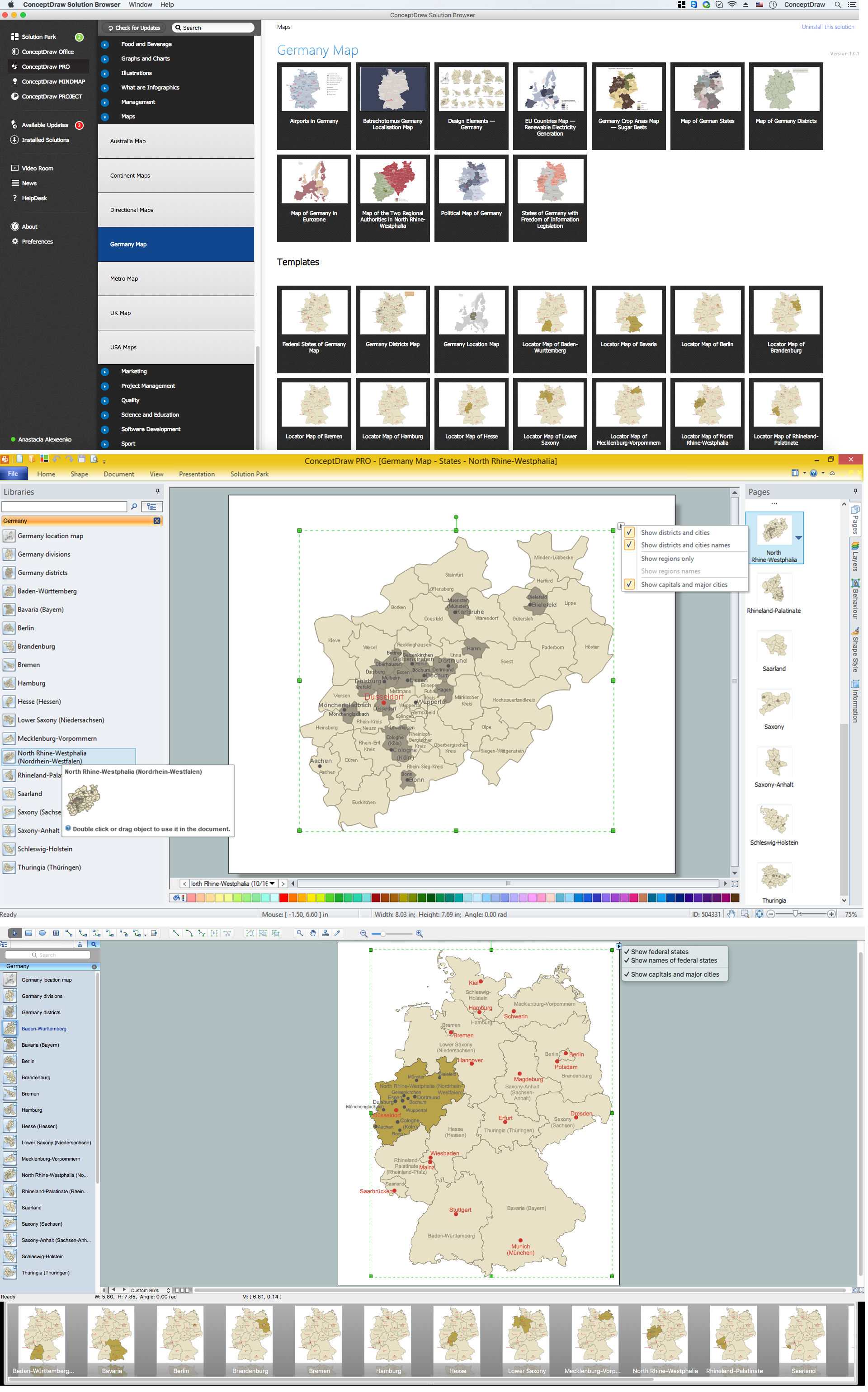
Lower Saxony is a German state (Bundesland) situated in northwestern Germany and is second in area, with 47,624 square kilometres (18,388 sq mi), and fourth in population (8 million) among the sixteen Länder of Germany. Despite the fact that the maps surround us everywhere in our life, usually the process of their drawing is sufficienly complex and labor-intensive. But now, thanks to the ConceptDraw PRO diagramming and vector drawing software extended with Germany Map Solution from the Maps Area of ConceptDraw Solution Park, we have the possibility to make easier this process. Design fast and easy your own pictorial maps of Germany, map of Germany with cities, and thematic Germany maps in ConceptDraw PRO!Map of Germany — North Rhine-Westphalia State
North Rhine-Westphalia is the most populous state of Germany, as well as the fourth largest by area. Its capital is Düsseldorf; the biggest city is Cologne. Despite the fact that the maps surround us everywhere in our life, usually the process of their drawing is sufficienly complex and labor-intensive. But now, thanks to the ConceptDraw PRO diagramming and vector drawing software extended with Germany Map Solution from the Maps Area of ConceptDraw Solution Park, we have the possibility to make easier this process. Design fast and easy your own pictorial maps of Germany, map of Germany with cities, and thematic Germany maps in ConceptDraw PRO!- An Easy Diagram Of Population
- Barrie population - Picture bar graph | Picture graphs - Vector ...
- World Population Chart Drawing
- Area Charts | Circle-Spoke Diagrams | Picture Graphs | Population ...
- Line Chart Examples | Line Graph | Pictures of Graphs | Population ...
- Population Drawing In Easy
- Line Chart Examples | San Francisco CA population growth ...
- Diagram On Population Data Using A Graph
- Barrie population - Picture bar graph | Pie Graph Worksheets | The ...
- Population Chart Drawing
- Population Growth Flow Diagram
- Picture Graphs | Infographic Maker | Chart Templates | Population ...
- Barrie population - Picture bar graph | What Is a Picture Graph ...
- Population Graph In Graphics Documentation Free Download
- World Population Infographics | Sample Pictorial Chart. Sample ...
- Population And Easy To Draw Picture
- Sample Pictorial Chart. Sample Infographics | How to Draw Pictorial ...
- Population Easy Drawing
- Basic Diagramming | Sample Pictorial Chart. Sample Infographics ...
- Images Of Best Graph Of Population

