The vector stencils library "Geography" contains 14 clipart images of natural landscapes and water features for drawing illustrations.
"A natural landscape is a landscape that is unaffected by human activity. A natural landscape is intact when all living and nonliving elements are free to move and change. The nonliving elements distinguish a natural landscape from a wilderness. A wilderness includes areas within which natural processes operate without human interference, but a wilderness must contain life. As implied, a natural landscape may contain either the living or nonliving or both." [Natural landscape. Wikipedia]
The clip art example "Geography - Vector stencils library" was created using the ConceptDraw PRO diagramming and vector drawing software extended with the Nature solution from the Illustration area of ConceptDraw Solution Park.
www.conceptdraw.com/ solution-park/ illustrations-nature
Geo Map of Americas
The Americas are the combined continental landmasses of North America and South America, in the Western Hemisphere. There are 35 sovereign states in the Americas. ConceptDraw is idea to draw the geological maps of America from the pre-designed vector geo map shapes and vector images map of america. Use Continent Maps solution from the Maps area of ConceptDraw Solution Park to draw thematic maps, geospatial infographics and vector illustrations for your business documents, presentations and websites.Geo Map - South America - Suriname
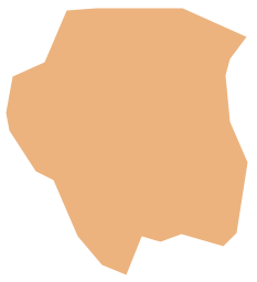
Suriname, officially known as the Republic of Suriname, is a country on the northeastern Atlantic coast of South America. The vector stencils library Suriname contains contours for ConceptDraw PRO diagramming and vector drawing software. This library is contained in the Continent Maps solution from Maps area of ConceptDraw Solution Park.- Lake River The Sea The Ocean Clipart
- Rivers Clipart
- Clipart Of A River
- Clipart Hills
- River Water Png
- Nature River Diagrams
- River Diagram To Ocean
- River Water Mixed With Ocean Diagram
- Drawing Of River Lakes Seas Oceans
- Clipart Png Hills
- Mountain Hill Clipart Png
- Beauty in nature Illustrations and Clipart | Rail transport - Design ...
- River Drawing
- Desert Mountain Clipart
- River Vector Design
- Lake Water Clipart
- Water River
- Clipart Mountains Ocean
- Nature Drawings - How to Draw | Watercraft - Design Elements ...
- Beauty in nature Illustrations and Clipart | Design elements - Ponds ...


