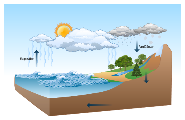
This Water cycle diagram example was drawn using the ConceptDraw PRO diagramming and vector graphics software extended with the clipart libraries Geography and Weather.
"The water cycle, also known as the hydrologic cycle or the H2O cycle, describes the continuous movement of water on, above and below the surface of the Earth. The mass water on Earth remains fairly constant over time but the partitioning of the water into the major reservoirs of ice, fresh water, saline water and atmospheric water is variable depending on a wide range of climatic variables. The water moves from one reservoir to another, such as from river to ocean, or from the ocean to the atmosphere, by the physical processes of evaporation, condensation, precipitation, infiltration, runoff, and subsurface flow. In so doing, the water goes through different phases: liquid, solid (ice), and gas (vapor)." [Water cycle. Wikipedia]
This water cycle diagram example is included in the Nature solution from the Illustration area of ConceptDraw Solution Park.
Vector illustration
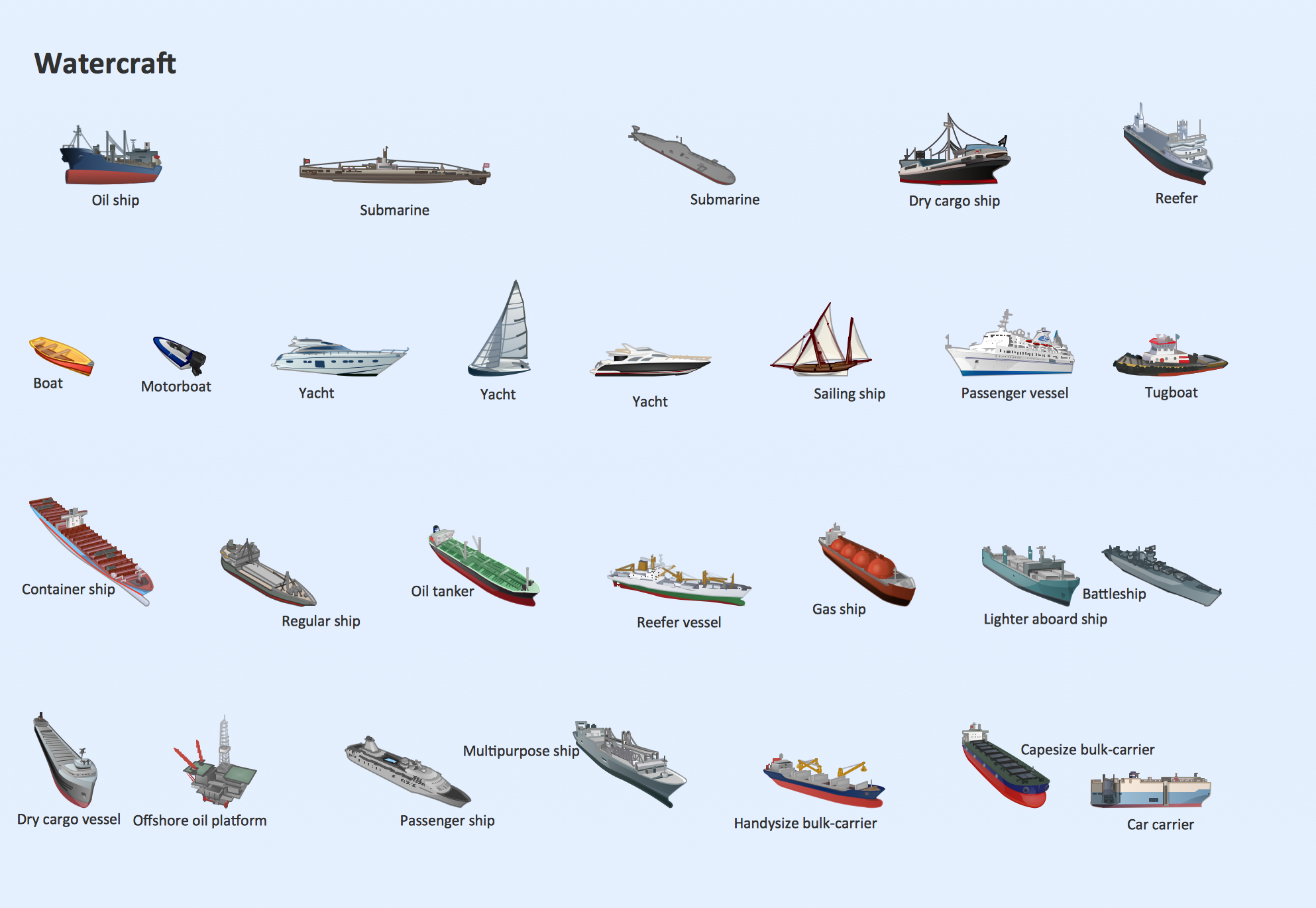
Watercraft - Design Elements
Rail transport - Design elements
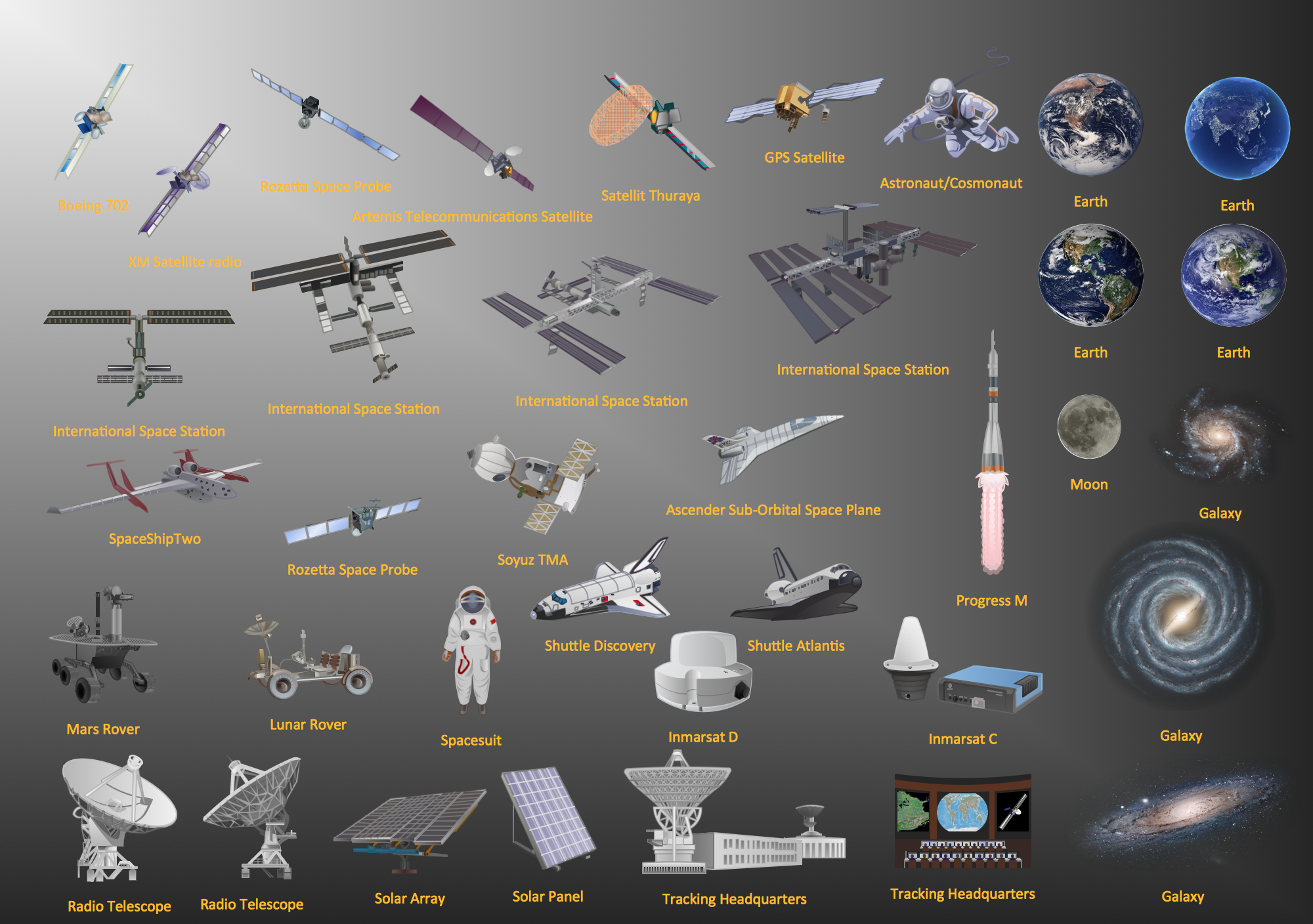
Aerospace - Design Elements
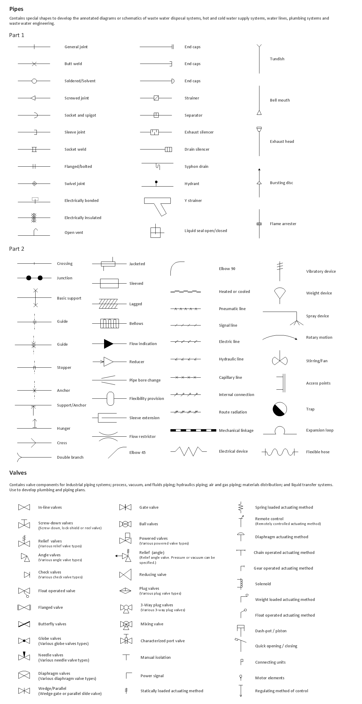
Building Drawing. Design Element: Piping Plan

Nature Drawings - How to Draw
Geo Map — South America Continent

The vector stencils library "Geography" contains 14 clipart images of natural landscapes and water features for drawing illustrations.
"A natural landscape is a landscape that is unaffected by human activity. A natural landscape is intact when all living and nonliving elements are free to move and change. The nonliving elements distinguish a natural landscape from a wilderness. A wilderness includes areas within which natural processes operate without human interference, but a wilderness must contain life. As implied, a natural landscape may contain either the living or nonliving or both." [Natural landscape. Wikipedia]
The clip art example "Geography - Vector stencils library" was created using the ConceptDraw PRO diagramming and vector drawing software extended with the Nature solution from the Illustration area of ConceptDraw Solution Park.
www.conceptdraw.com/ solution-park/ illustrations-nature
Ocean

Forest

River

Lake

Waterfall

Mountains

Mountain

Ravine

Volcano

Desert

Hills

Iceberg

Conifer tree

Tree

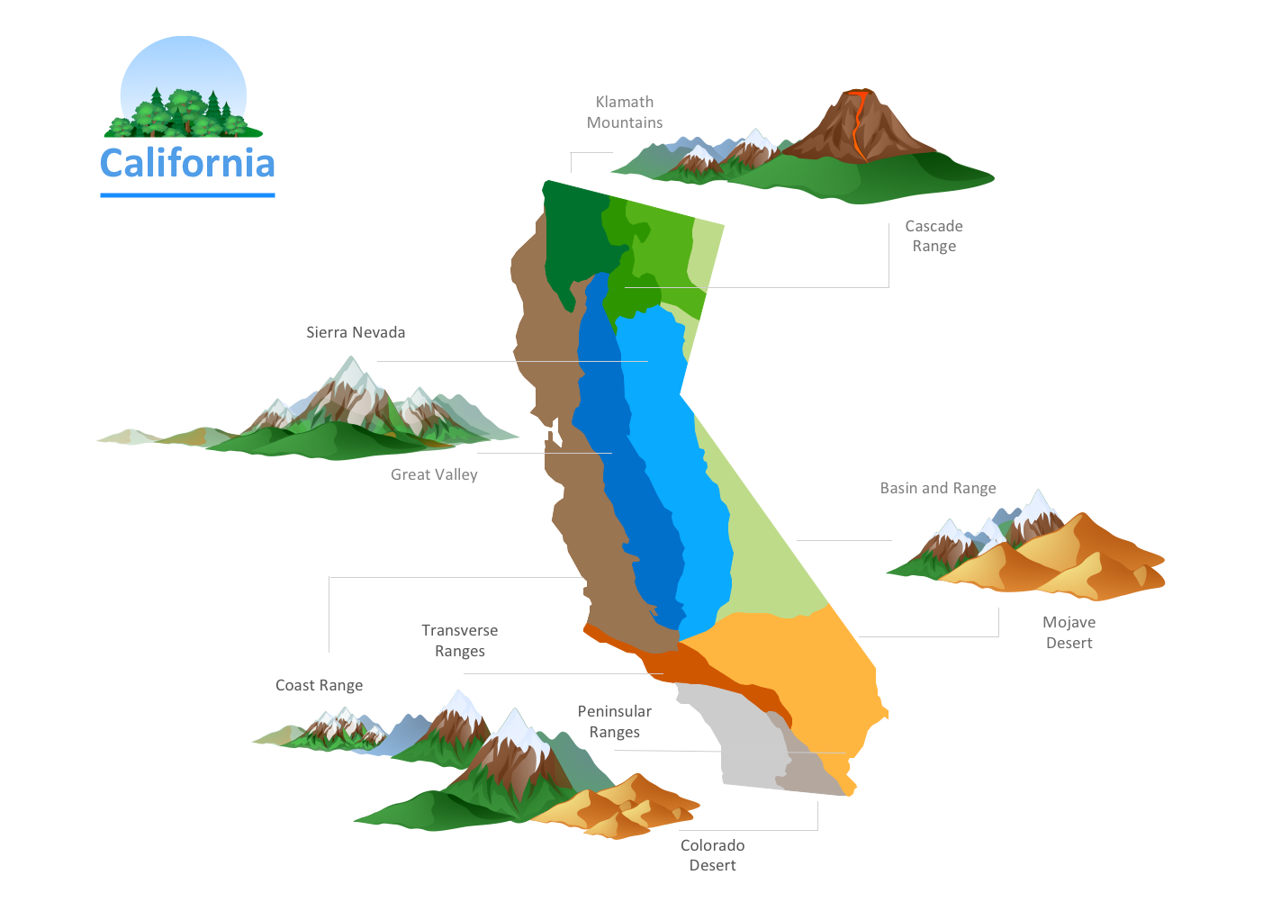
Geo Map - USA - Illinois

Geo Map - USA - Oregon

Geo Map — Europe

Geo Map - Africa - Senegal

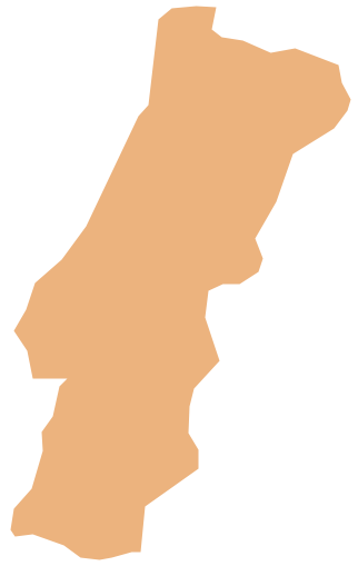
Geo Map - Europe - Portugal
The vector stencils library "Landmarks" contains 69 landmark symbols of buildings, waterways, scale and directional indicators for labeling transportation and directional maps, road and route maps, street and transit maps, locator and tourist maps.
The pictograms example "Landmarks - Vector stencils library" was created using the ConceptDraw PRO diagramming and vector drawing software extended with the Directional Maps solution from the Maps area of ConceptDraw Solution Park.
The pictograms example "Landmarks - Vector stencils library" was created using the ConceptDraw PRO diagramming and vector drawing software extended with the Directional Maps solution from the Maps area of ConceptDraw Solution Park.
Viewpoint

North arrow
North arrow
Building

Building

Town house

Suburban home

Skyscraper

Town hall

Public house

Petrol station

Gas station

Factory

School

Warehouse

Hospital

Fire station

Train station

Condos

Barn

Motel

Convenience store

Shopping centre

City

Church

Cathedral

National tail train station

Train railway

Bus stop

Tramlink

Marina / Ferry dock

Car ferry

Stop light

Airport

Airport

Underground / Subway / Metro

Taxi

Bicycle parking

Parking

Fuel / Gas / Petrol

Police

Hospital

Wheelchair access

First aid

Telephone

Post office

Landmarks and museums

University

Shopping

Refreshments / Public House

Restrooms / Toilets

Park

Zoo

Information center

Stadium 1

Stadium 2

Park

Tree

Fir-tree

Ocean

Lake

River

Angled river

Forked river

Curved river

Curved river

Flexible river

Bridge

Scale

Geo Map - Europe - Russia

- River Water Mixed With Ocean Diagram
- Photos Of River Flowing From Mountain To Ocean
- Nature River Diagrams
- Geography - Vector stencils library | Water cycle diagram | Watercraft ...
- Water cycle diagram | Clipart Of Ocean Movement
- Elements Of Nature River Ocean Mountain Hill Forest Volcano
- Geography - Vector stencils library | Water cycle diagram | Design ...
- Geography - Vector stencils library | Water cycle diagram | Surface ...
- Water cycle diagram | Geo Map of Americas | River Rain Clipart
- Clipart Of A River Flowing To The Sea
- Water cycle diagram | Natural Rain To Ocean Cycle
- Water cycle diagram | Geography - Vector stencils library | Business ...
- Free Clip Art River Flowing To The Sea
- Water cycle diagram | Sea With Cloud Clip Art
- Lake River The Sea The Ocean Clipart
- Active Directory Diagram | Design elements - Geography ...
- Waterfall Bar Chart | SSADM Diagram | Best Program to Make ...
- Water cycle diagram | Drawing Illustration | Drawing a Nature ...
- Mountain To River Illustration
- Powerful Drawing Feature for Creating Professional Diagrams ...