 Maps Area
Solutions from the Maps Area of ConceptDraw Solution Park collect templates, samples and libraries of vector stencils for drawing geographical, directional and transport maps.
Directions Map
ConceptDraw PRO is a powerful diagramming and vector drawing software. Extended with Directional Maps Solution from the Maps Area of ConceptDraw Solution Park, it became the best software for quick and easy designing Directions Map of any complexity.Directions Maps
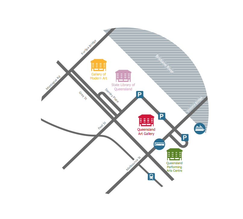
It is convenient to represent various routes, directions, roads on the directional maps and navigation schemes. ConceptDraw PRO diagramming and vector drawing software supplied with Directional Maps Solution from the Maps Area of ConceptDraw Solution Park is effective for drawing Directions Maps.
 Directional Maps
Directional Maps solution extends ConceptDraw PRO software with templates, samples and libraries of vector stencils for drawing the directional, location, site, transit, road and route maps, plans and schemes.
Maps and Directions
ConceptDraw PRO diagramming and vector drawing software extended with Directional Maps Solution from the Maps Area of ConceptDraw Solution Park is a powerful maps and directions design software. Let's review the tools of this solution.Maps Driving Directions
You need visually represent the Maps Driving Directions? Now it's incredibly easy to do this in ConceptDraw PRO diagramming and vector drawing software which was supplied with unique Directional Maps Solution from the Maps Area.UK Map
The United Kingdom of Great Britain and Northern Ireland, commonly known as the United Kingdom (UK), is a sovereign state in Europe which consists of four countries: England, Scotland, Wales, and Northern Ireland. UK is surrounded by the waters of Atlantic ocean, the North Sea, the English Channel, and the Irish Sea and includes large number of big and small islands.ConceptDraw PRO diagramming and vector drawing software offers the unique Map of UK Solution from the Maps Area of ConceptDraw Solution Park that is indispensable for easy drawing professional looking map of UK, UK counties map, UK map with cities, map of Scotland, map of England, map of Wales, Northern Ireland map.
 Site Plans
Vivid and enticing plan is the starting point in landscape design and site plan design, it reflects the main design idea and gives instantly a vision of the end result after implementation of this plan. Moreover site plan, architectural plan, detailed engineering documents and landscape sketches are obligatory when designing large projects of single and multi-floor buildings.
 ConceptDraw Solution Park
ConceptDraw Solution Park collects graphic extensions, examples and learning materials
 Universal Diagramming Area
This area collects solutions for drawing diagrams, charts, graphs, matrices, geographic and road maps for education, science, engineering, business.
 Spatial Infographics
Spatial infographics solution extends ConceptDraw PRO software with infographic samples, map templates and vector stencils libraries with design elements for drawing spatial information graphics.
 Vehicular Networking
Network engineering is an extensive area with wide range of applications. Depending to the field of application, network engineers design and realize small networks or complex networks, which cover wide territories. In latter case will be ideal recourse to specialized drawing software, such as ConceptDraw PRO.
 Plant Layout Plans
This solution extends ConceptDraw PRO v.9.5 plant layout software (or later) with process plant layout and piping design samples, templates and libraries of vector stencils for drawing Plant Layout plans. Use it to develop plant layouts, power plant desig
 Aerospace and Transport
This solution extends ConceptDraw PRO software with templates, samples and library of vector clipart for drawing the Aerospace and Transport Illustrations. It contains clipart of aerospace objects and transportation vehicles, office buildings and anci
- Vector Map of Germany | Infographic design elements, software ...
- Maps of Germany With Cities
- Maps | Geo Map - Australia | Geo Map - Europe - Germany | Geo ...
- Maps of Germany | Geo Map - Europe - Germany | How to Create a ...
- Germany Maps Design Vector Samples
- Spatial infographics Design Elements: Continental Map | How To ...
- Maps | Continent Maps | Geo Map - Africa | Drawing Of Map Of The ...
- Geo Map - Europe
- Geo Map - Australia
- Continent Maps
- Central Asia political map | Political map of Central America ...
- Political map of Europe | Tools to Create Your Own Infographics ...
- UK Map | How to Create a Map Depicting the United Kingdom ...
- Geo Map - Australia | Continent Maps | Map of median household ...
- Geo Map - Australia
- European membership of the EU and NATO map | EU 28: Candidate ...
- Geo Map - South America Continent | Geo Map Software | Geo Map ...
- Map of Australia depicting time zones offsets from UTC by state ...
- How to Draw a Map of North America Using ConceptDraw PRO ...
- Design elements - Geography | Geography - Vector stencils library ...


