The vector stencils library "Transport map" contains 96 pictograms for drawing transport maps.
Use it in your spatial infographics for visual representation of transport schemes and plans as metro maps in the ConceptDraw PRO diagramming and vector drawing software extended with the Spatial Infographics solution from the area "What is Infographics" of ConceptDraw Solution Park.
Use it in your spatial infographics for visual representation of transport schemes and plans as metro maps in the ConceptDraw PRO diagramming and vector drawing software extended with the Spatial Infographics solution from the area "What is Infographics" of ConceptDraw Solution Park.
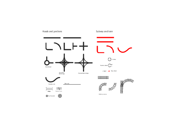
The vector stencils library "Roads and junctions" contains 38 symbols for creating the road and route maps, transit and directional maps, street and locator maps using the ConceptDraw PRO diagramming and vector drawing software.
The vector stencils library "Subway and train" contains 22 shapes for creating the transit maps of tube (metro) and railway.
"Road maps are perhaps the most widely used maps today, and form a subset of navigational maps, which also include aeronautical and nautical charts, railroad network maps, and hiking and bicycling maps." [Map. Wikipedia]
The example "Design elements - Roads and junctions, subway and train" is included in the Directional Maps solution from the Maps area of ConceptDraw Solution Park.
The vector stencils library "Transport map" contains 96 pictograms for drawing transport maps.
Use it in your spatial infographics for visual representation of transport schemes and plans as metro maps in the ConceptDraw PRO diagramming and vector drawing software extended with the Spatial Infographics solution from the area "What is Infographics" of ConceptDraw Solution Park.
Use it in your spatial infographics for visual representation of transport schemes and plans as metro maps in the ConceptDraw PRO diagramming and vector drawing software extended with the Spatial Infographics solution from the area "What is Infographics" of ConceptDraw Solution Park.
- Transport map - Vector stencils library
- Subway Train Map | Metro Train Map | Train seating plan | Train
- 3D pictorial road map | 2D Directional map - Template | Maps | Road ...
- Drawing Of Roadways Tarnsport
- Transport map - Vector stencils library | Fork In Road Icon
- Road Transport - Design Elements | UML Class Diagram Example ...
- 3D pictorial street map | Design elements - 3D directional maps | 3D ...
- Plan Diagram Subway Road Transport Com
- 3D pictorial street map | Design elements - 3D directional maps ...
- Transport map - Vector stencils library
- Transport map - Vector stencils library | Metro Map | Metro Map ...
- Transport map - Vector stencils library | Design elements ...
- IVR services diagram | Transport map - Vector stencils library ...
- Transport map - Vector stencils library | Chemical and Process ...
- How to draw Metro Map style infographics? Moscow, New York, Los ...
- Directional Maps | Transport map - Vector stencils library | Car ...
- Road Interchange Design Line Plan
- Rail transport - Vector stencils library | Rail transport - Design ...
- Supermarket parking | Value stream mapping - Vector stencils ...
- Transport map - Vector stencils library


