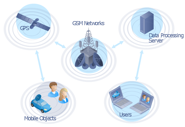
"The Global Positioning System (GPS) is a space-based satellite navigation system that provides location and time information in all weather conditions, anywhere on or near the Earth where there is an unobstructed line of sight to four or more GPS satellites. The system provides critical capabilities to military, civil and commercial users around the world. It is maintained by the United States government and is freely accessible to anyone with a GPS receiver." [Global Positioning System. Wikipedia]
This GPS operation diagram example was created using the ConceptDraw PRO diagramming and vector drawing software extended with the Telecommunication Network Diagrams solution from the Computer and Networks area of ConceptDraw Solution Park.
This GPS operation diagram example was created using the ConceptDraw PRO diagramming and vector drawing software extended with the Telecommunication Network Diagrams solution from the Computer and Networks area of ConceptDraw Solution Park.
"Interactive voice response (IVR) is a technology that allows a computer to interact with humans through the use of voice and DTMF tones input via keypad.
In telecommunications, IVR allows customers to interact with a company’s host system via a telephone keypad or by speech recognition, after which they can service their own inquiries by following the IVR dialogue. IVR systems can respond with prerecorded or dynamically generated audio to further direct users on how to proceed. IVR applications can be used to control almost any function where the interface can be broken down into a series of simple interactions. IVR systems deployed in the network are sized to handle large call volumes.
IVR technology is also being introduced into automobile systems for hands-free operation. Current deployment in automobiles revolves around satellite navigation, audio and mobile phone systems.
It is common in industries that have recently entered the telecommunications industry to refer to an automated attendant as an IVR. The terms, however, are distinct and mean different things to traditional telecommunications professionals, whereas emerging telephony and VoIP professionals often use the term IVR as a catch-all to signify any kind of telephony menu, even a basic automated attendant. The term voice response unit (VRU), is sometimes used as well." [Interactive voice response. Wikipedia]
The interactive voice response (IVR) diagram template for the ConceptDraw PRO diagramming and vector drawing software is included in the Interactive Voice Response Diagrams solution from the Computer and Networks area of ConceptDraw Solution Park.
Telecommunications Networks
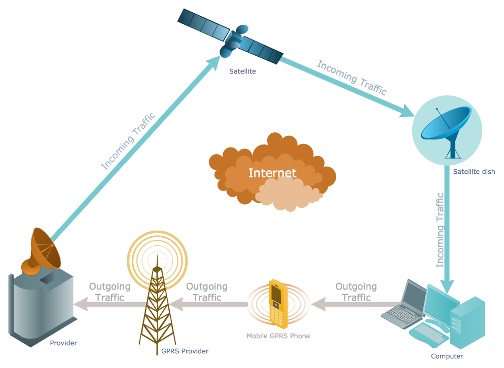
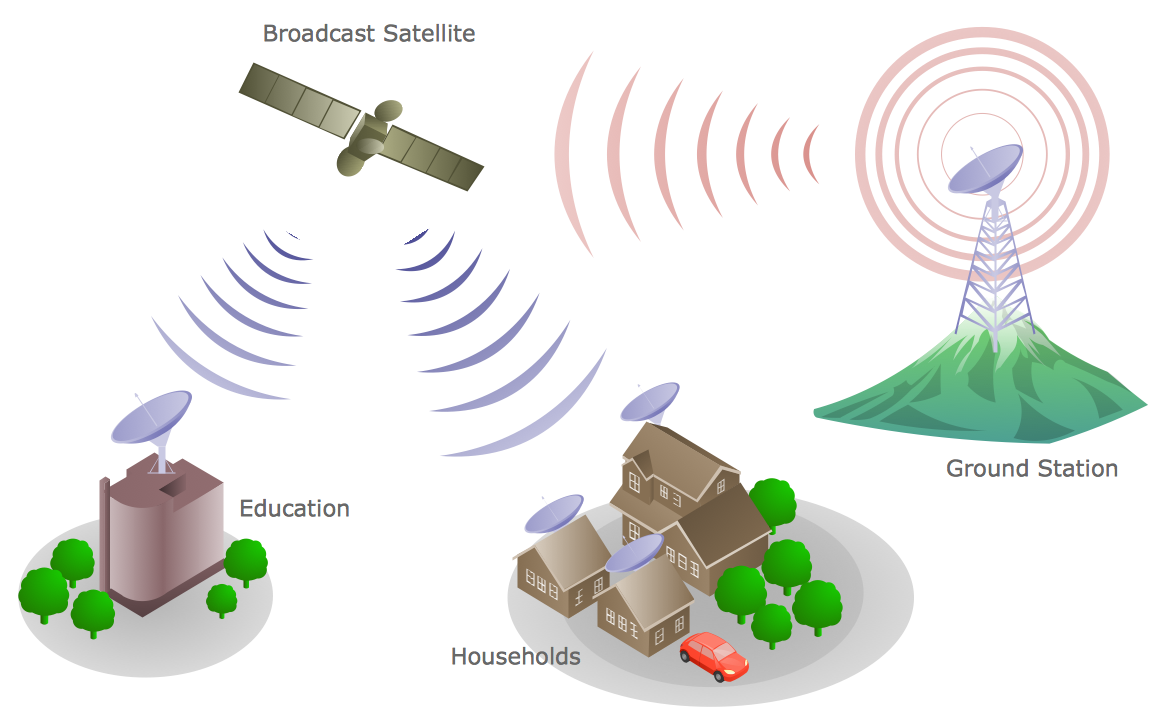
ConceptDraw PRO diagramming and vector drawing software provides the Telecommunication Network Diagrams Solution from the Computer and Networks Area for quick and easy drawing the Telecommunications Networks.
 Computer and Networks Area
The solutions from Computer and Networks Area of ConceptDraw Solution Park collect samples, templates and vector stencils libraries for drawing computer and network diagrams, schemes and technical drawings.
Network Visualization with ConceptDraw PRO
ConceptDraw makes the entire process of network visualization easier thanks to the numerous ready-to-use objects included in the package for presentation of network equipment, LDAP directory symbols and many other objects that symbolize resources in most various representations.Telecommunications Network
How to draw Telecommunications Network Diagram quick, easy and effective? ConceptDraw PRO offers the unique Telecommunication Network Diagrams Solution from the Computer and Networks Area which will help you.
 iPhone User Interface
iPhone User Interface solution extends ConceptDraw PRO v10 software with templates, samples and libraries with large quantity of vector stencils of graphical user interface elements, Apps icons, UI patterns for designing and prototyping of the iOS applic
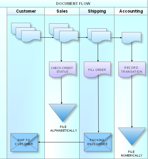
What is a Cross Functional Flow Chart?
For those who want to know what is a cross functional flowchart and how to draw it, we preared a special library and professional looking templates. Take all the advantage of your drawing software to learn and create such a well-designed flowcharts. Watch the HowTo video to learn more.- All Ooad Diagrams For Satellite Navigation System
- Hybrid satellite and common carrier network diagram | Mobile ...
- GPS operation diagram | Telecommunication Network Diagrams ...
- GPS operation diagram | 3D Network Diagram Software | UML ...
- Mobile satellite communication network diagram | Hybrid satellite ...
- Line Diagram Of Gps System
- Component Diagram For Satellite Based Navigation
- Hybrid satellite and common carrier network diagram | Satellite ...
- GPS operation diagram
- GPS operation diagram | Automatic vehicle location | 3D Network ...
- Gps System Diagram
- Global Position Satellite System Diagram
- Diagram Of Gps
- Hybrid satellite and common carrier network diagram | GPS ...
- Hybrid satellite and common carrier network diagram | Mobile ...
- GPS operation diagram | Satellite telecom network diagram ...
- Use Case Diagram For Satellite Navigation System
- 3D Network Diagram Software | Satellite telecom network diagram ...
- GPS operation diagram | Computers and network isometric - Vector ...
