AWS
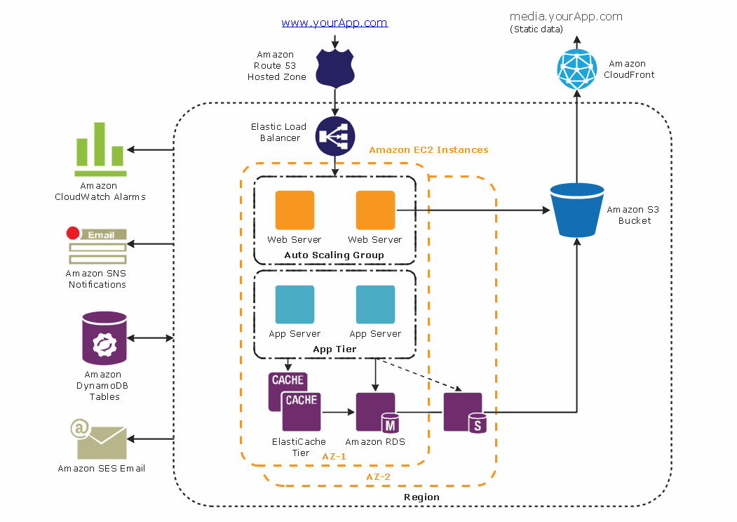
The AWS diagrams are convenient way for explaining the work of Amazon Web Services. ConceptDraw DIAGRAM diagramming and vector drawing software offers the AWS Architecture Diagrams Solution from the Computer and Networks Area for fast and easy creating the AWS diagrams of any complexity.Geo Map - Europe - Bulgaria
Bulgaria, officially the Republic of Bulgaria, is a country located in Southeastern Europe. Use the Continent Maps solution to create Bulgaria geographical map, cartograms and thematic map, to help visualize the business and thematic information connected with geographic areas, locations or customs.Geo Map — Asia
ConceptDraw is idea to draw the geological maps of Asia from the pre-designed vector geo map shapes. Use Geo Map Asia to draw thematic maps, geospatial infographics and vector illustrations for your business documents, presentations and websites.Geo Map - Asia - China
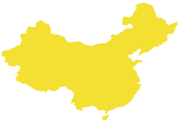
China, officially the People's Republic of China, is a sovereign state located in East Asia. The vector stencils library China contains contours for ConceptDraw DIAGRAM diagramming and vector drawing software. This library is contained in the Continent Maps solution from Maps area of ConceptDraw Solution Park.The vector stencils library "Asia" contains 57 Asian state map contours for drawing thematic and political maps of Asia. Use it for visual representation of geospatial information, statistics and quantitative data.
"Asia is the Earth's largest and most populous continent, located primarily in the eastern and northern hemispheres. ... Countries: 49 (and 5 disputed)." [Asia. Wikipedia]
The state map contours example "Asia - Vector stencils library" was created using the ConceptDraw PRO diagramming and vector drawing software extended with the Continent Maps solution from the Maps area of ConceptDraw Solution Park.
Geo Map — Asia — Indonesia
Indonesia, officially the Republic of Indonesia, is a sovereign state in Southeast Asia and Oceania. The vector stencils library Indonesia contains contours for ConceptDraw DIAGRAM diagramming and vector drawing software. This library is contained in the Continent Maps solution from Maps area of ConceptDraw Solution Park.
 Continent Maps
Continent Maps solution extends ConceptDraw DIAGRAM software with templates, samples and libraries of vector stencils for drawing the thematic maps of continents, state maps of USA and Australia.
Geo Map - Asia - Mongolia
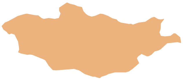
Mongolia is a landlocked country in Central Asia. The vector stencils library Mongolia contains contours for ConceptDraw DIAGRAM diagramming and vector drawing software. This library is contained in the Continent Maps solution from Maps area of ConceptDraw Solution Park.Geo Map — Asia — Vietnam
Vietnam, officially the Socialist Republic of Vietnam, is the easternmost country on the Indochina Peninsula in Southeast Asia. The vector stencils library Vietnam contains contours for ConceptDraw DIAGRAM diagramming and vector drawing software. This library is contained in the Continent Maps solution from Maps area of ConceptDraw Solution Park.How to draw Metro Map style infographics? Moscow, New York, Los Angeles, London
The solution handles designs of any complexity, and the comprehensive library covers all key aspects of a transportation system. To further enhance your map design, there is the option to embed links, that can display station images or other relevant, important information. We have also included a set of samples in the solution, that show the possible real-world application — complex tube systems including the London Tube and New York City Subway show the level of detail possible when using the Metro Map Solution.- Map symbols - Vector stencils library | How to Draw a Map of North ...
- Geo Map - Asia - India
- Southeast Asia Map
- North Asia - Political map | Southeast Asia - Political map | North ...
- SDL Flowchart Symbols | Geo Map - Africa | Multi Layer Venn ...
- South Asia - Political map | Southeast Asia - Political map ...
- Map Software | Geo Map - Asia - Mongolia | Geo Map - Asia ...
- Southeast Asia Map Vector
- Southeast Asia - Political map | Asia - Vector stencils library ...
- Basic Flowchart Symbols and Meaning | How To Make a Concept ...


-asia---vector-stencils-library.png--diagram-flowchart-example.png)


-asia---vector-stencils-library.png--diagram-flowchart-example.png)


