"A landmark is a recognizable natural or man-made feature used for navigation. ...
In urban studies as well as in geography, a landmark is furthermore defined as an external point of reference that helps orienting in a familiar or unfamiliar environment. ...
Landmarks are usually classified under natural landmarks or man-made landmarks, both are originally used to help navigation on finding direction. A variant is a seamark or daymark, a structure usually built intentionally to aid sailors navigating featureless coasts." [Landmark. Wikipedia]
The vector stencils library Landmarks contains symbols for drawing directional maps, street maps, road maps, route maps, locator maps, transit maps, tourist maps using the ConceptDraw PRO diagramming and vector drawing software.
The example "Design elements - Landmarks" is included in the Directional Maps solution from the Maps area of ConceptDraw Solution Park.
Landmarks
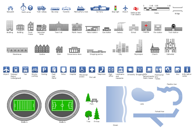
The vector stencils library "Landmarks" contains 34 signs and pictograms for drawing road and transit maps.
The vector stencils library "Map symbols" contains 10 signs and pictograms for drawing road and transit maps.
"A landmark is a recognizable natural or man-made feature used for navigation, a feature that stands out from its near environment and is often visible from long distances.
In modern use, the term can also be applied to smaller structures or features, that have become local or national symbols." [Landmark. Wikipedia]
The pictograms example "Design elements - Location map" was created using the ConceptDraw PRO diagramming and vector drawing software extended with the Spatial Infographics solution from the Maps area of ConceptDraw Solution Park.
Landmarks and Map symbols

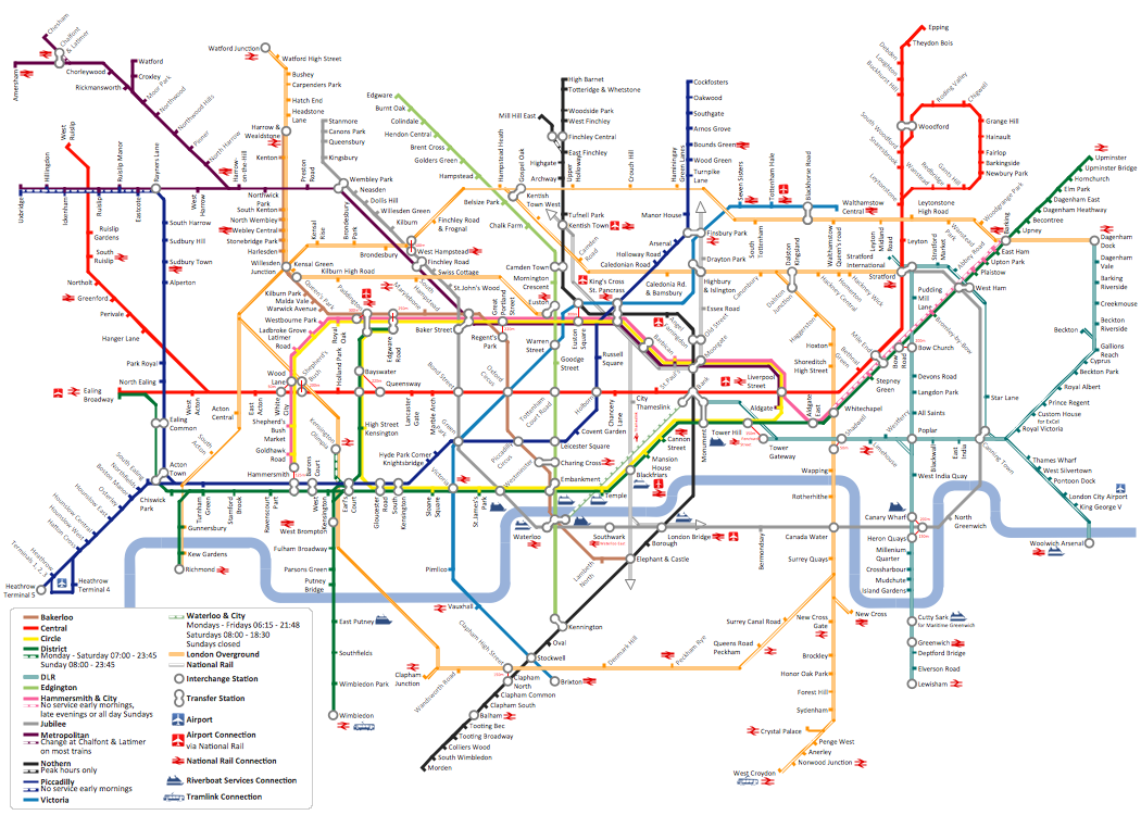
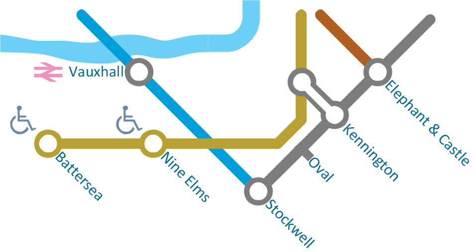
How to draw Metro Map style infographics? (London)
Types of Flowchart - Overview
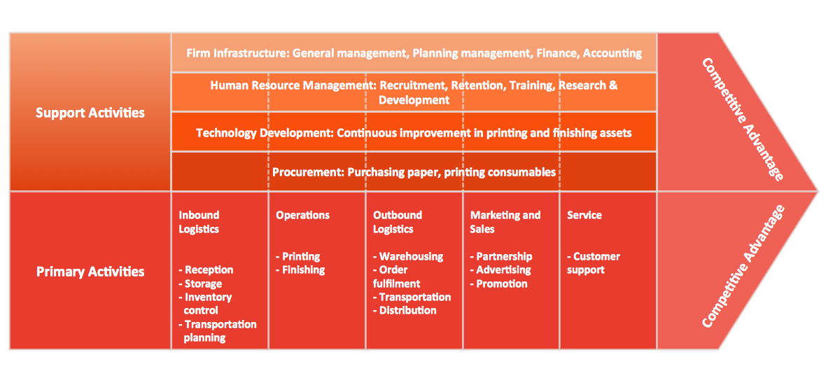
Porter's Value Chain
Infographic Software
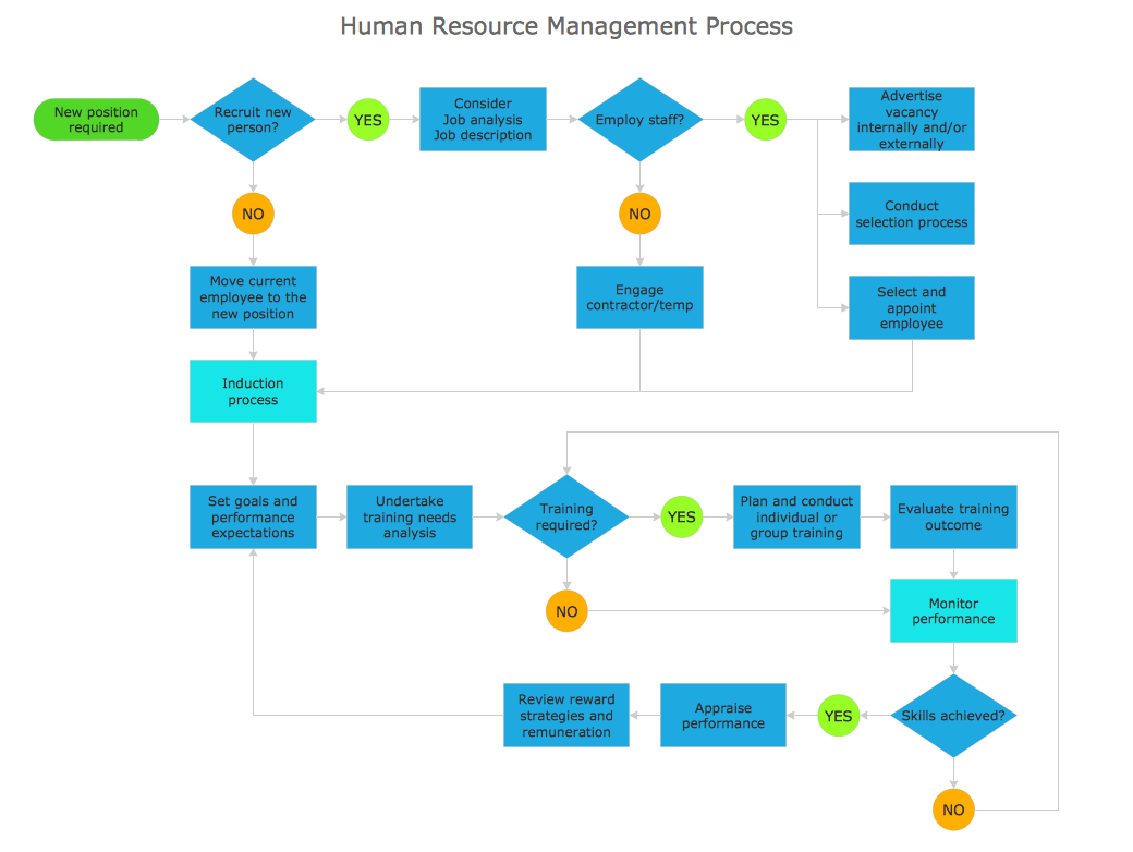
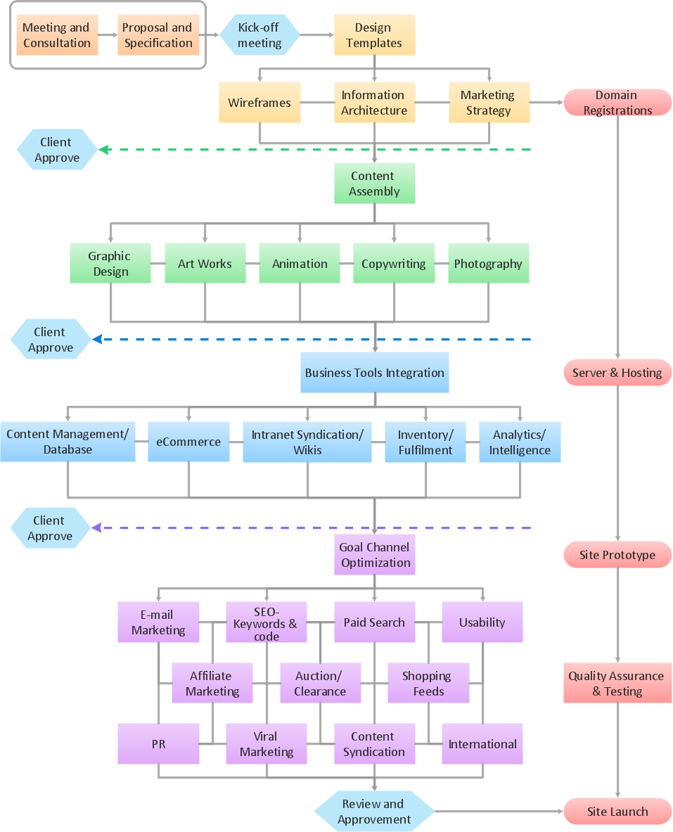
Example Process Flow
Spatial Infographics
How to draw Metro Map style infographics? (New York)

 USA Maps
Use the USA Maps solution to create a map of USA, a US interstate map, printable US maps, US maps with cities and US maps with capitals. Create a complete USA states map.
- Identify Specific Features Or Landmark Natural Or Human Made
- Identify Specific Features And Landmarks Both Natural Land Human ...
- Identify Specific Features Or Landmarks Natural And Manmade
- Specific Features Or Landmarks Natural And Human Made
- Landmarks Natural And Human Made
- | Identify Specific Features Or Landmarks Natural And Human Made ...
- Spatial infographics Design Elements: Location Map | Design ...
- Symbol Of Ropeway In Map
- Spatial infographics Design Elements: Location Map | Design ...
- Design elements - Location map | Landmarks - Vector stencils ...