The 3D pictorial street maps are used as road maps, route maps, locator maps, transit maps, directional maps, tourist maps with points of interest (POI).
"A point of interest, or POI, is a specific point location that someone may find useful or interesting. ...
Most consumers use the term when referring to hotels, campsites, fuel stations or any other categories used in modern (automotive) navigation systems. ...
The term is widely used in cartography, especially in electronic variants including GIS, and GPS navigation software. In this context the synonym waypoint is common.
A GPS point of interest specifies, at minimum, the latitude and longitude of the POI, assuming a certain map datum. A name or description for the POI is usually included, and other information such as altitude or a telephone number may also be attached. GPS applications typically use icons to represent different categories of POI on a map graphically." [Point of interest. Wikipedia]
The example "3D pictorial street map" was created using the ConceptDraw PRO diagramming and vector drawing software extended with the Directional Maps solution from the Maps area of ConceptDraw Solution Park.
"A 'Luge' ... is a small one- or two-person sled on which one sleds supine (face up) and feet-first. Steering is done by flexing the sled's runners with the calf of each leg or exerting opposite shoulder pressure to the seat. ... Luge is also the name of an Olympic sport. Of the three Olympic sliding sports, which include bobsleigh and skeleton, luge is the fastest and most dangerous. Lugers can reach speeds of 140 km per hour (87 mph). ...
Street luge is a recent innovation of the sport. It is considered an extreme sport, as well as an Olympic sport.
Lugers compete against a timer and are timed to a thousandth of a second, making luge one of the most precisely timed sports in the world." [Luge. Wikipedia]
The vector icon example "Luge" represents one of 20 symbols from the Winter sports pictograms library for the ConceptDraw PRO diagramming and vector drawing software.
The design elements library Winter sports pictograms is included in the Winter Sports solution from the Sport area of ConceptDraw Solution Park.
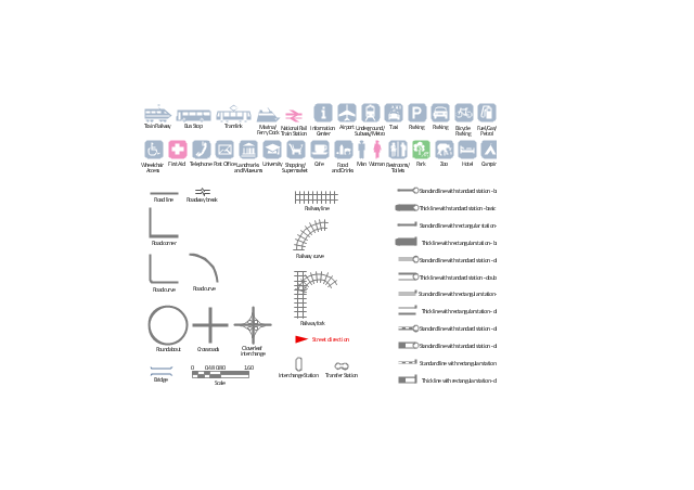
The vector stencils library "Transport map" contains 96 signs and pictograms for drawing road and transit maps.
"A transit map is a topological map in the form of a schematic diagram used to illustrate the routes and stations within a public transport system - whether this be bus lines, tramways, rapid transit, commuter rail or ferry routes. The main components are color coded lines to indicate each line or service, with named icons to indicate stations or stops.
Transit maps can be found in the transit vehicles, at the platforms or in printed timetables. Their primary function is to help users to efficiently use the public transport system, including which stations function as interchange between lines. Unlike conventional maps, transit maps are usually not geographically accurate - instead they use straight lines and fixed angles, and often illustrate a fixed distance between stations, compressing those in the outer area of the system and expanding those close to the center." [Transit map. Wikipedia]
The pictograms example "Design elements - Transport map" was created using the ConceptDraw PRO diagramming and vector drawing software extended with the Spatial Infographics solution from the Maps area of ConceptDraw Solution Park.
- Diagramming software for Amazon Web Service icon set: Monitoring ...
- Luge - Winter sports pictograms | Small Streets Icon
- App icons - Vector stencils library | Building Drawing Design ...
- Skeleton - Winter sports pictograms | Bobsleigh - Winter sports ...
- Road signs - Vector stencils library | Cloud round icons - Vector ...
- Advertising - Vector stencils library | Advertising - Design Elements ...
- Messages - Template | App icons - Vector stencils library | Design ...
- Skeleton - Winter sports pictograms | Figure skating - Winter sports ...
- App icons - Vector stencils library
- iPhone OS (iOS) graphic user interface (GUI) - SMS application ...
- Design elements - 3D directional maps | Directional Maps | Maps ...
- Figure skating - Winter sports pictograms | Winter Sports | Freestyle ...
- Road signs - Vector stencils library | Recreation signs - Vector ...
- AWS simple icons - Vector stencils library
- iPhone interface - Vector stencils library | App icons - Vector stencils ...
- iOS 8 / iPhone 6 home screen
- Curved Arrow Icon Png
- 3D Directional map - Template | 3D pictorial street map | Wireless ...
- Flowchart design. Flowchart symbols, shapes, stencils and icons ...
- Contact Card | iOS 8 / iPhone 6 home screen | iPhone User Interface ...


