HelpDesk
How to Make a Web Page from Your Metro Map
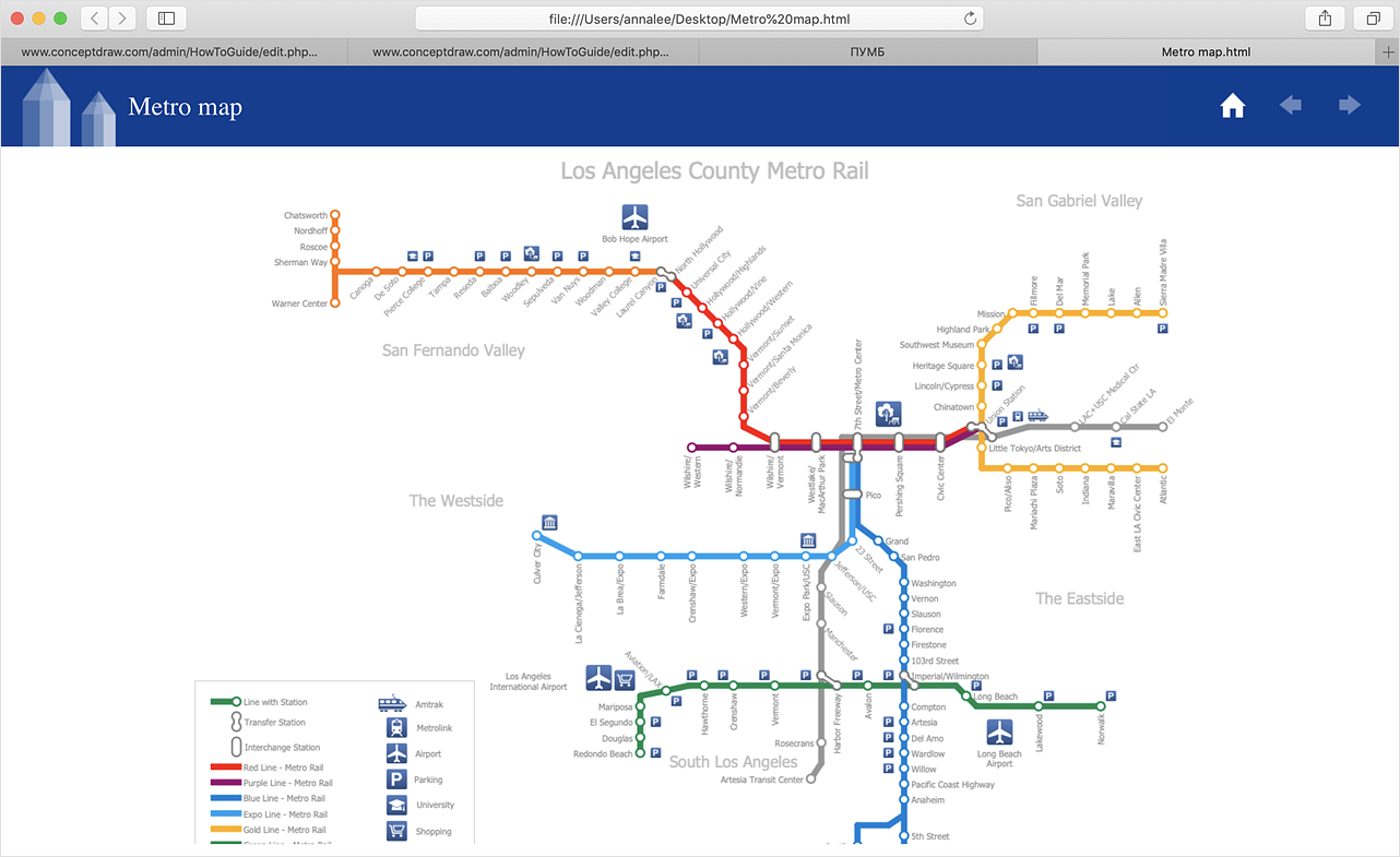
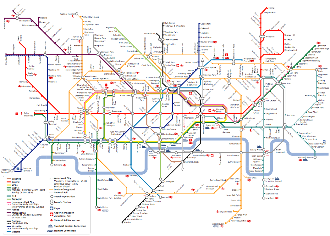
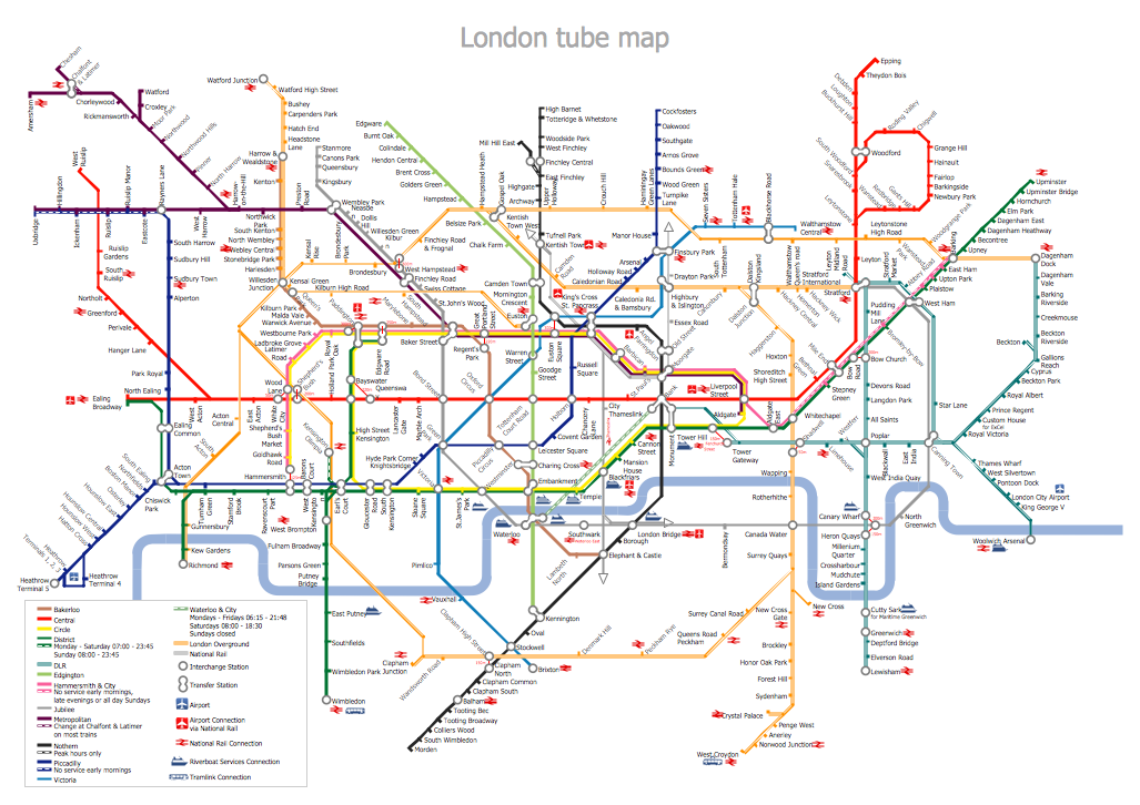
Using ConceptDraw DIAGRAM, you can create metro maps, route maps, and various transport schemes. It is easy for anyone to build a map, one does not need to be a cartographer to make good use of the ConceptDraw mapping solutions. Elaborate maps can be quickly assembled and then used on the web, printed, or made into signage. Graphical power and ease of use are built into the ConceptDraw mapping solutions. You can save your drawing as a Web page. ConceptDraw DIAGRAM adds the HTML tags that are needed to display your diagrams in a Web browser, so all you have to do is design their appearance.Rail transport - Design elements
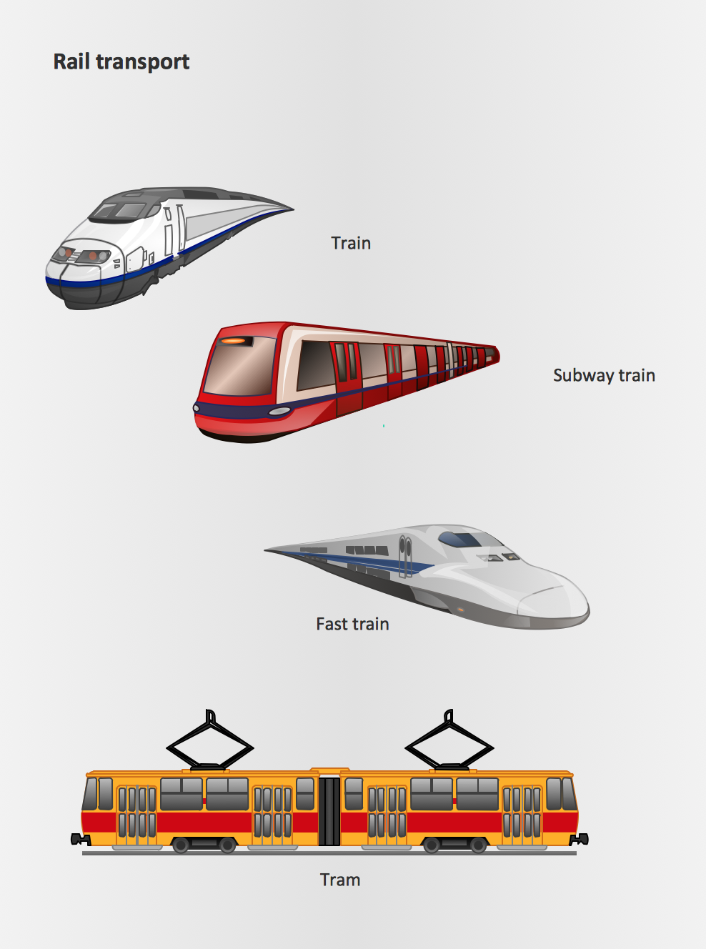
The vector stencils library Rail transport contains clipart of railway transport for ConceptDraw DIAGRAM diagramming and vector drawing software. Use it to draw illustrations of trains and transportation of passengers and goods by railroads.Industrial transport - Design elements
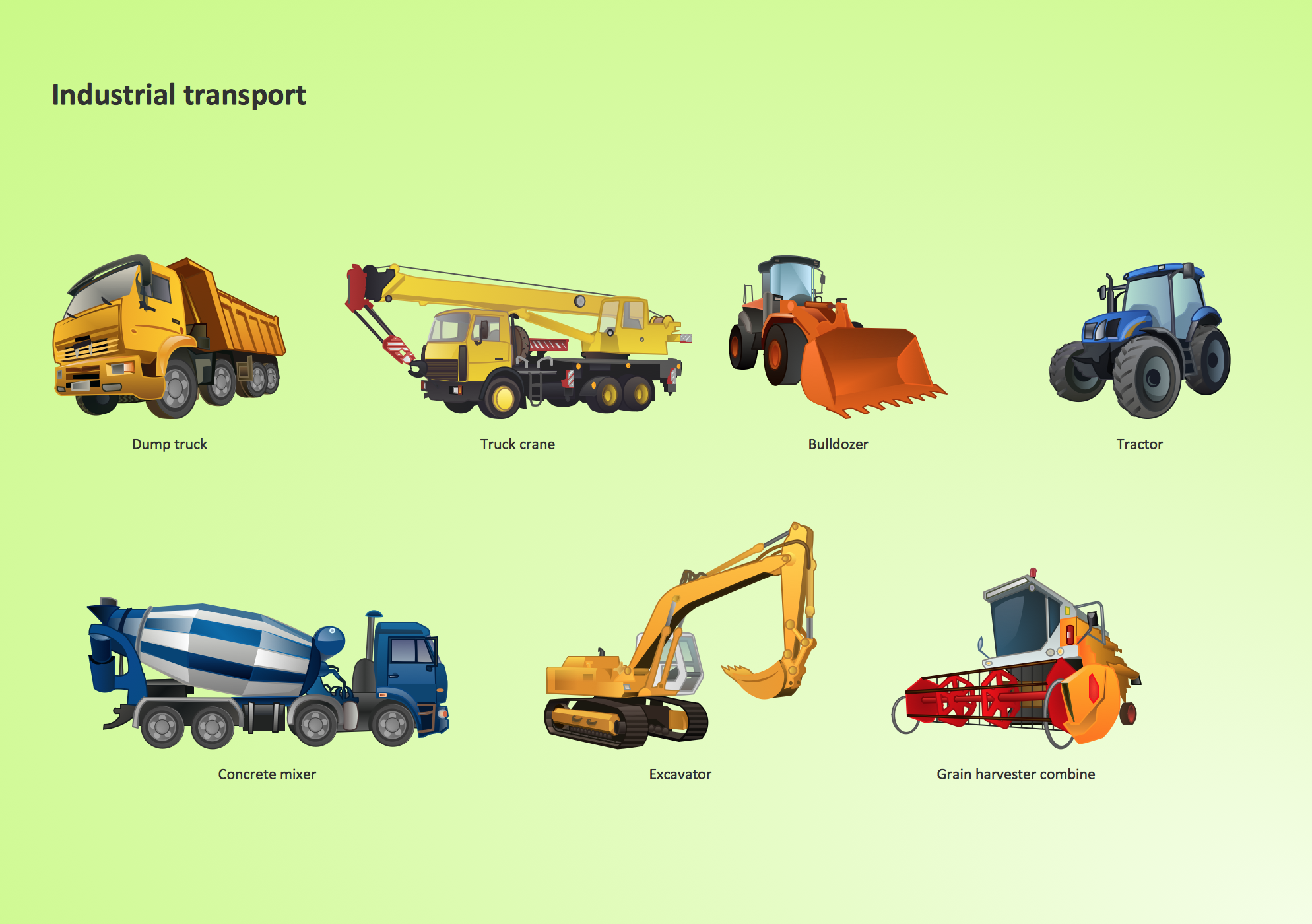
The vector stencils library Industrial transport contains clipart of industrial vehicles for ConceptDraw DIAGRAM diagramming and vector drawing software. Use it to draw illustrations of industrial vehicles, transportation, lifting and moving materials using machines.Road Transport - Design Elements
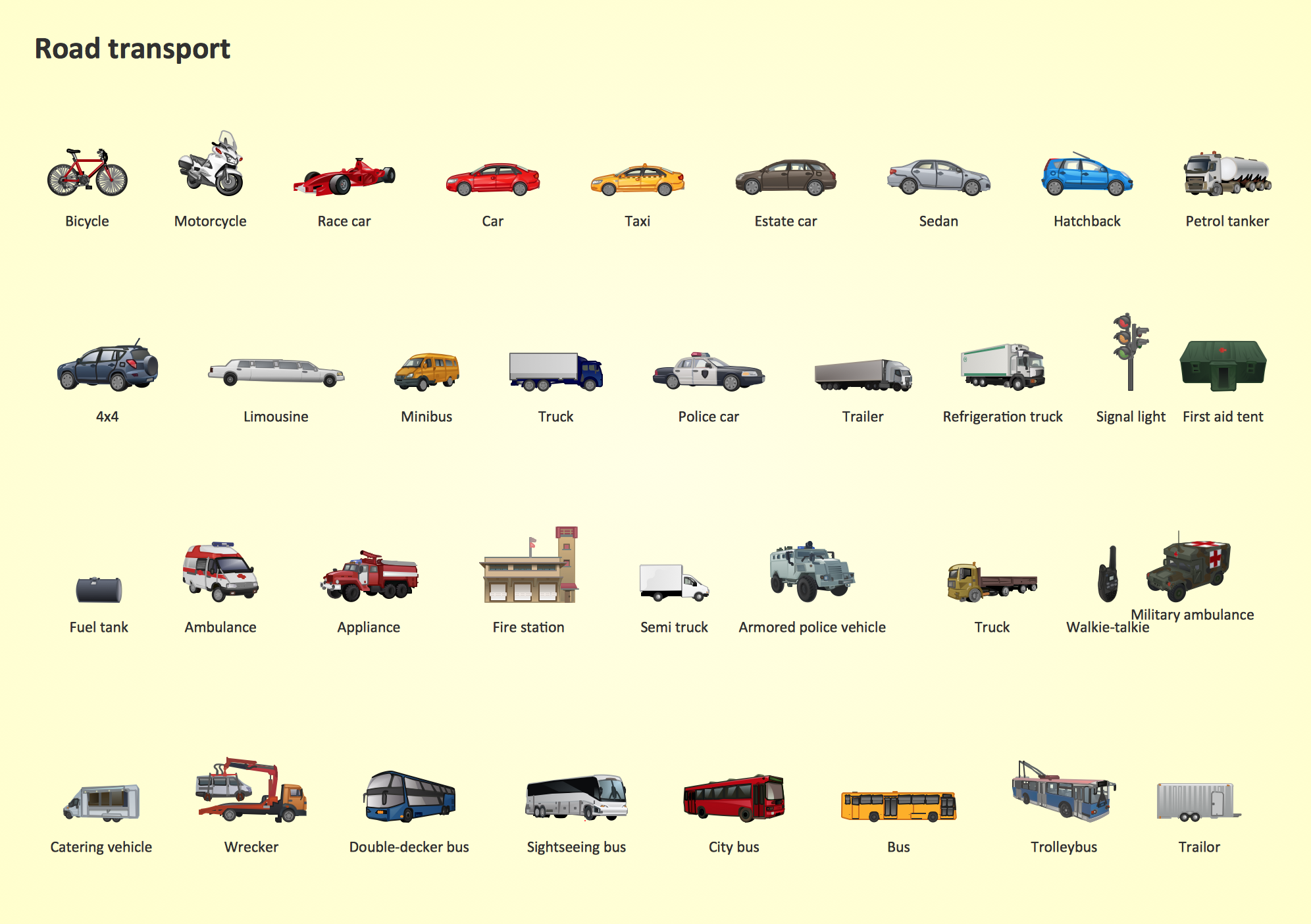
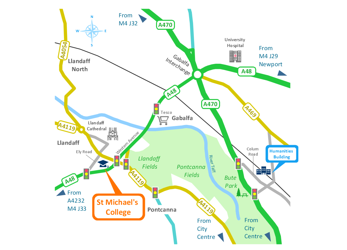
Samples, templates and libraries contain vector clip art for drawing the Road Transport Illustrations.Metro Map
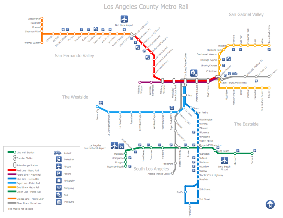
ConceptDraw Metro Maps solution is a one-click tool to add stations to the metro map. It lets you control the direction in which you create new stations, change lengths, and add text labels and icons. It contains Lines, Stations, and Landmarks objects. The Metro Map Solution from the Maps Area uses two ConceptDraw techniques: Replicating Objects and Switching Objects. And the result is a vector graphic document.How to draw Metro Map style infographics? (Los Angeles)
Tool to draw Metro Map styled inforgraphics. Los Angeles Metro Rail and Liner sample. This is a one-click tool to add stations to the map. It lets you control the direction in which you create new stations, change lengths, and add text labels and icons. It contains Lines, Stations, and Landmarks objects.The vector stencils library "Transport map" contains 96 pictograms for drawing transport maps.
Use it in your spatial infographics for visual representation of transport schemes and plans as metro maps in the ConceptDraw PRO diagramming and vector drawing software extended with the Spatial Infographics solution from the area "What is Infographics" of ConceptDraw Solution Park.
Use it in your spatial infographics for visual representation of transport schemes and plans as metro maps in the ConceptDraw PRO diagramming and vector drawing software extended with the Spatial Infographics solution from the area "What is Infographics" of ConceptDraw Solution Park.
HelpDesk
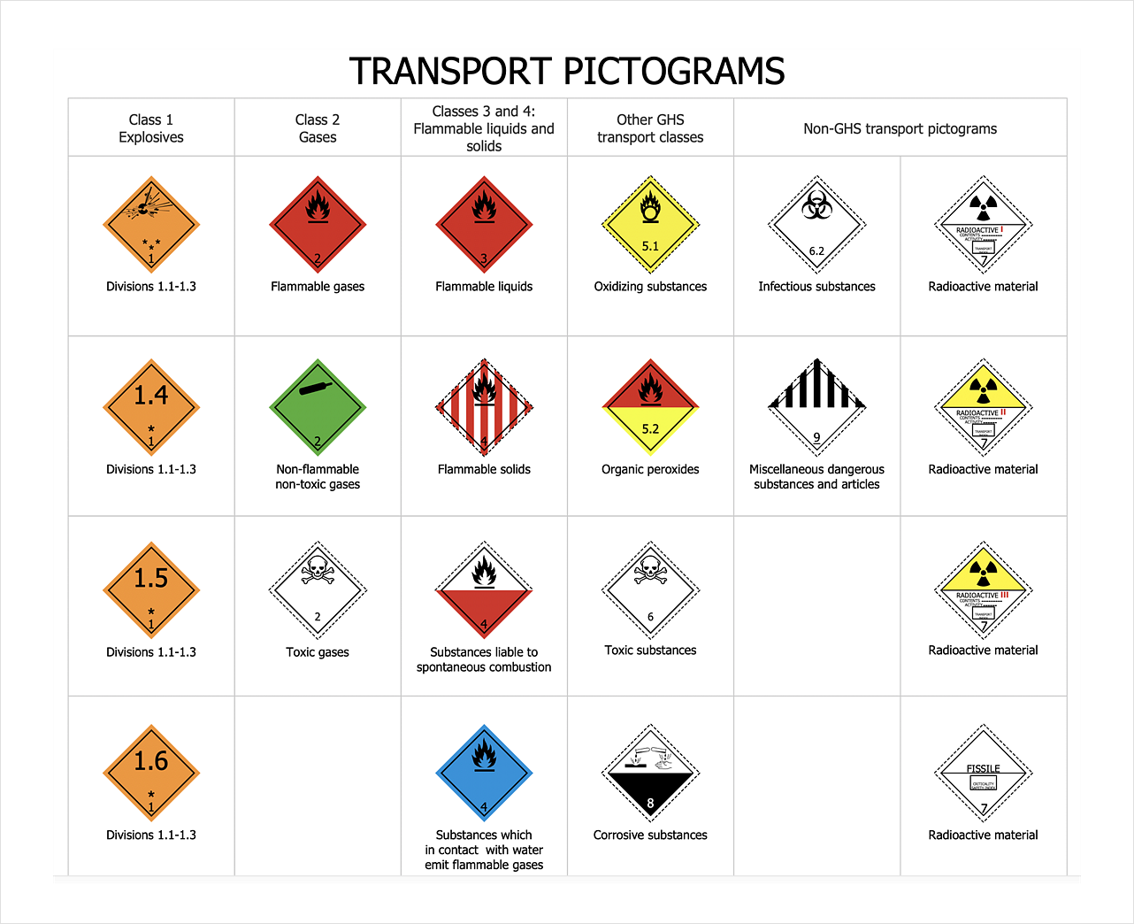
How To Design Warning Infographics Using Transport Hazard Pictograms
A hazard pictogram is intended to provide information about the hazard that can cause a damage of a human health or the environment. GHS Hazard pictogram consists from a standard hazard symbol placed to the shape of a red diamond with a white background. GHS Hazard Pictograms solution from the ConceptDraw Solution Park includes the set of standardized GHS hazard pictograms. It can be used for creating safety infographics, warning announcements, labels and regulatory documentation containing the elements of OSHA HAZCOM Standard.Spatial infographics Design Elements: Transport Map
Do you like infographics and data visualization? Creating infographics is super-easy with ConceptDraw.Metro Path Map
You need a powerful software for drawing a Metro Path Map? Use the ConceptDraw DIAGRAM diagramming and vector drawing software extended with Metro Map Solution from the Maps Area. Make sure that it is what you need.- Transport Schemes
- Scheme Clipart
- Winter Olympics - Skeleton | Winter Sports | Sport pictograms ...
- Sochi 2014 Mountain Cluster - Spectator transportation | Winter ...
- Winter Sports | Winter Olympics - Skeleton | Sochi 2014 Mountain ...
- Usecase Daigram For Scheme Management
- Sochi 2014 RusSki Gorki Ski Jumping Center | Sochi 2014 Mountain ...
- Road Transport - Design Elements | Aerospace and Transport ...
- Road Transport - Design Elements | Aerospace and Transport ...
