Samples / Infographics / Spatial Inforgaphics
Spatial Inforgaphics
Samples of vector geospatial infographics with thematic continent and country maps, directional, road and transport maps are created using ConceptDraw DIAGRAM diagramming and vector drawing software enhanced with Spatial Infographics solution from ConceptDraw Solution Park.
Tutorials and Solutions:
Video Tutorials: ConceptDraw Solution Park
Solutions: Spatial Infographics for ConceptDraw DIAGRAM
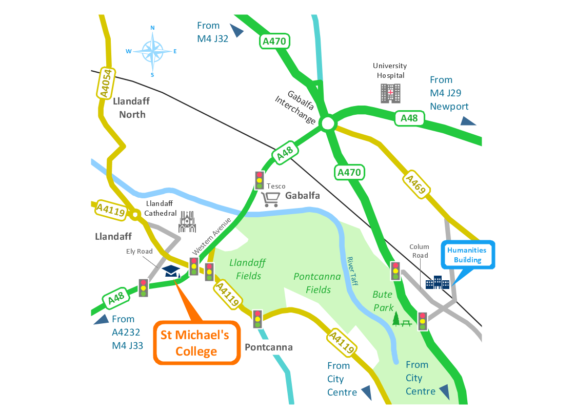
Sample 1: Spatial Infographics — Conference Centre Location Map
The sample of Spatial Infographics - Conference centre location map.
This example is created using ConceptDraw DIAGRAM diagramming and vector drawing software enhanced with Spatial Infographics solution from ConceptDraw Solution Park.

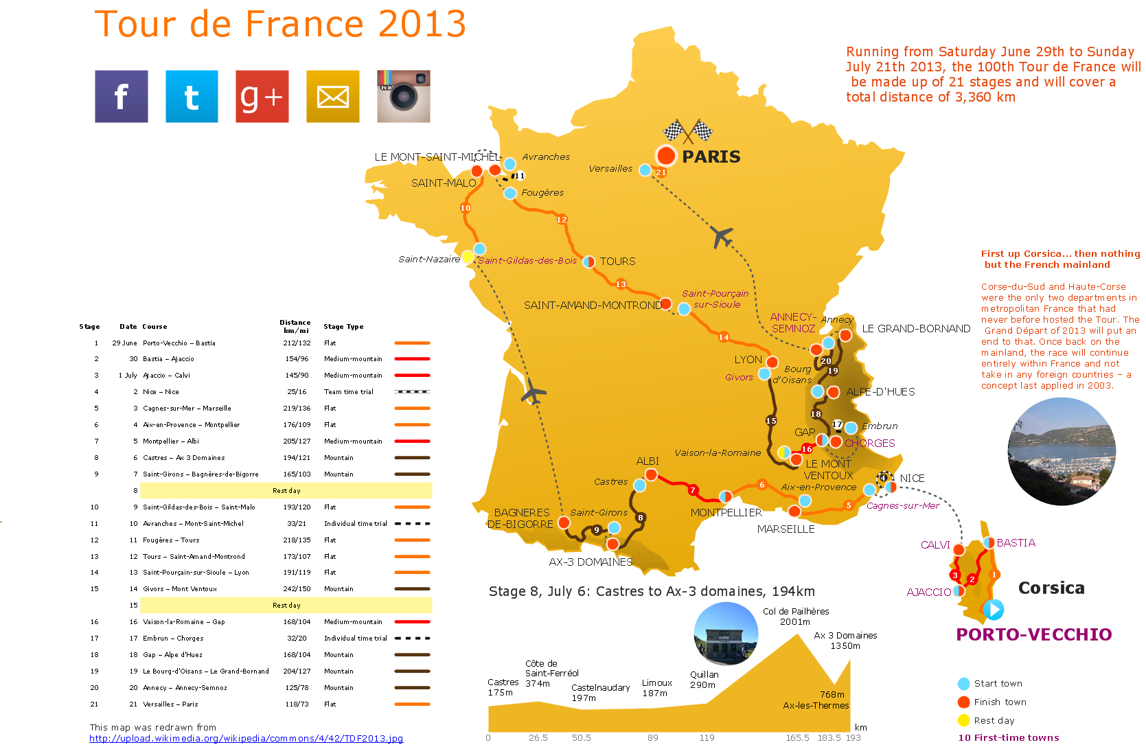
Sample 2: Spatial Infographics — The 100th Tour de France 2013
The sample of Spatial Infographics - The 100th Tour de France 2013.
This example is created using ConceptDraw DIAGRAM diagramming and vector drawing software enhanced with Spatial Infographics solution from ConceptDraw Solution Park.

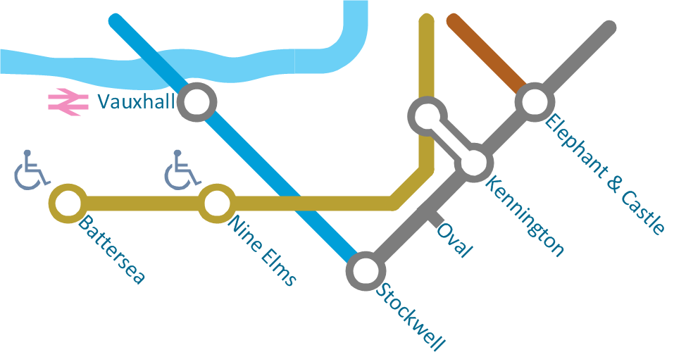
Sample 3: Spatial Infographics — Northern Line Extension to Battersea via Nine Elms
The sample of Spatial Infographics - Northern line extension to Battersea via Nine Elms.
This example is created using ConceptDraw DIAGRAM diagramming and vector drawing software enhanced with Spatial Infographics solution from ConceptDraw Solution Park.

Sample 4: Europe Map Template
The template of Europe map for drawing Spatial Infographics is created using ConceptDraw DIAGRAM diagramming and vector drawing software enhanced with Spatial Infographics solution from ConceptDraw Solution Park.

All samples are copyrighted CS Odessa's.
Usage of them is covered by Creative Commons “Attribution Non-Commercial No Derivatives” License.
The text you can find at: https://creativecommons.org/licenses/by-nc-nd/3.0