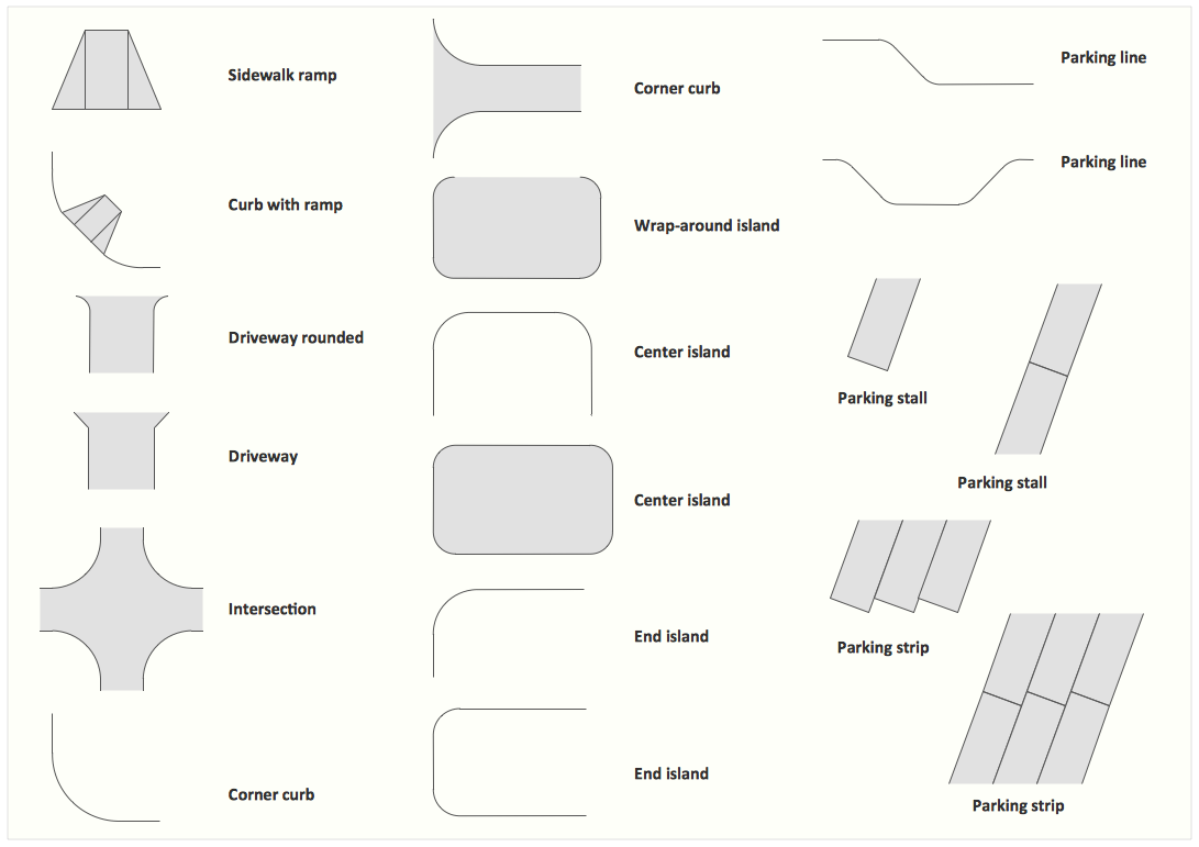
Interior Design. Site Plan — Design Elements
Site plans are large scale drawings that illustrate a lot of useful information, such as location of buildings on the surrounding territories, topography of the site, roads, footpaths, paved and hardstandings areas, ramps, parking areas, fencing, walls and gates, landscape elements, trees and plants, layout of external lighting and service runs, adjoining and adjacent structures, surrounding streets, and many other details. On each Site plan are also designated the scale, dimensions, site boundaries, key materials, and other additional notes. ConceptDraw DIAGRAM diagramming and interior design software extended with Site Plans solution from Building Plans area contains Parking and Roads, Site Accessories, Trees and Plants libraries with numerous collection of ready-to-use vector design elements for drawing detailed Site plans, Site design plans, Structural site plans, Landscape drawings for any locality and of any complexity without efforts. This software will be also useful for planning the parks, creation yard layouts, development residential and commercial landscape designs.
 ConceptDraw Solution Park
ConceptDraw Solution Park collects graphic extensions, examples and learning materials
 USA Maps
Use the USA Maps solution to create a map of USA, a US interstate map, printable US maps, US maps with cities and US maps with capitals. Create a complete USA states map.
 UK Map
The Map of UK solution contains collection of professionally designed samples and scalable vector stencil graphics maps, representing the United Kingdom counties, regions and cities. Use the Map of UK solution from ConceptDraw Solution Park as the base fo
 Maps Area
Solutions from the Maps Area of ConceptDraw Solution Park collect templates, samples and libraries of vector stencils for drawing geographical, directional and transport maps.
 Presentation Clipart
Presentation design elements solution extends ConceptDraw DIAGRAM software with slide samples, templates and vector stencils libraries with design elements of presentation symbols, arrows, callouts, backgrounds, borders and frames, title blocks.
- How to Create a BPMN Diagram Using Border Events in ...
- Interior Design Site Plan - Design Elements | CAD Drawing Software ...
- Design elements - Trees and plants | Interior Design Site Plan ...
- Design elements - Trees and plants | Tree Network Topology ...
- Design elements - Trees and plants | Design elements - Fault tree ...
- Design elements - Trees and plants | CAD Drawing Software for ...
- Design elements - Trees and plants | Trees and plants - Vector ...
- Design elements - Trees and plants | Interior Design Site Plan ...
- Design elements - Trees and plants | Interior Design Site Plan ...
- Design elements - Trees and plants | Plant Layout Plans | Building ...
- Design elements - Trees and plants | How To use Landscape ...
- Project —Task Trees and Dependencies | Trees and plants - Vector ...
- Design elements - Trees and plants | Interior Design Site Plan ...
- Affinity diagram - Implementing continuous process improvement ...
- Plant Layout Plans | How to Create a Plant Layout Design ...
- Interior Design Site Plan - Design Elements | Trees and plants ...
- Trees and plants - Vector stencils library | Design elements - Trees ...
- Design elements - Trees and plants | Plant Layout Plans | Trees and ...
- Interior Design Site Plan - Design Elements | Trees and plants ...
- How to Create a Plant Layout Design | Process Flowchart ...
