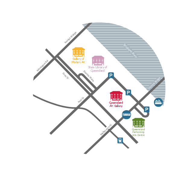
This travelling map sample was created on the base of the location map from the website of the Queensland Art Gallery | Gallery of Modern Art (QAGOMA). "Queensland's premier visual arts institution, the Queensland Art Gallery | Gallery of Modern Art (QAGOMA), connects people and art through a dynamic program of Australian and international exhibitions that showcase works from a diverse range of historical and contemporary artists.
Enriching the cultural life of Brisbane, these two vibrant and accessible galleries, the Queensland Art Gallery (QAG) and the Gallery of Modern Art (GOMA), offer distinct, yet complementary experiences.
QAGOMA’s highly acclaimed Children’s Art Centre presents engaging and interactive exhibitions and events for visitors of all ages and the cinemas at GOMA feature films by influential and popular film makers and artists. ...
The Queensland Art Gallery (QAG) and Gallery of Modern Art (GOMA) are located 150 metres from each other, on the south bank of the Brisbane River. Entrance to both buildings is possible from Stanley Place, and the river front entrance to the Queensland Art Gallery is on Melbourne Street. The Galleries are within easy walking distance to the city centre and South Bank Parklands." [qagoma.qld.gov.au/ visiting-us]
The locator map example "Travelling to the Gallery" was created using the ConceptDraw PRO diagramming and vector drawing software extended with the Directional Maps solution from the Maps area of ConceptDraw Solution Park.
The vector stencils library "Travel and tourism pictograms" contains 20 travelling and journey symbols.
Use it to draw your tour and trip infograms. The example "Travel and tourism pictograms - Vector stencils library" was created using the ConceptDraw PRO diagramming and vector drawing software extended with the Pictorial infographics solution from the area "What is infographics" in ConceptDraw Solution Park.
Use it to draw your tour and trip infograms. The example "Travel and tourism pictograms - Vector stencils library" was created using the ConceptDraw PRO diagramming and vector drawing software extended with the Pictorial infographics solution from the area "What is infographics" in ConceptDraw Solution Park.
Directions Map
ConceptDraw PRO is a powerful diagramming and vector drawing software. Extended with Directional Maps Solution from the Maps Area of ConceptDraw Solution Park, it became the best software for quick and easy designing Directions Map of any complexity.Planning a Trip with ConceptDraw Project
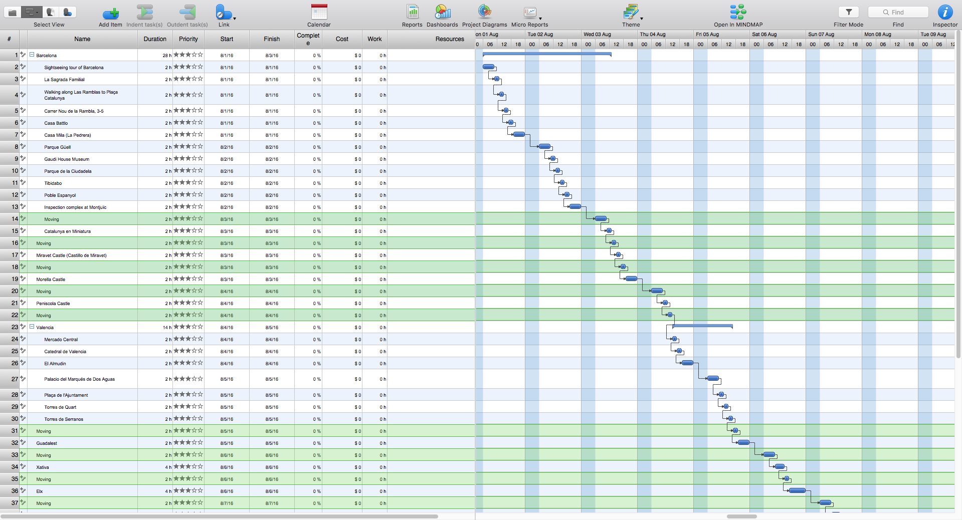
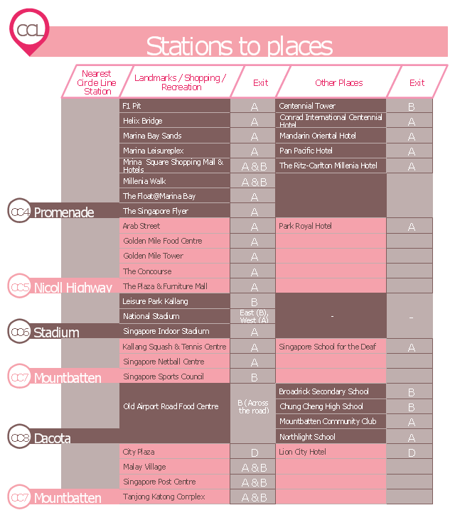
Planning a trip is real work; and the better this work is done, the more chances you have to enjoy an interesting itinerary and the trip in general. A good plan is never overloaded. It is always good to stick to the golden mean. Surely, you can create a perfectly accurate and detailed route. However, following it may become a hard task, which will turn your trip from a pleasure into a race to fulfil your own plan.This typography infographics example was redesigned from the Wikimedia Commons file: CCLStationstoplaces.jpg. [commons.wikimedia.org/ wiki/ File:CCLStationstoplaces.jpg]
This file is licensed under the Creative Commons Attribution-Share Alike 3.0 Unported license. [creativecommons.org/ licenses/ by-sa/ 3.0/ deed.en]
"The Circle Line (CCL) is Singapore's fourth Mass Rapid Transit line. This underground line is 35.7 kilometres (22.2 mi) long with 31 stations (excluding Bukit Brown) and is fully automatically operated. It takes about one hour to travel from one end to the other. The line is coloured orange in the rail map.
As the name implies, the line is an orbital circle route linking all radial routes leading to the city. It also covers many parts of the Central Area. From Promenade, the line branches with one branch terminating at Dhoby Ghaut and the other terminating at Marina Bay. Transfers to the North South Line are provided at Bishan, Dhoby Ghaut and Marina Bay, East West Line at Paya Lebar and Buona Vista, and North East Line at Dhoby Ghaut, Serangoon and HarbourFront. The Downtown Line interchanges with the Circle Line at Bayfront and Promenade and future sections of the Downtown Line will interchange at Botanic Gardens and MacPherson. The future Thomson Line will interchange with the Circle Line at Caldecott and Marina Bay.
The Circle Line is the first medium capacity line in Singapore. As a medium capacity line, each Circle Line train has only three cars instead of the six-car configuration as seen on current MRT lines. Half a million people are expected to use the Circle Line each day. The line reduces travelling time for commuters by allowing them to shorten trips between north to east or north to west and vice versa, bypassing busy interchange like City Hall and Raffles Place." [Circle MRT Line. Wikipedia]
The example "CCL Stations to places - Infographics" was created using the ConceptDraw PRO diagramming and vector drawing software extended with the Typography Infographics solition from the area "What is infographics" in ConceptDraw Solution Park.
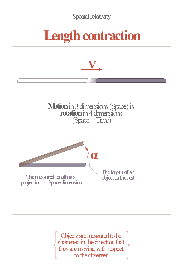
"In physics, length contraction is the phenomenon of a decrease in length measured by the observer of an object which is traveling at any non-zero velocity relative to the observer. This contraction (more formally called Lorentz contraction or Lorentz-FitzGerald contraction after Hendrik Lorentz and George FitzGerald) is usually only noticeable at a substantial fraction of the speed of light. Length contraction is only in the direction parallel to the direction in which the observed body is travelling. This effect is negligible at everyday speeds, and can be ignored for all regular purposes. Only at greater speeds does it become relevant." [Length contraction. Wikipedia]
The educational infogram "Length contraction" was created using the ConceptDraw PRO diagramming and vector drawing software extended with the Education Infographics solition from the area "Business Infographics" in ConceptDraw Solution Park.
The educational infogram "Length contraction" was created using the ConceptDraw PRO diagramming and vector drawing software extended with the Education Infographics solition from the area "Business Infographics" in ConceptDraw Solution Park.
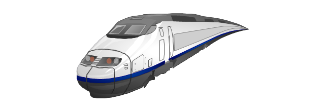
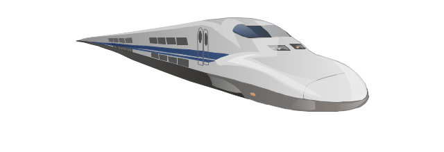
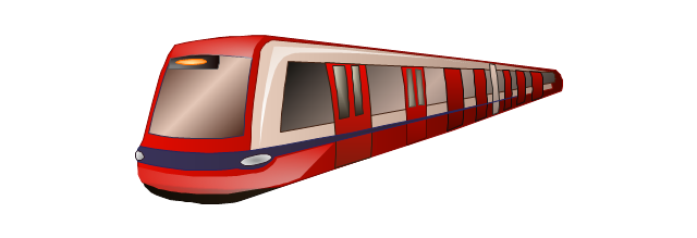
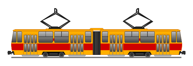
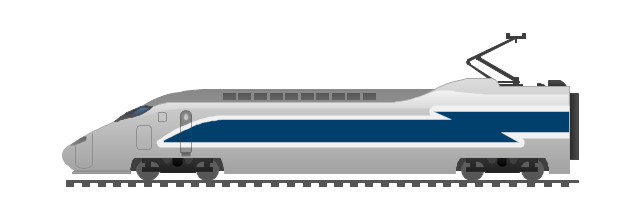
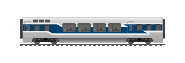
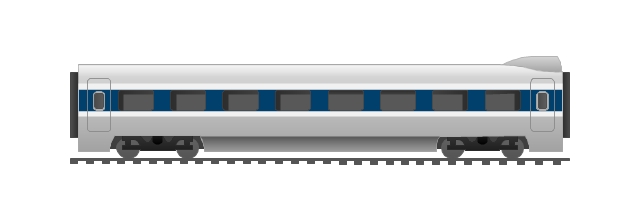
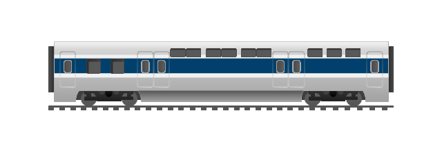
The vector stencils library "Rail transport" contains 8 clip art images for creating train, tram, railway and rapid transit illustrations, presentation slides, infographics and webpages using the ConceptDraw PRO diagramming and vector drawing software.
"Rail transport is a means of conveyance of passengers and goods, by way of wheeled vehicles running on rails. It is also commonly referred to as train transport. In contrast to road transport, where vehicles merely run on a prepared surface, rail vehicles are also directionally guided by the tracks on which they run. Track usually consists of steel rails installed on sleepers/ ties and ballast, on which the rolling stock, usually fitted with metal wheels, moves. However, other variations are also possible, such as slab track where the rails are fastened to a concrete foundation resting on a prepared subsurface.
Rolling stock in railway transport systems generally has lower frictional resistance when compared with highway vehicles and the passenger and freight cars (carriages and wagons) can be coupled into longer trains. The operation is carried out by a railway company, providing transport between train stations or freight customer facilities. Power is provided by locomotives which either draw electrical power from a railway electrification system or produce their own power, usually by diesel engines. Most tracks are accompanied by a signalling system. Railways are a safe land transport system when compared to other forms of transport. Railway transport is capable of high levels of passenger and cargo utilization and energy efficiency, but is often less flexible and more capital-intensive than highway transport is, when lower traffic levels are considered." [Rail transport. Wikipedia]
The vector stencils library "Rail transport" is included in the Aerospace and Transport solution from the Illustrations area of ConceptDraw Solution Park.
www.conceptdraw.com/ solution-park/ illustrations-aerospace-transport
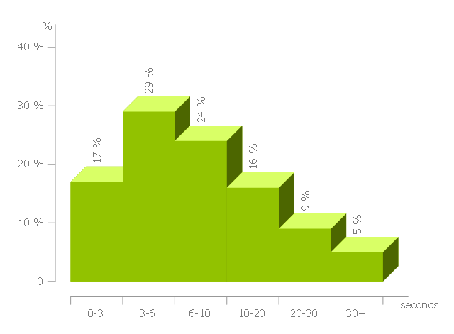
This histogram sample shows the frequency distribution of web page load time.
"Web performance optimization, WPO, or website optimization is the field of knowledge about increasing the speed in which web pages are downloaded and displayed on the user's web browser. ...
With the average internet speed now increasing globally, it's fitting for website administrators and "webmasters" to consider the time it takes for websites to render for the visitor.
Faster website download speeds have been shown to increase visitor retention and loyalty and user satisfaction, especially for users with slow internet connections and those on mobile devices. Web performance also leads to less data travelling across the web, which in turn lowers a website's power consumption and environmental impact. Some aspects which can affect the speed of page load include Browser/ Server Cache, Image Optimization and also encryption (for example SSL), which can affect the time it takes for pages to render." [Web performance optimization. Wikipedia]
The histogram example "Page load time" was created using the ConceptDraw PRO diagramming and vector drawing software extended with the Histograms solution from the Graphs and Charts area of ConceptDraw Solution Park.
 Directional Maps
Directional Maps solution extends ConceptDraw PRO software with templates, samples and libraries of vector stencils for drawing the directional, location, site, transit, road and route maps, plans and schemes.
 Computer and Networks Area
The solutions from Computer and Networks Area of ConceptDraw Solution Park collect samples, templates and vector stencils libraries for drawing computer and network diagrams, schemes and technical drawings.
- Plane Travelling Png
- Map symbols - Vector stencils library | Travel and tourism pictograms ...
- Mountain Vector Png
- Travel Vector Png
- Road transport - Vector stencils library | Travel and tourism ...
- Flight Vector Png
- Png File Of Mile Stone
- Vector Mountain Png
- Airplane Vector Png
- Earth Vector Png
- Cab booking public process - Collaboration BPMN 2.0 diagram ...
- Chart Examples | How to Draw a Histogram in ConceptDraw PRO ...
- Travel and tourism pictograms - Vector stencils library | Travel and ...
- Wind speed histogram | Weather - Vector stencils library | Resources ...
- Travel and tourism pictograms - Vector stencils library | Design ...
- Geography - Vector stencils library | Travel and tourism pictograms ...
- Design elements - Travel and tourism pictograms | Travel and ...
- Travelling to the Gallery
- How to Operate with Project Time Frames in ConceptDraw ...
- Design elements - Travel and tourism pictograms | Travel and ...
