HelpDesk
How to Draw a Map of USA States Using ConceptDraw PRO
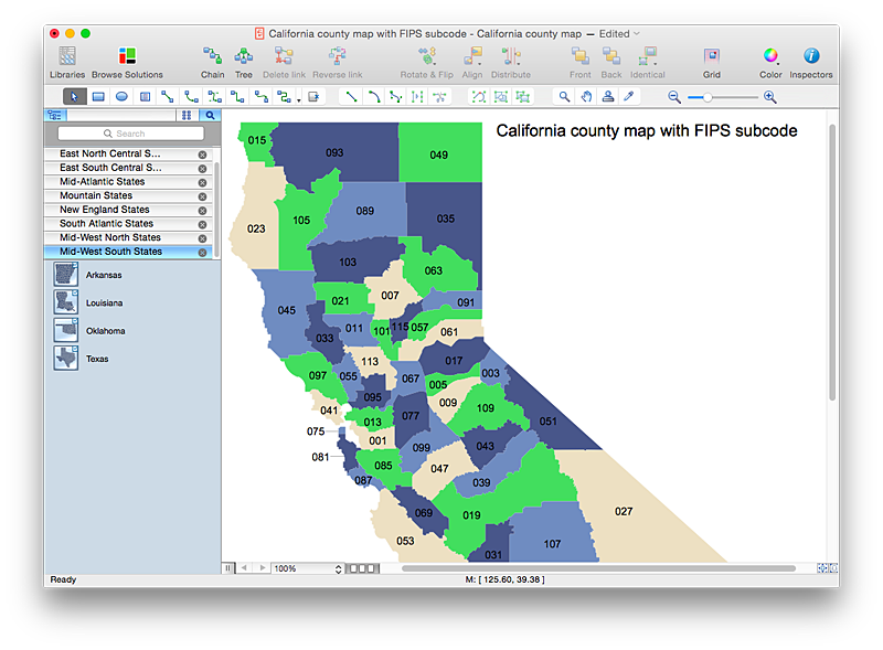
You can found a huge set of geopolitical statistical data regarding America. A common way of visualizing this data is to create maps that connect a particular data in relation to a specific geographical area. Thematic maps are used to depict such data as population density, average rainfall, or political allegiance, representing the data by using visual elements and annotation. Thematic maps always focus on one particular subject matter unlike general reference maps, which display information on a different subjects — vegetation, topology, roads and highways, etc.The United States Mapping Solution for ConceptDraw PRO includes all of the US States with county outlined borders, from the largest, San Bernardino in California, to the smallest Kalawao County, Hawaii.
HelpDesk
How to Draw a Map of North America Using ConceptDraw PRO
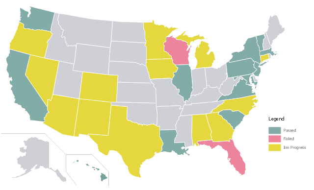
Geographic maps, cardiograms, and thematic maps are often used for geographical visualization of business information. Any country can inspire a wealth of geopolitical statistical data. A common way of assimilating this data is to create maps that convey a particular theme or subject matter in relation to a specific geographical area. Known as thematic maps, they cover themes such as population density, average rainfall, or political allegiance, differentiating the data by using graphical elements and annotation. Thematic maps contrast general reference maps, which tend to display information on a variety of subjects — vegetation, topology, roads and highways, for example. A thematic map will always focus on one particular subject matter. ConceptDraw PRO can be helpful as a tool for creating maps of countries and regions of the world. It allows you to draw continental maps quickly and easily using the special templates and vector stencils libraries.A color-coded map showing US state-by-state status of Benefit Corporation legislation.
"A thematic map is a type of map or chart especially designed to show a particular theme connected with a specific geographic area. These maps "can portray physical, social, political, cultural, economic, sociological, agricultural, or any other aspects of a city, state, region, nation, or continent"." [Thematic map. Wikipedia]
This U.S.A. thematic map was redesigned from Wikipedia file: Benefit Corporation Map 2012 05 16.svg. [commons.wikimedia.org/ wiki/ File:Benefit_ Corporation_ Map_ 2012_ 05_ 16.svg]
This file is licensed under the Creative Commons Attribution-Share Alike 3.0 Unported license.
[creativecommons.org/ licenses/ by-sa/ 3.0/ deed.en]
This U.S. thematic map example was created using the ConceptDraw PRO diagramming and vector drawing software extended with the Continent Maps solution from the Maps area of ConceptDraw Solution Park.
 Maps
Maps
This solution extends ConceptDraw PRO v9.4 with the specific tools necessary to help you draw continental, directional, road, or transit maps, to represent international, business, or professional information visually.
HelpDesk
How to Draw Maps of Australia Using ConceptDraw PRO
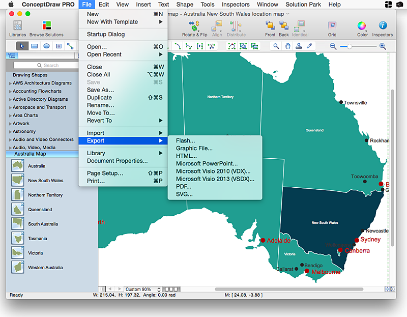
Australia is the sixth largest country in the world. Australia consists from the mainland which is surrounded by many thousands of small fringing islands and numerous larger ones. The vast territories, aligned with interesting historic features across a wide expanse, make the thematic map an ideal way of depicting geographical, geological and political information related to Australia.The Australia Map solution for ConceptDraw PRO will help you to make the steps of the creativeness easy and intuitive. The Australia Map solution provides templates and samples along with vector stencils to get you started. Used together with other ConceptDraw PRO solutions it will allow you to create comprehensive geography-related infographics.A color-coded map showing US state-by-state status of Benefit Corporation legislation.
"A thematic map is a type of map or chart especially designed to show a particular theme connected with a specific geographic area. These maps "can portray physical, social, political, cultural, economic, sociological, agricultural, or any other aspects of a city, state, region, nation, or continent"." [Thematic map. Wikipedia]
This U.S.A. thematic map was redesigned from Wikipedia file: Benefit Corporation Map 2012 05 16.svg. [commons.wikimedia.org/ wiki/ File:Benefit_ Corporation_ Map_ 2012_ 05_ 16.svg]
This file is licensed under the Creative Commons Attribution-Share Alike 3.0 Unported license.
[creativecommons.org/ licenses/ by-sa/ 3.0/ deed.en]
This U.S. thematic map example was created using the ConceptDraw PRO diagramming and vector drawing software extended with the Continent Maps solution from the Maps area of ConceptDraw Solution Park.
HelpDesk
How to Create a Map of Germany Using ConceptDraw PRO
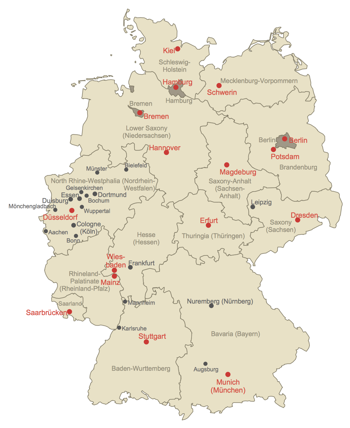
Geographical thematic maps are used to display information on a variety of subjects. It is a common way of representing any form of spatial data in relation to a specific geographical area. The Germany Map Solution for ConceptDraw PRO includes all of the German federal states with county outlined borders and major cities. You can quickly create geographic maps, cartograms, and thematic maps for geographical visualization information for business and travels.HelpDesk
How to Insert a Mind Map into Microsoft Word Document
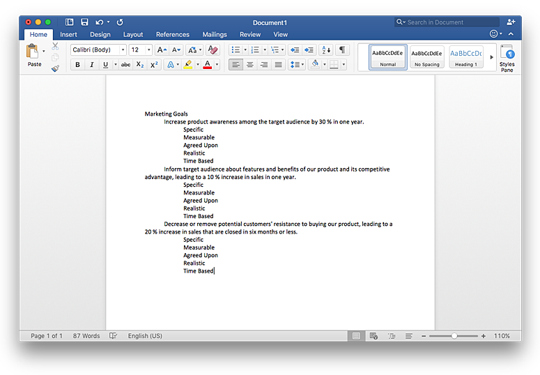
ConceptDraw MINDMAP offers several options of converting your mind map to MS Word document.You can choose the proper format that meets your needs to communicate content of your mind maps. Generate text, presentations, images or web pages that are pertinent to your work. Primary, you can export a mind map to MS Word. This method allows stylizing the document by using a custom MS Word templates. If you need to combine text and hierarchically structured information in a single document, the best solution is to incorporate a mind map into the MS Word document using the copy-paste capabilities of ConceptDraw MINDMAP.
HelpDesk
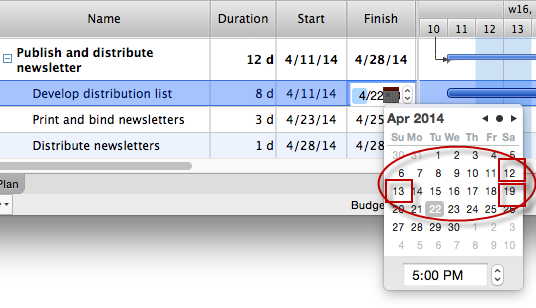
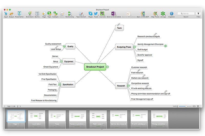
How the Project Data from Mind Map is Transformed by ConceptDraw PROJECT
The artilce describes some details of the data conversion between ConceptDraw MINDMAP and PROJECT.HelpDesk
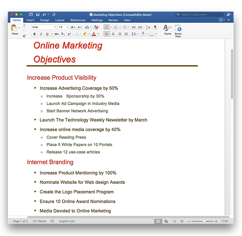
How to Convert a Mind Map into MS Word Document
Mind maps are often used for structuring ideas, planning and organizing of various documents. ConceptDraw MINDMAP allows you transfer a mind map to MS Word format using its export facilities. You can convert a mind map to a MS Word outline using the set of standard templates, or even your custom template. Thus, your mind map will be transformed into the proper document format. Using a custom MS Word template allows you apply your individual style to each document, being exported from ConceptDraw MINDMAP. You can use a mind mapping to capture ideas and structure information. Then making a quick conversion to MS Word and you finally obtain a clean and stylish document.HelpDesk
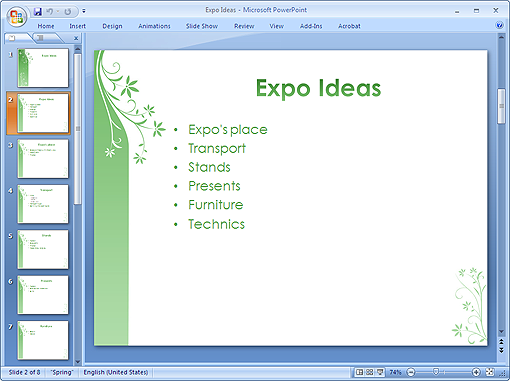
How to Create PowerPoint® Text Slides from Mind Maps
Instruction on how to create power point slides from a mind map.HelpDesk
How to Import Text to ConceptDraw MINDMAP
Mind mapping is a quick and efficient way to start up project. When you create a mind map, it might be necessary to use a previously recorded files, notes, or text outlines. The importing capabilities of ConceptDraw MINDMAP allows you to easily convert text into a mind map. You can quickly turn your TXT file to the hierarchical structure of mind map. You can convert the entire TXT file as well as a selected part. ConceptDraw MINDMAP supports the ability to convert text in both single-page and multi-page mind map.You can create a multiple page project mind map quickly, using various text work-pieces. Read this article to find out how to create your multi page mind map from a text outline.- Geo Map - United States of America Map | USA Maps | Map of USA ...
- US State Map
- Enhancing maps using ConceptDraw MINDMAP′ s Theme Gallery ...
- Geo Map - United States of America Map | | | U S
- Geo Map - United States of America Map | Map of USA | USA Maps ...
- Geo Map - United States of America Map | How to Draw a Map of ...
- Benefit Corporation legislation - Thematic map | Ranks US states by ...
- Us Color Coded Map
- Geo Map - USA - Illinois | East Africa - Political map | Geo Map - USA ...
- Geo Map - USA - Washington | How to Draw a Map of USA States ...
- Map of USA with state names | Benefit Corporation legislation ...
- Basic Flowchart Symbols and Meaning | Geo Map - USA - Michigan ...
- USA Maps | ConceptDraw Solution Park | Organizational Charts ...
- Thematic maps - Vector stencils library | Design elements ...
- Continent Maps | Germany Map | Maps of Germany | Usa And Eu Map
- Diagram Of The US
- Geo Map - USA - Kansas | United States of America - Vector stencils ...
- Geo Map - United States of America Map | Map of Continents ...
- Geo Map - USA - Oregon
- Geo Map - United States of America Map | 2012 United States ...
