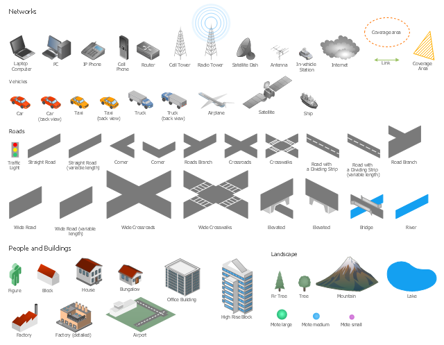
The vector stencils library "Local vehicular networking" contains 88 symbols for drawing the vehicular computer telecommunication network diagrams using the ConceptDraw PRO diagramming and vector drawing software.
"A vehicular ad hoc network (VANET) uses cars as mobile nodes in a MANET to create a mobile network.[1] A VANET turns every participating car into a wireless router or node, allowing cars approximately 100 to 300 metres of each other to connect and, in turn, create a network with a wide range. As cars fall out of the signal range and drop out of the network, other cars can join in, connecting vehicles to one another so that a mobile Internet is created. It is estimated that the first systems that will integrate this technology are police and fire vehicles to communicate with each other for safety purposes. ...
Vehicular ad hocal networks are expected to implement wireless technologies such as dedicated short-range communications (DSRC) which is a type of Wi-Fi. Other candidate wireless technologies are cellular, satellite, and WiMAX. Vehicular ad hoc networks can be viewed as component of the intelligent transportation systems (ITS).
As promoted in ITS, vehicles communicate with each other via inter-vehicle communication (IVC) as well as with roadside base stations via roadside-to-vehicle communication (RVC)." [Vehicular ad hoc network. Wikipedia]
The example "Design elements - Local vehicular networking" is included in the Vehicular Networking solution from the Computer and Networks area of ConceptDraw Solution Park.
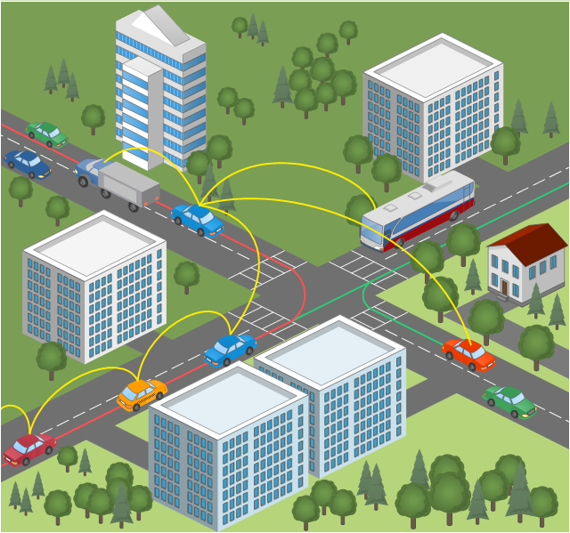
This vehicular network diagram example was drawn on the base of picture illustrating the post "Intelligent transportation system" from the blog "Technology New Here".
"Intelligent transportation systems are projects that aim to integrate modern communication and information technology into existing transportation management systems in order to optimize vehicle life, fuel efficiency, safety, and traffic in urbanized cities.
The need for intelligent transportation systems stems from the fact that traffic congestion has been increasing all around the world because of increasing population, increasing amount of transportation vehicles and increasing urbanization."
[technologynewhere.wordpress.com/ 2010/ 05/ 12/ intelligent-transportation-system/ ]
The vehicular network diagram example "Intelligent transportation system" was created using the ConceptDraw PRO diagramming and vector drawing software extended with the Vehicular Networking solution from the Computer and Networks area of ConceptDraw Solution Park.
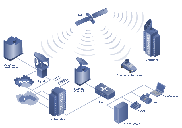
"A communications satellite or comsat is an artificial satellite sent to space for the purpose of telecommunications. Modern communications satellites use a variety of orbits including geostationary orbits, Molniya orbits, elliptical orbits and low (polar and non-polar) Earth orbits.
For fixed (point-to-point) services, communications satellites provide a microwave radio relay technology complementary to that of communication cables. They are also used for mobile applications such as communications to ships, vehicles, planes and hand-held terminals, and for TV and radio broadcasting." [Communications satellite. Wikipedia]
"Satellite telecommunication services:
Satellite crop monitoring,
Satellite Internet access,
Satellite navigation,
Satellite phone,
Satellite radio,
Satellite television." [Satellite. Wikipedia]
This hybrid satellite and common carrier network diagram example was created using the ConceptDraw PRO diagramming and vector drawing software extended with the Telecommunication Network Diagrams solution from the Computer and Networks area of ConceptDraw Solution Park.
- Hybrid satellite and common carrier network diagram | Aerospace ...
- Vehicular Networking | How to Create a Vehicular Network Diagram ...
- Design elements - Local vehicular networking | GPRS network ...
- Design elements - Local vehicular networking | Computers and ...
- Vehicular Networking | UML Class Diagram Example - Social ...
- Design elements - Local vehicular networking | Local vehicular ...
- Vehicular Networking | How to Create a Vehicular Network Diagram ...
- How to Create Telecommunication Network Diagram ...
- Design elements - Local vehicular networking | Local vehicular ...
- Design elements - Vehicles 2D, 3D | Industrial vehicles - Vector ...
- Wireless Networking for Mac | Design elements - Local vehicular ...
- Mobile satellite communication network diagram | Using Both Wired ...
- Design elements - Local vehicular networking | How to Draw a ...
- Vehicular Networking | Design elements - Local vehicular ...
- Mobile satellite communication network diagram | Hybrid satellite ...
- Design elements - Network layout floorplan | Design elements ...
- Satellite telecom network diagram | Hybrid satellite and common ...
- Mobile satellite communication network diagram | Mobile satellite TV ...
- Tree Network Topology Diagram | Network Topologies | Star ...
- Mobile satellite communication network diagram | Hybrid satellite ...


