Geo Map — Europe
Europe Map Contours and Geographic Overview
Europe is a continent in the western part of Eurasia. It is commonly shown on political maps, regional maps, thematic maps, business presentations, educational materials, and geospatial infographics.
Europe map contours are useful when you need to show countries, borders, regions, sales territories, routes, market areas, or geographic data in a clear visual format.
Why Create Custom Europe Maps
Ready-made Europe maps are easy to find online, but custom vector maps give you more control over design, detail, labels, colors, and regional focus.
Custom Europe maps are especially useful for business planning, reporting, education, website visuals, market analysis, and presentation slides.
Software for Drawing Europe Map Contours
ConceptDraw DIAGRAM is a professional diagramming and vector drawing tool for creating accurate and visually clear maps.
With ready-made map libraries and templates, you can design Europe political maps, country maps, regional maps, thematic maps, and customized geographic visuals.
Europe Vector Library with Country Map Contours
The vector design elements library “Europe” contains country map contours that can be used in ConceptDraw DIAGRAM.
This library is available as part of the Continent Maps solution in the Maps area of ConceptDraw Solution Park.
Europe Map Library Features
The Europe map library helps you build editable vector maps without drawing country borders manually. It is designed for users who need clean map visuals for documents, reports, presentations, and web pages.
What is included?
The library includes a Europe political map, individual country map contours, regional Europe map examples, and design elements that can be reused in ConceptDraw DIAGRAM documents.
How many countries?
The Europe library contains country map contours for European countries and includes 44 map contours, including the Europe political map and country outlines.
What templates are available?
You can use ready-made examples for Europe, Europe contour map, Central Europe, Scandinavia, Europe country map contours, and European flag design elements.
How to edit the map?
Open the map template in ConceptDraw DIAGRAM, select the required country or region, and modify the vector objects. You can change colors, add labels, combine countries, highlight regions, and place additional diagram elements on the map.
How to export it?
ConceptDraw DIAGRAM documents are vector graphic files and can be exported or converted to common formats, including image, HTML, PDF, PowerPoint, Adobe Flash, and MS Visio.
ConceptDraw STORE and Map Solutions Access
ConceptDraw STORE provides access to downloadable solutions and libraries that extend the functionality of ConceptDraw DIAGRAM.
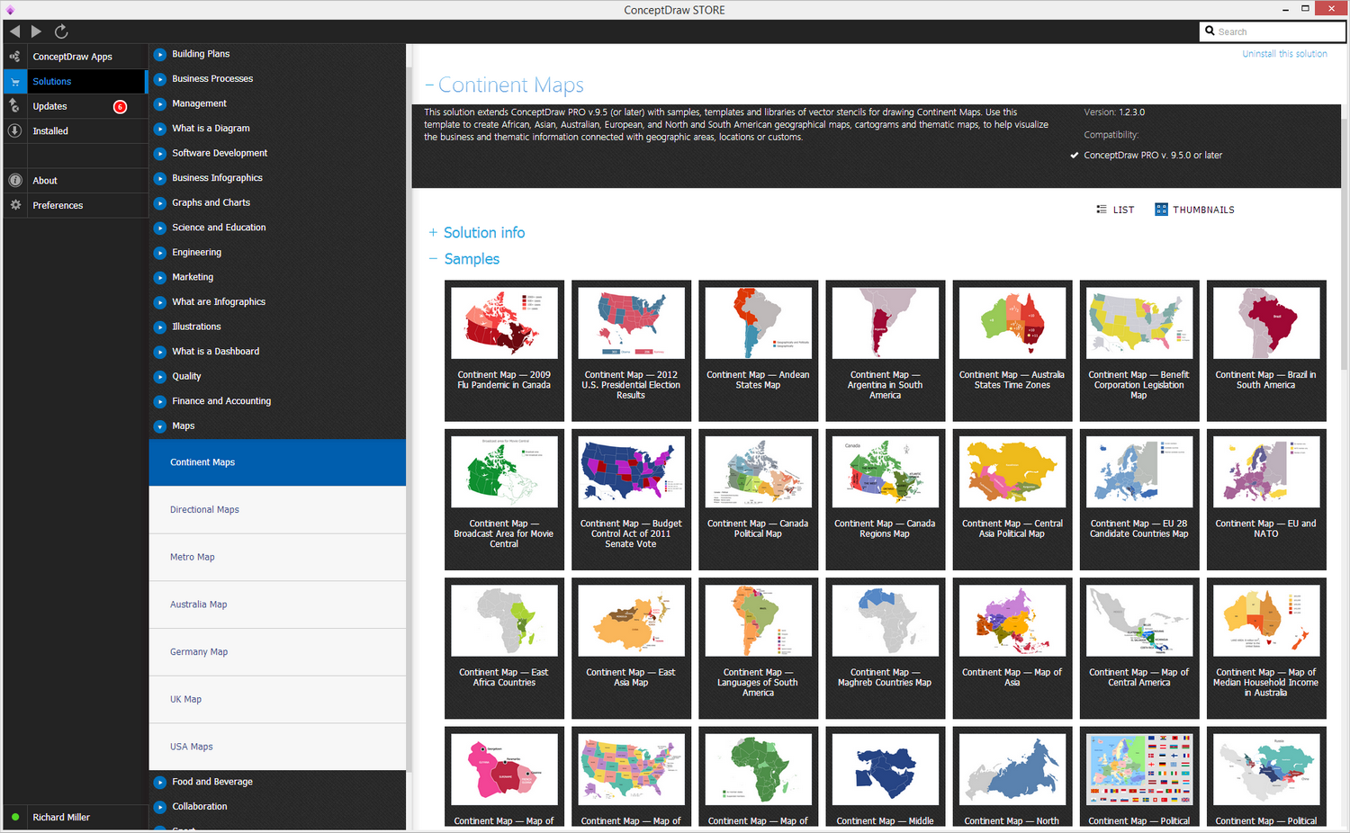
Pic. 1. Geo Map solution
Using both tools together allows you to create maps, plans, schemes, charts, flowcharts, and diagrams using ready-made vector elements.
Find Europe Map Templates and Design Resources
You can find the required map solutions in the Maps area of ConceptDraw Solution Park. The platform also provides examples, tutorials, and visual references for diagrams, maps, and flowcharts.
These resources help speed up the process of creating professional visuals for business, education, web publishing, and documentation.
Europe Political Map and Country Contours Library
Our map contours library named “Europe” includes 44 vector map contours, including a Europe political map and individual country outlines.
The Geo Map solution also provides additional regional map contours for Central Europe, Scandinavia, and other parts of the continent.
Create Europe Thematic Maps and Geospatial Infographics
You can use ready-made templates, thematic maps, and vector illustrations as a starting point for creating your own visuals.
These resources are suitable for business documents, presentations, website content, educational materials, and regional data visualization.
Additional Map Solutions and European Flag Libraries
ConceptDraw DIAGRAM also includes solutions for other regions such as Africa, Asia, Australia, Canada, South America, and the United States.
In addition, you can access flag libraries for European countries and regional groups such as the European Union and Benelux.
Maps and flowcharts solve different visual tasks. Geographic maps show locations and regions, while flowchart symbols represent steps, decisions, and workflows in business and technical systems.
Europe Country Map Contours for Diagramming
Vector design elements library “Europe” provides country map contours for use in ConceptDraw DIAGRAM, helping you quickly create professional geographic maps and visual documents.
It's included in the Continent Maps solution from the Maps area of ConceptDraw Solution Park.
The Geo Map solution gives users access to map templates and vector map libraries for creating regional, political, and thematic maps.
Use it to draw thematic maps, geospatial infographics, and vector illustrations for your business documents, presentations, and websites.
Europe Map Examples and Country Contour Templates
The following examples show how Europe map contours and regional map templates can be used as ready-made visual elements in ConceptDraw DIAGRAM.
Country Map Contours — Europe
This Europe map example shows the continent as a ready-to-edit geographic template for regional visualization, business presentations, education, and thematic map design.
Use this map when you need to show Europe as a whole, compare European regions, highlight countries, present market coverage, or build a visual overview of political and geographic data.
The map can be used as a base layer for adding labels, routes, sales territories, regional indicators, icons, callouts, and other diagram elements in ConceptDraw DIAGRAM.

Pic. 2. Country Map Contours — Europe
Country Map Contours — Europe Contour
This Europe contour map provides a simplified outline for creating thematic maps, presentation visuals, and regional diagrams.
Use the contour version when you need a clean map without extra visual details. It works well for reports, slides, dashboards, educational handouts, and web illustrations where the map should support the message without distracting from the data.
You can place symbols, color-coded regions, arrows, labels, and data markers over the contour map to explain geographic patterns, regional distribution, logistics, or business coverage.
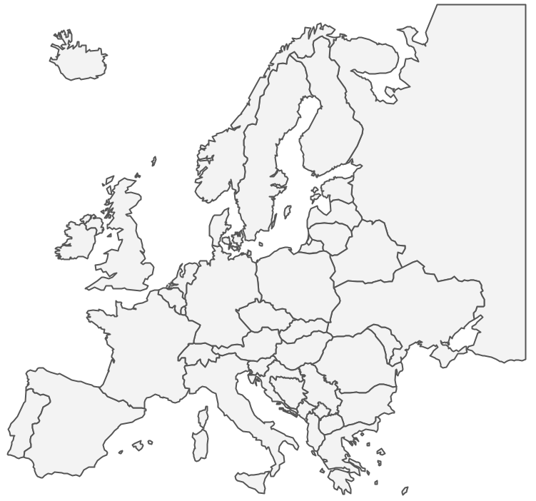
Pic. 3. Country map contours — Europe Contour
Country Map Contours — Central Europe
Central Europe is often shown as a separate region in business, education, political, and geographic presentations.
This regional contour map is useful for focusing attention on a smaller part of Europe instead of showing the entire continent. It helps make regional comparisons, market analysis, logistics planning, and country-specific presentations clearer.
Use it to highlight selected countries, show cross-border relationships, visualize regional operations, or present Central Europe as a business, transport, cultural, or geographic area.
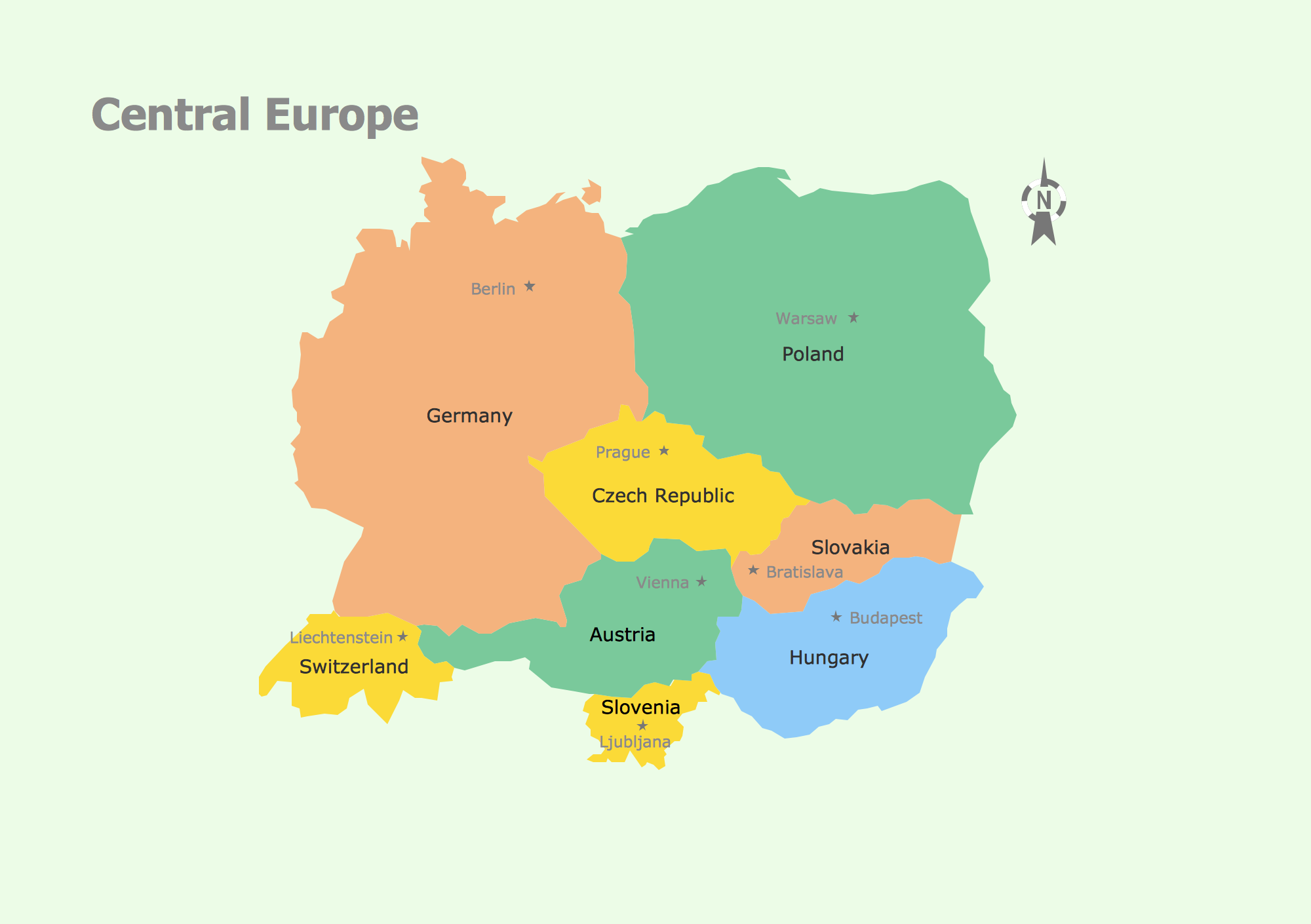
Pic. 4. Country Map Contours — Central Europe
Country Map Contours — Scandinavia
Scandinavia map contours are useful for showing Northern European geography, regional comparison, travel routes, market areas, and country-based thematic data.
Use this map when your document or presentation focuses on Northern Europe and does not need the full Europe map. It is suitable for regional planning, travel and transport visualization, education, market coverage maps, and geographic infographics.
You can edit the vector contours, apply different colors to countries or regions, add labels, and combine the map with arrows, icons, charts, and other diagram elements.

Pic. 5. Country Map Contours — Scandinavia
In addition to geographic visualization, ConceptDraw solutions support process modeling, including flowcharts, workflow diagrams, and business process mapping for professional documentation.
Europe Map Library and Design Elements
The vector stencils library Europe contains 43 country map contours. These ready-made elements help users build maps faster while keeping visual consistency across diagrams and presentation materials.
Library of Europe Country Map Contours
The Europe country map contours library provides reusable vector elements for creating political maps, thematic maps, and country-focused diagrams.
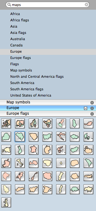
Pic. 6. Library of Europe Country Map Contours
Europe Country Map Contours — Design Elements
Use the map contours library Europe to design thematic maps using the ConceptDraw DIAGRAM software.
The vector stencils library “Europe” contains 44 map contours, including a Europe political map and map contours of individual countries.
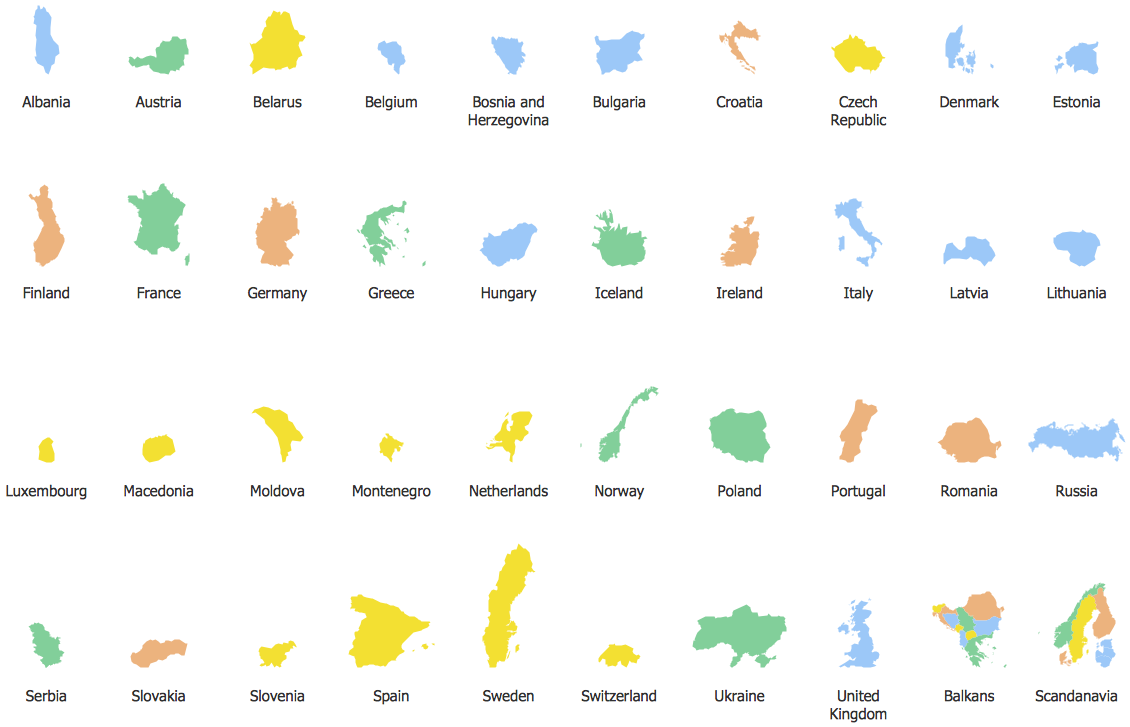
Pic. 7. Europe Country Map Contours — Design Elements
Design Elements — Europe Flags
European flag design elements can be used together with country contours to create political maps, country profiles, regional infographics, and presentation visuals.
Flags help users quickly identify countries on a map and make geographic diagrams more readable in presentations, reports, educational materials, and web pages.
Use these design elements to create country comparison graphics, European Union or regional group visuals, travel maps, country profiles, and map-based dashboards. Since the elements are editable, they can be resized, moved, combined with map contours, and exported with the final ConceptDraw DIAGRAM document.
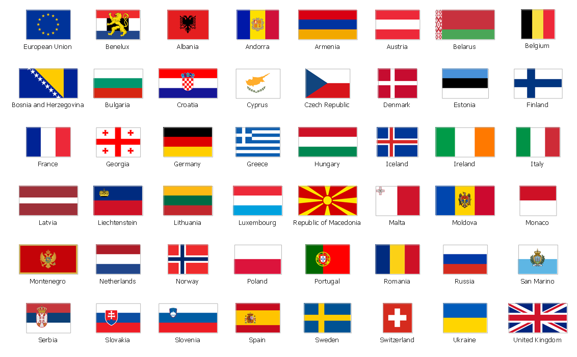
Pic. 8. Design Elements — Europe Flags
See also Geo Maps of Europe Countries :
The Europe library includes individual country map pages that provide editable vector map contours for specific European countries.
These country maps are useful when you need to focus on a single nation rather than the entire continent. They can be used for business presentations, sales territory planning, demographic analysis, educational materials, geographic infographics, travel documents, and regional reporting.
Each country page contains map examples, vector design elements, country contours, and ready-to-use resources that can be edited in ConceptDraw DIAGRAM and exported to multiple document and presentation formats.
Browse the country map collection below to find the required Europe country map template.
- Albania
- Austria
- Belarus
- Bulgaria
- Bosnia and Herzegovina
- Belgium
- Czech Republic
- Croatia
- Denmark
- Estonia
- France
- Finland
- Greece
- Germany
- Hungary
- Italy
- Ireland
- Iceland
- United Kingdom
- Latvia
- Luxembourg
- Lithuania
- Montenegro
- Macedonia
- Moldova
- Norway
- Netherlands
- Portugal
- Poland
- Russia
- Romania
- Switzerland
- Sweden
- Spain
- Slovenia
- Slovakia
- Serbia
- Ukraine
Export Europe Maps and Reuse Vector Documents
All ConceptDraw DIAGRAM documents are vector graphic files and are available for reviewing, modifying, and converting to a variety of formats: image, HTML, PDF file, MS PowerPoint Presentation, Adobe Flash, and MS Visio.
This makes Europe map diagrams suitable for business reports, presentations, web pages, educational content, and reusable visual documentation.