Spatial infographics Design Elements: Continental Map

Map Infographic Creator

Tools to Create Your Own Infographics

Visualization Spatial Data Using Thematic Maps Combined with Infographics

Superb Examples of Infographic Maps

The vector stencils library "Europe" contains 39 country contours for drawing thematic maps of Europe.
Use it in your spatial infographics for visual representation of geospatial information, statistics and quantitative data in the ConceptDraw PRO diagramming and vector drawing software extended with the Spatial Infographics solution from the area "What is Infographics" of ConceptDraw Solution Park.
Use it in your spatial infographics for visual representation of geospatial information, statistics and quantitative data in the ConceptDraw PRO diagramming and vector drawing software extended with the Spatial Infographics solution from the area "What is Infographics" of ConceptDraw Solution Park.
Europe

Albania

Austria

Belarus

Belgium

Bosnia and Herzegovina

Bulgaria

Croatia

Czech Republic

Denmark

Estonia

Finland

France

Germany

Greece

Hungary

Iceland

Ireland

Italy

Latvia

Lithuania

Luxembourg

Macedonia

Moldova

Montenegro

Netherlands

Norway

Poland

Portugal

Romania

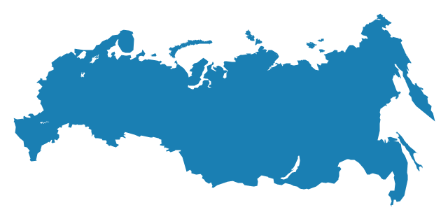
Russia
Serbia

Slovakia

Slovenia

Spain

Sweden

Switzerland

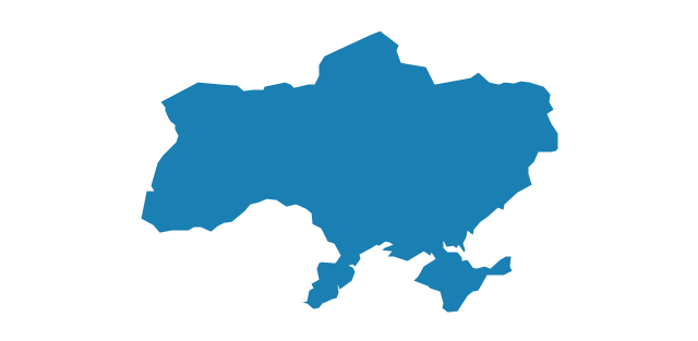
Ukraine
United Kingdom

Geo Map - Europe - Hungary

"A thematic map is a map that focuses on a specific theme or subject area, whereas in a general map the variety of phenomena - geological, geographical, political - regularly appear together. The contrast between them lies in the fact that thematic maps use the base data, such as coastlines, boundaries and places, only as points of reference for the phenomenon being mapped. General maps portray the base data, such as landforms, lines of transportation, settlements, and political boundaries, for their own sake." [Thematic map. Wikipedia]
The template "Europe thematic map" for the ConceptDraw PRO diagramming and vector drawing software is included in the Spatial Infographics solution from the area "What is Infographics" of ConceptDraw Solution Park.
The template "Europe thematic map" for the ConceptDraw PRO diagramming and vector drawing software is included in the Spatial Infographics solution from the area "What is Infographics" of ConceptDraw Solution Park.
Europe contour map
Geo Map — Europe — Poland

Geo Map - Europe - Austria

Geo Map - South America - Uruguay

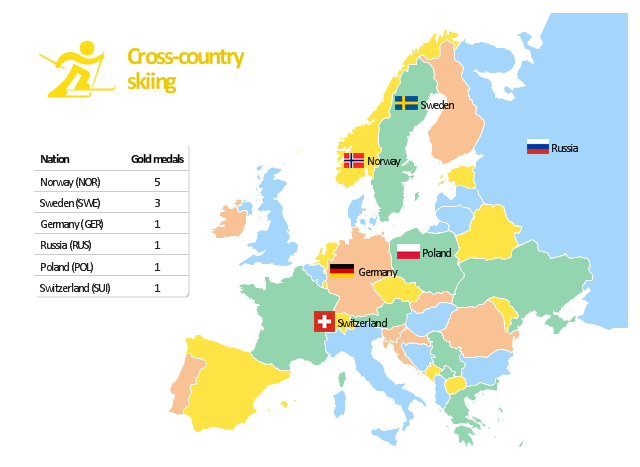
"The cross-country skiing competition of the 2010 Winter Olympics in Vancouver were held at Whistler Olympic Park. The events were held between 15 and 28 February 2010. ...
Across the twelve cross-country skiing events, a maximum of 310 athletes are allowed to compete. No nation can have more than 20 skiers competing, with an additional limit of 12 men or 12 women per specific nation. For each event, a nation can enter four skiers in individual events and one team in relay races." [Cross-country skiing at the 2010 Winter Olympics. Wikipedia]
The Europe map example "Cross-country skiing gold medals - 2010 Winter Olympics" is created using the ConceptDraw PRO diagramming and vector drawing software extended with the Winter Sports solution.
The Winter Sports solution from the Sport area of ConceptDraw Solution Park contains the vector stencils library "Winter sports pictograms" and examples of diagrams and infographics.
Infographics
Geo Map - Europe - Luxembourg

Geo Map — Europe

Geo Map Software

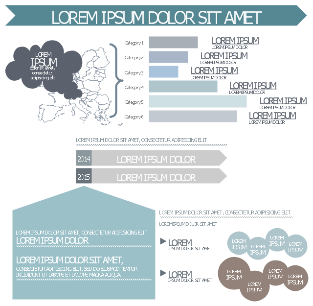
This infographic template consist of Europe map contours, bar chart, title blocks, text blocks and callouts.
Use it to design your management infograms using the ConceptDraw PRO diagramming and vector drawing software.
The template "EU management infogram" is included in the Management infographics solution from the Business infographics area of ConceptDraw Solution Park.
Use it to design your management infograms using the ConceptDraw PRO diagramming and vector drawing software.
The template "EU management infogram" is included in the Management infographics solution from the Business infographics area of ConceptDraw Solution Park.
EU management infogram template
 Spatial Infographics
Spatial infographics solution extends ConceptDraw DIAGRAM software with infographic samples, map templates and vector stencils libraries with design elements for drawing spatial information graphics.
Maps of Germany

Geo Map - Europe - Slovakia

Geo Map — Europe — France

- Spatial infographics Design Elements: Continental Map | Map ...
- Map Infographic Creator | Geo Map | Infographics Map Europe
- Maps | Map Infographic Creator | How To Draw Europe
- Map Infographic Creator | Europe Map Graphic
- Geo Map Software | Map Infographic Creator | Continent Maps | Map ...
- Europe map with capitals - Template | Europe thematic map ...
- Map Infographic Creator | Europe thematic map - Template | Europe ...
- Map Infographic Creator | Drawing Of Europe Of Powerpoint
- Europe Map Ppt Free